- Geography of Saint Helena
-
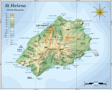 St Helena island
Saint Helena is an island in the South Atlantic Ocean, about mid-way between South America and Africa, at the geographic coordinates 15°56′S 5°42′W / 15.933°S 5.7°W. St Helena has a land area of 122 square kilometres and is part of a wider territory called Saint Helena, Ascension and Tristan da Cunha which includes Ascension Island and the island group of Tristan da Cunha.
Contents
Physical Geography
Climate
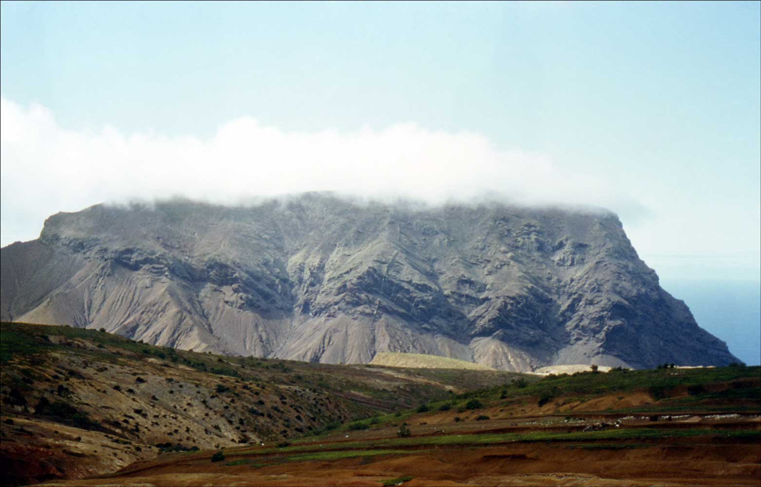
 The Barn, which forms the northeast point of the island
The climate of Saint Helena island can be described as tropical, marine and mild, tempered by the Benguela Current and trade winds which blow almost continuously. Similarly, the climate of Tristan da Cunha is marine, mild and also tempered by trade winds, although the climate is temperate in nature. Ascension Island is warmer and wetter than St Helena.
Terrain
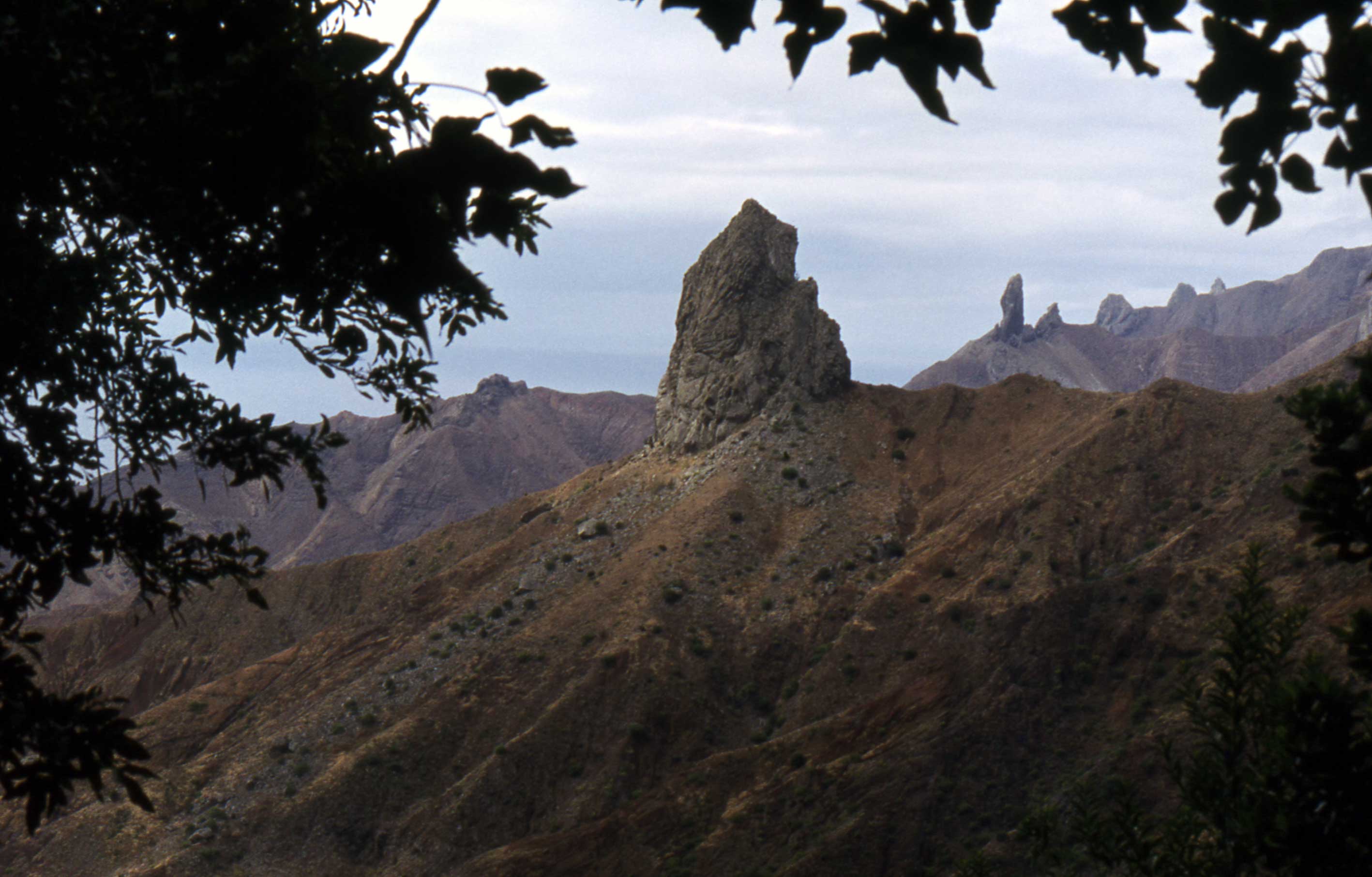
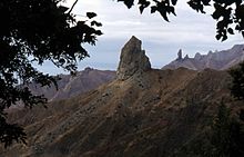 Picture of 'Lot' and 'Lot's Wife'.
Saint Helena has a rugged, volcanic terrain, with small scattered plateaus and plains, with the largest area of level ground on the island being Prosperous Bay Plain in the eastern arid area. The other islands of the group have a volcanic origin. The highest point on the island is Diana's Peak at 818 metres (2,684 ft), though Queen Mary's Peak on Tristan da Cunha is the highest in the British territory at 2,062 m.
A natural hazard on Tristan da Cunha is active volcanism, though this is not the case on St Helena itself.
Geological Features
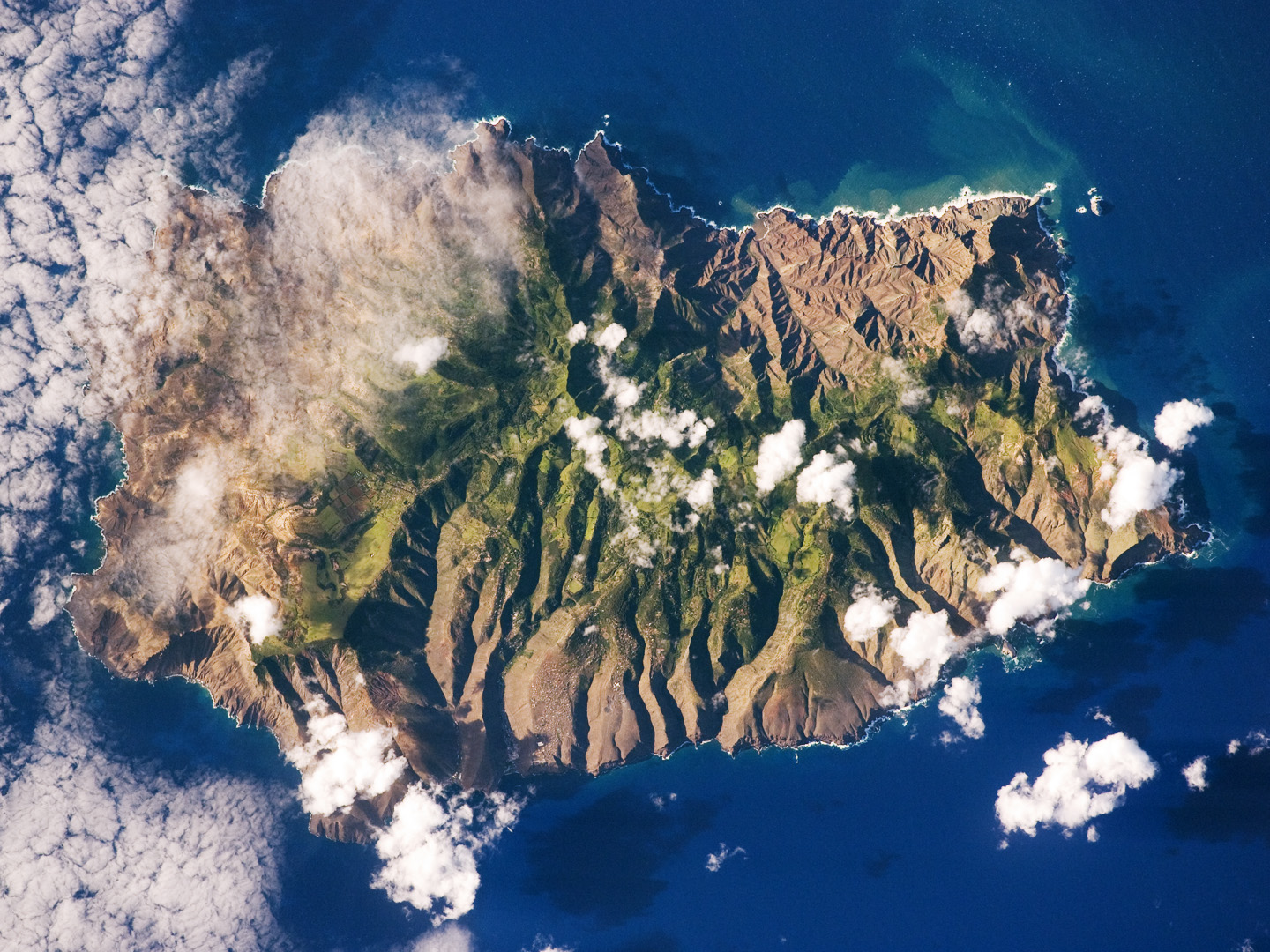
 Saint Helena Island as seen from space.
The Barn is a capping of younger lavas upon weaker rocks. The Barn features cliffs on the side that faces the sea. It overlooks the pyroclasts and weak flows of Turk's Cap Valley to the south.[1]
Taking their names from the story of Lot in the Book of Genesis, "Lot" and "Lot's Wife" are two solitary pillars of rock topping two valleys near Sandy Bay. The pillars are phonolitic intrusions, which are more resistant to erosion than surrounding volcanic features which have, in time, eroded away. [2]
Natural resources
Saint Helena possesses fish as a main natural resource. Land use in the island group is divided between arable land (with 12.9% of the area given to this) and other uses, which occupy the remaining 87.1%.
In terms of maritime claims, St Helena has an exclusive fishing zone of 200 nautical miles, and a territorial sea of twelve nautical miles.
Islands
Just off the coast of St Helena island itself are numerous small islands. Starting from the north and running clockwise, these are: Shore Island, George Island, Rough Rock Island, Flat Rock, The Buoys, Sandy Bay Island, Black Horse Island, White Bird Island, Frightus Island, Jar Rock, Castle Point Rock, Robert Rock, Salt Rock, Speery Island, Flat Rock, The Needle, Lower and Upper Black Rock, Bird Island, Black Rock, Thompson's Valley Island, Peaked Island, Egg Island, Lady's Chair, Lighter Rock, Long Ledge, and Red Rock.
Ecology
Saint Helena harbours at least 40 species of plants unknown anywhere else in the world, and Ascension is a breeding ground for sea turtles and sooty terns.
Districts
The island of St Helena is divided into 8 districts,[1] which are used for electoral and administrative purposes.
References
 This article incorporates public domain material from websites or documents of the CIA World Factbook.
See also
- List of mountains and hills of Saint Helena, Ascension and Tristan da Cunha
- List of towns in Saint Helena, Ascension and Tristan da Cunha
- Geography of Tristan da Cunha
External links
Sovereign
states- Algeria
- Angola
- Benin
- Botswana
- Burkina Faso
- Burundi
- Cameroon
- Cape Verde
- Central African Republic
- Chad
- Comoros
- Democratic Republic of the Congo
- Republic of the Congo
- Côte d'Ivoire (Ivory Coast)
- Djibouti
- Egypt
- Equatorial Guinea
- Eritrea
- Ethiopia
- Gabon
- The Gambia
- Ghana
- Guinea
- Guinea-Bissau
- Kenya
- Lesotho
- Liberia
- Libya
- Madagascar
- Malawi
- Mali
- Mauritania
- Mauritius
- Morocco
- Mozambique
- Namibia
- Niger
- Nigeria
- Rwanda
- São Tomé and Príncipe
- Senegal
- Seychelles
- Sierra Leone
- Somalia
- South Africa
- South Sudan
- Sudan
- Swaziland
- Tanzania
- Togo
- Tunisia
- Uganda
- Zambia
- Zimbabwe
States with limited
recognition- Sahrawi Arab Democratic Republic
- Somaliland
Dependencies and
other territories- Canary Islands / Ceuta / Melilla / Plazas de soberanía (Spain)
- Madeira (Portugal)
- Mayotte / Réunion (France)
- Saint Helena / Ascension Island / Tristan da Cunha (United Kingdom)
- Western Sahara
Categories:- Geography of Saint Helena
- Afrotropic
- Geography of Saint Helena, Ascension and Tristan da Cunha

Wikimedia Foundation. 2010.