- Geography of Côte d'Ivoire
-
Geography of Côte d'Ivoire 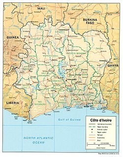
Continent Africa Region West Africa
Sub-Saharan AfricaCoordinates 8°00'N, 5°00'W Area Ranked 69th
322,460 km2 (124,500 sq mi)
98.62% land
1.38 % waterBorders Total land borders:
3,110 km (1,930 mi)
Liberia: 716 km (445 mi)
Ghana: 668 km (415 mi)
Guinea: 610 km (380 mi)
Burkina Faso: 584 km (363 mi)
Mali: 532 km (331)Highest point Mount Nimba
1,752 m (5,748 ft)Lowest point Gulf of Guinea
0 m/ft (sea level)Longest river Bandama River Largest lake Lake Kossou 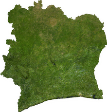 Satellite image of Côte d'Ivoire
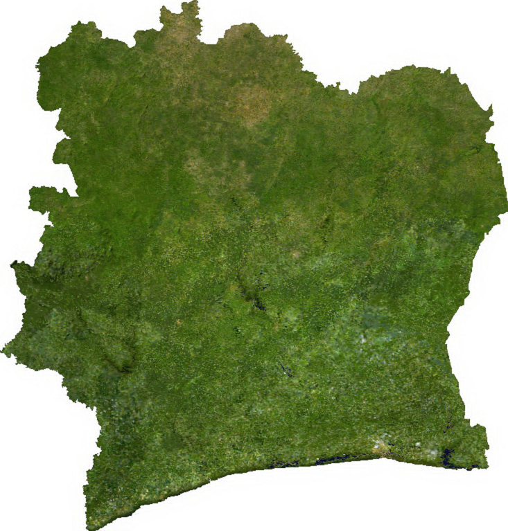
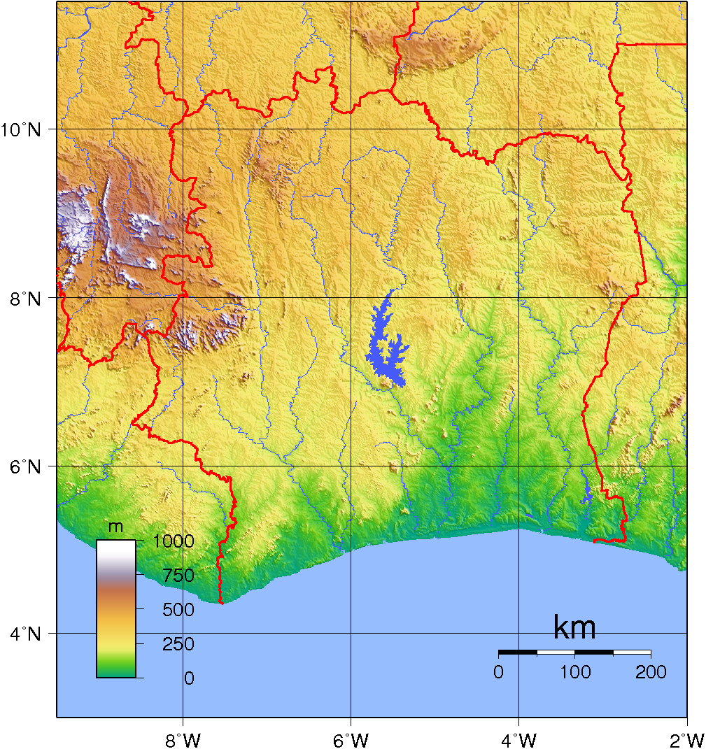
 Topography of Côte d'Ivoire
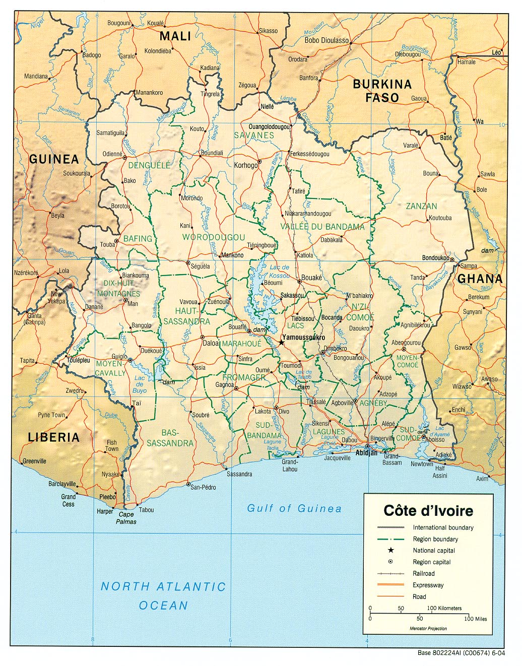
Côte d'Ivoire (the Ivory Coast) is a sub-Saharan nation in southern West Africa located at 8 00°N, 5 00°W. The country is shaped like a square and borders the Gulf of Guinea on the north Atlantic Ocean to the south (515 km of coastline) and five other African nations on the other three sides, with a total of 3,110 km of borders: Liberia to the southwest (716 km), Guinea to the northwest (610 km), Mali to the north-northwest (532 km), Burkina Faso to the north-northeast, and Ghana to the east (668 km). In total, Côte d'Ivoire comprises 322,460 km2, of which 318,000 km2 is land and 4,460 km2 is water, which makes the country slightly larger than the U.S. state of New Mexico, or about the size of Germany.
Contents
Maritime claims
Côte d'Ivoire makes maritime claims of 200 nautical miles (370.4 km; 230.2 mi) as an exclusive economic zone, 12 nautical miles (22.2 km; 13.8 mi) of territorial sea, and a 200 nautical miles (370.4 km; 230.2 mi) continental shelf.
Terrain and topography
Côte d'Ivoire's terrain can generally be described as a large plateau rising gradually from sea level in the south to almost 500 m elevation in the north. The nation's natural resources have made it into a comparatively prosperous nation in the African economy. The southeastern region of Côte d'Ivoire is marked by coastal inland lagoons that starts at the Ghanaian border and stretch 300 km (186 mi) along the eastern half of the coast. The southern region, especially the southwest, is covered with dense tropical moist forest. The Eastern Guinean forests extend from the Sassandra River across the south-central and southeast portion of Côte d'Ivoire and east into Ghana, while the Western Guinean lowland forests extend west from the Sassandra River into Liberia and southeastern Guinea. The mountains of Dix-Huit Montagnes region, in the west of the country near the border with Guinea and Liberia, are home to the Guinean montane forests.
The Guinean forest-savanna mosaic belt extends across the middle of the country from east to west, and is the transition zone between the coastal forests and the interior savannas. The forest-savanna mosaic interlaces forest, savanna and grassland habitats. Northern Côte d'Ivoire is part of the West Sudanian Savanna ecoregion of the Tropical and subtropical grasslands, savannas, and shrublands biome. It is a zone of lateritic or sandy soils, with vegetation decreasing from south to north.
The terrain is mostly flat to undulating plains, with mountains in the northwest. The lowest elevation in Côte d'Ivoire is at sea level on the coasts. The highest elevation is Mount Nimba, at 1,752 metres (5,748 ft) in the far west of the country along the border with Guinea and Liberia.
Rivers
Climate
The climate of Côte d'Ivoire is generally warm and humid, ranging from equatorial in the southern coasts to tropical in the middle and semiarid in the far north. There are three seasons: warm and dry (November to March), hot and dry (March to May), and hot and wet (June to October). Temperatures average between 25 and 32 °C (77 and 89.6 °F) and range from 10 to 40 °C (50 to 104 °F).
Crops and natural resources
Côte d'Ivoire's also has a large timber industry due to its large forest coverage. The nation's hardwood exports match that of Brazil. In recent years there has been much concern about the rapid rate of deforestation. Rainforests are being destroyed at a rate sometimes cited as the highest in the world. The only forest left completely untouched in Côte d'Ivoire is Taï National Park (Parc National de Taï), a 3,600 km2 (1,390 sq mi) area in the country's far southwest that is home to over 150 endemic species and many other endangered species such as the Pygmy Hippopotamus and 11 species of monkeys.
Eight percent of the country is arable land. Côte d'Ivoire is the world's largest producer of cocoa, a major national cash crop. Other chief crops include coffee, bananas, and oil palms, which produce palm oil and kernels. Natural resources include petroleum, natural gas, diamonds, manganese, iron, cobalt, bauxite, copper, and hydropower. There are more foreigners than Ivorians. Foreigners currently make up 67% of the country's population.
Natural hazards
Natural hazards include the heavy surf and the lack of natural harbors on the coast; during the rainy season torrential flooding is a danger.
Extreme points
This is a list of the extreme points of Cote d'Ivoire, the points that are farther north, south, east or west than any other location.
- Northern-most point – the point at which the border with Mali enters the Bagoé river, Savanes Region, the Sahel.
- Eastern-most point – unnamed location on the border with Ghana south-west of the town of Tanbi, Zanzan
- Southern-most point – Boubré, Bas-Sassandra region
- Western-most point - unnamed location on the border with Liberia in the Nuon river west of Klobli, Moyen-Cavally region
References
 This article incorporates public domain material from the CIA World Factbook document "2004 edition".[1]
- This article uses information published in the World Almanac and Book of Facts as a reference. (2006) "Cote d'Ivoire."
 Côte d'Ivoire topics
History Gyaaman · Ashanti Empire · French West Africa · 1960-1999 · 1999 coup d'état · First Civil War · Second Civil War (Crisis)Politics Constitution · Elections · Flag · Foreign relations · Law enforcement · Military · Political parties · President · Prime MinisterGeography Economy and infrastructure Agriculture · Airports · West African CFA franc · Communications · Companies · Energy · Mining · Tourism · TransportCulture and society Communications · Demographics · Education · Ethnic groups · Health · Holidays · Languages · Media · Music · Olympics · ReligionList of Côte d'Ivoire-related topicsSovereign
states- Algeria
- Angola
- Benin
- Botswana
- Burkina Faso
- Burundi
- Cameroon
- Cape Verde
- Central African Republic
- Chad
- Comoros
- Democratic Republic of the Congo
- Republic of the Congo
- Côte d'Ivoire (Ivory Coast)
- Djibouti
- Egypt
- Equatorial Guinea
- Eritrea
- Ethiopia
- Gabon
- The Gambia
- Ghana
- Guinea
- Guinea-Bissau
- Kenya
- Lesotho
- Liberia
- Libya
- Madagascar
- Malawi
- Mali
- Mauritania
- Mauritius
- Morocco
- Mozambique
- Namibia
- Niger
- Nigeria
- Rwanda
- São Tomé and Príncipe
- Senegal
- Seychelles
- Sierra Leone
- Somalia
- South Africa
- South Sudan
- Sudan
- Swaziland
- Tanzania
- Togo
- Tunisia
- Uganda
- Zambia
- Zimbabwe
States with limited
recognition- Sahrawi Arab Democratic Republic
- Somaliland
Dependencies and
other territories- Canary Islands / Ceuta / Melilla / Plazas de soberanía (Spain)
- Madeira (Portugal)
- Mayotte / Réunion (France)
- Saint Helena / Ascension Island / Tristan da Cunha (United Kingdom)
- Western Sahara
Climate of Africa Sovereign
states- Algeria
- Angola
- Benin
- Botswana
- Burkina Faso
- Burundi
- Cameroon
- Cape Verde
- Central African Republic
- Chad
- Comoros
- Democratic Republic of the Congo
- Republic of the Congo
- Côte d'Ivoire (Ivory Coast)
- Djibouti
- Egypt
- Equatorial Guinea
- Eritrea
- Ethiopia
- Gabon
- The Gambia
- Ghana
- Guinea
- Guinea-Bissau
- Kenya
- Lesotho
- Liberia
- Libya
- Madagascar
- Malawi
- Mali
- Mauritania
- Mauritius
- Morocco
- Mozambique
- Namibia
- Niger
- Nigeria
- Rwanda
- São Tomé and Príncipe
- Senegal
- Seychelles
- Sierra Leone
- Somalia
- South Africa
- South Sudan
- Sudan
- Swaziland
- Tanzania
- Togo
- Tunisia
- Uganda
- Zambia
- Zimbabwe
States with limited
recognition- Sahrawi Arab Democratic Republic
- Somaliland
Dependencies and
other territories- Canary Islands / Ceuta / Melilla / Plazas de soberanía (Spain)
- Madeira (Portugal)
- Mayotte / Réunion (France)
- Saint Helena / Ascension Island / Tristan da Cunha (United Kingdom)
- Western Sahara
Categories:
Wikimedia Foundation. 2010.