- Limpopo
-
This article is about the province in South Africa. For other uses, see Limpopo (disambiguation)."Northern Transvaal" redirects here. For the rugby union team, see Blue Bulls.
Limpopo — Province of South Africa — The Province of Limpopo 
Coat of armsMotto: Peace, Unity and Prosperity Location of Limpopo in South Africa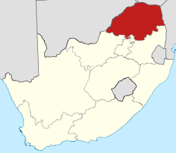
Country  South Africa
Established 27 April 1994 Capital Polokwane Districts Government – Type Parliamentary system – Premier Cassel Mathale (ANC) Area[1] – Total 125,754 km2 (48,553.9 sq mi) Area rank 5th in South Africa Highest elevation 2,126 m (6,975 ft) Population (2007)[2][3] – Total 5,238,286 – Estimate (2010) 5,439,600 – Rank 5th in South Africa – Density 41.7/km2 (107.9/sq mi) – Density rank 4th in South Africa Population groups[4] – Black African 97.5% – White 2.2% – Coloured 0.2% – Indian or Asian 0.2% Languages[5] – Northern Sotho 54.8% – Tsonga 18.1% – Venda 16.8% – Afrikaans 2.6% – Tswana 2.1% Time zone SAST (UTC+2) ISO 3166 code ZA-LP Website www.limpopo.gov.za Limpopo (
 /lɪmˈpoʊpoʊ/) is the northernmost province of South Africa. The capital is Polokwane, formerly named Pietersburg. The province was formed from the northern region of Transvaal Province in 1994, and initially named Northern Transvaal. The following year, it was renamed Northern Province, which remained the name until 11 July 2003, when the name of the province was formally changed to the name of its most important river–on the border with Zimbabwe and Botswana–after deliberation by the provincial government and amendment of the Constitution. Another notable consideration for the name was Mapungubwe, the area where the most ancient gold-using civilisation of the province was discovered a few years earlier.
Contents
Law and government
Main article: Politics of LimpopoThe current premier of Limpopo province is Cassel Mathale of the African National Congress.
Geography
Limpopo Province shares international borders with districts and provinces of three countries: Botswana's Central and Kgatleng districts to the west and north-west respectively, Zimbabwe's Matabeleland South and Masvingo provinces to the north and northeast respectively, and Mozambique's Gaza Province to the east. The province is the link between South Africa and countries further afield in sub-Saharan Africa. On its southern flank from east to west, the province shares borders with Mpumalanga, Gauteng, and North West. Its border with Gauteng includes that province's Johannesburg-Pretoria axis, the most industrialised metropole on the continent. The province is at the centre of regional, national, and international developing markets.
The province contains much of the Waterberg Biosphere, a UNESCO-designated Biosphere Reserve. The Waterberg Biosphere, a massif of approximately 15,000 km2 (5,800 sq mi), is the first region in the northern part of South Africa to be named as a Biosphere Reserve by UNESCO. The massif was shaped by hundreds of millions of years of riverine erosion to yield diverse bluff and butte landforms.[6] The Waterberg ecosystem can be characterised as a dry deciduous forest or Bushveld. Within the Waterberg, archaeological finds date to the Stone Age. Nearby are early evolutionary finds related to the origin of humans.
Municipalities
Limpopo Province is divided into five municipal districts, subdivided in 24 local municipalities:
- Capricorn District
- Aganang
- Blouberg
- Lepele-Nkumpi
- Molemole
- Polokwane
- Mopani District
- Ba-Phalaborwa
- Greater Giyani
- Greater Letaba
- Greater Tzaneen
- Maruleng
- Sekhukhune District
- Elias Motsoaledi
- Fetakgomo
- Ephraim Mogale
- Greater Tubatse
- Makhuduthamaga
- Waterberg District
- Bela-Bela
- Lephalale
- Modimolle
- Mogalakwena
- Mookgopong
- Thabazimbi
Demographics
 Population density in Limpopo
 <1 /km²1–3 /km²3–10 /km²10–30 /km²30–100 /km²100–300 /km²300–1000 /km²1000–3000 /km²>3000 /km²
The population of Limpopo consists of several ethnic groups distinguished by culture, language and race. 97.3% of the population is Black, 2.4% is White, 0.2% is Coloured, and 0.1% is Indian/Asian. The province has the smallest percentage and second smallest by number of white South Africans in the country. It also has the highest Black percentage out of all the provinces.
The Northern Sotho (of which the Bapedi are part of) make up the largest number, being nearly 57%. The Tsonga (Shangaan) speakers comprise 23%, while the Venda make up 12%. Afrikaans speakers make up 2.6%, while English-speaking whites are less than one-half per cent.
HIV / Aids
At 18.5% (2007) The Limpopo has a fairly low rate of HIV compared to other South African provinces. Although there was slight a fall in cases between 2005 and 2007, cases rose from 14.5% to 21.5% between 2001 and 2005.[7]
Economy
The province is a typical developing area, exporting primary products and importing manufactured goods and services. It is also one of the poorest regions of South Africa, especially rural areas.[8] However the Limpopo has shown great improvements in the economy and in standard of living. A recent border change with the Limpopo's wealthier neighbour, Mpumalanga, has occurred to try and shed some wealth onto the province.
Agriculture
The bushveld is cattle country, where extensive ranching operations are often supplemented by controlled hunting. About 80% of South Africa's hunting industry is found in Limpopo.
Sunflowers, cotton, maize and peanuts are cultivated in the Bela-Bela and Modimolle areas. Modimolle is also known for its table-grape crops.
Tropical fruit–such as bananas, litchis, pineapples, mangoes and pawpaws–as well as a variety of nuts, are grown in the Tzaneen and Makhado areas. Tzaneen is also at the centre of extensive tea and coffee plantations.
Mining
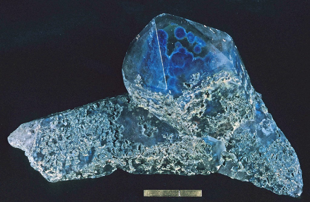
Limpopo's rich mineral deposits include the platinum group metals, iron ore, chromium high- and middle-grade coking coal, diamonds, antimony, phosphate, and copper–as well as mineral reserves like gold, emeralds, scheelite, magnetite, vermiculite, silicon, and mica. Commodities such as black granite, corundum, and feldspar are also found. Mining contributes to over a fifth of the provincial economy.
Tourism
Tourism is one of the three pillars of the Limpopo economy along with mining and agribusiness,.[9] In 2008, the Province accounted for 5% of all foreign tourist bed nights in South Africa, numbers which are showing strong annual growth. The R 93 million Provincial tourism budget for 2010/11 represents 11% of Limpopo's total budget.[9]
Near Limpopo, at Sunland Baobab farms, there is a large Baobab tree which has been fashioned into a rather spacious pub [11].
Tourism Development
The Limpopo Department of Economic Development, Environment and Tourism has targeted the province as a preferred eco-tourism destination. Its Environment and Tourism Programme encompasses tourism, protected areas and community environment development to achieve sustainable economic growth[10]
Whilst Limpopo is one of South Africa's poorest provinces, it is rich in wildlife which gives it an edge in attracting tourism. Both the private and public sectors are investing in tourism development.
Infrastructure and communications
The province has excellent road, rail, and air links. The N1 route from Johannesburg, which extends the length of the province, is the busiest overland route in Africa in terms of cross-border trade in raw materials and beneficiated goods. The port of Durban, Africa’s busiest, is served directly by the province, as are the ports of Richards Bay and Maputo. The Polokwane International Airport is situated in Polokwane, the capital of the province.
Education
The branch is charged with the responsibility of effecting quality education and training for all. It was during this time that the branch had to shape up its direction and co-ordinate all professional developments and support. Policies, systems, and procedures had to be developed. This was not easily achievable due to lack of personnel to effect change.
Hereunder follows a brief description of the activities which the branch carried out.
Curriculum development & education technology
The greater part of this was characterised by a series of workshop on awareness and training on Curriculum 2005. Learning programmes were developed up to the selection of the relevant learning materials for grade 1 for 1998. The new curriculum for Grade 1 was subjected to a trailing phase with few selected pilot schools. This was seen as a breakthrough in breaking with the past in terms of philosophy and methodology of approach to concepts and information.
In order for teaching and learning to be effective workshops were also conducted on Technology Enhanced Learning Initiative. This was seen as a marriage between theory and practice to improvise for the effectiveness of the learning experience. Pilot schools were selected for Technology 2005 which, in spite of the lack of necessary equipment, was seen as a success.
Structural affairs and statistics
There was not much progress realised in this area due to the lack of personnel and necessary equipments. There was almost total dependence on outsourcing which in a way crippled this department in terms of building capacity to the skeleton staff available. The department could not capture all the necessary data. In order to plan properly one should have access to information and also develop management systems for the sake of control and monitoring. Although a number of a strategic planning units is seen as a handicap towards development.
Early childhood development
Much progress was made in this area through the assistance of UNICEF which provided technical assistance towards the development of ECD policy document. All stakeholders participated to produce a policy document.
Projects and funding
There was an advocacy campaign to educate the communities on the delivery of basic educational needs, e.g. classroom provisioning.
The directorate drew proposals for Japan International Cooperation Agency and was instrumental in effecting the Interactive Tele-teaching Programme with funds from Limpopo Education Development Trust. Business plans for the RDP projects were developed and also funding proposal for the Presidential Education Initiative which involved foreign countries. Workshops on ABET were conducted focusing on the implementation of the new policy. Stakeholders were involved with the national department taking the lead towards the development of action plans.
Educational institutions
- Universities
- University of Limpopo (Polokwane, Ga-Rankuwa)
- Comprehensive University of Venda (Thohoyandou)
- Other educational institutions
- Southern Africa Wildlife College
Sports
- Soccer. Polokwane was one of South Africa's host cities for the 2010 FIFA World Cup with matches being played at the Peter Mokaba Stadium.
- Rugby union: Limpopo has no provincial rugby team of its own; it is represented in the domestic Currie Cup by the Pretoria-based Blue Bulls. The Blue Bulls operate a Super 15 franchise, also based in Pretoria, known simply as the Bulls. Limpopo nonetheless produces its share of top players. Most notably, the two most-capped forwards in the history of the country's national team, John Smit and Victor Matfield, are both natives of Polokwane.
See also
References
- ^ Stats in Brief, 2010. Pretoria: Statistics South Africa. 2010. p. 3. ISBN 978-0-621-39563-1. http://www.statssa.gov.za/publications/StatsInBrief/StatsInBrief2010.pdf.
- ^ "Community Survey 2007: Basic results" (PDF). Statistics South Africa. p. 2. http://www.statssa.gov.za/publications/CS2007Basic/CS2007Basic.pdf. Retrieved 14 January 2011.
- ^ Mid-year population estimates, 2010 (Report). Statistics South Africa. 2010. http://www.statssa.gov.za/publications/P0302/P03022010.pdf. Retrieved 14 January 2011.
- ^ "Statistical release P0301: Community Survey, 2007 (Revised version)" (PDF). Statistics South Africa. p. 25. http://www.statssa.gov.za/publications/P0301/P0301.pdf. Retrieved 7 October 2009.
- ^ "Table: Census 2001 by province, language, population group and gender.". Census 2001 Interactive Tables. Statistics South Africa. http://www.statssa.gov.za/timeseriesdata/pxweb2006/Dialog/varval.asp?ma=Language%20by%20province&ti=Table%3A+Census+2001+by+province%2C+language%2C+population+group+and++gender%2E&path=../Database/South%20Africa/Population%20Census/Census%202001%20-%20NEW%20Demarcation%20boundaries%20as%20at%209%20December%202005/Provincial%20level%20-%20Persons/&lang=1. Retrieved 28 January 2010.
- ^ C.Michael Hogan, Mark L. Cooke and Helen Murray, The Waterberg Biosphere, Lumina Technologies, 22 May 2006. [1]
- ^ http://www.avert.org/safricastats.htm -HIV rates in South Africa
- ^ http://muse.jhu.edu/login?uri=/journals/eastern_africa_social_science_research_review/v019/19.2gyekye.pdf
- ^ a b Budget speech of Limpopo Department of Economic Development and Environment and Tourism 12 March 2010, retrieved 9 July 2010
- ^ a b DEPARTMENT OF ECONOMIC DEVELOPMENT, ENVIRONMENT & TOURISM Budget Speech 2009/2010, retrieved 9 July 2010
- ^ http://www.bigbaobab.co.za/
External links
Province of Limpopo, South Africa Provincial Capital: PolokwaneDistrict
and Local
MunicipalitiesGreater Giyani · Greater Letaba · Greater Tzaneen · Ba-Phalaborwa · MarulengBlouberg · Aganang · Molemole · Polokwane · Lepelle-NkumpiEphraim Mogale · Elias Motsoaledi · Makhuduthamaga · Fetakgomo · Greater Tubatse Administrative divisions of South AfricaProvinces Eastern Cape • Free State • Gauteng • KwaZulu-Natal • Limpopo • Mpumalanga • North West • Northern Cape • Western Cape
Municipalities Buffalo City (East London) · Cape Town · Ekurhuleni (East Rand) · eThekwini (Durban) · Johannesburg · Mangaung (Bloemfontein) · Nelson Mandela Bay (Port Elizabeth) · Tshwane (Pretoria)of the Eastern Cape · of the Free State · of Gauteng · of KwaZulu-Natal · of Limpopo · of Mpumalanga · of the North West · of the Northern Cape · of the Western Cape · Full listSettlements in the Eastern Cape · in the Free State · in Gauteng · in KwaZulu-Natal · in Limpopo · in Mpumalanga · in the North West · in the Northern Cape · in the Western CapeCategories:- Limpopo
- Provinces of South Africa
- States and territories established in 1994
- Capricorn District


Wikimedia Foundation. 2010.