- Cape Town
-
For other uses, see Cape Town (disambiguation).
Cape Town
Kaapstad
iKapa— City — Top: V&A Waterfront. Centre left: Cape Town City Hall. Centre right: Central Cape Town. Middle left: Simon's Town. Middle right: Bo-Kaap historical Malay quarter. Bottom: Table Mountain as seen from Bloubergstrand.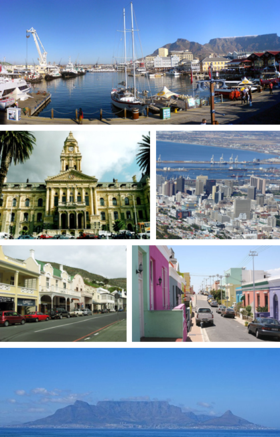
Flag
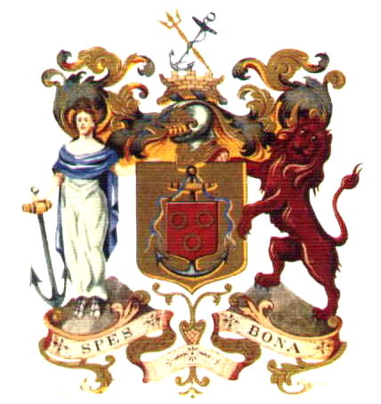
SealNickname(s): The Mother City, The Tavern of the Seas Motto: Spes Bona (Latin for "Good Hope") The Cape Town metropolitan area Location in the Western Cape
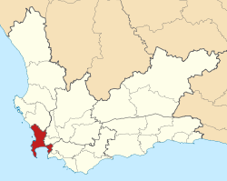 Location in South Africa
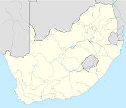
 Cape Town
Coordinates (City Hall): 33°55′31″S 18°25′26″E / 33.92528°S 18.42389°ECoordinates: 33°55′31″S 18°25′26″E / 33.92528°S 18.42389°E Country  South Africa
Province Western Cape Municipality City of Cape Town Founded 1652 Municipal government 1839 Government[1] – Type Metropolitan municipality – Mayor Patricia de Lille (DA) – Council Cape Town City Council – City manager Achmat Ebrahim Area[2] – Total 2,454.72 km2 (947.8 sq mi) Highest elevation 1,590.4 m (5,218 ft) Lowest elevation 0 m (0 ft) Population (2007)[3] – Total 3,497,097 – Density 1,424.6/km2 (3,689.8/sq mi) Demonym Capetonian Racial makeup[4] – Coloured 44.0% – Black African 34.9% – White 19.3% – Indian or Asian 1.8% Languages[5] – Afrikaans 41.4% – Xhosa 28.8% – English 28.0% Time zone SAST (UTC+2) Postal code range 7700 to 8099 Area code(s) +27 (0)21 Twin Cities – Aachen  Germany
– Haifa  Israel
– Hangzhou  China
China– Miami-Dade County  United States
– Nice  France
– Saint Petersburg  Russia
Website www.CapeTown.gov.za Cape Town (Afrikaans: Kaapstad; Xhosa: iKapa) is the second-most populous city in South Africa,[3] and the provincial capital and primate city of the Western Cape. As the seat of the National Parliament, it is also the legislative capital of the country. It forms part of the City of Cape Town metropolitan municipality. The city is famous for its harbour as well as its natural setting in the Cape floral kingdom, including such well-known landmarks as Table Mountain and Cape Point. Cape Town is also Africa's most popular tourist destination.[6]
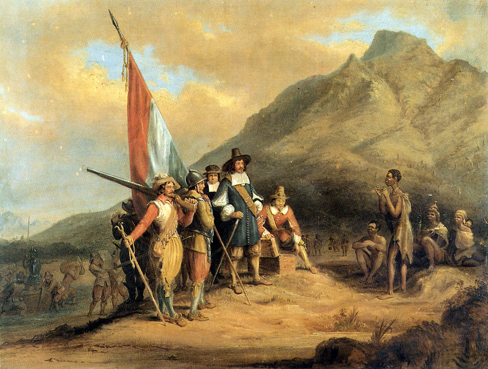
Located on the shore of Table Bay, Cape Town was originally developed by the Dutch East India Company as a victualling (supply) station for Dutch ships sailing to Eastern Africa, India, and the Far East. Jan van Riebeeck's arrival on 6 April 1652 established the first permanent European settlement in South Africa. Cape Town quickly outgrew its original purpose as the first European outpost at the Castle of Good Hope, becoming the economic and cultural hub of the Cape Colony. Until the Witwatersrand Gold Rush and the development of Johannesburg, Cape Town was the largest city in South Africa.
Today it is one of the most multicultural cities in the world, reflecting its role as a major destination for immigrants and expatriates to South Africa. As of 2007[update] the city had an estimated population of 3.5 million.[3] Cape Town's land area of 2,455 square kilometres (948 sq mi) is larger than other South African cities, resulting in a comparatively lower population density of 1,425 inhabitants per square kilometre (3,690 /sq mi).[2]
The city was named the World Design Capital for 2014 by the International Council of Societies of Industrial Design.[citation needed]
Contents
History
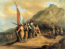
There is no certainty as to when humans first occupied the area prior to the first visits of Europeans in the 15th century. The earliest known remnants in the region were found at Peers cave in Fish Hoek and date to between 15,000 and 12,000 years ago.[7] Little is known of the history of the region's first residents, since there is no written history from the area before it was first mentioned by Portuguese explorer Bartolomeu Dias in 1486. Vasco da Gama recorded a sighting of the Cape of Good Hope in 1497. In the late 16th century, Portuguese, French, Danish, Dutch and English ships regularly stopped over in Table Bay en route to the Indies. They traded tobacco, copper and iron with the Khoikhoi in exchange for fresh meat. In 1652, Jan van Riebeeck and other employees of the Dutch East India Company (Dutch: Verenigde Oost-indische Compagnie, VOC) were sent to the Cape to establish a way-station for ships travelling to the Dutch East Indies, and the Fort de Goede Hoop (later replaced by the Castle of Good Hope). The settlement grew slowly during this period, as it was hard to find adequate labour. This labour shortage prompted the authorities to import slaves from Indonesia and Madagascar. Many of these became ancestors of the first Cape Coloured communities.[8][9] Under Van Riebeeck and his successors as VOC commanders and later governors at the Cape, an impressive range of useful plants were introduced to the Cape – in the process changing the natural environment forever. Some of these, including grapes, cereals, ground nuts, potatoes, apples and citrus, had an important and lasting influence on the societies and economies of the region.[10]
During the French Revolutionary and Napoleonic wars, the Netherlands was repeatedly occupied by France, and Great Britain moved to take control of Dutch colonies. Britain captured Cape Town in 1795, but the Cape was returned to the Netherlands by treaty in 1803. British forces occupied the Cape again in 1806 following the battle of Bloubergstrand. In the Anglo-Dutch Treaty of 1814, Cape Town was permanently ceded to Britain. It became the capital of the newly formed Cape Colony, whose territory expanded very substantially through the 1800s.[11]
The discovery of diamonds in Griqualand West in 1867, and the Witwatersrand Gold Rush in 1886, prompted a flood of immigrants to South Africa.[citation needed] Conflicts between the Boer republics in the interior and the British colonial government resulted in the Second Boer War of 1899–1902, which Britain won. In 1910, Britain established the Union of South Africa, which unified the Cape Colony with the two defeated Boer Republics and the British colony of Natal. Cape Town became the legislative capital of the Union, and later of the Republic of South Africa.
In the 1948 national elections, the National Party won on a platform of apartheid (racial segregation) under the slogan of "swart gevaar". This led to the Group Areas Act, which classified all areas according to race. Formerly multi-racial suburbs of Cape Town were either purged of unlawful residents or demolished. The most infamous example of this in Cape Town was District Six. After it was declared a whites-only region in 1965, all housing there was demolished and over 60,000 residents were forcibly removed.[12] Many of these residents were relocated to the Cape Flats and Lavender Hill. Under apartheid, the Cape was considered a "Coloured labour preference area", to the exclusion of "Bantus", i.e. blacks.
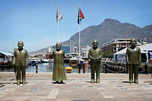
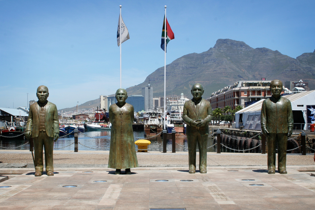
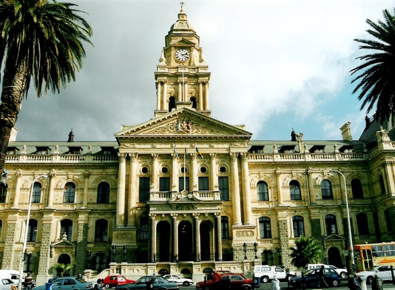
Cape Town was home to many leaders of the anti-apartheid movement. On Robben Island, a former penitentiary island 10-kilometres from the city, many famous political prisoners were held for years. In one of the most famous moments marking the end of apartheid, Nelson Mandela made his first public speech in decades on 11 February 1990 from the balcony of Cape Town City Hall hours after being released. His speech heralded the beginning of a new era for the country, and the first democratic election was held four years later, on 27 April 1994. Nobel Square in the Victoria & Alfred Waterfront features statues of South Africa's four Nobel Peace Prize winners – Albert Luthuli, Desmond Tutu, F. W. de Klerk and Nelson Mandela. Since 1994, the city has struggled with problems such as HIV/AIDS, tuberculosis, a surge in violent drug-related crime and more recent xenophobic violence. At the same time, the economy has surged to unprecedented levels due to the boom in the tourism and the real estate industries.[citation needed]
Geography
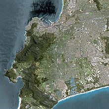 Cape Town seen from Spot satellite
 A Landsat image of Cape Town overlaid on SRTM elevation data. Elevation is exaggerated by a factor of two.
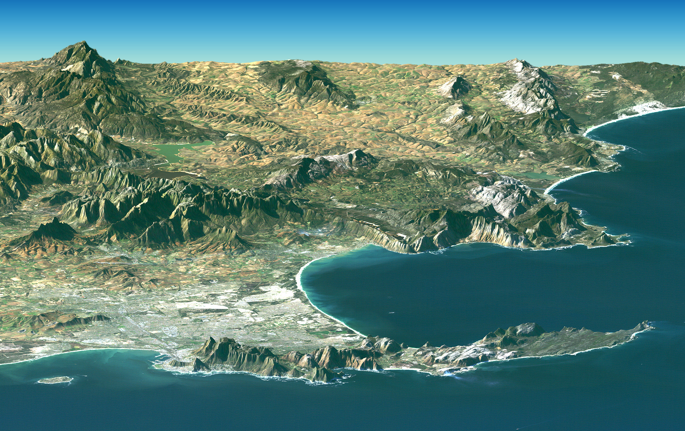
The centre of Cape Town is located at the northern end of the Cape Peninsula. Table Mountain forms a dramatic backdrop to the City Bowl, with its plateau over 1,000 m (3,300 ft) high; it is surrounded by near-vertical cliffs, Devil's Peak and Lion's Head. Sometimes a thin strip of cloud forms over the mountain, and owing to its appearance, it is colloquially known as the "tablecloth". The peninsula consists of a dramatic mountainous spine jutting southwards into the Atlantic Ocean, ending at Cape Point. There are over 70 peaks above 1,000 feet (300 m) (the American definition of a mountain) within Cape Town's official city limits. Many of the suburbs of Cape Town are on the large plain of the Cape Flats, which joins the peninsula to the mainland. The Cape Flats lie on what is known as a rising marine plain, consisting mostly of sandy geology which shows that at one point Table Mountain itself was an island.[citation needed]
Climate
Cape Town Climate chart (explanation) J F M A M J J A S O N D 1526161727162025144123126920993188821877718840199302111142413172515Average max. and min. temperatures in °C Precipitation totals in mm Source: HKO[13] Imperial conversion J F M A M J J A S O N D 0.679600.780600.878581.673532.769493.765463.26445364461.667481.270510.674560.77759Average max. and min. temperatures in °F Precipitation totals in inches The Cape Peninsula has a Subtropical Mediterranean climate (Koppen Csa), with mild, wet winters, and dry and very warm summers. In winter time, which lasts from the beginning of June to end of August, large cold fronts come across from the Atlantic Ocean with heavy precipitation and strong north-westerly winds. The winter months are cool, with an average minimum of 7.0 °C (45 °F) and maximum of 17.5 °C (63 °F).[14] Most of the city's annual rainfall occurs in wintertime, but due to the mountainous topography of the city, rainfall amounts for specific areas can vary dramatically. Newlands, to the south of the city, is the wettest suburb in South Africa.[15] The valleys and coastal plains average 515 millimetres (20.3 in) of rain per annum, while mountain areas can average as much as 1,500 millimetres (59 in) per annum.
Summer, which lasts from November to March, is warm and dry. The Peninsula gets frequent strong winds from the south-east, known locally as the Cape Doctor, because it blows away pollution and cleans the air. The south-easterly wind is caused by a high-pressure system which sits in the South Atlantic to the west of Cape Town, known as the South-Atlantic High. Summer temperatures are mild, with an average maximum of 26.5 °C (80 °F). Cape Town can be uncomfortably hot when the Berg Wind, meaning "mountain wind" blows from the Karoo interior for a couple of weeks in February or early March.
Cape Town's weather is remarkably similar to that of San Francisco,[16][17] with temperature being the conspicuous exception.[18][19] Cape Town receives slightly more hours of sunlight than San Francisco (3090 to 3030 hours)[20][21],, somewhat less rainfall (515mm to 518mm) [22][23] and marginally less wind (a mid-range 3 on the Beaufort scale with just under 50% wind probability,[24] compared to an average low Beaufort 4 at barely over 50% wind probability).[25] Cape Town is, however, noticeably warmer, with an average annual ambient air temperature of 19 °C (66 °F) versus San Francisco's 13 °C (55 °F).[16][17][19][20][21][21][22] On a much smaller, national scale compared to other large South African cities, Cape Town receives a nearly identical annual amount of precipatation as Pretoria 517 millimetres (20.4 in), and considerably less than Durban 828 millimetres (32.6 in). Remarkably, given that its 3,094 hours of sunshine is extremely high by international standards, Cape Town in fact receives slightly less sunshine than the South African national average for sunshine.[16] It is the least sunny of South Africa's three capital cities (Bloemfontein receives 3470 hours of sun a year, and Pretoria receives 3300), and also less sunny than the country’s financial centre of Johannesburg (3250 hours), Kimberly (3500 hours), Calvinia (3590 hours) or Upington (3840 hours).[26][27][28][29] However, Cape Town surpasses subtropical Durban (2,354 hours) by a great deal in terms of sunshine, though it is far cooler. As a matter of fact, Cape Town receives even more annual sunshine hours than almost all locations in the tropical zones of both the Northern and Southern Hemispheres, as do many Mediterranean climate areas due to their dry Summers. Compared to other Mediterranean climates (either Koppen climate Csa or Csb), Cape Town is rather warm but it is not hot. As an annual average, Cape Town (19 °C (66 °F)) is significantly warmer than Barcelona (16 °C (61 °F)),[30] barely warmer than Rome (18 °C (64 °F)),[31] fractionally cooler than Palermo,[32] or Athens (20 °C (68 °F)),[33] and the same as Naples.[34] The city receives very much more sunlight than any major city in the Mediterranean however (e.g. Especially sunny Mediterranean cities include Athens (2800 hours per year) [33] and Madrid (2830 hours per year)).[35]
Water temperatures range greatly, between 10 °C (50 °F) on the Atlantic Seaboard, to 22 °C (72 °F) in False Bay. Average annual Ocean temperatures are between 13 °C (55 °F) on the Atlantic Seaboard (similar to Californian waters, such as San Francisco or Big Sur), and 17 °C (63 °F) in False Bay (similar to Northern Mediterranean temperatures, such as Nice or Monte Carlo).
Climate data for Cape Town (1961–1990) Month Jan Feb Mar Apr May Jun Jul Aug Sep Oct Nov Dec Year Record high °C (°F) 39
(102)38
(100)41
(106)39
(102)34
(93)30
(86)29
(84)32
(90)33
(91)37
(99)40
(104)35
(95)41
(106)Average high °C (°F) 26.1
(79.0)26.5
(79.7)25.4
(77.7)23.0
(73.4)20.3
(68.5)18.1
(64.6)17.5
(63.5)17.8
(64.0)19.2
(66.6)21.3
(70.3)23.5
(74.3)24.9
(76.8)22.0 Average low °C (°F) 15.7
(60.3)15.6
(60.1)14.2
(57.6)11.9
(53.4)9.4
(48.9)7.8
(46.0)7.0
(44.6)7.5
(45.5)8.7
(47.7)10.6
(51.1)13.2
(55.8)14.9
(58.8)11.4 Record low °C (°F) 7
(45)6
(43)5
(41)2
(36)1
(34)−1
(30)−1
(30)0
(32)0
(32)1
(34)4
(39)6
(43)−1
(30)Rainfall mm (inches) 15
(0.59)17
(0.67)20
(0.79)41
(1.61)69
(2.72)93
(3.66)82
(3.23)77
(3.03)40
(1.57)30
(1.18)14
(0.55)17
(0.67)515
(20.28)% humidity 71 73 77 80 83 83 83 82 79 76 74 71 - Avg. rainy days (≥ 1.0 mm) 5.5 4.6 4.8 8.3 11.4 13.3 11.8 13.7 10.4 8.7 4.9 6.2 103.6 Sunshine hours 337.9 299.9 291.4 234.0 204.6 174.0 192.2 210.8 225.0 279.0 309.0 334.8 3,092.2 Source: South African weather service,[36] Hong Kong Observatory,[13] Climate & Temperature[37] Flora and fauna
Main article: Biodiversity of Cape TownLocated in a CI Biodiversity hotspot as well as the unique Cape Floristic Region, the city of Cape Town has one of the highest levels of biodiversity of any equivalent area in the world.[38]
It is home to a total of 19 different vegetation types, of which several are completely endemic to the city and occur nowhere else in the world.[39] It is also the only habitat of hundreds of endemic species,[40] and hundreds of others which are severely restricted or threatened. This enormous species diversity is mainly because the city is uniquely located at the convergence point of several different soil types and micro-climates.
An often quoted fact is that there are more indigenous plant species just on Table Mountain than there are in the whole of the British Isles.[41][42][43]
Unfortunately, rapid population growth and urban sprawl has covered much of these ecosystems with development. Consequently Cape Town now has over 300 threatened plant species and 13 which are now extinct. In fact, the Cape Peninsula, which lies entirely within the city of Cape Town, has the highest concentration of threatened species of any continental area of equivalent size in the world.[44] Tiny remnants of critically endangered or near extinct plants often survive on road sides, pavements and sports fields.[45] The remaining ecosystems are partially protected through a system of over 30 nature reserves – including the massive Table Mountain National Park.
Suburbs
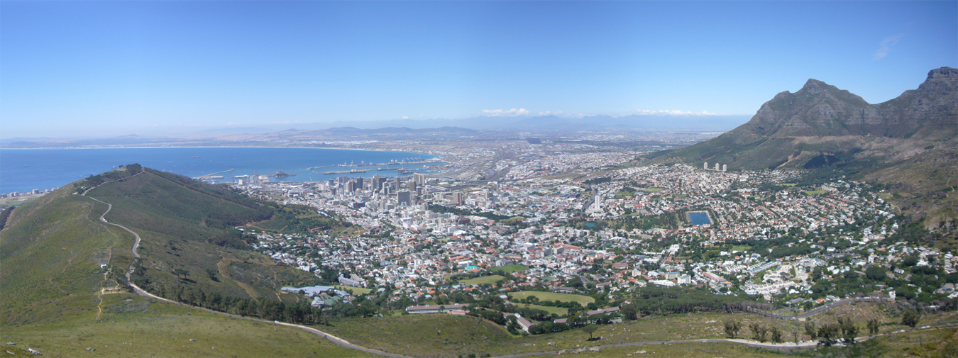
City Bowl
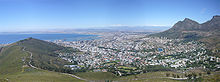 The City Bowl viewed from Lion's Head
The City Bowl is a natural amphitheatre-shaped area bordered by Table Bay and defined by the mountains of Signal Hill, Lion's Head, Table Mountain and Devil's Peak.
The area includes the central business district of Cape Town, the harbour, the Company's Garden, and the residential suburbs of De Waterkant, Devil's Peak, District Six, Zonnebloem, Gardens, Bo-Kaap, Higgovale, Oranjezicht, Schotsche Kloof, Tamboerskloof, University Estate, Vredehoek, Walmer Estate and Woodstock.
Northern Suburbs
The Northern Suburbs are mostly Afrikaans-speaking, and include Bellville, Bothasig, Brooklyn, Burgundy Estate, Durbanville, Edgemead, Elsie's River, Facreton, Goodwood, Kensington, Maitland, Monte Vista, Panorama, Parow, Richwood, Thornton, Table View, and Welgemoed.
Eastern Suburbs
The Eastern Suburbs include Fairdale, Brackenfell, Kraaifontein, Kuils River, Blue Downs, Belhar and Protea Hoogte.
Atlantic Seaboard
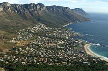
 A panoramic view of Hout Bay from Chapman's Peak. Chapman's Peak Drive can be seen at the base of the mountain.
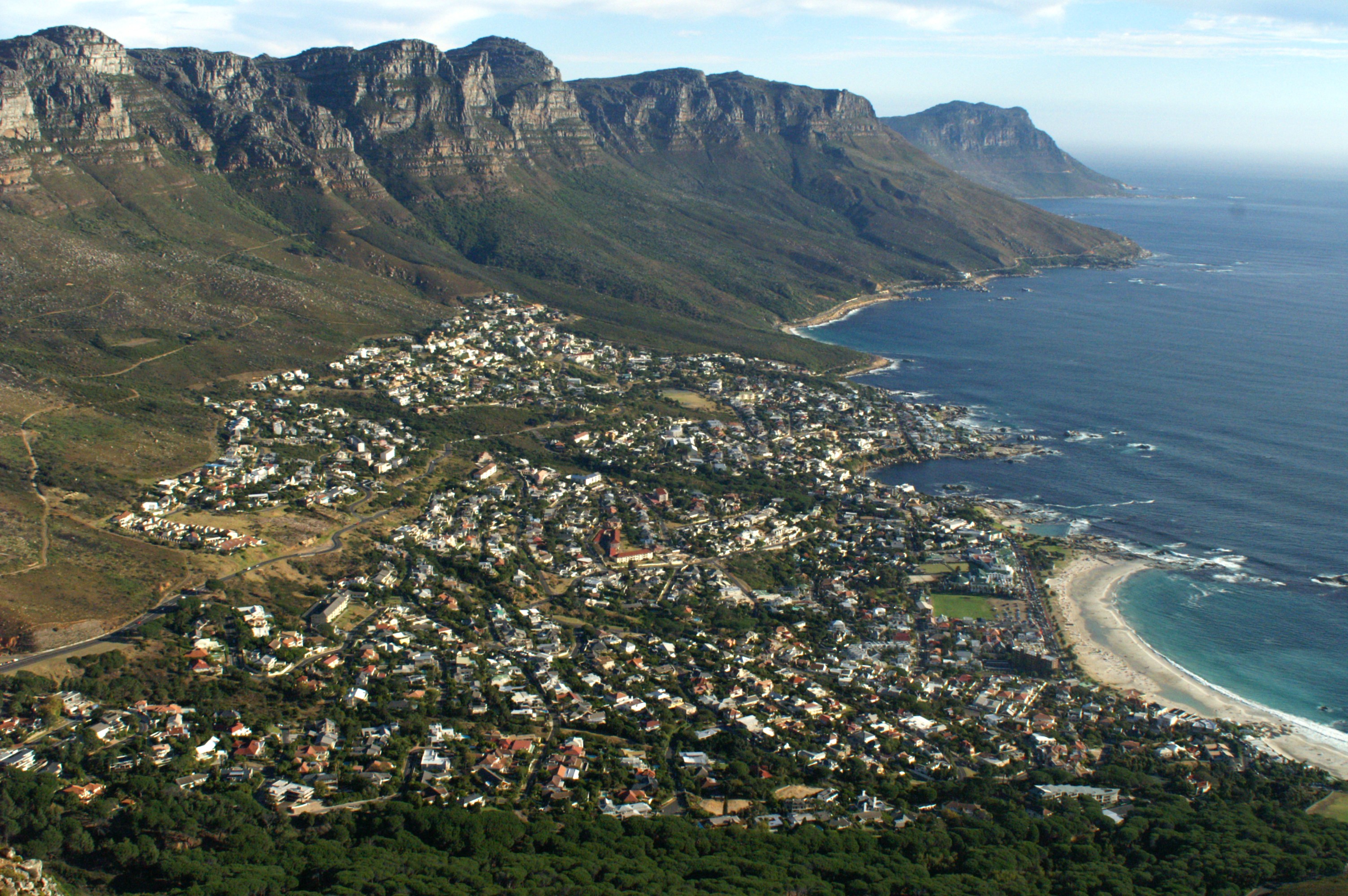
The Atlantic Seaboard includes Bantry Bay, Camps Bay, Clifton, Fresnaye, Green Point, Hout Bay, Llandudno, Mouille Point, Sea Point, and Three Anchor Bay.
Southern Suburbs
The Southern Suburbs include Rondebosch, Claremont, Plumstead, Ottery, Pinelands, Wynberg, Newlands, Bergvliet, Constantia and Bishopscourt.
South Peninsula
 The historical centre of Simon's Town
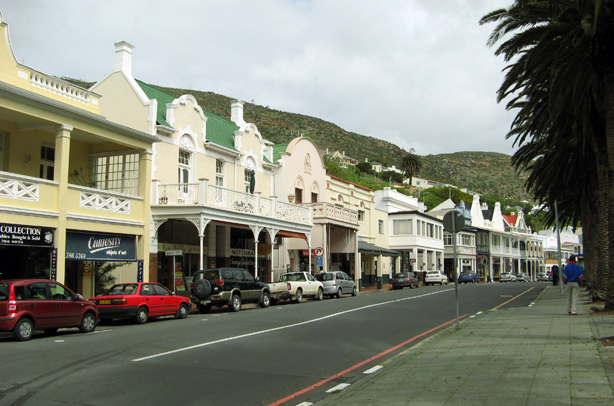
The South Peninsula is generally regarded as the area south of Muizenberg on the Indian Ocean and Noordhoek on the Atlantic Ocean, all the way to Cape Point. Until recently quite rural, the population of the area is growing quickly as new coastal developments proliferate and larger plots are subdivided to provide more compact housing. It includes Capri Village, Clovelly, Fish Hoek, Glencairn, Kalk Bay, Kommetjie, Masiphumelele, Muizenberg, Noordhoek, Ocean View, Scarborough, Simon's Town, St James, Sunnydale, Sun Valley, and Steenberg.
Cape Flats
The Cape Flats is an expansive, low-lying, flat area situated to the southeast of the central business district of Cape Town. To most people in Cape Town, the area is known simply as 'The Flats'.
Described by some as 'apartheid's dumping ground', from the 1950s the area became home to people the apartheid government designated as non-White. Race-based legislation such as the Group Areas Act and pass laws either forced non-white people out of more central urban areas designated for white people and into government-built townships in the Flats, or made living in the area illegal, forcing many people designated as Black into informal settlements elsewhere in the Flats. The Flats have since then been home to much of the population of Greater Cape Town.
West Coast
The West Coast suburbs of Cape Town include Bloubergstrand, Milnerton, Tableview, West Beach, Atlantis, Melkbosstrand, Big Bay, Sunset Beach, Sunningdale and Parklands.
Government
Cape Town's local government is the City of Cape Town, which is a metropolitan municipality. Cape Town is governed by a 221-member city council. The city is divided into 111 electoral wards; each ward directly elects one member of the council, whilst the other 110 councillors are elected by a system of party-list proportional representation. The Executive Mayor and Executive Deputy Mayor are chosen by the city council.
In the local government elections of 18 May 2011, the Democratic Alliance (DA) won an outright majority, taking 135 of the 221 council seats. The African National Congress, the national ruling party, received 73 seats.[46] As a result of this victory Patricia de Lille, the DA mayoral candidate, was inaugurated as Executive Mayor on 1 June.
Demographics
 Population density in Cape Town<1 /km²1–3 /km²3–10 /km²10–30 /km²30–100 /km²100–300 /km²300–1000 /km²1000–3000 /km²>3000 /km²
According to the South African National Census of 2001, the population of the City of Cape Town metropolitan municipality — an area that includes suburbs and exurbs often considered not to be part of Cape Town — was 2,893,251 people. There are 759,767 formal households, of which 87.4% have a flush or chemical toilet, and 94.4% have refuse removed by the municipality at least once a week. 80.1% of households use electricity as the main source of energy. 16.1% of households are headed by one person.[47]
Coloured people account for 48.13% of the population, followed by Black Africans at 31%, Whites at 18.75%, and Asians at 1.43%. In 1944, 47% of the city's population was White, 46% was Coloured, less than 6% was Black African and 1% was Asian.[48] 46.6% of the population is under the age of 24, whilst 5% are over the age of 65. The median age in the city is 26 years old, and for every 100 females, there are 92.4 males. 19.4% of city residents are unemployed; 58.3% of the unemployed are Black, 38.1% are Coloured, 3.1% are White and 0.5% are Asian.[47] In the actual city of Cape Town, there is a higher percentage of white people.
41.4% of Cape Town residents speak Afrikaans at home, 28.7% speak Xhosa, 27.9% speak English, 0.7% speak Sotho, 0.3% speak Zulu, 0.1% speak Tswana and 0.7% of the population speaks a non-official language at home. 76.6% of residents are Christian, 10.7% have no religion, 9.7% are Muslim, 0.5% are Jewish and 0.2% are Hindu. 2.3% have other or undetermined beliefs.[47]
4.2% of residents aged 20 and over have received no schooling; 11.8% have had some primary; 7.1% have completed only primary school; 38.9% have had some high education; 25.4% have finished only high school and 12.6% have an education higher than the high school level. Overall, 38.0% of residents have completed high school. The median annual income of working adults aged 20–65 is ZAR 25 774. Males have a median annual income of ZAR 27 406 versus ZAR 22 265 for females.[47]
Economy
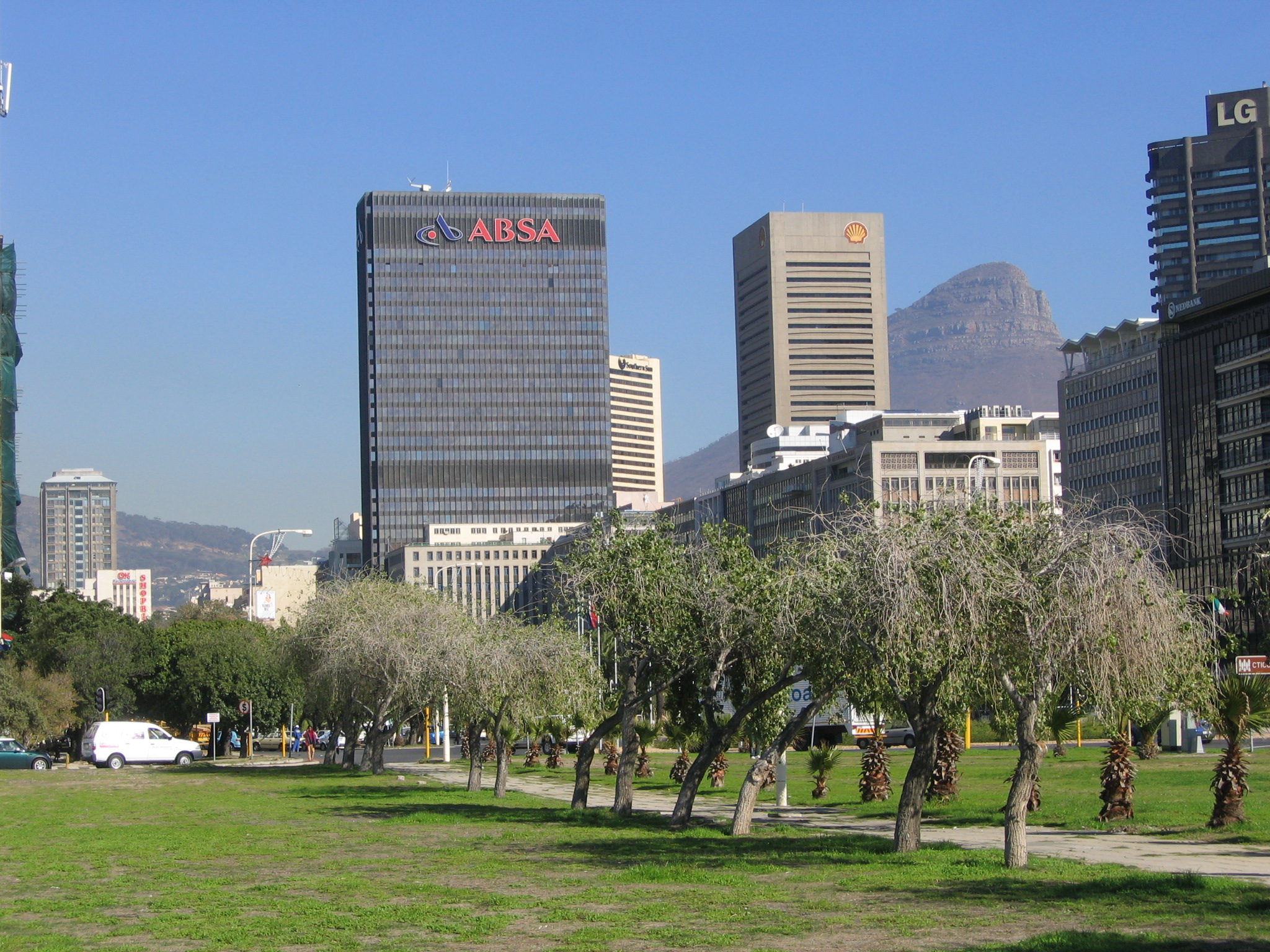
Main article: Economy of the Western Cape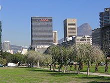 Cape Town foreshore area with the ABSA Bank building in the background.
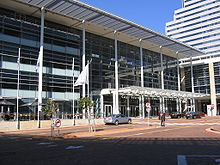
Cape Town is the economic centre of the Western Cape Province, South Africa's second main economic centre and Africa's third main economic hub city. It serves as the regional manufacturing centre in the Western Cape. It also has the primary harbour and airport in the province. The large government presence in the city – both as the capital of the Western Cape and the seat of the National Parliament – has led to increased revenue and growth in industries that serve the government. Cape Town hosts many conferences, particularly in the recently expanded Cape Town International Convention Centre, which opened in June 2003 and is due for another expansion within the next year.[citation needed]
Cape Town has recently enjoyed a booming real estate and construction market, because of the 2010 World Cup as well as many people buying summer homes in the city or relocating there permanently. Cape Town hosted 9 World Cup matches: Six 1st round matches, one second round, one quarter final and a semifinal. The central business district is under an extensive urban renewal programme, with numerous new buildings and renovations taking place under the guidance of the Cape Town Partnership.[49]
Cape Town has four major commercial nodes, with Cape Town Central Business District containing the majority of job opportunities and office space. Century City, the Bellville/TygerValley strip and Claremont commercial nodes are well established and contain many offices and corporate headquarters as well. Most companies headquartered in the city are insurance companies, retail groups, publishers, design houses, fashion designers, shipping companies, petrochemical companies, architects and advertising agencies.[citation needed]
Much of the produce is handled through the Port of Cape Town or Cape Town International Airport. Most major shipbuilding companies have offices and manufacturing locations in Cape Town.[50] The Province is also a centre of energy development for the country, with the existing Koeberg nuclear power station providing energy for the Western Cape's needs. Recently, oil explorers have discovered oil and natural gas off the coast in the Atlantic Ocean.[51]
The Western Cape is an important tourist region in South Africa; the tourism industry accounts for 9.8% of the GDP of the province and employs 9.6% of the province's workforce. In 2004, over 1.5 million international tourists visited the area.[52]
With the highest number of successful Information Technology companies in Africa, Cape Town is an important centre for the industry on the continent. Growing at an annual rate of 8.5% and an estimated worth of R77 billion in 2010 nationwide the IT industry in Cape Town is becoming increasingly important to the city's economy.[53]
The city was recently named as the most entrepreneurial city in South Africa, with the percentage of Capetonians pursuing business opportunities almost three times higher than the national average. Those aged between 18–64 were 190% more likely to pursue new business, whilst in Johannesburg, the same demographic group was only 60% more likely than the national average to pursue a new business.[54]
Tourism
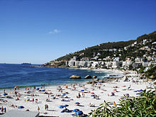 Clifton 4th Beach
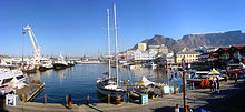 Panoramic view across the Victoria Basin at the Victoria & Alfred Waterfront, with Table Mountain in the background
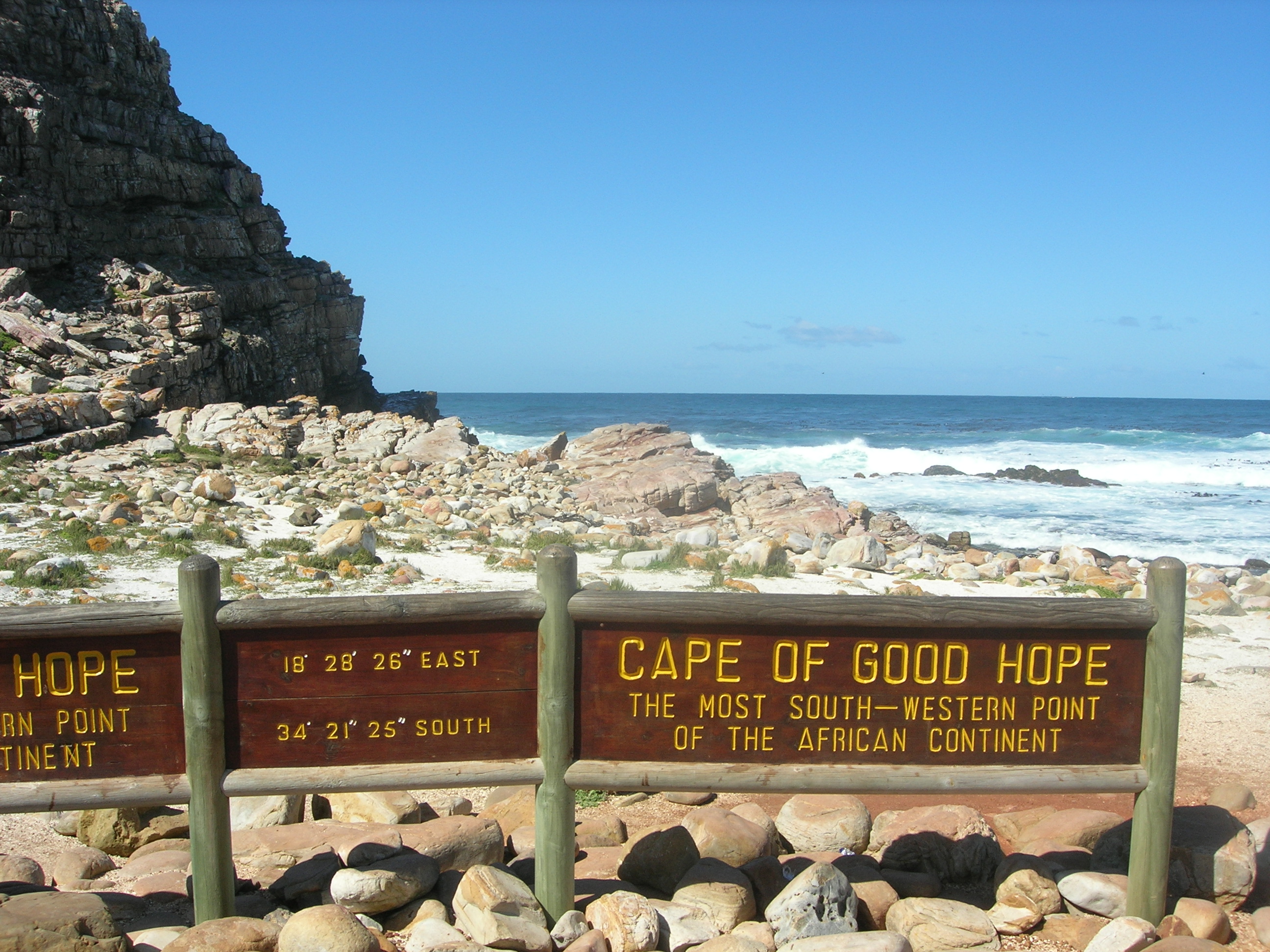
Cape Town is not only the most popular international tourist destination in South Africa, but Africa as a whole. This is due to its good climate, natural setting, and well-developed infrastructure. The city has several well-known natural features that attract tourists, most notably Table Mountain,[55] which forms a large part of the Table Mountain National Park and is the back end of the City Bowl. Reaching the top of the mountain can be achieved either by hiking up, or by taking the Table Mountain Cableway. Cape Point is recognised as the dramatic headland at the end of the Cape Peninsula.[56] Many tourists also drive along Chapman's Peak Drive, a narrow road that links Noordhoek with Hout Bay, for the views of the Atlantic Ocean and nearby mountains. It is possible to either drive or hike up Signal Hill for closer views of the City Bowl and Table Mountain.[57]
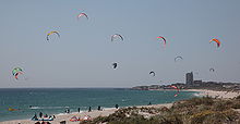
Many tourists also visit Cape Town's beaches, which are popular with local residents.[58] Due to the city's unique geography, it is possible to visit several different beaches in the same day, each with a different setting and atmosphere. Though the Cape's water ranges from cold to mild, the difference between the two sides of the city is dramatic. While the Atlantic Seaboard averages annual water temperatures barely above that of coastal California around 13 °C (55 °F), the False Bay coast is very much warmer, averaging between 16 and 17 °C (61 and 63 °F) annually. This is similar to water temperatures in much of the Northern Mediterranean (for example Nice). In Summer, False bay water averages slightly over 20 °C (68 °F), with 22 °C (72 °F) a common high. Beaches located on the Atlantic Coast tend to have very cold water due to the Benguela current which originates from the Southern Ocean, whilst the water at False Bay beaches may be warmer by up to 10 °C (18 °F) at the same moment due to the influence of the warm Agulhas current, and the surface warming effects of the South Easter wind.[58]
Both coasts are equally popular, although the beaches in affluent Clifton and elsewhere on the Atlantic Coast are better developed with restaurants and cafés, with a particularly vibrant strip of restaurants and bars accessible to the beach at Camps Bay. Boulders Beach near Simon's Town is known for its colony of African Penguins.[59] Surfing is popular and the city hosts the Red Bull Big Wave Africa surfing competition every year.
The city has several notable cultural attractions. The Victoria & Alfred Waterfront, built on top of part of the docks of the Port of Cape Town, is the city's most visited tourist attraction. It is also one of the city's most popular shopping venues, with several hundred shops and the Two Oceans Aquarium.[60][61] Part of the charm of the V&A, as it is locally known, is that the Port continues to operate and visitors can watch ships enter and leave. The V&A also hosts the Nelson Mandela Gateway, through which ferries depart for Robben Island.[62] It is possible to take a ferry from the V&A to Hout Bay, Simon's Town and the Cape Fur Seal colonies on Seal and Duiker Islands. Several companies offer tours of the Cape Flats, a mostly Coloured township, and Khayelitsha, a mostly black township. An option is to sleep overnight in Cape Town's townships. There are several B&Bs where you can spend a safe and real African night.[63]
Cape Town is noted for its architectural heritage, with the highest density of Cape Dutch style buildings in the world. Cape Dutch style, which combines the architectural traditions of the Netherlands, Germany, France and Indonesia, is most visible in Constantia, the old government buildings in the Central Business District, and along Long Street.[64][65] The annual Cape Town Minstrel Carnival, also known by its Afrikaans name of Kaapse Klopse, is a large minstrel festival held annually on 2 January or "Tweede Nuwe Jaar" (Afrikaans: Second New Year). Competing teams of minstrels parade in brightly coloured costumes, performing Cape Jazz, either carrying colourful umbrellas or playing an array of musical instruments. The Artscape Theatre Centre is the main performing arts venue in Cape Town.
The city also encloses the 36 hectare Kirstenbosch National Botanical Garden that contains protected natural forest and fynbos along with a variety of animals and birds. There are over 7000 species in cultivation at Kirstenbosch, including many rare and threatened species of the Cape Floristic Region. In 2004 this Region, including Kirstenbosch, was declared a UNESCO World Heritage Site.[66]
Cape Town's transport system links it to the rest of South Africa; it serves as the gateway to other destinations within the province. The Cape Winelands and in particular the towns of Stellenbosch, Paarl and Franschhoek are popular day trips from the city for sightseeing and wine tasting.[67][68] Whale watching is popular amongst tourists: Southern Right Whales and Humpback Whales are seen off the coast during the breeding season (August to November) and Bryde's Whales and Killer Whale can be seen any time of the year.[69] The nearby town of Hermanus is known for its Whale Festival, but whales can also be seen in False Bay.[69] Heaviside's dolphins are endemic to the area and can be seen from the coast north of Cape Town; Dusky dolphins live along the same coast and can occasionally be seen from the ferry to Robben Island.[69]
The only complete windmill in South Africa is Mostert's Mill, Mowbray. It was built in 1796 and restored in 1935 and again in 1995. The mill is open to the public on one Saturday a month.
Approximately 1.5 million tourists visited in Cape Town during 2004, bringing in a total of R10 billion in revenue.[citation needed] The forecasts for 2006 anticipate 1.6 million tourists spending a total of R12 billion.[who?] The most popular areas for visitors to stay include Camps Bay, Sea Point, the V&A Waterfront, the City Bowl, Hout Bay, Constantia, Rondebosch, Newlands, Somerset West, Hermanus and Stellenbosch, as well.[70]
The total accommodation capacity in Cape Town currently stands at close to 60,000 beds (29, 800 rooms) in 2690 establishments,[citation needed] the highest of all South African cities.[citation needed]
Communications and media
Several newspapers, magazines and printing facilities have their offices in the city. Independent News and Media publishes the major English language papers in the city, the Cape Argus and the Cape Times. Naspers, the largest media conglomerate in South Africa, publishes Die Burger, the major Afrikaans language paper.[71]
Cape Town has many local community newspapers. Some of the largest community newspapers in English are the Athlone News from Athlone, the Atlantic Sun, the Constantiaberg Bulletin from Constantiaberg, the City Vision from Bellville, the False Bay Echo from False Bay, the Helderberg Sun from Helderberg, the Plainsman from Michells Plain, the Sentinel News from Hout Bay, the Southern Mail from the Southern Peninsula, the Southern Suburbs Tatler from the Southern Suburbs, Table Talk from Table View and Tygertalk from Tygervalley/Durbanville. Afrikaans language community newspapers include the Landbou-Burger and the Tygerburger. Vukani, based in the Cape Flats, is published in Xhosa.[72]
Cape Town is a centre for broadcast media and has several radio stations that only broadcast within the city. 94.5 Kfm (94.5 MHz FM) and Good Hope FM (94–97 MHz FM) mostly play pop music. Heart FM (104.9 MHz FM), the former P4 Radio, plays Jazz and R&B, while Fine Music Radio (101.3 FM) plays classical music and jazz. Bush Radio is a community radio station (89.5 MHz FM). The Voice of the Cape (95.8 MHz FM) and Cape Talk (567 kHz MW) are the major talk radio stations in the city.[73] The University of Cape Town also runs its own radio station, UCT Radio (104.5 MHz FM).
The SABC (South African Broadcasting Corporation) has a small presence in the city, with satellite studios located at Sea Point. e.tv has a greater presence, with a large complex located at Longkloof Studios in Gardens. M-Net is not well represented with infrastructure within the city. Cape Town TV is a local TV station, supported by numerous organisation and folcus mostly on documentaries. Numerous productions companies and their support industries are located in the city, mostly supporting the production of overseas commercials, model shoots, TV-series and movies.[74] The local media infrastructure remains primarily in Johannesburg.
Sport
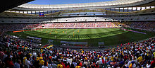
Venue Sport Capacity Club(s) Cape Town Stadium Football/Rugby 69,070 Ajax CT Newlands Cricket Ground Cricket 25,000 Cape Cobras, Western Province Cricket Newlands Rugby Stadium Rugby 47,000 Stormers, Western Province Athlone Stadium Football 24,000 Santos Football Club Philippi Stadium Football 5,000 Bellville Velodrome Cycling (Track) 3,000 Western Province Cycling Hartleyvale Hockey Centre Field Hockey 2,000 Western Province Hockey Turfhall Stadium Softball 3,000 Western Province Softball Good Hope Centre Various indoor sports 6,000 Various Royal Cape Yacht Club Sailing N/A Royal Cape Yacht Club Grand West Arena Various 6,000 N/A Green Point Athletics Stadium Athletics, Football 5,000 N/A Newlands Swimming Pool Swimming/water polo/diving 2,000 WP Aquatics Autshumato/Berg River Dam Rowing/Canoe-Kayak N/A N/A Cape Town's most popular sports by participation are cricket, association football, swimming, and rugby union.[75] In rugby union, Cape Town is the home of the Western Province side, who play at Newlands Stadium and compete in the Currie Cup. In addition, Western Province players (along with some from Wellington's Boland Cavaliers) comprise the Stormers in the Southern Hemisphere's Super Rugby competition. Cape Town also regularly hosts the national team, the Springboks, and hosted matches during the 1995 Rugby World Cup, including the opening ceremony and game, as well as the All Blacks versus England semi-final that saw Jonah Lomu run in four tries.
Association football, which is better known as soccer in South Africa, is also popular. Three clubs from Cape Town play in the Premier Soccer League (PSL), South Africa's premier league. These teams are Ajax Cape Town, which formed as a result of the 1999 amalgamation of the Seven Stars and the Cape Town Spurs, Santos and newly-promoted Vasco da Gama. Cape Town was also the location of several of the matches of the FIFA 2010 World Cup including a semi-final,[76] held in South Africa. The Mother City built a new 70,000 seat stadium (Green Point Stadium) in the Green Point area.
In cricket, the Cape Cobras represent Cape Town at the Newlands Cricket Ground. The team is the result of an amalgamation of the Western Province Cricket and Boland Cricket teams. They take part in the Supersport and Standard Bank Cup Series. The Newlands Cricket Ground regularly hosts international matches.
Cape Town has Olympic aspirations: in 1996, Cape Town was one of the five candidate cities shortlisted by the IOC to launch official candidatures to host the 2004 Summer Olympics. Although the games ultimately went to Athens, Cape Town came in third place. There has been some speculation that Cape Town is seeking the South African Olympic Committee's nomination to be South Africa's bid city for the 2020 Summer Olympic Games.[77]
Sports events
Further information: List of sports events in Cape TownThe city of Cape Town has vast experience in hosting major national and international sports events.
The Cape Argus Pick 'n Pay Cycle Tour is the world's largest individually timed cycle race – and the first event outside Europe to be included in the International Cycling Union's Golden Bike Series. It sees over 35 000 cyclists tackling a 109 km route around Cape Town. The Absa Cape Epic is the largest full-service mountain bike stage race in the world.
Some notable events hosted by Cape Town have included the 1995 Rugby World Cup, 2003 ICC Cricket World Cup, and World Championships in various sports such as athletics, fencing, weightlifting, hockey, cycling, canoeing, gymnastics and others.
Cape Town was also a host city to the 2010 FIFA World Cup from 11 June to 11 July 2010, further enhancing its profile as a major events city. It was also one of the host cities of the 2009 Indian Premier League cricket tournament.
Education
Public primary and secondary schools in Cape Town are run by the Western Cape Education Department. This provincial department is divided into seven districts; four of these are "Metropole" districts – Metropole Central, North, South, and East – which cover various areas of the city.[78] There are also many private schools, both religious and secular, in Cape Town.
Tertiary education

Cape Town has a well-developed higher system of public universities. Cape Town is served by three public universities: the University of Cape Town (UCT), the University of the Western Cape (UWC) and the Cape Peninsula University of Technology (CPUT). Stellenbosch University, while not in the city itself, is 50-kilometres from the City Bowl and has additional campuses, such as the Tygerberg Faculty of Health Sciences and the Bellville Business Park closer to the City.
Both the University of Cape Town and Stellenbosch University are leading universities in South Africa. This is due in large part to substantial financial contributions made to these institutions by both the public and private sector. UCT is an English speaking institution. It has over 21,000 students and has an MBA programme that is ranked 51st by the Financial Times in 2006.[79] It is also the top-ranked university in Africa, being the only African university to make the world's Top 200 university list at number 146.[80] Since the African National Congress has come into governmental power, some restructuring of Western Cape universities has taken place and as such, traditionally non-white universities have seen increased financing, which has benefitted the University of the Western Cape.[81][82]
The public Cape Peninsula University of Technology was formed on 1 January 2005, when two separate institutions – Cape Technikon and Peninsula Technikon – were merged. The new university offers education primarily in English, although one may take courses in any of South Africa's official languages. The institution generally awards the National Diploma.
Cape Town has also become a popular study abroad destination for many American college students. Many study abroad providers, such as IES Abroad, offer semester, summer, short-term, and internship programs in partnership with Cape Town universities as a chance for American students to gain intercultural understanding.
Transport
- Air
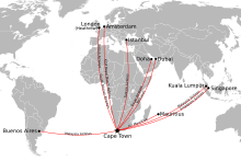 Map showing flights from Cape Town International Airport to destinations outside Southern Africa.
Cape Town International Airport serves both domestic and international flights. It is the second-largest airport in South Africa and serves as a major gateway for travellers to the Cape region. Cape Town has direct flights to most cities in South Africa as well as a number of international destinations.[83]
Cape Town International Airport recently opened a brand new central terminal building that was developed to handle an expected increase in air traffic as tourism numbers will increase in the lead-up to the 2010 FIFA World Cup.[84] Other renovations include several large new parking garages, a revamped domestic departure terminal, a new Bus Rapid Transit system station and a new double-decker road system. The airport's cargo facilities are also being expanded and several large empty lots are being developed into office space and hotels.
The Cape Town International Airport was among the winners of the World Travel Awards for being Africa's leading airport.[85]
- Sea
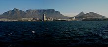 Table Mountain from the Harbour.
Cape Town has a long tradition as a port city. The Port of Cape Town, the city's main port, is located in Table Bay directly to the north of the central business district. The port is a hub for ships in the southern Atlantic: it is located along one of the busiest shipping corridors in the world. It is also a busy container port, second in South Africa only to Durban. In 2004, it handled 3,161 ships and 9.2 million tonnes of cargo.[86]
Simon's Town Harbour on the False Bay coast of the Cape Peninsula is the main base of the South African Navy.
The Port of Cape Town (specifically the V&A Waterfront) made headlines worldwide during 2009 when plans to berth the iconic liner QE2 were announced.
- Rail
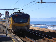
The Shosholoza Meyl is the passenger rail operations of Spoornet and operates two long-distance passenger rail services from Cape Town: a daily service to and from Johannesburg via Kimberley and a weekly service to and from Durban via Kimberley, Bloemfontein and Pietermaritzburg. These trains terminate at Cape Town railway station and make a brief stop at Bellville. Cape Town is also one terminus of the luxury tourist-oriented Blue Train as well as the five-star Rovos Rail.
Metrorail operates a commuter rail service in Cape Town and the surrounding area. The Metrorail network consists of 96 stations throughout the suburbs and outskirts of Cape Town.
- Road
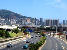 The N2, also known as the Nelson Mandela Boulevard (prev. Eastern Boulevard), as it enters the City Bowl and ends in the Central Business District
Three national roads start in Cape Town: the N1 which links Cape Town with Bloemfontein, Johannesburg, Pretoria and Zimbabwe; the N2 which links Cape Town with Port Elizabeth, East London and Durban; and the N7 which links Cape Town with the Northern Cape Province and Namibia. The N1 and N2 both start in the Central Business District, and split to the east of the CBD, with the N1 continuing to the north east and the N2 heading south east past Cape Town International Airport. The N7 starts in Mitchells Plain and runs north, intersecting with the N1 and the N2 before leaving the city.
Cape Town also has a system of freeway and dual carriageway M-roads, which connect different parts of the city. The M3 splits from the N2 and runs to the south along the eastern slopes of Table Mountain, connecting the City Bowl with Muizenberg. The M5 splits from the N1 further east than the M3, and links the Cape Flats to the CBD. The R300, which is informally known as the Cape Flats Freeway, links Mitchells Plain with Bellville, the N1 and the N2.
- Buses
Golden Arrow Bus Services operates scheduled bus services throughout the Cape Town metropolitan area. Several companies run long-distance bus services from Cape Town to the other cities in South Africa.
- Integrated Rapid Transit
Cape Town has embarked on Phase 1 of the IRT system with a total investment of close to R5 billion. Phase 1 will include a West Coast Service, Inner City Service and Airport Link. A 2010 Starter service to meet the requirements for the FIFA World Cup will include an Inner City Service, Stadium Shuttle and Airport Service. A total of 43 IRT Volvo buses have been ordered and are expected to be delivered during April and May.
- Taxis
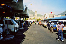 Cape Town taxi rank above train station
Cape Town has two kinds of taxis: metered taxis and minibus taxis. Unlike many cities, metered taxis are not allowed to drive around the city to solicit fares and instead must be called to a specific location.
Minibus taxis are the standard form of transport for the majority of the population who cannot afford private vehicles.[87] Although essential, these taxis are often poorly maintained and are frequently not road-worthy. These taxis make frequent unscheduled stops to pick up passengers, which can cause accidents.[88][89] With the high demand for transport by the working class of South Africa, minibus taxis are often filled over their legal passenger allowance, making for high casualty rates when minibuses are involved in accidents. Minibuses are generally owned and operated in fleets, and inter-operator violence flares up from time to time, especially as turf wars occur over lucrative taxi routes.[90]
Twin towns – sister cities
Cape Town has six twin towns and sister cities, as listed below:
Country City Established GermanyAachen[91] 2000  Thailand
Bangkok[citation needed] 2007 IsraelHaifa[92] 1975 ChinaHangzhou[93] 2005 FranceNice[94] 1974 RussiaSaint Petersburg[95] 2001  Belgium
Antwerp[citation needed] 1996 See also
References
- ^ Pollack, Martin (31 May 2006). "Achmat Ebrahim is the new city manager of Cape Town". City of Cape Town Metropolitan Municipality. http://www.capetown.gov.za/clusters/viewarticle3.asp?conid=12705. Retrieved 25 March 2007.
- ^ a b "City of Cape Town". Municipal Demarcation Board. http://www.demarcation.org.za/PortalPages/Info_1.aspx?type=Metropolitan&code=CPT&Prov=Western%20Cape&sT=Metropolitan&to=&frm=home. Retrieved 23 March 2008.[dead link]
- ^ a b c "Community Survey, 2007: Basic Results Municipalities" (PDF). Statistics South Africa. http://www.statssa.gov.za/Publications/P03011/P030112007.pdf. Retrieved 23 March 2008.
- ^ "Community Survey 2007 interactive data". Statistics South Africa. http://www.statssa.gov.za/community_new/content.asp?link=interactivedata.asp. Retrieved 19 October 2009.
- ^ "Census 2001 interactive data". Statistics South Africa. http://www.statssa.gov.za/census01/html/C2001Interactive.asp. Retrieved 19 October 2009.
- ^ "Why Cape Town is one of the Best Tourist and Expat Destinations". http://www.expatcapetown.com/why-cape-town.html.
- ^ "The Antiquity of man". SouthAfrica.info. http://www.antiquityofman.com/Peers_Cave.html.
- ^ "Cape-Slavery-Heritage " Coloured People of the Western Cape have the most Diverse Ancestry in the World :: iBlog". Cape-slavery-heritage.iblog.co.za. 1 May 2009. http://cape-slavery-heritage.iblog.co.za/2009/05/01/coloured-people-of-the-western-cape-have-the-most-diverse-ancestry-in-the-world/. Retrieved 17 March 2011.
- ^ "Slavery and early colonisation , South African History Online". Sahistory.org.za. 22 September 1927. http://www.sahistory.org.za/pages/governence-projects/slavery/slavery.htm. Retrieved 17 March 2011.
- ^ Pooley, S. ‘Jan van Riebeeck as Pioneering Explorer and Conservator of Natural Resources at the Cape of Good Hope (1652–62),’ Environment and History 15 (2009): 3–33. doi: 10.3197/096734009X404644
- ^ Bell, Charles. "A painting of the arrival of Jan van Riebeeck in Table Bay". http://www.rosebuds.co.za/Toere/Cape%20Town.htm. Retrieved 11 April 2011.
- ^ "Recalling District Six". SouthAfrica.info. 19 August 2003. http://www.southafrica.info/ess_info/sa_glance/history/districtsix.htm.
- ^ a b "Climatological Normals of Cape Town". Hong Kong Observatory. http://www.hko.gov.hk/wxinfo/climat/world/eng/africa/sa_zi/cape_town_e.htm. Retrieved 23 May 2010.
- ^ "World Weather Information Service – Cape Town". http://www.worldweather.org/035/c00138.htm. Retrieved 4 May 2010.
- ^ http://www.1stweather.com/regional/climate/index_climate.shtml
- ^ a b c "ICP 2012". ICP 2012. http://www.icp2012.com/index.php?bodyhtml=tour-weather.html. Retrieved 2011-10-01.
- ^ a b "Cape Town Map". Town.Siegmann.org. http://town.siegmann.org/cape-town-map/?pg=2. Retrieved 2011-10-01.
- ^ Laws, Glen (2011-04-04). Love Suzanne. Xlibris Corporation. p. 31. ISBN 9781456892722. http://books.google.com/books?id=Mzx_-xPks9AC&pg=PA31. Retrieved 1 October 2011.
- ^ a b "city: Cape Town, South Africa". Place-beautiful.blogspot.com. http://place-beautiful.blogspot.com/2009/10/cape-town-south-africa.html. Retrieved 2011-10-01.
- ^ a b Weather2travel.com. "Cape Town Climate Guide, South Africa". Weather2Travel.com. http://www.weather2travel.com/climate-guides/south-africa/cape-town.php. Retrieved 2011-10-01.
- ^ a b c "San Francisco Climate Guide, California". Weather2Travel.com. http://www.weather2travel.com/climate-guides/united-states/california/san-francisco-ca.php. Retrieved 2011-10-01.
- ^ a b "BBC Weather | Cape Town". BBC News. 2010-01-29. http://news.bbc.co.uk/weather/forecast/81?&search=cape%20town&itemsPerPage=10®ion=world. Retrieved 2011-10-01.
- ^ "BBC Weather | San Francisco". BBC News. 2010-01-29. http://news.bbc.co.uk/weather/forecast/105?&search=san%20francisco&itemsPerPage=10®ion=world. Retrieved 2011-10-01.
- ^ "Real time wind & weather report Cape Town Airport" (in (Polish)). Windfinder. http://www.windfinder.com/report/cape_town_airport. Retrieved 2011-10-01.
- ^ "Real time wind & weather report San Francisco Airport" (in (Polish)). Windfinder. http://www.windfinder.com/report/san_francisco. Retrieved 2011-10-01.
- ^ . http://www.weather2travel.com/climate-guides/south-africa/johannesburg.php.
- ^ . http://www.weather2travel.com/climate-guides/south-africa/pretoria.php.
- ^ http://www.weather2travel.com/climate-guides/south-africa/calvinia.php
- ^ . http://www.weather2travel.com/climate-guides/south-africa/kimberley.php.
- ^ "BBC Weather | Barcelona". BBC News. 2010-01-29. http://news.bbc.co.uk/weather/forecast/42. Retrieved 2011-10-01.
- ^ "BBC Weather | Rome". BBC News. 2010-01-29. http://news.bbc.co.uk/weather/forecast/65?&search=rome&itemsPerPage=10®ion=world. Retrieved 2011-10-01.
- ^ "BBC Weather | Palermo". BBC News. 2010-01-29. http://news.bbc.co.uk/weather/forecast/67?&search=palermo&itemsPerPage=10®ion=world. Retrieved 2011-10-01.
- ^ a b "BBC Weather | Athens". BBC News. 2010-01-29. http://news.bbc.co.uk/weather/forecast/70?&search=athens&itemsPerPage=10®ion=world. Retrieved 2011-10-01.
- ^ "BBC Weather | Naples". BBC News. 2010-01-29. http://news.bbc.co.uk/weather/forecast/66?&search=naples&itemsPerPage=10®ion=world. Retrieved 2011-10-01.
- ^ "BBC Weather | Madrid". BBC News. 2010-01-29. http://news.bbc.co.uk/weather/forecast/43. Retrieved 2011-10-01.
- ^ "Climate data: Cape Town". Old.weathersa.co.za. 28 October 2003. http://old.weathersa.co.za/Climat/Climstats/CapeTownStats.jsp. Retrieved 17 March 2011.
- ^ "Cape Town Weather Averages". Climate & Temperature. http://www.climatetemp.info/south-africa/cape-town.html. Retrieved 5 March 2011.
- ^ "Brochures, booklets and posters". Capetown.gov.za. http://www.capetown.gov.za/en/EnvironmentalResourceManagement/publications/Pages/BrochuresBooklets.aspx. Retrieved 2011-10-01.
- ^ http://www.capetown.gov.za/en/stats/Documents/Vegetation%20Types.mht
- ^ "Endemic Species of the city of Cape Town". http://www.capetown.gov.za/en/EnvironmentalResourceManagement/publications/Documents/Biodiv_fact_sheet_suppl_Endemic_spp_list_2010-03.pdf.
- ^ A.G. Rebelo, C. Boucher, N. Helme, L. Mucina, M.C. Rutherford et al. 2006. Fynbos Biome, in: L. Mucina & M.C. Rutherford (eds). The Vegetation of South Africa, Lesotho and Swaziland.
- ^ [1][dead link]
- ^ [2][dead link]
- ^ http://perceval.bio.nau.edu/downloads/grail/climate_seminar/section2/Hannah_etal05.pdf
- ^ [3][dead link]
- ^ "Seat Calculation Detail: City of Cape Town". Independent Electoral Commission. 21 May 2011. http://www.elections.org.za/content/LGEPublicReports/197/Seat%20Calculation%20Detail/WP/CPT.pdf. Retrieved 23 May 2011.
- ^ a b c d "Statistics South Africa: 2001 Census Results". http://www.statssa.gov.za/census01/Census/Database/Census%202001/Census%202001.asp.[dead link]
- ^ Rebekah Lee (2009). "African women and apartheid: migration and settlement in urban South Africa". I.B. Tauris. p.205. ISBN 1845118197
- ^ http://www.capetown.gov.za/econstats/econrep.asp
- ^ "South African Boatbuilders Business Council". http://www.southafricanboatbuilders.co.za.
- ^ "South African Department of Minerals and Energy". http://www.dme.gov.za.
- ^ (PDF) Annual Report 2004/2005. Cape Town Routes Unlimited. ISBN 0-621-35496-1. http://www.capegateway.gov.za/Text/2005/12/dmo_annualreport_20042005.pdf.
- ^ "Cape Town Leads In Information Technology". 27 March 2007. http://www.capegateway.gov.za/eng/pubs/news/2007/mar/154622.
- ^ "Cape Town breeds entrepreneurs: Fin24: Business". Fin24. 2008-09-07. http://www.fin24.com/articles/default/display_article.aspx?Nav=ns&ArticleID=1518-1786_2389511. Retrieved 2011-10-01.
- ^ "Table Mountain Aerial Cableway". http://www.thecape.org/.
- ^ "Cape Point". Cape Point. http://www.capepoint.co.za. Retrieved 2011-10-01.
- ^ http://www.nbi.ac.za/frames/kirstfram.htm
- ^ a b "Beaches, Cape Town, South Africa". Safarinow.com. http://www.safarinow.com/cms/cape-town-beaches/irie.aspx. Retrieved 2011-10-01.
- ^ "The African Penguin". http://www.simonstown.com/tourism/penguins/penguins.htm.
- ^ "V&A Waterfront". Waterfront.co.za. http://www.waterfront.co.za/. Retrieved 2011-10-01.
- ^ Ingrid Sinclair (30 September 2011). "Two Oceans Aquarium Cape Town, South Africa". Aquarium.co.za. http://www.aquarium.co.za. Retrieved 2011-10-01.
- ^ "Robben Island Museum". Robben-island.org.za. 2011-05-02. http://www.robben-island.org.za. Retrieved 2011-10-01.
- ^ "Township stays". http://www.capetownmagazine.com/todonight/Western-Cape/Townships/Township-BaBs-Discover-what-true-African-hospitality-is-all-about~11.[dead link]
- ^ "Cape Dutch Architecture". Encounter South Africa. http://www.encounter.co.za/article/19.html.
- ^ A Comparative Evaluation of Urbanism in Cape Town. University of Cape Town Press. 1977. pp. 20–98. ISBN 0-620-02535-2.
- ^ "Kirstenbosch National Botanical Garden". Sanbi.org. http://www.sanbi.org/index.php?option=com_content&view=category&layout=blog&Itemid=57&id=139. Retrieved 2011-10-01.
- ^ "Cape Winelands". http://www.tourismcapewinelands.co.za/.
- ^ "The Western Cape wine lands". http://www.winelands.co.za.
- ^ a b c "Cape Town Whale Watching". Afton Grove. http://www.afton.co.za/whale-watching.htm.
- ^ "Cape Town Tourism Statistics". Cape Town Direct. http://www.capetown-direct.com/article/cape-town-tourism-statistics.
- ^ "South Africa Newspapers". ABYZ News Links. http://www.abyznewslinks.com/safri.htm.
- ^ "South Africa Newspapers". Daily Earth. http://www.dailyearth.com/IntnNews/southafrica.html.
- ^ "Radio companies". BizCommunity.Com. http://www.biz-community.com/Companies/196/59.html.
- ^ "South African Industry News". filmmakersguide.co.za. http://www.filmmakersguide.co.za/filming_in_sa.
- ^ Time Out: Cape Town. Time Out Publishing. 2006. pp. 127–130: Sports. ISBN 1-904978-12-6.
- ^ "SA 2010: frequent questions". southafrica.info. http://www.southafrica.info/2010/2010-faq.htm. Retrieved 26 May 2007.
- ^ South Africa Announces Bid For 2020 Summer Olympic Games, Gamesbids.com
- ^ "Education Management and Development Centres (EMDCs)". Western Cape Education Department. Archived from the original on 9 April 2008. http://web.archive.org/web/20080409162520/http://wced.wcape.gov.za/operations/emdc_links.html. Retrieved 10 April 2008.
- ^ "Competitiveness factors". City of Cape Town. http://www.capetown.gov.za/econstats/pdf/compete.zip.[dead link]
- ^ "University of cape town". Top Universities. 12 November 2009. http://www.topuniversities.com/university/98/university-of-cape-town. Retrieved 2 July 2010.
- ^ "Cape Town Society". CapeConnected. http://www.capetown.at/heritage/society/index.htm.
- ^ "Education Cosas critical of education funding". Dispatch Online. http://www.dispatch.co.za/1998/01/20/PAGE7.HTM.
- ^ "Cape Town International Airport". SouthAfrica.info. http://www.southafrica.info/plan_trip/travel_tips/arriving/ctairport.htm.
- ^ Jordan, Bobby (17 May 1998). "R150-million upgrade kicks off one of the biggest developments in Cape Town's history". Sunday Times (UK). http://www.suntimes.co.za/1998/05/17/news/cape/nct01.htm.
- ^ "Cape Town International Airport" (PDF). Cape Town Routes Unlimited. http://www.ctru.co.za/C3/CapeTownInternationalAirportamongtheWorld.pdf.[dead link]
- ^ "Introducing SAPO". South African Port Operations. http://www.ports.co.za/port-operations.php.[dead link]
- ^ "Transport". CapeTown.org. http://www.cape-town.org/directory.asp?McatId=8.
- ^ "South Africa's minibus wars: uncontrollable law-defying minibuses oust buses and trains from transit". LookSmart. http://www.findarticles.com/p/articles/mi_go1566/is_200209/ai_n7215423.[dead link]
- ^ "Transportation in Developing Countries: Greenhouse Gas Scenarios for South Africa". Pew Center. http://www.pewclimate.org/global-warming-in-depth/all_reports/transportation_in_south_africa/trans_sa_execsumm.cfm.
- ^ "Taxing Alternatives: Poverty Alleviation and the South African Taxi/Minibus Industry" (PDF). Enterprise Africa! Research Publications. http://www.enterpriseafrica.org/repository/docLib/20060427_MC_GPI_EATaxi_060323.pdf.[dead link]
- ^ "Agenda 21 Partnership Cape Town – Aachen". http://www.aachen-kapstadt.de/e_start.html. Retrieved 5 March 2010.
- ^ "Cape Town". Haifa City. http://www.haifa.muni.il/Haifa/en-us/Pages/CAPE-TOWN.aspx. Retrieved 5 March 2010.
- ^ "Agreement on the Establishment of Relations of Friendship between the City of Hangzhou of the People's Republic of China and the City of Cape Town of the Republic of South Africa". 18 April 2005. http://www.capetown.gov.za/en/ExternalRelations/Documents/City%20of%20Hangzhou.pdf. Retrieved 5 March 2010.
- ^ "Villes jumelées avec la Ville de Nice" (in French). Ville de Nice. http://www.nice.fr/Municipalite/Villes-jumelees-avec-la-Ville-de-Nice. Retrieved 5 March 2010.
- ^ "Saint Petersburg in figures – International and Interregional Ties". Saint Petersburg City Government. http://eng.gov.spb.ru/figures/ities. Retrieved 23 March 2008.
External links
- Government
- Official website of the City of Cape Town
- Official website of the Western Cape
- OPENCities Monitor participant
- Other
- Cape Town travel guide from Wikitravel
- Official Cape Town Tourism website
- Cape Town Routes Unlimited (official Western Cape Tourism website)
Capitals of Africa Abuja, Nigeria
Accra, Ghana
Addis Ababa, Ethiopia
Algiers, Algeria
Antananarivo, Madagascar
Asmara, Eritrea
Bamako, Mali
Bangui, Central African Republic
Banjul, Gambia
Bissau, Guinea-Bissau
Bloemfontein, South Africa 1
Brazzaville, Rep. of the Congo
Bujumbura, Burundi
Cairo, Egypt
Cape Town, South Africa 2
Conakry, GuineaPort Louis, Mauritius
Porto-Novo, Benin
Praia, Cape Verde
Pretoria, South Africa 3
Rabat, Morocco
Saint-Denis, Réunion
São Tomé, São Tomé and Príncipe
Tripoli, Libya
Tunis, Tunisia
Victoria, Seychelles
Windhoek, Namibia
Yaoundé, Cameroon
Yamoussoukro, Côte d'Ivoire1 Judicial. 2 Parliamentary. 3 Executive. 4 An unrecognised or partially-recognised state.Province of the Western Cape Topics Climate · Ecology · Economy · Government · Politics
Government Regions Cape Peninsula · Cape Flats · Boland · Swartland · West Coast · Breede River Valley · Overberg · Garden Route · Little Karoo · Great KarooCities and major towns Cape Town · Paarl · George · Worcester · Somerset West · Atlantis · Strand · Stellenbosch · Oudtshoorn · Wellington · Knysna · Mossel Bay · Vredenburg · Beaufort West · Saldanha · Grabouw · Malmesbury · Robertson · Vredendal · Swellendam · Bredasdorp · Riversdale · Ashton · Caledon · Hermanus · Montagu · Ceres · Piketberg · Plettenberg BaySuburbs of Cape Town City Bowl Bo-Kaap · De Waterkant · Gardens · Higgovale · Oranjezicht · Schotsche Kloof · Tamboerskloof · University Estate · Vredehoek · Walmer Estate · Woodstock · ZonnebloemNorthern Suburbs Bellville · Bothasig · Brackenfell · Brooklyn · Durbanville · Edgemead · Elsie's River · Facreton · Goodwood · Kensington · Kuils River · Maitland · Monte Vista · Panorama · Parow · ThorntonAtlantic Seaboard Bantry Bay · Camps Bay · Clifton · Fresnaye · Green Point · Hout Bay · Llandudno · Mouille Point · Sea Point · Three Anchor BaySouthern Suburbs Bergvliet · Bishopscourt · Claremont · Constantia · Diep River · Heathfield · Kenilworth · Mowbray · Newlands · Observatory · Pinelands · Plumstead · Retreat · Rondebosch · Rondebosch East · Rosebank · Salt River · Steenberg · Tokai · WynbergSouth Peninsula Capri Village · Clovelly · Fish Hoek · Glencairn · Kalk Bay · Kommetjie · Masiphumelele · Muizenberg · Noordhoek · Ocean View · Scarborough · Simon's Town · St James · Sunnydale · Sun ValleyCape Flats Athlone · Belhar · Blue Downs · Bonteheuwel · Crawford · Crossroads · Delft · Elsie's River · Epping · Grassy Park · Gugulethu · Khayelitsha · Langa · Lansdowne · Lotus River · Manenberg · Mfuleni · Mitchell's Plain · Nyanga · Ottery · Philippi · WettonFalse Bay West Coast Categories:- Cape Town
- Provincial capitals in South Africa
- Populated coastal places in South Africa
- Populated places established in 1652
- Capitals in Africa
- Port cities in South Africa
- Populated places in the City of Cape Town


Wikimedia Foundation. 2010.