- Oranjezicht
-
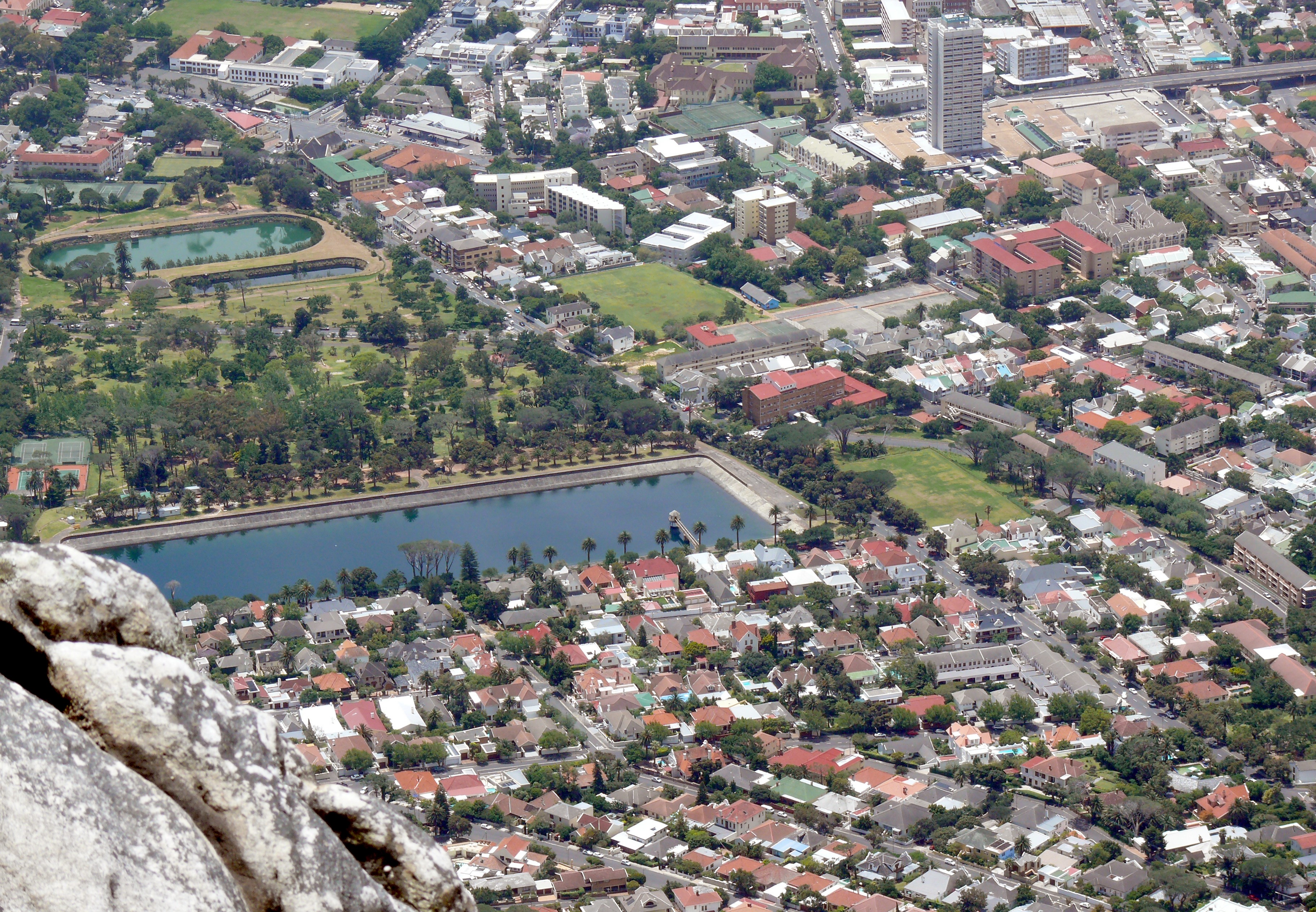
Oranjezicht — Neighborhood — Part of Oranjezicht from the summit of Table Mountain. Molteno Dam and De Waal Park centre left.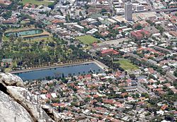 Street map of Oranjezicht
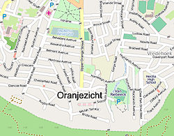 Location of Oranjezicht in Cape Town
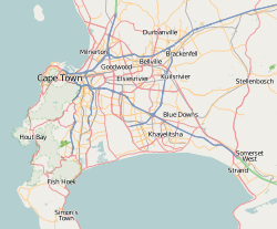
 Oranjezicht
Coordinates: 33°56′30″S 18°24′50″E / 33.94167°S 18.41389°ECoordinates: 33°56′30″S 18°24′50″E / 33.94167°S 18.41389°E Country  South Africa
Province Western Cape Municipality City of Cape Town Wards 77 Government[1] – Councillor Vivienne Walker (DA) Population (2001)[2] – Total 3,130 Ethnic groups – Black African 5.81% – Coloured 4.41% – Indian or Asian 0.96% – White 88.85% Languages – English 68.91% – Afrikaans 23.90% – Xhosa 3.10% Time zone SAST (UTC+2) Postal code 8001 Oranjezicht (Dutch: orange view) is a suburb in Cape Town, South Africa, built on the site of the old Oranjezicht farm, which used to stretch at least as far as the Mount Nelson Hotel and supplied the Castle of Good Hope with fresh produce
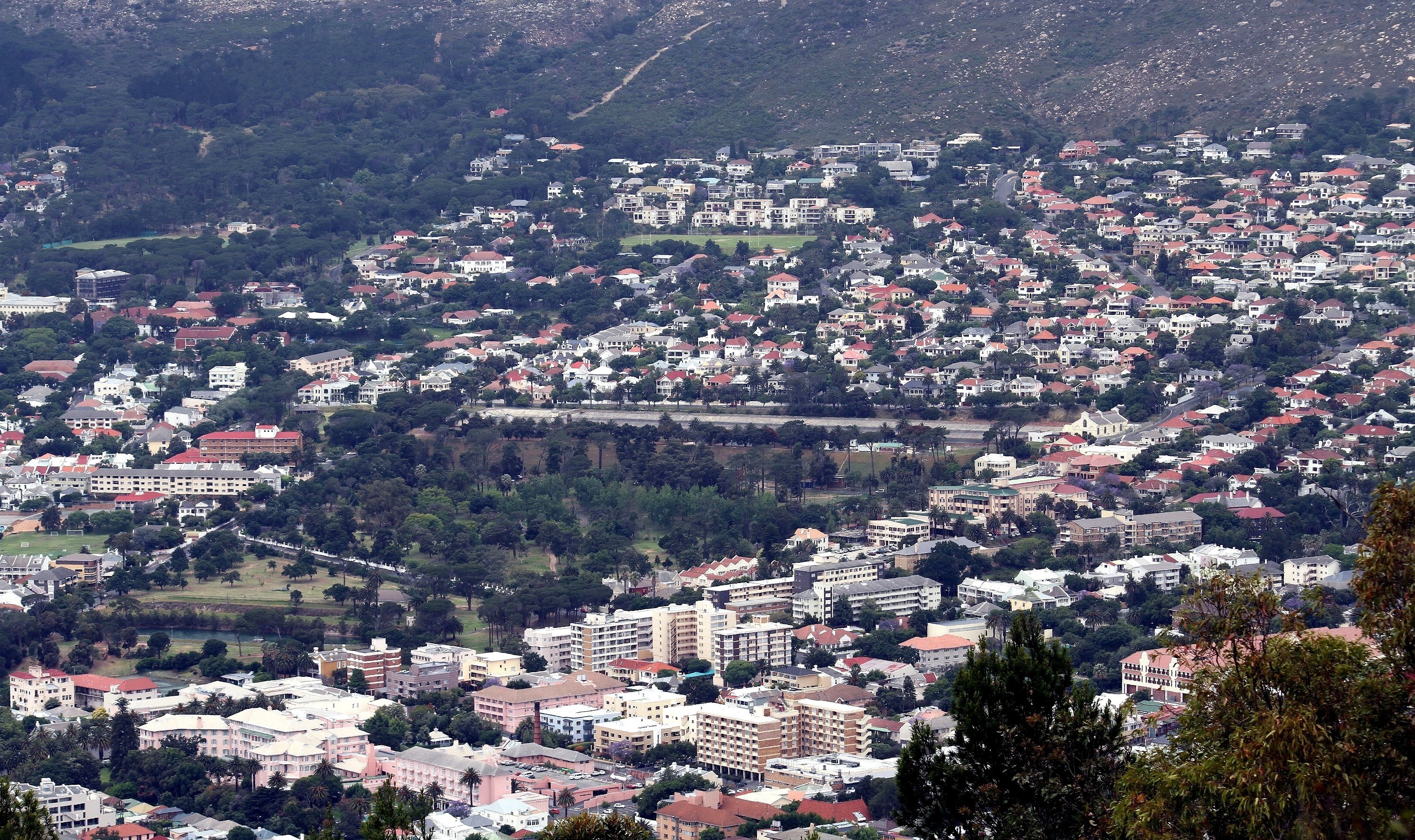
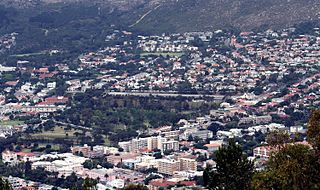 The suburb of Oranjezicht on the slopes of Table Mountain, in Cape Town; De Waal park in the centre.
In 1708, Nicolaus Laubscher (1651–1721), who had immigrated in the 1670s from the Swiss canton of Fribourg, bought a property on the slopes of Table Mountain that he called “Oranjezicht” because of the good view from there of the Oranje (Orange) bastion of the Castle.[3] Subsequent to his death, the farm was evidently acquired by Pieter van Breda (1696–1759), who arrived at the Cape in 1719 from the Netherlands.[4] “Oranjezicht” was a farm for the next two centuries. Some of the buildings of the farm as well as the old slave bell are still at the location where the farm once stood. The farmhouse was on the property directly to the east of what is now a public park and playground. It was torn down in the 1960s to make way for a bowling green (which is also still there).
The Molteno Dam was built in 1877, to provide water for Cape Town by storing natural spring water from Table Mountain. At the time it was located on the mountain slopes above the infant city, but the city grew around it and it is now in the middle of the Oranjezicht suburbs. It is still in operation today.[5]St. Cyprian's School and the Booth Memorial Hospital are located in the suburb.
References
- ^ "Cape Town city Councillors by ward". City of Cape Town. http://web1.capetown.gov.za/web1/newcitycouncil/councilsearch.asp. Retrieved 25 July 2010.
- ^ "Oranjezicht". Census 2001. City of Cape Town. http://www.capetown.gov.za/en/stats/2001census/Documents/Oranjezicht.htm. Retrieved 2 July 2010.
- ^ Adolphe Linder, The Swiss at the Cape of Good Hope, 1652–1971 (Basel: Basel Afrika Bibliographien, 1997), pp. 64–69.
- ^ Pieter van Breda's dates from C. C. de Villiers, Geslagsregisters van die ou Kaapse families / Genealogies of Old South African Families, rev. ed. by C. Pama, 3 vols. (Cape Town: Balkema, 1966), 1: 96.
- ^ Heikki Vuorinen, “Environmental History of Water” (IWA Publishing, 2007), pp. 170–171.
Suburbs of Cape Town City Bowl Bo-Kaap · De Waterkant · Gardens · Higgovale · Oranjezicht · Schotsche Kloof · Tamboerskloof · University Estate · Vredehoek · Walmer Estate · Woodstock · ZonnebloemNorthern Suburbs Bellville · Bothasig · Brackenfell · Brooklyn · Durbanville · Edgemead · Elsie's River · Facreton · Goodwood · Kensington · Kuils River · Maitland · Monte Vista · Panorama · Parow · ThorntonAtlantic Seaboard Bantry Bay · Camps Bay · Clifton · Fresnaye · Green Point · Hout Bay · Llandudno · Mouille Point · Sea Point · Three Anchor BaySouthern Suburbs Bergvliet · Bishopscourt · Claremont · Constantia · Diep River · Heathfield · Kenilworth · Mowbray · Newlands · Observatory · Pinelands · Plumstead · Retreat · Rondebosch · Rondebosch East · Rosebank · Salt River · Steenberg · Tokai · WynbergSouth Peninsula Capri Village · Clovelly · Fish Hoek · Glencairn · Kalk Bay · Kommetjie · Masiphumelele · Muizenberg · Noordhoek · Ocean View · Scarborough · Simon's Town · St James · Sunnydale · Sun ValleyCape Flats Athlone · Belhar · Blue Downs · Bonteheuwel · Crawford · Crossroads · Delft · Elsie's River · Epping · Grassy Park · Gugulethu · Khayelitsha · Langa · Lansdowne · Lotus River · Manenberg · Mfuleni · Mitchell's Plain · Nyanga · Ottery · Philippi · WettonFalse Bay West Coast Categories:- Suburbs of Cape Town


Wikimedia Foundation. 2010.