- Clifton, Cape Town
-
Clifton — Suburb — Clifton from Lion's Head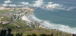 Street map of Clifton
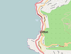
Country  South Africa
Province Western Cape Municipality City of Cape Town Wards 74 Government[1] - Councillor Marga Haywood (DA) Population (2001)[2] - Total 444 Ethnic groups - Black African 7.43% - Coloured 9.68% - Indian or Asian 1.35% - White 81.53% Languages - English 76.52% - Afrikaans 16.03% - Xhosa 5.42% Time zone SAST (UTC+2) Postal code 8005 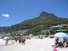 Lion's head from Clifton 4th Beach
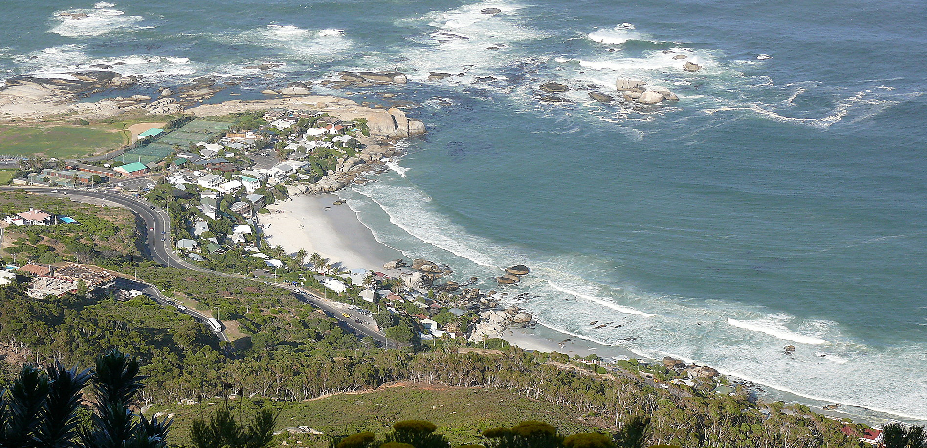
Clifton is an affluent suburb of Cape Town, South Africa.
It is an exclusive residential area and is home to some of the most expensive real estate in South Africa, with dwellings nestled on cliffs that have sweeping views of the Atlantic Ocean.[3]
The area has a set of 4 beaches which are frequently used destinations for both locals and tourists.[4] The beaches, which are named from 1st to 4th, are separated by falls of granite boulders and have almost pure white granitic sand. The four beaches of Clifton are one of the few areas well protected from the notorious south-easterly wind, which has a great deal to do with its popularity with bathers. A fifth beach, before First Beach, called Moses Beach (so-called because of the papyrus plants that grow along it), appears and disappears as the sand is washed in and out with the seasons. The water, although chilly (12–16 °C), plays host to many watersports, mostly surfing, both board and body. The strongest surf is at First, diminishing to Fourth, where it is the weakest. Fourth beach (to the South), is the most populated and glamorous venue;[5] attracting families. Yachts anchor off Fourth beach, especially on summer weekends. Third beach attracts gay men. Second beach is populated by students playing beach volleyball and beach bats. First beach, to the north, the smallest beach, draws a mixed crowd of locals and surfers (although Beach Bat tournaments have been held frequently here, with the current champions being team "PE to CT", consisting of Galia D and Jason G). Clifton Beach was noted as one of Discovery.com's best beaches by region.
Clifton's 4th beach has also been awarded the Blue Flag award in recognition of its environmental, safety and tourist standards.
The small size of the properties on which bungalows are built between Fourth and Second beaches is attributable to the fact that the area was laid out by the City of Cape Town for returning soldiers who had fought in World War I. The original bungalows, now all but replaced by new structures, were built from the packing cases that conveyed imported motor cars during the 1920's and '30's. Narrow flights of stairs run between Victoria Road and the various beaches. These houses now fetch very high prices on the housing market, despite being only able to be reached by stairs, and, in most cases, having no garaging.
Clifton was rated as one of the Top Ten Beaches by the cable and satellite television network Discovery Travel Channel in 2003 and 2004 and has received Blue Flag status. In 2005 and 2006 it was rated by Forbes.com at number 8 in the Top 10 Topless beaches in the World.
An interesting feature of Clifton's 4 beaches involves the water temperatures and annual denudation and re-deposit of the bay's sugar-white sands, although for the most part protected in the 'wind shadow' of Lion's Head mountain that stands behind Clifton (on its Eastern side).
The strong prevailing south-east wind of summer (October to April), being off-shore, moves the warmer top layer of water out of the bay – with the result that a compensating strong inflow of icy cold water is set up into the bay. This tends to make water temperatures in summer dip to their lowest levels – sometimes below 10 C. It also has the effect of re-depositing sand (stripped in winter) onto the beaches, so that by late summer, Clifton's beaches are at their widest, allowing for easy pedestrian movement along the waterline, from beach to beach.
By contrast, winter's howling north-west gales drive warm surface-water into the bay, setting up a compensating outflow of water along the bottom. This water movement tends to cause the bay (and most of the adjacent Atlantic Seaboard) to fill with relatively warm water (10 - 20°C) during winter – but also strips the sand from the beaches, causing temporary beach erosion that exposes the granite boulder headlands that define the beaches. This peculiarity often startles those unaccustomed to the regular cycle; during these periods, city officials have been known to petition to have sand dumped on the Clifton shore to rectify what they perceive as a defect. But, each summer, Clifton repairs itself with new sand.
Clifton has had at least two separate shark attacks:
1) During 1942, Johan Christian Bergh was attacked by a shark 30 meters off of 4th beach. Mr. Bergh's body was never recovered. Witnesses report seeing a 6 meter great white shark swim along the surf's backline and take Mr. Bergh in two rapid attacks. The attacks were so swift that Bergh did not have a chance to emit a sound – consequently, few witnessed the event.
2) On Saturday 27 November 1976, Jeff Spence, an 18-year old submariner in the S.A. Navy was attacked by a 3.5 meter great white while treading water 100m from 4th beach. Mr. Spence suffered significant trauma to the left side of his torso – with deep punctures and gouges back and front. Being an extremely hot day, no fewer than 6 doctors were on the beach at that time, and, together with the efforts of volunteer lifesavers from Clifton Lifesaving Club, Spence survived and was airlifted to hospital where he made a full recovery.
The attacks notwithstanding, shark sightings are extremely rare in Clifton and on the Atlantic coast in general. Most supposed sightings turn out to be seals or sunfish.
References
- ^ "Cape Town city Councillors by ward". City of Cape Town. http://web1.capetown.gov.za/web1/newcitycouncil/councilsearch.asp. Retrieved 28 July 2010.
- ^ "Clifton". Census 2001. City of Cape Town. http://www.capetown.gov.za/en/stats/2001census/Documents/Clifton.htm. Retrieved 28 July 2010.
- ^ "Cape Town woos Africans to Millionaire's Row" (Jan 2011) African Business 371 pp.54-55
- ^ "CAPE TOWN" (Nov 2010) Arthur Frommer's Budget Travel, Intellitravel Media, Inc., New York
- ^ "Cape Escape" (Dec 2005) Variety, suppl. V LIFE 400. 13: 46,48.
External links
- Discovery.com feature on the Best beaches of 2006
- Forbes.com feature on Top 10 Topless Beaches of 2006
- Article on the beaches of Cape Town
- Blue Flag Award
Coordinates: 33°56′24″S 18°22′33″E / 33.93994°S 18.37588°E
Suburbs of Cape Town City Bowl Bo-Kaap · De Waterkant · Gardens · Higgovale · Oranjezicht · Schotsche Kloof · Tamboerskloof · University Estate · Vredehoek · Walmer Estate · Woodstock · ZonnebloemNorthern Suburbs Bellville · Bothasig · Brackenfell · Brooklyn · Durbanville · Edgemead · Elsie's River · Facreton · Goodwood · Kensington · Kuils River · Maitland · Monte Vista · Panorama · Parow · ThorntonAtlantic Seaboard Bantry Bay · Camps Bay · Clifton · Fresnaye · Green Point · Hout Bay · Llandudno · Mouille Point · Sea Point · Three Anchor BaySouthern Suburbs Bergvliet · Bishopscourt · Claremont · Constantia · Diep River · Heathfield · Kenilworth · Mowbray · Newlands · Observatory · Pinelands · Plumstead · Retreat · Rondebosch · Rondebosch East · Rosebank · Salt River · Steenberg · Tokai · WynbergSouth Peninsula Capri Village · Clovelly · Fish Hoek · Glencairn · Kalk Bay · Kommetjie · Masiphumelele · Muizenberg · Noordhoek · Ocean View · Scarborough · Simon's Town · St James · Sunnydale · Sun ValleyCape Flats Athlone · Belhar · Blue Downs · Bonteheuwel · Crawford · Crossroads · Delft · Elsie's River · Epping · Grassy Park · Gugulethu · Khayelitsha · Langa · Lansdowne · Lotus River · Manenberg · Mfuleni · Mitchell's Plain · Nyanga · Ottery · Philippi · WettonFalse Bay West Coast Categories:- Suburbs of Cape Town
- Beaches of South Africa
- Western Cape geography stubs


Wikimedia Foundation. 2010.