- Constantia, Cape Town
-
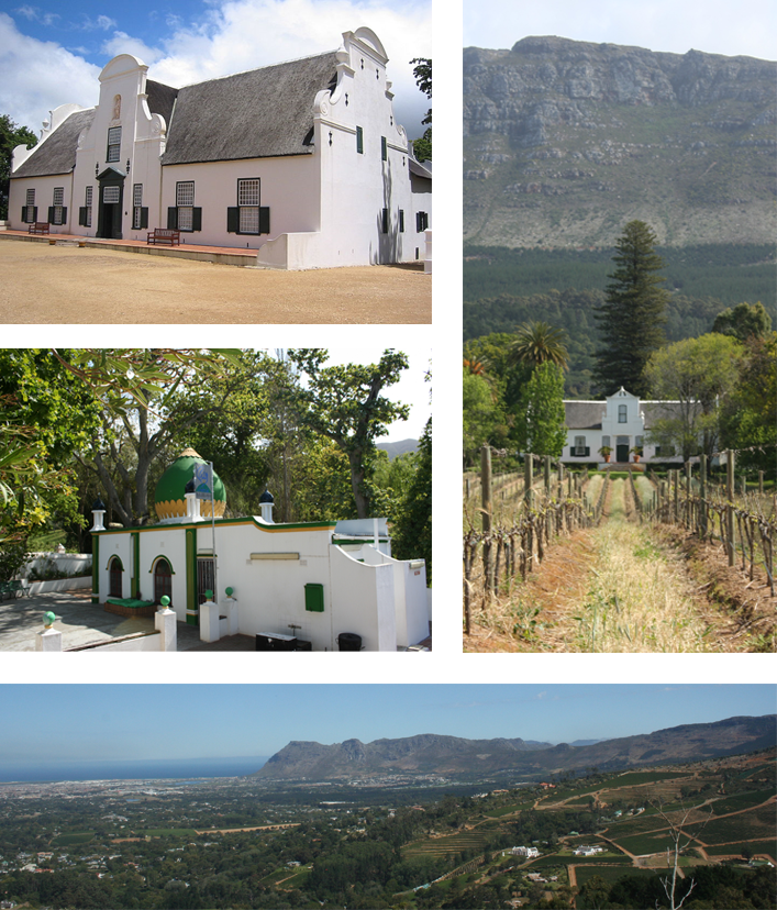
Constantia — Suburb — Top left: Groot Constantia. Middle left: The kramat of Sheik Abdurachman Matebe Shah in Klein Constantia. Right: The Cape Dutch homestead at Buitenverwachting. Bottom: a view of Constantia from Constantia Neck.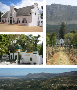 Street map of Constantia
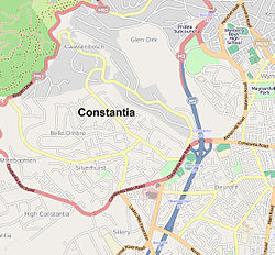 Location of Constantia in Cape Town
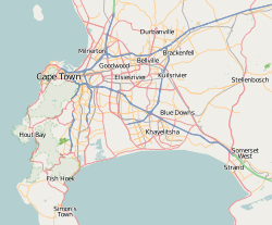
 Constantia
Coordinates: 34°01′53″S 18°25′06″E / 34.03139°S 18.41833°ECoordinates: 34°01′53″S 18°25′06″E / 34.03139°S 18.41833°E Country  South Africa
Province Western Cape Municipality City of Cape Town Wards 62, 71, 73 Government[1] - Councillor Neil Ross (Ward 62) (DA)
Denis Joseph (Ward 71) (DA)
Carol Bew (Ward 73) (DA)Population (2001)[2] - Total 6,010 Ethnic groups - Black African 5.99% - Coloured 6.08% - Indian or Asian 1.13% - White 86.80% Languages - English 87.16% - Afrikaans 6.80% - Xhosa 2.92% Time zone SAST (UTC+2) Postal code 7806[3] 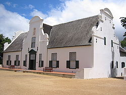
Constantia is an affluent suburb of Cape Town, South Africa, situated about 15 kilometres south of the centre of Cape Town. The Constantia Valley lies to the east of and at the foot of the Constantiaberg mountain. Constantia Nek is a low pass linking to Hout Bay in the west.
Contents
History
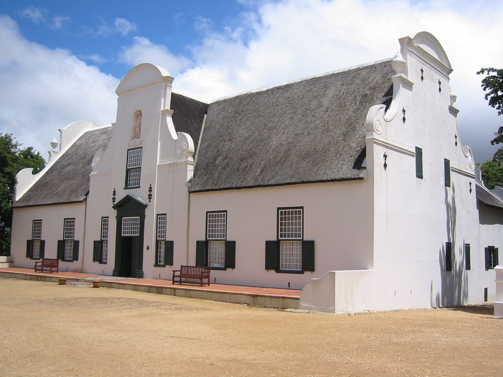
Constantia is one of the oldest suburbs of Cape Town and is famed for its wine. The estate of Groot Constantia (Great Constantia) was established in 1684 by the Dutch Colonial Governor of Cape Town, Simon van der Stel. Other notable wine farms in the area include the oldest estate, Steenberg (Mountain of Stone), established in 1682, Buitenverwachting (Beyond Expectations), Klein Constantia (Small Constantia) and Constantia Uitsig (View of Constantia). Before the twentieth century, the region was noted for its exports of Vin De Constance a sweet dessert wine. Many years ago the trade was crippled by the arrival in the Cape of a parasite that attacked the vines.
In 1661, during the Dutch conquest of Sumatra, Sheik Abdurachman Matebe Shah and his companion Sheikh Mahmoud were banished to Constantia by the Dutch. Sheik Abdurachman is regarded as one of the three people that first brought Islam to South Africa. The kramat at Klein Constantia is built on the site that Sheik Abdurachman is thought to have died in 1681 or 1682.
Notable events and people
Mark Thatcher, the son of Margaret Thatcher[4] and Charles Spencer, 9th Earl Spencer, the brother of the late Princess Diana, both lived in Constantia. Mark's house is now owned by the Sahara Group.
Wine
The area is a major tourist hub outside of the central city area. Apart from its own wine route with centuries-old estates it has a number of fine restaurants with an international flavour such as Pastis (French), La Colombe (French) - ranked among the Top 50 in the world, Constantia Uitsig, Mama Roma (Italian) and more. Many of the homesteads along the wine route display Baroque and Cape Dutch architectural styles.
References
- ^ "Cape Town city Councillors by ward". City of Cape Town. http://web1.capetown.gov.za/web1/newcitycouncil/councilsearch.asp. Retrieved 25 July 2010.
- ^ "Constantia". Census 2001. City of Cape Town. http://www.capetown.gov.za/en/stats/2001census/Documents/Constantia.htm. Retrieved 16 September 2010.
- ^ "Cape Postal Codes of South Africa". Post. http://www.sapostalcodes.co.za/postal/postal_o.asp. Retrieved 30 July 2010.
- ^ "Thatcher fined over 'coup plot'". BBC News. 2005-01-13. http://news.bbc.co.uk/1/hi/world/africa/4169557.stm.
See also
Suburbs of Cape Town City Bowl Bo-Kaap · De Waterkant · Gardens · Higgovale · Oranjezicht · Schotsche Kloof · Tamboerskloof · University Estate · Vredehoek · Walmer Estate · Woodstock · ZonnebloemNorthern Suburbs Bellville · Bothasig · Brackenfell · Brooklyn · Durbanville · Edgemead · Elsie's River · Facreton · Goodwood · Kensington · Kuils River · Maitland · Monte Vista · Panorama · Parow · ThorntonAtlantic Seaboard Bantry Bay · Camps Bay · Clifton · Fresnaye · Green Point · Hout Bay · Llandudno · Mouille Point · Sea Point · Three Anchor BaySouthern Suburbs Bergvliet · Bishopscourt · Claremont · Constantia · Diep River · Heathfield · Kenilworth · Mowbray · Newlands · Observatory · Pinelands · Plumstead · Retreat · Rondebosch · Rondebosch East · Rosebank · Salt River · Steenberg · Tokai · WynbergSouth Peninsula Capri Village · Clovelly · Fish Hoek · Glencairn · Kalk Bay · Kommetjie · Masiphumelele · Muizenberg · Noordhoek · Ocean View · Scarborough · Simon's Town · St James · Sunnydale · Sun ValleyCape Flats Athlone · Belhar · Blue Downs · Bonteheuwel · Crawford · Crossroads · Delft · Elsie's River · Epping · Grassy Park · Gugulethu · Khayelitsha · Langa · Lansdowne · Lotus River · Manenberg · Mfuleni · Mitchell's Plain · Nyanga · Ottery · Philippi · WettonFalse Bay West Coast Categories:- Suburbs of Cape Town
- Wine regions of South Africa


Wikimedia Foundation. 2010.