- Molteno Dam
-
The Molteno Dam 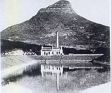
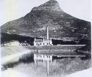
A photo of Molteno Dam soon after construction, with Lions Head in the background. The white building behind the dam is the Graaff Electric Lighting Works, Cape Town's first power plant.Official name The Molteno Dam Location Western Cape, South Africa Coordinates 33°56′19″S 18°24′43″E / 33.9385°S 18.412°ECoordinates: 33°56′19″S 18°24′43″E / 33.9385°S 18.412°E Construction began 1877 Opening date 1881 Dam and spillways Height 15 m Length 350 m Base width 100 m Reservoir Capacity 200,000 Molteno Dam is a small but historic dam on the lower slopes of Table Mountain in Western Cape, South Africa. Still in service, it was established in 1877 and is now located in the suburb of Oranjezicht, Cape Town.
In earlier days, the infant settlement of Cape Town had been supplied with water from Table Mountain by way of canals or "grachts" (such as Buitengracht, Kaizergracht and Heerengracht - now major streets). When these canals had to be covered due to public health concerns, the elders of the city agreed on the need to build a dam up on the Table Mountain slope above the growing city, to store water from the mountain's springs. This water would otherwise have flowed directly into the sea - a shameful waste in the eyes of the city's administrators. Its actual construction was part of a huge expansion of infrastructure, instituted by the government of Premier John Molteno (after whom it is named) and the mayor David Graaff (after whom the Graaff Electric Lighting Works is named).[1]
The reservoir provided sufficient storage capacity for the young city for decades to come, until massive urbanisation in the 20th century meant drawing on the much larger Western Cape Water Supply System. The Graaff Electric Light Works, the first powerplant in South Africa, is also located next to the reservoir.
The existing dam is in fact the second to be constructed in this spot. In 1882, the original reservoir had been accidentally breached, causing a wave of water to rush down into the city. The deluge destroyed houses, uprooted trees and swept away belongings. Following its reconstruction however, it has served Cape Town faithfully and still supplies the city centre today.[2]
-
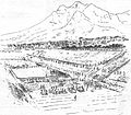
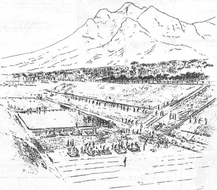
A 19th Century drawing of the construction of the dam.
-
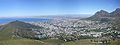
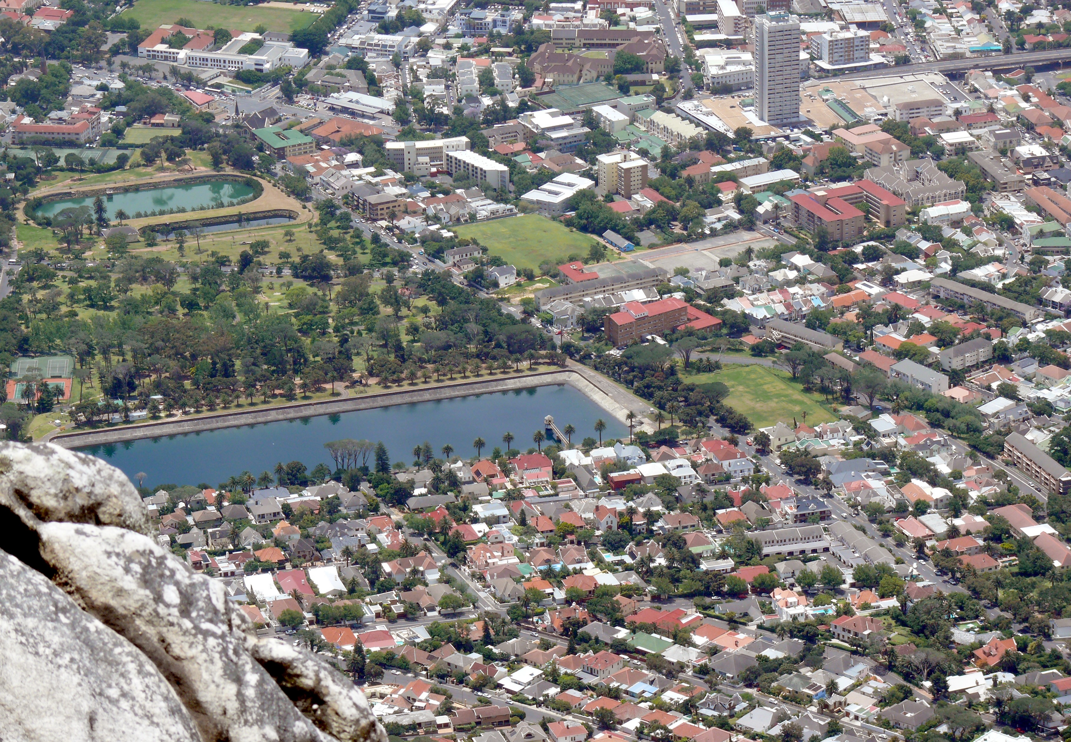
A view of the Cape Town city centre from Lions Head. Molteno Dam is visible in the centre right of the picture. Due to the city's expansion up the mountain slope, the dam is now completely surrounded by suburbs.
-
Oranjezicht From the summit of Table Mountain, with Molteno Dam in the foreground
-
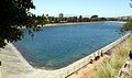
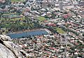
The Molteno Dam from Belvedere Avenue, Oranjezicht
See also
- Oranjezicht
- List of reservoirs and dams in South Africa
References
External links
Categories:- Dams in South Africa
- South African dam stubs
-

Wikimedia Foundation. 2010.