- Wellington, Western Cape
-
Wellington Location of Wellington in the Western Cape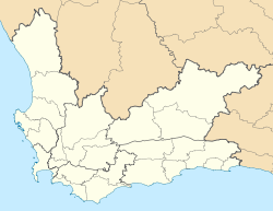
 Wellington
Coordinates: 33°38′S 18°59′E / 33.633°S 18.983°ECoordinates: 33°38′S 18°59′E / 33.633°S 18.983°E Country South Africa Province Western Cape District Cape Winelands Municipality Drakenstein Time zone SAST Postcode 7655 Website http://www.wellingtonza.com/ 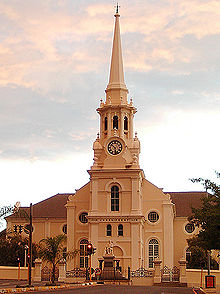 Moederkerk in Wellington
Wellington is a town in the Western Cape Winelands 45 minutes from Cape Town, in South Africa with a population of approximately 58,300. Wellington's economy is centered around agriculture such as wine, table grapes, citrus fruit and a brandy industry. The town is located 75 km north-east of Cape Town, reached by the N1 motorway and R44 highway.
Wellington is situated at the foot of the Groenberg on the banks of the Kromme Rivier (Dutch for Bend River) and forms the center of the Cape Winelands with its picturesque environment and numerous wineries, Wellington's tourism industry has started to blossom. The erstwhile name of the 'dorp' (Dutch for thorp or village) was Wagenmakersvallei, meaning, Wagon makers valley, or Val du Charron as the French Huguenots called it. The town is at the base of one of the oldest mountain passes in the country, Bain's Kloof Pass, built by master road-builder Andrew Geddes Bain. The town is the home of the Boland Rugby Union and the professional rugby team the Boland Kavaliers. The town is also an academic centre, with Huguenot College, Cape Peninsula University of Technology, the Timothy Ministry Team, Bible Media, Huguenot High School and Bergriver Senior Secondary School amongst others.
The beauty of the area is best viewed either by foot, by horse or by car to take in the scenery of nature, fynbos, wine, olives and the historical buildings to name but a few. The pass up to Bain's Kloof winds through pine tree plantations, to the summit where on a clear day you can see a vast area, consisting of the Swartland to the left, home of the extensive wheat fields, the Cape Flats and Cape Town to the right, and the sun glimmering on the sea.
External links
- Wellington South Africa
- Wellington Tourism
- Val du Charron Magazine - Wellington news
- The Timothy Ministry Team

Witzenberg • Drakenstein • Stellenbosch • Breede Valley • Langeberg
Cities and towns Ashton • Bonnievale • Ceres • Chicago • De Doorns • Denneburg • Franschhoek • Gouda • Kayamandi • Klapmuts • Kylemore • Languedoc • McGregor • Montagu • Op-die-Berg • Paarl • Pniel • Prince Alfred Hamlet • Rawsonville • Robertson • Robertsvlei • Rozendal • Saron • Stellenbosch • Touws River • Tulbagh • Wellington • Wemmershoek • Wolseley • Worcester
Categories:- Western Cape geography stubs
- Populated places in the Cape Winelands District Municipality


Wikimedia Foundation. 2010.