- Paarl
-
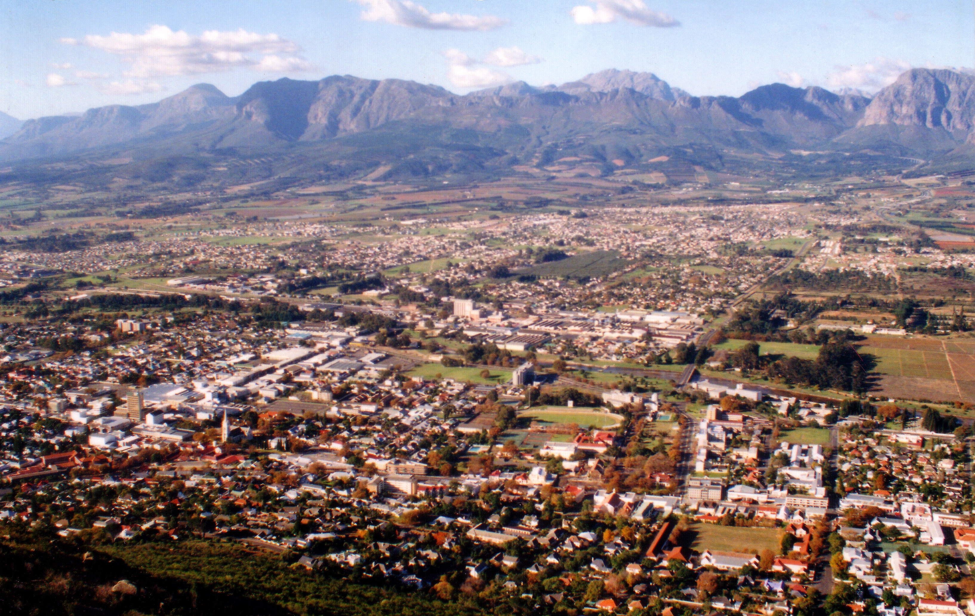
Paarl — Town — Paarl from Paarl Mountain, with the Drakenstein Mountains beyond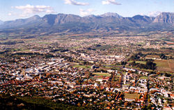
 Paarl
PaarlCoordinates: 33°43′27″S 18°57′21″E / 33.72417°S 18.95583°E Country  South Africa
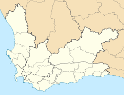
Province Western Cape District Cape Winelands Municipality Drakenstein European exploration 1657 European settlement 1687 Elevation[1] 451 ft (137 m) Population (2001) – Total 108,000 Time zone SAST (UTC+2) Paarl (
 /ˈpɑrl/; Afrikaans: [ˈpɛːrəl]; derived from Parel, meaning Pearl in Dutch) is a town with 191,013 inhabitants in the Western Cape province of South Africa. Its the third oldest European settlement in the Republic of South Africa (after Cape Town and Stellenbosch) and the largest town in the Cape Winelands. It is situated about 60 kilometres (37 mi) northeast of Cape Town in the Western Cape Province and is renowned for its haunting scenic beauty and deep viticulture and fruit growing heritage.
Today Paarl is part of the greater/metro part of the city of Cape Town. Paarl is unusual in South Africa in that the name of the place is pronounced differently in English and Afrikaans. An unusual feature of the name of the town is that Afrikaners customarily attach the definite article to it: people say in die Paarl ("in the Paarl"), rather than in Pearl.
Paarl gained international attention when, on 11 February 1990, Nelson Mandela walked out of Victor Verster Correctional Centre (now known as Drakenstein Correctional Centre) in Paarl ending 27 years of imprisonment and beginning the march to South Africa's post-apartheid era and multi-racial elections.[2] Mandela spent three years in prison here living in a private house within the walls. Today, a bronze statue of Mandela stands outside the prison.
Paarl hosted a match from the ICC Cricket World Cup 2003. The headquarters of Ceres Fruit Juices are located in the city.
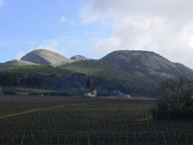
The district is particularly well known for its Pearl Mountain or "Paarl Rock". This huge granite rock is formed by three rounded outcrops that make up Paarl Mountain and has been compared in majesty to Uluru (formerly known as Ayers Rock) in Australia. (However, they are not geologically similar. Paarl Rock consists of intrusive igneous rock, while Uluru is a sedimentary remnant).
Contents
History
The area that is now known as Paarl was first inhabited by the Khoikhoi and San people. The Peninsular Khoikhoi people and the Cochoqua people lived in this area divided by the Berg River Valley. The Cochaqua were cattle heading people and among the richest of the Khoi tribes. They had between 16,000-18,000 members and originally called Paarl Mountain, Tortoise Mountain.[3]
The Dutch East India Company under the leadership of Jan van Riebeeck established meat trading relationships with the Khoikhoi people on the Table Bay coastline. In 1657, in search of new trading relationships inland, Abraham Gabemma saw a giant granite rock glistening in the sun after a rainstorm and named it "de Diamondt en de Peerlberg” (Diamond and Pearl Mountain) from which Paarl is derived.[4] Gabemma (often also spelled Gabbema) was the Fiscal (public treasurer) for the settlement on the shores of Table Bay. The "diamonds" disappeared from the name and it became known simply as Pearl Rock or Pearl Mountain.
In 1687, Governor Simon van der Stel gave title to the first colonial farms in the area to "free burghers". The following year, the French Huguenots arrived in the Western Cape and began to settle on farms in the area.[3] The fertile soil and the Mediterranean-like climate of this region provided perfect conditions for farming. The settlers planted orchards, vegetable gardens and above all, vineyards.[5] Thus began Paarl's long and continuing history as a major wine and fruit producing area of South Africa.
The arrival of the European settlers brought on conflict with the Khoikhoi people, as land and water resources began to be contested and the Khoi traditions of communal land use came in conflict with the settler's concept of private property. The Khoi peoples were defeated in local war and were further decimated by European diseases. The population scattered inland toward the Orange River or became laborers on settler farms.[3]
Demography
In the 2001 census Paarl's population was recorded as being 82,713 people in 20,138 households, in a land area of 32.2 square kilometres (12.4 sq mi). 67.8% of the inhabitants described themselves as "Coloured", 21.2% as "White", 10.5% as "Black African", and 0.5% as "Indian or Asian". 85.5% spoke Afrikaans as their first language, 8.5% spoke Xhosa, and 5.2% spoke English.[6]
Tourist attractions
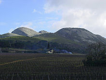 Paarl Rock
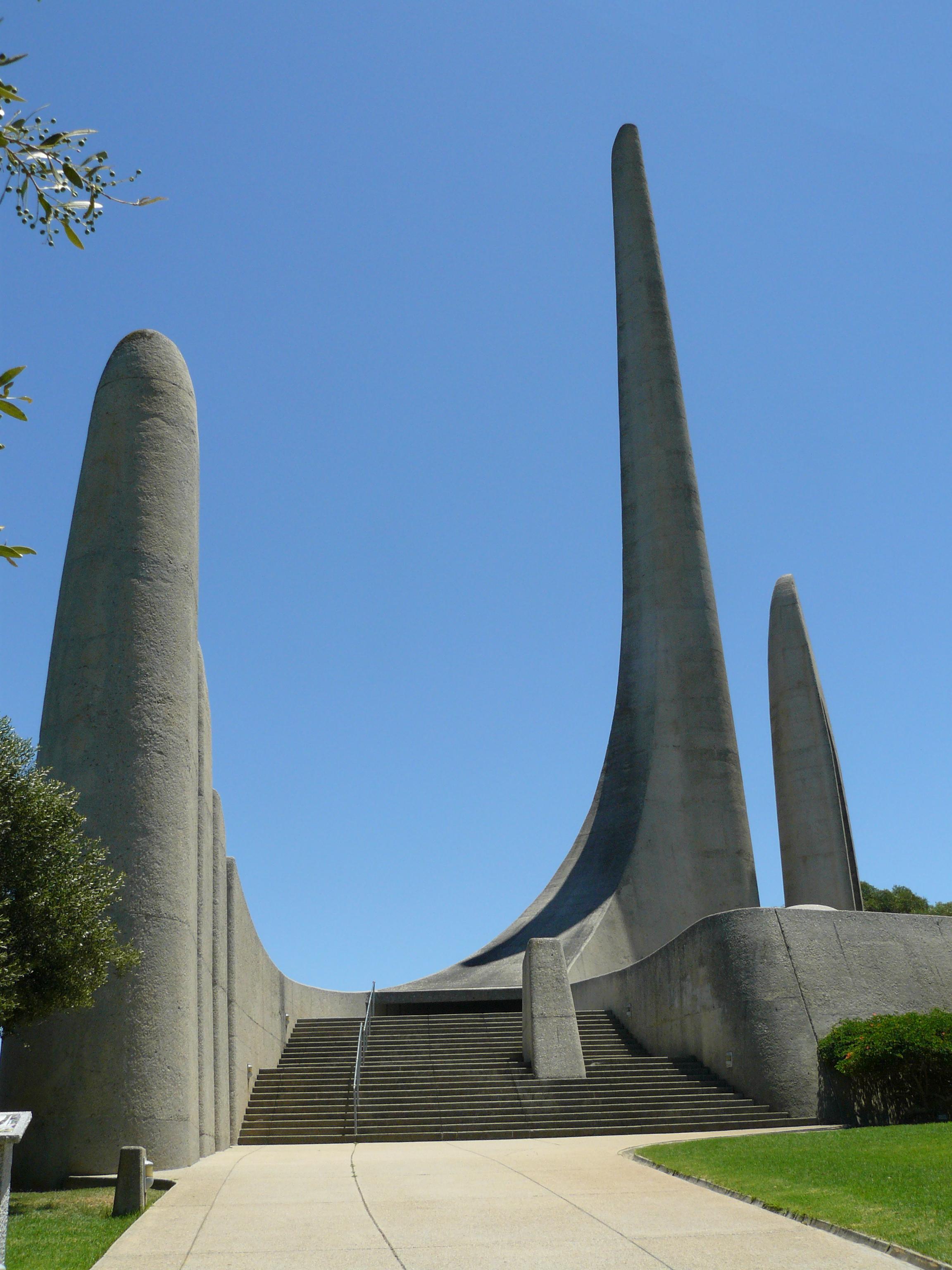
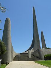 Afrikaanse Taalmonument in Paarl
Like many towns in the Cape Winelands, Paarl is home to a prosperous community, with many well maintained and attractive Cape Dutch houses, beautiful gardens and streets lined with old oak trees.
Paarl boasts a unique cultural attraction: it was here that the foundations of the Afrikaans language were laid by the Genootskap van Regte Afrikaners. The "Afrikaanse Taalmonument" (monument to the Afrikaans language) on the slopes of Paarl Mountain, the Language Museum and the Afrikaans Language Route through Dal Josaphat are memorials to this achievement.
The former headquarters of the wine industry in South Africa is also situated here.: This was the famous "Co-operative Wine Growers' Association" (better known by its Afrikaans initials KWV). The KWV became a South African institution that has acquired an international reputation based on its unique achievements and its imprint of quality on the local wine industry. Over the past decade, however, KWV became a completely profit-driven private company that has no administrative role anymore. (KWV's main wine production and maturation facilities are on its Paarl premises, while its brandy production takes place in Worcester and grape juice concentrate production in Upington in the Northern Cape).
The town and its surroundings attract many visitors with an array of activities and interests. There are magnificent Cape Dutch buildings (17-19th Century), scenic drives, hiking trails and the Paarl wine route, with its many wine tasting opportunities (including vintages from the famous Nederburg estate) and excellent restaurants.
The Paarl Rock itself is these days a popular Mecca for rock climbers. However, in the pioneering period of rock climbing in South Africa, the mountain was ignored or shunned because its steep faces were so smooth and unfissured that climbers could find no place to attach "runners" or anchor points for belays. The first climbing routes up the rock were pioneered in 1969 by J.W.Marchant and G. Athiros, the former from the University of Cape Town Mountain and Ski Club. Soon afterwards Marchant and John Knight established a few routes on which the rope was run out for 100 m (330 ft) or more with no protection whatsoever.[7] This was in the days before bolting was possible and these achievements are still held in high regard today. Nowadays protection is afforded by bolts in the granite and there are on Paarl Rock a few dozen spectacular, beautiful and very hard routes that attract the best climbers of the current generation. (All of these climbs remain dangerous for the inexperienced.) A guide book for these routes was published in mid-2006.
Districts
The town is basically divided in six different areas, namely:
Courtrai (in the southern part of town and including the wealthy suburbs), Northern Paarl, Paarl-East, Central Paarl (generally known as upper-paarl and also containing wealthy suburbs), Denneburg (in the south east of the town), and Vrykyk (in the south).
Schools
The town boasts some of the best academic schools in the country including Paarl Boys' High School (est.1868), Paarl Girls' High, Paarl Gimnasium High School (est.1858) and La Rochelle Girls' High School (est.1860), in 2007 three of these four predominant high schools were placed in the Western Cape Province's top ten list (Paarl Gimnasium, being mainly sport orientated and not as academically established as the other schools, did not make the list).
Notable residents
- Wayne Julies - Rugby union player
- Elsa Joubert - Writer
- Marius Charl Joubert - Rugby union player
- Justin Lee Ontong - Cricketer Cape Cobras
- Gurthro Steenkamp - Rugby union player
- Jean de Villiers - Rugby union player
- Deon Meyer - Novelist
- Willem de Waal - Rugby union player
- Chester Mornay Williams - Rugby union player
- Louis Theodor Weichardt - Founder and leader of the Greyshirts
- Nelson Mandela - Released from Victor Vester Prison in Paarl on 11 February 1990
- Noelani King Conradie - Macro Economist and founder of NKC Independent Economists
- David James - Actor
- Jenna Pietersen - Model
- Johan Lindeque - really cool man
References
- ^ Paarl, South Africa Forecast : Weather Underground
- ^ BBC on this Day 11 Feb 1990: Freedom of Nelson Mandela
- ^ a b c http://www.paarlonline.com/history.html
- ^ The concise illustrated South African Encyclopaedia. P. Schirmer, 1980. Central News Agency, Johannesburg. First edition, about 211pp
- ^ A General Collection of the Best and Most Interesting Voyages and Travels in All Parts of the World, Vol XVI. John Pinkerton, 1814. London: Longman, Hurst, Rees, and Orme.
- ^ "Main Place 'Paarl'". Census 2001. http://census.adrianfrith.com/place/10706. Retrieved 2 April 2011.
- ^ Annual Bulletin. University of Cape Town Mountain and Ski Club (UCTMSC), 1970.
External links
- Official Paarl Tourist information guide
- Cape Winelands Tourism guide to Winelands accommodation, holiday and visitor information
- Everything in Paarl
- Paarl travel guide from Wikitravel
- Paarl Directory

Witzenberg • Drakenstein • Stellenbosch • Breede Valley • Langeberg
Cities and towns Ashton • Bonnievale • Ceres • Chicago • De Doorns • Denneburg • Franschhoek • Gouda • Kayamandi • Klapmuts • Kylemore • Languedoc • McGregor • Montagu • Op-die-Berg • Paarl • Pniel • Prince Alfred Hamlet • Rawsonville • Robertson • Robertsvlei • Rozendal • Saron • Stellenbosch • Touws River • Tulbagh • Wellington • Wemmershoek • Wolseley • Worcester
Province of the Western Cape Topics Climate · Ecology · Economy · Government · Politics
Government Premier · Provincial Parliament · High Court · MunicipalitiesRegions Cape Peninsula · Cape Flats · Boland · Swartland · West Coast · Breede River Valley · Overberg · Garden Route · Little Karoo · Great KarooCities and major towns Cape Town · Paarl · George · Worcester · Somerset West · Atlantis · Strand · Stellenbosch · Oudtshoorn · Wellington · Knysna · Mossel Bay · Vredenburg · Beaufort West · Saldanha · Grabouw · Malmesbury · Robertson · Vredendal · Swellendam · Bredasdorp · Riversdale · Ashton · Caledon · Hermanus · Montagu · Ceres · Piketberg · Plettenberg BayCoordinates: 33°43′27″S 18°57′21″E / 33.72417°S 18.95583°E
Categories:- Wine regions of South Africa
- Paarl
- Populated places in the Cape Winelands District Municipality


Wikimedia Foundation. 2010.