- Rabat
Infobox Settlement
official_name = Rabat
other_name =
native_name = الرباط
nickname =
motto =
imagesize = 300px
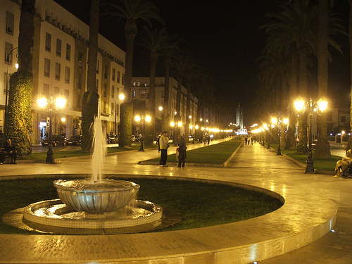
image_caption = Rabat Downtown
flag_size =
image_
seal_size =
image_shield =
shield_size =
city_logo =
citylogo_size =
mapsize = 200px
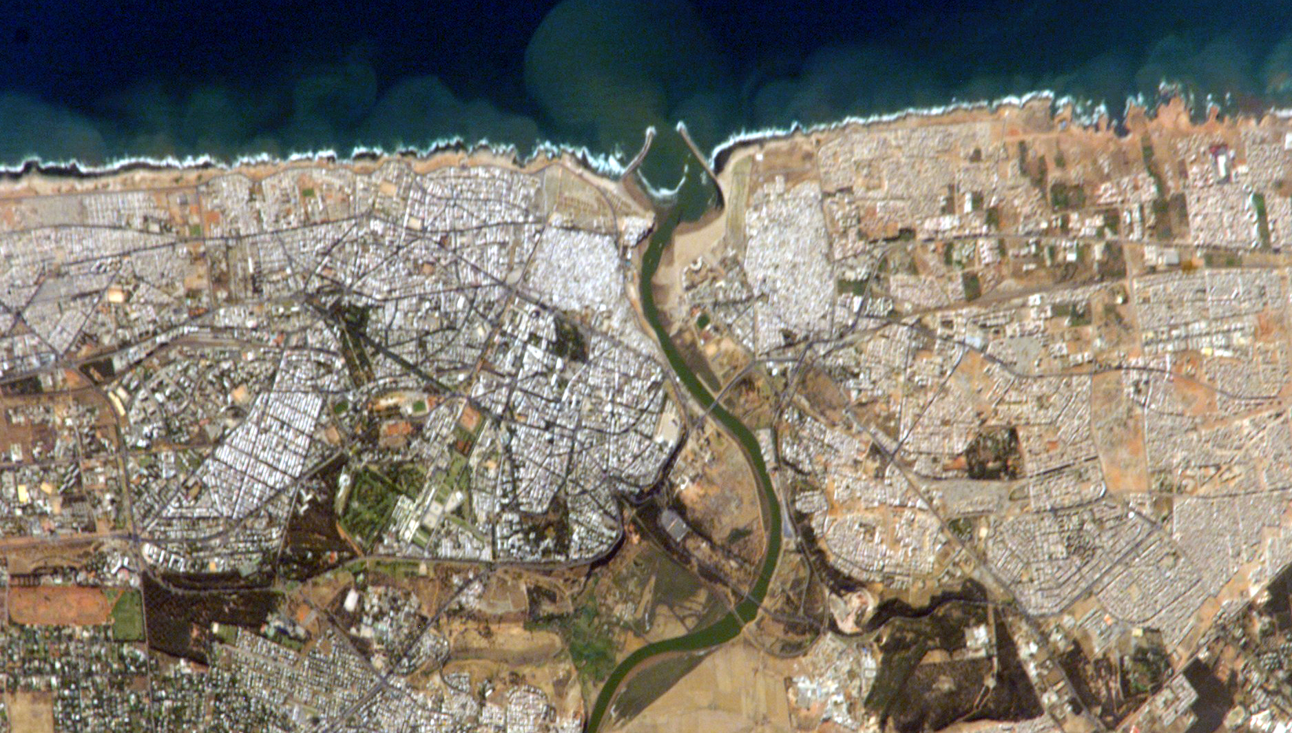
map_caption = NASA image of Rabat
pushpin_
pushpin_label_position =
pushpin_map_caption = Political map showing Rabat, Morocco
subdivision_type =Country
subdivision_name = MAR
subdivision_type1 =administrative region
subdivision_name1 =Rabat-Salé-Zemmour-Zaer
subdivision_type2 =
subdivision_name2 =
subdivision_type3 =
subdivision_name3 =
subdivision_type4 =
subdivision_name4 =
government_type =monarchy
leader_title = ruler
leader_name = Mohammed VI
leader_title1 = mayor
leader_name1 =Omar El Bahraoui
leader_title2 =
leader_name2 =
leader_title3 =
leader_name3 =
leader_title4 =
leader_name4 =
established_title = First settled
established_date = 3rd century BC
established_title2 =
established_date2 =
established_title3 =
established_date3 =
area_magnitude =
unit_pref =
area_footnotes =
area_total =
area_land =
area_water =
TotalArea_sq_mi =
LandArea_sq_mi =
WaterArea_sq_mi =
area_water_percent =
area_urban =
UrbanArea_sq_km = 118
area_metro =
MetroArea_sq_mi =
population_as_of =
population_footnotes =
population_note = 2004 census
settlement_type =
population_total = 630,000
population_density =
population_density_km2 = 5321
population_metro = 1,614,000
population_density_metro_km2 =
population_density_metro_mi2 =
population_urban =
population_density_urban_km2 =
population_density_urban_mi2 =
timezone =
utc_offset =
timezone_DST =
utc_offset_DST =
latd=34 |latm=02 |lats= |latNS=N
longd=6 |longm=50 |longs= |longEW=W
elevation_footnotes =
elevation =
elevation_ft =
postal_code_type =
postal_code =
area_code =
website = http://www.rabat.ma/
footnotes =Rabat (Arabic الرباط, transliterated ar-Rabāṭ or ar-Ribāṭ), population 2 million ("2007 estimate"), is the
capital of the Kingdom of Morocco. It is also the capital of theRabat-Salé-Zemmour-Zaer region.The city is located on the
Atlantic Ocean at the mouth of the riverBou Regreg . On the facing shore of the river liesSalé , Rabat'sbedroom community . Together the two cities with Témara account for a population of 2 million. Unfortunately, silting problems have diminished the city's role as a port; however, Rabat andSalé still maintain relatively importanttextile ,food processing andconstruction industries; some are from sweatshop labor by major multinational corporations (seeSalé ).In addition, tourism and the presence of all foreign embassies in Morocco serve to make Rabat the second most important city in the country after the larger and more economically significant
Casablanca .History
Rabat's history began with a settlement, known as
Chellah on the banks of theOued Bou Regreg [C. Michael Hogan, "Chellah", The Megalithic Portal, ed. A. Burnham, [http://www.megalithic.co.uk/article.php?sid=17910] ] in the third century BC. In 40 AD, Romans took over Chellah and converted it to the Roman settlement of Sala Colonia. Rome held the colony until 250 AD when they abandoned it to Berber rulers. The Berbers played an important role inMuslim Spain . In 1146, theAlmohad rulerAbd al-Mu'min turned Rabat's ribat into a full scale fortress to use as a launching point for attacks onSpain . In 1170, due to its military importance, Rabat acquired the title "Ribatu l-Fath", meaning "stronghold of victory," from which it derives its current name.Yaqub al-Mansur (known as Moulay Yacoub in Morocco), another Almohad Caliph, moved the capital of his empire to Rabat. ["History of Morocco", Henri Terrasse, 1952] He built Rabat's city walls, the
Kasbah of the Udayas and began construction on what would have been the world's largest mosque. However, Yaqub died and construction stopped. The ruins of the unfinished mosque, along with theHassan Tower , still stand today.Yaqub's death initiated a period of decline. The Almohad empire lost control of its possessions in Spain and much of its African territory, eventually leading to its total collapse. In the 13th century, much of Rabat's economic power shifted to Fez. In 1515 a
Moorish explorer, El Wassan, reported that Rabat had declined so much that only 100 inhabited houses remained. An influx ofMorisco s, who had been expelled from Spain, in the early 17th century helped boost Rabat's growth (principal families: Mouline [Molina] , Bargach [Vargas] , Balafrej [Palafresa] , Moreno, Baena, Olivares [Loubaris] ,...).Rabat and neighboring Salé united to form the
Republic of Bou Regreg in 1627. The republic was run byBarbary pirates who used the two cities as base ports for launching attacks on shipping. The pirates did not have to contend with any central authority until theAlaouite Dynasty united Morocco in 1666. They attempted to establish control over the pirates, but failed. European and Muslims authorities continued to attempt to control the pirates over many years, but the Republic of Bou Regreg did not collapse until 1818. Even after the republic's collapse, pirates continued to use the port of Rabat, which led to the shelling of the city byAustria in 1829 after an Austrian ship had been lost to a pirate attack.The French invaded Morocco in 1912 and established a protectorate. The French administrator of Morocco, General
Hubert Lyautey , ["Morocco: The Islamist Awakening and Other Challenges" 2005, Marvine Howe] decided to relocate the country's capital from Fez to Rabat. Among other factors, rebellious Berbers (native Moroccans) had made Fez an unstable place. Sultan Moulay Youssef followed the decision of the French and moved his residence to Rabat. In 1913, Gen. Lyautey hiredHenri Prost who designed the Ville Nouvelle (Rabat's modern quarter) as an administrative sector. When Morocco achieved independence in 1956,Mohammed V , the thenKing of Morocco , chose to have the capital remain at Rabat.Following World War II, the United States established a military presence in Rabat at the former French air base. By the early 1950s, Rabat Salé Air Base was a
U.S. Air Force installation hosting the17th Air Force and the 5th Air Division, [http://en.wikipedia.org/wiki/Seventeenth_Air_Force] which oversaw forward basing forStrategic Air Command (SAC)B-47 Stratojet aircraft [http://en.wikipedia.org/wiki/B-47_Stratojet] in the country. With the destabilization of French government in Morocco, and Moroccan independence in 1956, the government ofMohammed V wanted the U.S. Air Force to pull out of the SAC bases in Morocco, insisting on such action after American intervention in Lebanon in 1958. The United States agreed to leave as of December 1959, and was fully out of Morocco by 1963. SAC felt the Moroccan bases were much less critical with the long range capability of theB-52 Stratofortress es that were replacing the B-47s and with the completion of the USAF installations inSpain in 1959. [http://www.globalsecurity.org/wmd/facility/sidi_slimane.htm]With the USAF withdrawal from Rabat Salé in the 1960s, the facility became a primary facility for the
Royal Moroccan Air Force known as Air Base Nº 1, a status it continues to hold. [http://en.wikipedia.org/wiki/Royal_Moroccan_Air_Force]Culture
The biggest place for theatre is the Theatre Mohamed V in the centre of the town.Few official galleries and an archeological museum. Many Foundation are active in culture and social issues. Orient-Occident Foundation and ONA Foundation are the biggest ones and have important places for meetings and educative workshops. An independent art scene is ver active in town with
L'appartement 2 2 which is the first independent space for visual arts opened in 2002 byAbdellah Karroum .Main Sights
*
Mausoleum of Mohammed V
*Mohammed V University is located in the city.
*Hassan Tower
*Chellah necropolis
*Kasbah of the Udayas Gallery
ister cities
*
*
* Honolulu,United States
*
*Amman ,Jordan
*Bethlehem ,Palestinian Authority
*Algiers ,Algeria Climate
Infobox Weather
single_line=yes
location=Rabat
Jan_Hi_°F =62 |Jan_REC_Hi_°F =
Feb_Hi_°F =63 |Feb_REC_Hi_°F =
Mar_Hi_°F =66 |Mar_REC_Hi_°F =
Apr_Hi_°F =67 |Apr_REC_Hi_°F =
May_Hi_°F =71 |May_REC_Hi_°F =
Jun_Hi_°F =74 |Jun_REC_Hi_°F =
Jul_Hi_°F =80 |Jul_REC_Hi_°F =
Aug_Hi_°F =80 |Aug_REC_Hi_°F =
Sep_Hi_°F =79 |Sep_REC_Hi_°F =
Oct_Hi_°F =74 |Oct_REC_Hi_°F =
Nov_Hi_°F =69 |Nov_REC_Hi_°F =
Dec_Hi_°F =64 |Dec_REC_Hi_°F =
Year_Hi_°F =71 |Year_REC_Hi_°F =
Jan_Lo_°F =46 |Jan_REC_Lo_°F =
Feb_Lo_°F =49 |Feb_REC_Lo_°F =
Mar_Lo_°F =50 |Mar_REC_Lo_°F =
Apr_Lo_°F =52 |Apr_REC_Lo_°F =
May_Lo_°F =56 |May_REC_Lo_°F =
Jun_Lo_°F =61 |Jun_REC_Lo_°F =
Jul_Lo_°F =65 |Jul_REC_Lo_°F =
Aug_Lo_°F =65 |Aug_REC_Lo_°F =
Sep_Lo_°F =64 |Sep_REC_Lo_°F =
Oct_Lo_°F =58 |Oct_REC_Lo_°F =
Nov_Lo_°F =55 |Nov_REC_Lo_°F =
Dec_Lo_°F =49 |Dec_REC_Lo_°F =
Year_Lo_°F =56 |Year_REC_Lo_°F =
Jan_Precip_inch =3.2
Feb_Precip_inch =2.7
Mar_Precip_inch =2.6
Apr_Precip_inch =2.2
May_Precip_inch =1
Jun_Precip_inch =0.3
Jul_Precip_inch =0
Aug_Precip_inch =0
Sep_Precip_inch =0.3
Oct_Precip_inch =1.8
Nov_Precip_inch =3.3
Dec_Precip_inch =4
Year_Precip_inch =21.5
source= [weatherbase.com]
publisher= |language=fact|date=August 2008ee also
*
Hajja References
External links
* [http://www.temaracity.npage.de Places in Rabat]
* [http://www.africatravelling.net/morocco/rabat/rabat_history.htm Rabat: History]
* [http://www.visitrabat.com Rabat Touristic Portal]
* [http://www.rabat.ma Rabat Portal]
* [http://lexicorient.com/morocco/rabat.htm Entry in Lexicorient]
* [http://www.britannica.com/eb/article-9062340/Rabat Encyclopaedia Britannica, Rabat]
* [http://www.goruma.de/staedte/rabat.html Rabat at "goruma" (German)]
Wikimedia Foundation. 2010.

