- N'Djamena
-
N'Djamena
نجامينا NijāmīnāDowntown N'Djamena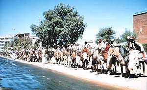
Coat of armsLocation in Chad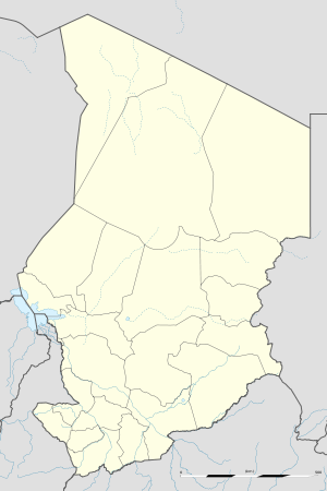
 N'Djamena
Coordinates: 12°6′47″N 15°2′57″E / 12.11306°N 15.04917°E Country  Chad
ChadRegion N'Djamena Arrondissments Elevation 978 ft (298 m) Population (2009) – Total 993,492 Time zone +1 N'Djamena (
 /ɨndʒəˈmeɪnə/; Arabic: نجامينا Nijāmīnā) is the capital and largest city (population 993,492 in 2009) of Chad. A port on the Chari River, near the confluence with the Logone River, it directly faces the Cameroonian town of Kousséri, to which the city is connected by a bridge. It is also a special statute region, divided in 10 arrondissements. It is a regional market for livestock, salt, dates, and grains. Meat, fish and cotton processing are the chief industries, and the city continues to serve as the centre of economic activity in Chad, despite the violent civil conflicts.[1]
Contents
History
N'Djamena was founded as Fort-Lamy by French commander Émile Gentil on May 29, 1900, and named after Amédée-François Lamy, an army officer who had been killed in the Battle of Kousséri a few days earlier.[2] It was a major trading city and became the capital of the region and nation.
During the Second World War, the French relied heavily upon the airport to move troops and supplies.[1] On 21 January 1942, a lone German He 111 of the Sonderkommando Blaich successfully bombed the airfield at Fort Lamy, destroying oil supplies and ten aircraft.[3] Fort Lamy received its first bank branch in 1950, when the Bank of West Africa (BAO) opened a branch there.
On April 6, 1973, the President François Tombalbaye [2] changed its name to N'Djamena (taken from the Arab name of a nearby village, Niǧāmīnā, meaning "place of rest") as part of his authenticité program of Africanization. The city was occupied by Libya during the 1980-1 Libyian intervention as part of the Chadian–Libyan conflict,[4] and the associated Transitional Government of National Unity.
The city was partly destroyed during the Chadian Civil War, in 1979 and again in 1980. In these years almost all of the population fled the town, searching for refuge on the opposite bank of the Chari River, in Cameroon next to the city of Kousseri. The residents did not return until 1981-82 after the end of the clashes. Up until 1984, facilities and services were subject to strict rationing, and the schools remained closed.[5]
The period of turmoil in the city was started by the abortive coup attempted by the northerner Prime Minister Hissène Habré against the southerner President General Félix Malloum: while Malloum and the national army loyal to him were defeated, the intervention in the battle of other northern factions rival to that of Habré complicated the situation. A temporary truce was reached in 1979 through international mediation, establishing the warlord Goukouni Oueddei as head of a government of national unity with his rival Habré as Defense Minister. The intense rivality between Goukouni and Habré caused the eruption of new clashes in the city in 1980; N'Djamena found itself divided in sectors controlled by the various warlords. The tug-of-war reached a conclusion after many monthes only when Goukouni asked for the intervention of the Libyans, whose tanks overwhelmed Habré's defenses in the capital.[6]
Following differences between Goukouni and Qaddafi and international disapproval of Libyan intervention, the Libyan troops left the capital and Chad in 1981. This opened the door to Habré, who marched on N'Djamena occupying with little resistance the city in 1982 and placing himself as new President.[7] He was eventually dislodged in a similar fashion in 1990 by a former general of his, Idriss Déby, the current head of state of Chad.
The city had only 9,976 inhabitants in 1937, but a decade later, in 1947, the population had almost doubled at 18,435. After independence in 1968 the population reached 126,483. In 1993 it surpassed half a million with 529,555. A good deal of this growth has been due to refugees fleeing into N'Djamena for security, although many people fled N'Djamena also, depending on the political situation.[1]
On April 13, 2006, a rebel United Front for Democratic Change attack on the city was defeated[8] in the Battle of N'Djamena.
The city was once again attacked on February 2, 2008, by UFDD and RFC rebels.[9] (See Battle of N'Djamena (2008))
Demographics
The population growth is shown below:-
- 1937: 9,976
- 1940: 12,552
- 1947: 18,375
- 1958: 53,000[1]
- 1960: 60,000[1]
- 1970: 130,000[1]
- 1993: 529,555[1][10]
- 2000: 728,000[1]
- 2005: 721,000
- 2008: 860,000 (est)
- 2009: 993,492
A variety of religions are practised in the city, but with a clear Islamic predominance. The main ethnic groups are Ngambaye (16.41%), Chadian Arabs (11.08%), Hadjerai (9.15%), Daza (6.97%), Bilala (5.83%), Kanembu (5.80%), Maba (4.84%), Kanuri (4.39%), Gor (3.32%), Kuka (3.20%), Sara (2.24%), and Barma (2.10%).
Geography
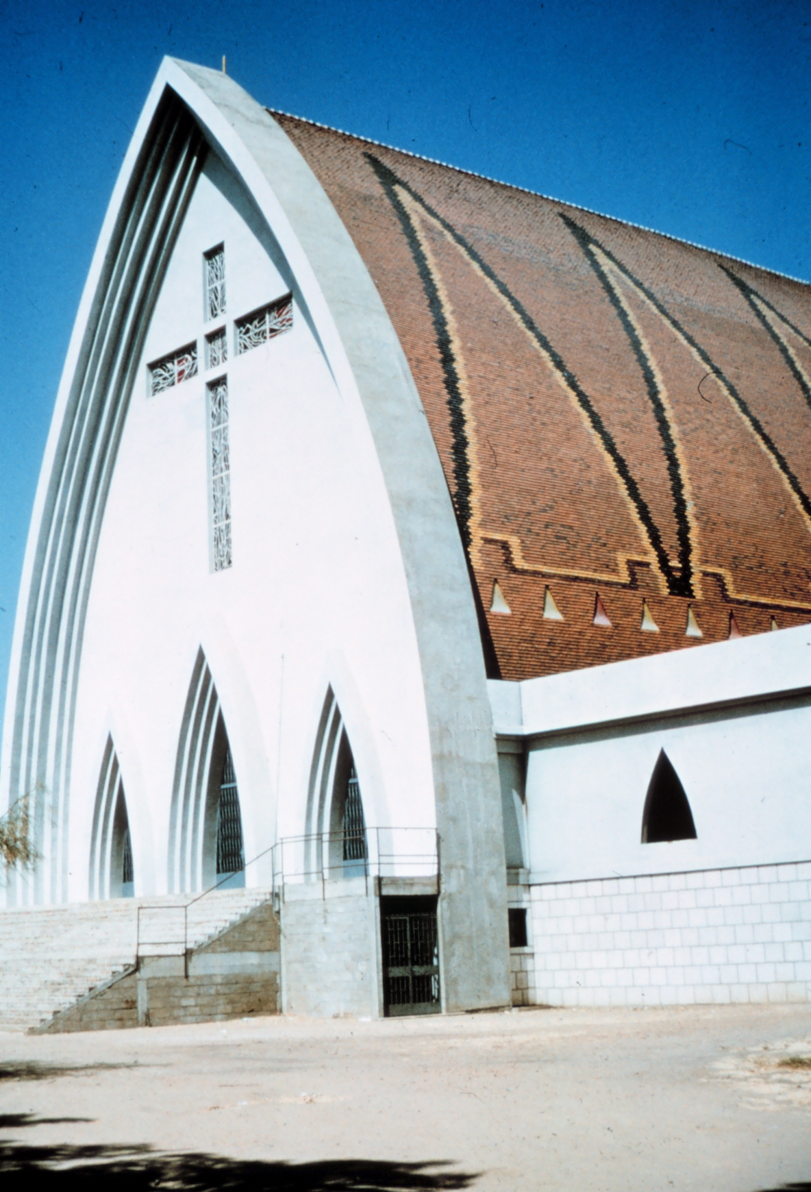
 The cathedral in N'Djamena, Chad, as it was before it was severely damaged during the civil war.
N'Djamena is located at 12°6'47" N, 15°2'57" E, on the confluence of the Chari and Logone rivers.[1]
While primarily an administrative center, the city includes the Nassara Strip commercial centre and residential areas such as Mbololo, Chagoua, Paris Congo and Moursal. The main commercial avenue of the city is the Avenue Charles de Gaulle.
Climate
N'Djamena features a semi-arid climate with a short wet season and a lengthy dry season. Despite the fact that the city receives on average approximately 750 mm of rain annually, due to the area’s very high evapotranspiration, N'Djamena still falls under the semi-arid climate category. The wet season covers from June to September, with the heaviest precipitation occurring in August. The dry season essentially covers the remaining eight months. Based on annual temperatures, N'Djamena is one of the hottest major cities on the planet. Only one month of the year (August) do average monthly high temperatures fail to cross the 32°C (90°F) mark. The city's highest temperatures are usually seen between March and June, just before the onset of the heavier rains. However outside of the warmest months of the year, nights in N'Djamena are generally tolerable.
Climate data for N'Djamena (1961-1990) Month Jan Feb Mar Apr May Jun Jul Aug Sep Oct Nov Dec Year Average high °C (°F) 32.4
(90.3)35.2
(95.4)38.7
(101.7)41.0
(105.8)39.9
(103.8)37.2
(99.0)33.5
(92.3)31.6
(88.9)33.7
(92.7)36.9
(98.4)35.8
(96.4)33.5
(92.3)35.78
(96.41)Average low °C (°F) 14.3
(57.7)16.6
(61.9)21.0
(69.8)24.8
(76.6)25.8
(78.4)24.7
(76.5)23.1
(73.6)22.4
(72.3)22.7
(72.9)21.8
(71.2)17.8
(64.0)14.8
(58.6)20.82
(69.47)Precipitation mm (inches) 0.0
(0)0.0
(0)0.3
(0.012)10.3
(0.406)25.8
(1.016)51.0
(2.008)143.8
(5.661)174.4
(6.866)84.3
(3.319)20.3
(0.799)0.1
(0.004)0.0
(0)510.3
(20.091)% humidity 29 23 21 28 39 52 68 76 72 49 33 31 43.4 Avg. precipitation days (≥ 0.1 mm) 0 0 1 3 6 9 13 15 9 3 1 0 60 Sunshine hours 297.6 277.2 282.1 273.0 285.2 258.0 213.9 201.5 228.0 285.2 300.0 303.8 3,205.5 Source no. 1: WMO Source no. 2: CMA Tourism and culture
Attractions in the city include the Chad National Museum, a cathedral and several mosques. Views of sunset across the Chari River can also be spectacular. N'Djamena was named Capital of Islamic Culture for 2009.[11]
Education
N'Djamena has two universities: University of N'Djamena in French as a studying language built 1971[12] and King Faisal University - Chad in Arabic as a studying language[13] built 1991, a number of secondary schools (including the long established Lycée Félix Éboué and Lycée technique commercial), and the American International School of N'Djamena.
Government
N'Djamena is the home of the National Assembly of Chad, along with many political organisations and parties, and every national ministry. The Supreme Court and Court of Appeal are also in N'Djamena, along with every major embassy in Chad, including the French and US.[14] It is sometimes considered within the region of Chari-Bagrimi, although separate.[15]
Transport
The city is the eastern terminus of the Trans-Sahelian Highway, and is linked to East Africa by the Ndjamena-Djibouti Highway. The Tripoli-Cape Town Highway also passes through N'Djamena, making it a key Central African location in the Trans-African Highway network. Ndjamena is linked by road bridge to Kousseri in Cameroon.
N'Djamena International Airport (IATA code NDJ) is located on the outskirts of the city.
Historically, N'Djamena's main link to the exterior was by river boat up the Chari and Logone rivers but these now carry little trade.
The city has no railway links, however railways are proposed in the AfricaRail project.
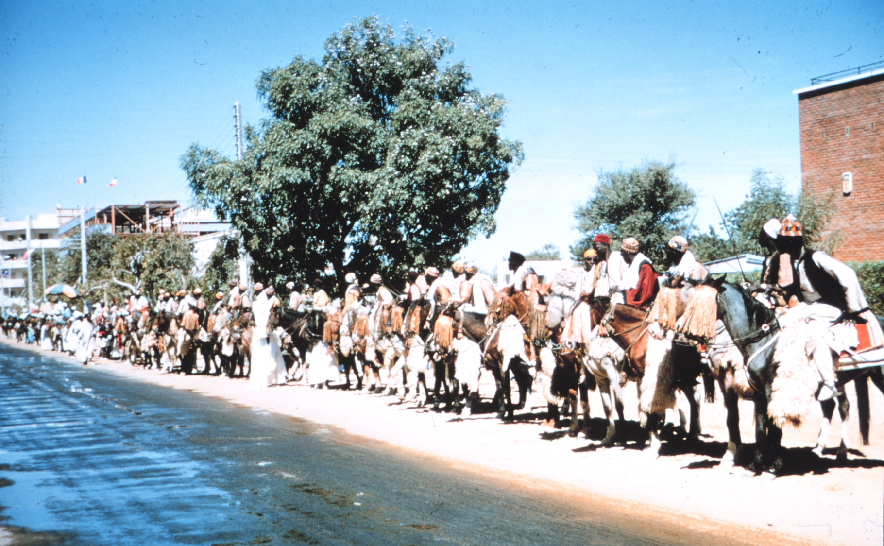
Gallery
The following pictures are undated but were all probably taken in the 1960s, apart from the first, which, based on the cars in the picture, must be from after 1984.
-
Boulevard in N'Djamena.
-

Streets of N'Djamena.
-
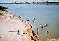
Beach on Chari River at N'Djamena.
-

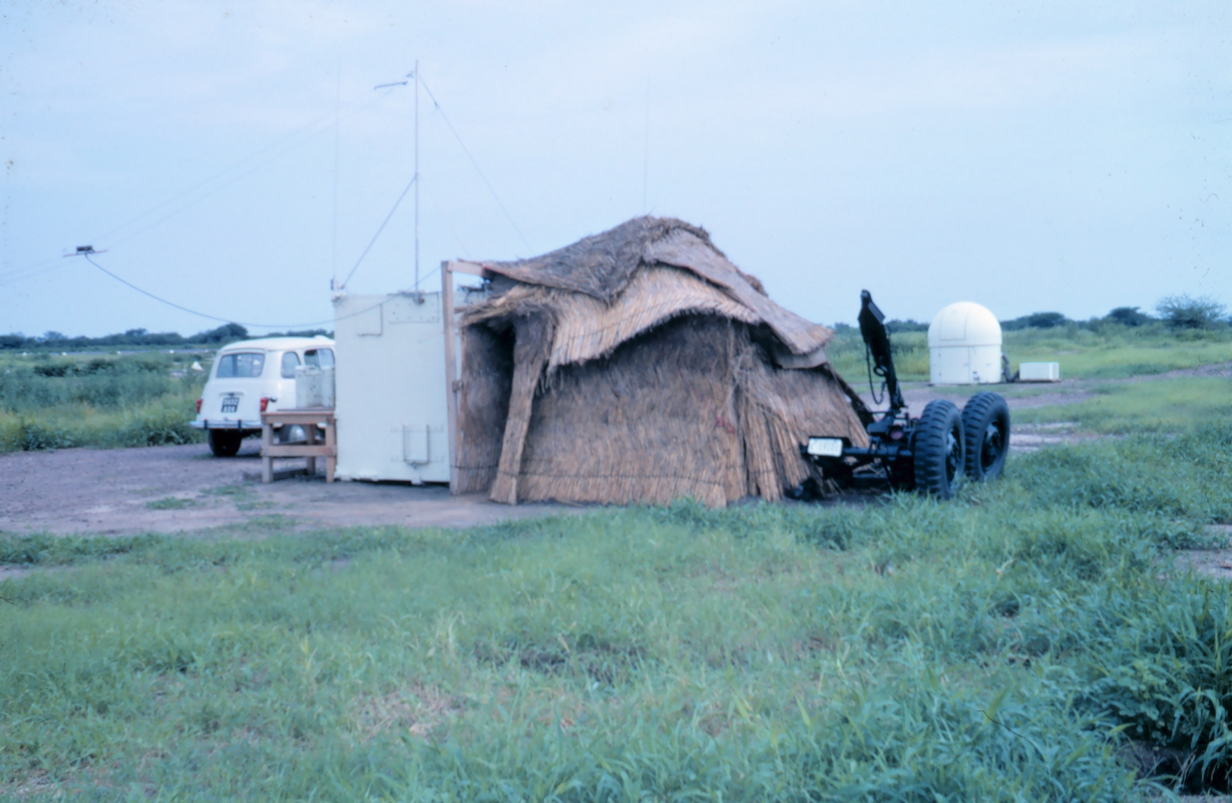
Temporary radio station used by NOAA near N'Djamena.
Cheesburger hi
Twin cities
sup MZ u fat cheeseburger
Notes
- ^ a b c d e f g h i Zeleza, Tiyambe; Dickson Eyoh (2003). Encyclopedia of twentieth-century African history. Taylor & Francis. p. 379. ISBN 9780415234795. http://books.google.co.uk/books?id=kjUHZrPBPPYC&pg=PA379#v=onepage&q=&f=false.
- ^ a b Zurocha-Walske, Christine (2009). Chad in Pictures. Twenty-First Century Books. p. 17. ISBN 9781575059563. http://books.google.co.uk/books?id=kkB1GaR2SXEC&pg=PT19#.
- ^ MESSERSCHMITT Bf 108 - 'TAIFUN' accessed: 29 April 2011
- ^ "N’Djamena (Chad)". Encyclopædia Britannica Online. 2009. http://www.britannica.com/EBchecked/topic/407350/NDjamena. Retrieved 29 November 2009.
- ^ Samuel Decalo, Historical Dictionary of Chad, Scarecrow, 1987, pp. 229-230
- ^ Robert Buijtenhuijs, Le Frolinat et les guerres civiles du Tchad, Karthala, 1987, pp. 67-175
- ^ R. Buijtenhuijs, Le Frolinat et les guerres civiles du Tchad, pp. 177-225
- ^ BBC: UN condemns rebel attack in Chad
- ^ "Rebels clash with Chadian forces inside capital". February 2, 2008. http://www.msnbc.msn.com/id/22962528.
- ^ Europa Publications (2004). Africa South of the Sahara. Routledge. p. 230. ISBN 9781857431834. http://books.google.co.uk/books?id=jj4J-AXGDaQC&pg=PA230#v=onepage&q=&f=false.
- ^ "N’Djamena, Capital of Islamic Culture for 2009". 2009. http://www.isesco.org.ma/english/capitalsIslamic/N%20Djamena2009/index.php. Retrieved 1 December 2009.[dead link]
- ^ http://www.univ-ndjamena.org Official webpage
- ^ [1]
- ^ Europa Publications (2004). Africa South of the Sahara. Routledge. pp. 235–6. ISBN 9781857431834. http://books.google.co.uk/books?id=jj4J-AXGDaQC&pg=PA235.
- ^ "N'Djamena, Chari-Baguirmi, Chad". Mbendi Information Services. http://www.mbendi.com/a_sndmsg/place_view.asp?pid=1116. Retrieved 1 December 2009.
- ^ "Toulouse-N’Djamena: une solidarité durable" (in French). Adequations. 2008. http://www.adequations.org/spip.php?article165. Retrieved 30 November 2009.
- ^ (Russian) "Российско-чадские отношения". Russian Ministry of Foreign Affairs. 16 February 2009. http://www.mid.ru/ns-rafr.nsf/89414576079db559432569d8002421fc/d6d8fcf1a1c7ad25c32571210044bea9?OpenDocument. Retrieved 2009-07-23.
External links
- Map of N'Djamena
- Best travel guide
- Photo 1 Photo 2 Photo 3
- http://earth-info.nga.mil/gns/html/cntry_files.html
Coordinates: 12°06′43″N 15°02′06″E / 12.112°N 15.035°E
Capitals of Africa Abuja, Nigeria
Accra, Ghana
Addis Ababa, Ethiopia
Algiers, Algeria
Antananarivo, Madagascar
Asmara, Eritrea
Bamako, Mali
Bangui, Central African Republic
Banjul, Gambia
Bissau, Guinea-Bissau
Bloemfontein, South Africa 1
Brazzaville, Rep. of the Congo
Bujumbura, Burundi
Cairo, Egypt
Cape Town, South Africa 2
Conakry, GuineaPort Louis, Mauritius
Porto-Novo, Benin
Praia, Cape Verde
Pretoria, South Africa 3
Rabat, Morocco
Saint-Denis, Réunion
São Tomé, São Tomé and Príncipe
Tripoli, Libya
Tunis, Tunisia
Victoria, Seychelles
Windhoek, Namibia
Yaoundé, Cameroon
Yamoussoukro, Côte d'Ivoire1 Judicial. 2 Parliamentary. 3 Executive. 4 An unrecognised or partially-recognised state.Categories:- N'Djamena
- Capitals in Africa
- Populated places in Chad
- Populated places established in 1900
- Logone River
- French Equatorial Africa
- Cameroon–Chad border crossings
- Regions of Chad


Wikimedia Foundation. 2010.