- Niamey
-
Niamey 
 Niamey
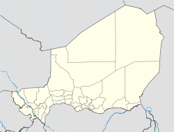
Coordinates: 13°31′17″N 02°06′19″E / 13.52139°N 2.10528°ECoordinates: 13°31′17″N 02°06′19″E / 13.52139°N 2.10528°E Country  Niger
NigerRegion Niamey Urban Community Communes Urbaines 5 Communes Districts 44 Districts Quartiers 99 Quarters Government – Type Appointed district government, elected city council, elected commune and quarter councils[1] – Governor of Niamey Urban Community Mrs. Kané Aichatou Boulama[1] – Mayor of Niamey City Oumarou Dogari Moumouni[1] AreaNiamey Urban Community[2] – Total 239.30 km2 (92.4 sq mi) Elevation 207 m (679 ft) Population (2006 estimate[3]) – Total 774,235 – Density 2,597/km2 (6,726.2/sq mi) Niamey Urban Community Time zone WAT (UTC+1) Area code(s) 20 Niamey (French pronunciation: [njaˈmɛ]) is the capital and largest city of the West African country of Niger. Niamey lies on the Niger River, primarily situated on the east bank. It is an administrative, cultural and economic center. Niamey's population, which was estimated at 774,235 in 2006,[3], is now projected to be much higher.[1]
The city is located in a pearl millet growing region, while manufacturing industries include bricks, ceramic goods, cement and weaving.
Niamey was probably founded in the eighteenth century, but was of little importance to most of the country until the French developed a colonial post in the 1890s. This rapidly grew into an important center. In 1926 it became the capital of Niger, and the population gradually increased, from about 3,000 in 1930 to around 30,000 in 1960, 250,000 in 1980 and - by some estimates - 800,000 in 2000. In 2011, government press estimated the total urban population at over 1.5 million.[1] A major cause of the increase has been in migration for work and during droughts, as well a high population grown.[1] This last factor means a majority of the city's citizens are youths.[1]
Contents
Geography and climate
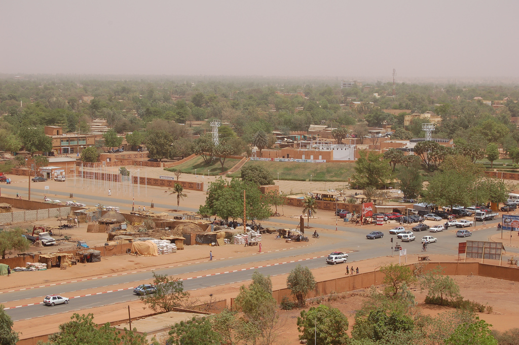
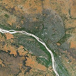 Niamey seen from Spot Satellite
Covering an area of over 250 km² the metropolitan area sits atop two plateaus reaching 218 m in altitude, bisected by the Niger River. At Niamey, the river, running almost straight SSE from Gao, makes a series of wide bends. The city was founded on the east ("left bank") of the river as it meanders from a west to east flow to run almost directly south. A series of marshy islands begin at Niamey and extend south in the river.
The climate is hot semi-arid (Köppen climate classification BSh), with an expected rainfall of between 500 mm (20 in) and 750 mm (30 in) a year, mostly beginning with a few storms in May, then accelerating to a rainy season usually lasting from sometime in June to early September, when the rains taper off rather quickly. Most of the rainfall is from late June to mid August. There is practically no rain from mid-October to April. Niamey is remarkably hot throughout the year. Average monthly high temperatures reach 38°C (100°F) six months out of the year and in no month does average high temperatures fall below 32°C (90°F). During the dry season, particularly from November through February, nights are generally relatively cool. Average nighttime lows between November and February range from 14°C-18°C (57°F-64°F).
Climate data for Niamey Month Jan Feb Mar Apr May Jun Jul Aug Sep Oct Nov Dec Year Average high °C (°F) 32.5
(90.5)35.7
(96.3)39.1
(102.4)40.9
(105.6)40.2
(104.4)37.2
(99.0)34.0
(93.2)33.0
(91.4)34.4
(93.9)37.8
(100.0)36.2
(97.2)33.3
(91.9)36.19
(97.15)Average low °C (°F) 16.1
(61.0)19.0
(66.2)22.9
(73.2)26.5
(79.7)27.7
(81.9)25.7
(78.3)24.1
(75.4)23.2
(73.8)23.6
(74.5)24.2
(75.6)19.5
(67.1)16.7
(62.1)22.43
(72.38)Precipitation mm (inches) 0.0
(0)0.0
(0)3.9
(0.154)5.7
(0.224)34.7
(1.366)68.8
(2.709)154.3
(6.075)170.8
(6.724)92.2
(3.63)9.7
(0.382)0.7
(0.028)0.0
(0)540.8
(21.291)Sunshine hours 297.6 263.2 269.7 252.0 279.0 267.0 257.3 235.6 235.6 285.2 282.0 279.0 3,203.2 Source no. 1: WMO [4] Source no. 2: HKO Population
Year Population
(estimate)1901 600 1930 3,000 1960 30,000 1980 250,000 2005 750,000 While Niamey's population has grown steadily since independence, the droughts of the early 1970s and 1980s, along with the economic crisis of the early 1980s, have propelled an exodus of rural inhabitants to Niger's largest city. Under the Military government of General Seyni Kountché, there were strict controls on residency, and the government would regularly round up and "deport" those without permits back to their villages.[5] The growing freedoms of the late 1980s and 1990s, along with the Tuareg Rebellion of 1990s and famine in the 2000s, have reinforced the process of immigration, with large informal settlements appearing on the outskirts of the cities. Noticeable in the city's centre since the 1980s are groups of poor, young, or handicapped beggars. Within the richer or more trafficked neighbourhoods, these beggars have in fact formed a well regulated hierarchical system in which beggars garner sadaka (alms) according to cultural and religious norms.[5]
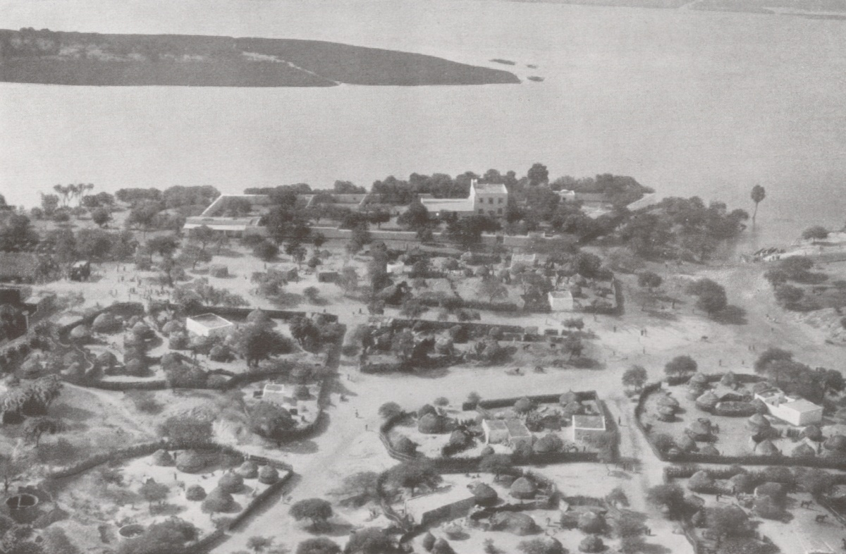
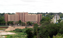 The Hotel Gaweye
Sites and institutions
Attractions in the city include the Niger National Museum, incorporating a zoo, a museum of vernacular architecture, a craft centre, and exhibits including dinosaur skeletons and the Tree of Ténéré. There are also American, French and Nigerien cultural centres, seven major market centers including the large Niamey Grand Market, a traditional wrestling arena and a horse track.
The city is also the site of Diori Hamani International Airport, the National School of Administration, Abdou Moumouni University, the Higher Institute of Mining, Industry and Geology which lies on the right bank of the river, and many institutes (Centre numérique de Niamey, IRD, ICRISAT, Hydrologic Institute, etc.) AMU has seen a number of protest actions over the years, including the 2006 Abdou Moumouni University protests.
Several hospitals are located in Niamey, including the National Hospital and Lamordé University Hospital.
In December 2005 it was the host of the Jeux de la Francophonie.
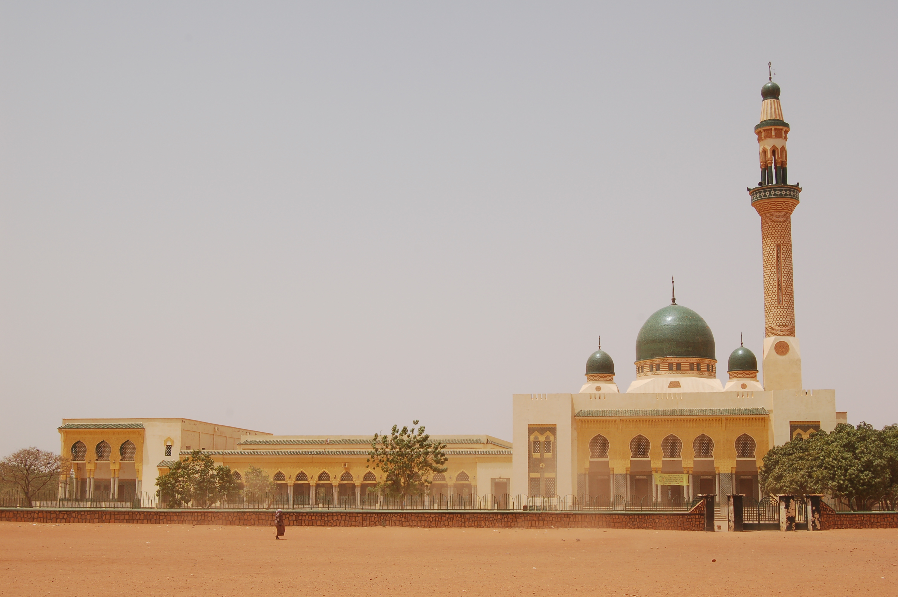
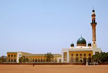 The Grand Mosque of Niamey
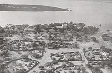 Niamey in December 1930. The large house in the centre is the French governor's residence. Air photo taken by Swiss pilot and photographer Walter Mittelholzer.
Niamey makes up a special capital district of Niger, which is surrounded by the department of Tillabéri.
Religion
More than 90% of Niger is populated by Muslims. Niamey hosts the largest mosque in the country, the Grand Mosque of Niamey. The city is the headquarters of the Roman Catholic Archdiocese of Niamey.
Governance
The city of Niamey itself is governed as an autonomous first-level administrative block, the Niamey Urban Community (fr. Communauté Urbaine de Niamey, CUN). It includes five Urban Communes, divided into 44 "Districts" and 99 "Quartiers", including formerly independent towns. It is a co-equal first division subdivision with the seven Regions of Niger. The Niamey Urban Community includes an administration and Governor appointed by national leaders.[1] Like the rest of Niger, Niamey has seen a decentralization of governance since 2000. Government Ordinance n°2010-56 and Presidential Decree n°2010-679 of September 2010 mandated an elected City Council for the city of Niamey, subsumed under the CUN. This excludes some outlying areas of the CUN.[1] Forty-five councilors are popularly elected and in turn elect the Mayor of the City of Niamey. In July 2011 the first Mayor under the new system, Oumarou Dogari Moumouni, was installed by the Governor of the CUN Mrs. Kané Aichatou Boulama and the City Council.[1] The City Council and Mayor have limited roles compared the CUN Governor. Niamey has a third layer of government in the Commune system. Each Commune elects its own council, and outside major cities, these function like independent cities. Niamey and other major cities have been, since the advent of decentralization, developing coordination of Commune governments in large cities made up of multiple Communes.[1]
Under this devolution process[6] formalised in the 1999 Constitution of Niger, the CUN contains five "Urban Communes" and no "Rural Communes". As all Nigerien Urban Communes, they are divided into Quarters ("Quartiers") with elected boards.
The CUN includes 99 Quarters:[7]
- Niamey I commune, 20 Quarters
- Niamey II commune, 17 Quarters
- Niamey III commune, 17 Quarters
- Niamey IV commune, 17 Quarters
- Niamey V commune, 28 Quarters
The CUN includes land where there were formerly several surrounding towns and villages which the city of Niamey has now annexed. These include Soudouré, Lamordé, Gamkallé, Yantala, and Gaweye.[8]
The CUN covers a territory of 239.30 km2,[9] or 0.02% of the nation's territory.[10]
Until 1998, all of greater Niamey was part of Tillabery Region, which prior to 1992 was named the Niamey Department. The CUN remains surrounded on all sides by Tillabery Region.[8]
References
- ^ a b c d e f g h i j k Installation du Conseil de ville de Niamey et élection des membres : M. Oumarou Dogari Moumouni, élu maire de la ville de Niamey. Laouali Souleymane, Le Sahel (Niamey). 2011-07-01
- ^ ADAMOU Abdoulaye. Parcours migratoire des citadins et problème du logement à Niamey. REPUBLIQUE DU NIGER UNIVERSITE ABDOU MOUMOUNI DE NIAMEY Faculté des Lettres et Sciences Humaines DEPARTEMENT DE GEOGRAPHIE(2005), p. 34
- ^ a b African researcher visits Oklahoma. p. 2
- ^ "Weather Information for Niamey". WMO. http://worldweather.wmo.int/074/c00327.htm. Retrieved 2011-01-21.
- ^ a b Patrick Gilliard, and Laurent Pédenon "Rues de Niamey, espace et territoires de la mendicité" Politique africaine, Paris (October 1996) no.63 pp. 51-60.
- ^ Haut Commissariat à la Réforme Administrative: loi N°2002-016 bis du 11 une 2002.
- ^ Adamou Abdoulaye. Parcours migratoire des citadins et problème du logement à Niamey. Département de Géographie, Faculté des Lettres et Sciences Humaines, Université Abdou Moumouni de Niamey (2005). (French)
- ^ a b Decalo, Samuel (1997). Historical Dictionary of the Niger (3rd ed.). Boston & Folkestone: Scarecrow Press. ISBN 0810831368. pp. 225-227
- ^ FAO (2003), Section VI
- ^ Amadou Oumarou. Etat et contexte de la fourniture des services publics dans la commune urbaine de Say. LASDEL - Laboratoire d'études et recherches sur les dynamiques Sociales et le développement local, Niamey, Niger. (April 2007)
- Decalo, Samuel (1997). Historical Dictionary of the Niger (3rd ed.). Boston & Folkestone: Scarecrow Press. ISBN 0810831368.
- Geels, Jolijn (2006). Niger. Chalfont St Peter, Bucks / Guilford, CT: Bradt UK / Globe Pequot Press. ISBN 9781841621524.
External links
- Niamey travel guide from Wikitravel
- Niger Assemblee Nationale official website
- Mission of Niger to the United Nations official website
- BBC News Country Profile - Niger
- CIA World Factbook - Niger
- Niger at the Open Directory Project
- US State Department - Niger includes Background Notes, Country Commercial Guides and major reports
- MSN Map
Capital: Niamey in Niamey Capital DistrictAgadez Region Diffa Region Dosso Region Maradi Region Aguie Department • Dakoro Department • Guidan Roumdji Department • Madarounfa Department • Mayahi Department • Tessaoua DepartmentTahoua Region Tillabéri Region Zinder Region Capitals of Africa Abuja, Nigeria
Accra, Ghana
Addis Ababa, Ethiopia
Algiers, Algeria
Antananarivo, Madagascar
Asmara, Eritrea
Bamako, Mali
Bangui, Central African Republic
Banjul, Gambia
Bissau, Guinea-Bissau
Bloemfontein, South Africa 1
Brazzaville, Rep. of the Congo
Bujumbura, Burundi
Cairo, Egypt
Cape Town, South Africa 2
Conakry, GuineaPort Louis, Mauritius
Porto-Novo, Benin
Praia, Cape Verde
Pretoria, South Africa 3
Rabat, Morocco
Saint-Denis, Réunion
São Tomé, São Tomé and Príncipe
Tripoli, Libya
Tunis, Tunisia
Victoria, Seychelles
Windhoek, Namibia
Yaoundé, Cameroon
Yamoussoukro, Côte d'Ivoire1 Judicial. 2 Parliamentary. 3 Executive. 4 An unrecognised or partially-recognised state.Niger River Countries 
Sections Tributaries (list) and
distributariesTinkisso River · Sankarani River · Milo River · Bani River · Mekrou River · Alibori River · Sola River · Sokoto River · Sota River Kaduna River · Benue River · Anambra River · Forcados River · Nun RiverCities Lakes Dams and bridges King Fahd Bridge · Martyrs Bridge · Markala Dam · Gao Bridge · Kennedy Bridge · Kainji Dam · River Niger Bridge (Onitsha)Protected Areas Categories:- Niamey
- Capitals in Africa
- Populated places in Niger
- Communities on the Niger River
- Capital districts and territories
- Regions of Niger


Wikimedia Foundation. 2010.