- Tillabéri Region
Demographic info|name=Tillabéri
capital=Tillabéri
population=1,889,515
census=2001
area=89,623
density=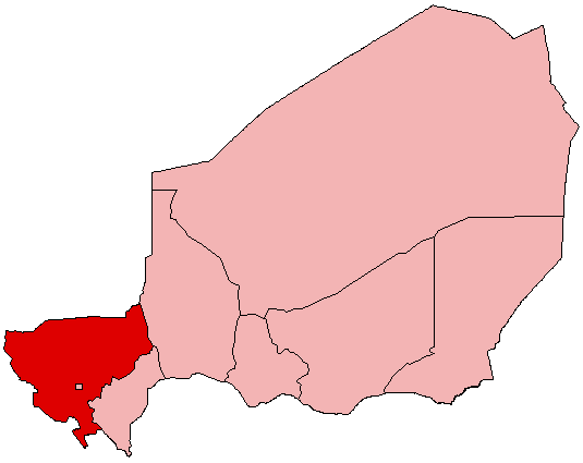
Tillabéri (var. "Tillabéry") is an administrative Region in
Niger ; the capital of the Region isTillabéri . Tillabéri Region was created in 1992, whenNiamey Region was split, with the area immediately outside Niamey renamed as the "capital district". [According to [http://64.233.169.104/search?q=cache:QoLVC0VLhpMJ:www.statoids.com/une.html+FIPS+Niger+NG08&hl=en&ct=clnk&cd=3&gl=us&client=firefox-a Statsoid] : "~1992: Tillabéry Region split from Niamey (whose FIPS code was NG05 before the change). Status of Niamey changed from Region to capital district."]Divisions and borders
Tillabéri is divided into 6 departments:
*Filingue Department
*Kollo Department
*Ouallam Department
*Say Department
*Téra Department
*Tillaberi Department Tillabéri has the following foreign borders, including Niger's only border with
Burkina Faso :
*Gao Region, Mali - north
*Oudalan Province, Burkina Faso - west, north of Séno
*Séno Province, Burkina Faso - west, south of Oudalan and north of Yagha
*Yagha Province, Burkina Faso - southwest, south of Séno and north of Komondjari
*Komondjari Province, Burkina Faso - southwest, south of Yagha and northwest of Tapoa
*Tapoa Province, Burkina Faso - south, southeast of Komondjari
*Alibori Department, Benin - southeastDomestically, it borders the following departments:
*Dosso Region - east
*Tahoua Region - northeastTillabéri also surrounds the capital district ofNiamey .ee also
*
Departments of Niger
*Regions of Niger
*Communes of Niger References
Wikimedia Foundation. 2010.