- Mopti
-
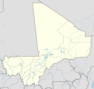
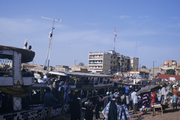
Mopti — Commune and town — Mopti Market Location within Mali Coordinates: 14°30′N 4°12′W / 14.5°N 4.2°W Country  Mali
MaliRegions of Mali Mopti Region Cercle Mopti Cercle islands List- New Town
- Old Town
- Bani
Elevation 275 m (905 ft) Population (2009)[1] - Total 114,296 Time zone GMT (UTC0) Mopti (Pronounced Mohti) is a city at the confluence of the Niger and the Bani in Mali, between Timbuktu and Ségou. The city lies on three islands linked by dykes: the New Town, the Old Town and Medina Coura. As a result it is sometimes known as the "Venice of Mali".
Contents
History
The city of Mopti derives its name from the Fulfulde word for gathering. The islands had long been inhabited, but Mopti was only founded in the nineteenth century as part of the Massina Empire, later becoming the base of El Hadj Umar Tall. With French domination, Mopti became known for its egret feather industry.[2]
Due to the limited land available, Mopti is very densely built compared to most Malian cities, containing many multi-story buildings and narrow streets. Originally, the islands were much smaller than they are today; first linked by dykes in the early twentieth century, the areas around and between natural islands have been gradually filled and raised—often by deposition of household trash, a process that still continues today in areas such as the western edge of the Old Town.
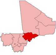
Mopti is the capital of the 5th administrative region of Mali, the Région de Mopti.
In 2002, Mopti was one of several Malian cities to host the Cup of African Nations tournament. A large, modern stadium was constructed for this event.
Amadou Toumani Touré, current president of Mali, is a native of Mopti.
Industry
Mopti is the region's commercial center and Mali's most important port; markets around its harbour sell salt from the Sahara, among many other goods. Fishing, herding, and agriculture (particularly rice production) also continue to be important to the local economy.
Tourist industry
Mopti is popular with tourists, having an active river port, a mosque, and across the Niger, small fishing villages. Attractions in Mopti include Mopti Grand Mosque and the nearby Pays Dogon. There are several popular hotels, the Hotel Kanaga, Hotel Y a pas de Problème, and Hotel Ambedjele which is on the road to Sevare.
Transport
Ferries connect Mopti with Timbuktu, Gao, Koulikoro and Djenné. A causeway links the town to Sévaré, the actual location of Mopti's airport.
Demographics
Niger River at Mopti

Average monthly flow (m³/s) at the Mopti hydrometric station over the period 1922-1990[3]
Mopti is the fourth-largest city in Mali, with a population of 110,000, primarily of the Bambara, Bozo, Dogon, Songhai and Fula ethnic groups.
Climate
The weather is hot and dry throughout much of the year with plenty of sunshine. Average daily maximum temperatures in the hottest months of the year - April and May - exceed 40°C. Temperatures are slightly cooler, though still very hot, from June through September, when practically all of the annual rainfall occurs. Only the winter months of December and January have average daily maximum temperatures below 32°C.
Climate data for Mopti Month Jan Feb Mar Apr May Jun Jul Aug Sep Oct Nov Dec Year Average high °C (°F) 31.7
(89.1)34.9
(94.8)37.7
(99.9)40.2
(104.4)40.5
(104.9)38.3
(100.9)34.6
(94.3)32.6
(90.7)33.3
(91.9)35.5
(95.9)35.0
(95.0)31.6
(88.9)35.49
(95.89)Average low °C (°F) 15.1
(59.2)17.6
(63.7)21.2
(70.2)24.7
(76.5)26.5
(79.7)25.7
(78.3)23.9
(75.0)23.3
(73.9)23.7
(74.7)23.4
(74.1)19.5
(67.1)16.0
(60.8)21.72
(71.09)Precipitation mm (inches) 0.8
(0.031)0.0
(0)0.8
(0.031)4.0
(0.157)23.4
(0.921)55.8
(2.197)140.5
(5.531)165.6
(6.52)88.7
(3.492)19.8
(0.78)0.3
(0.012)0.4
(0.016)500.1
(19.689)Source: World Weather Information Service[4] -
Countryside near Sévaré in the commune of Mopti
References
- ^ Resultats Provisoires RGPH 2009 (Région de Mopti), République de Mali: Institut National de la Statistique, http://instat.gov.ml/contenu_documentation.aspx?type=23
- ^ Marc, Lucien (1910), "Mopti et le commerce du moyen Niger" (in French), Annales de Géographie 19 (103): 42–47, doi:10.3406/geo.1910.7915, http://www.persee.fr/web/revues/home/prescript/article/geo_0003-4010_1910_num_19_103_7915.
- ^ Composite Runoff Fields V 1.0: Mopti, University of New Hampshire/Global Runoff Data Center, http://www.compositerunoff.sr.unh.edu/html/Polygons/P1134500.html, retrieved 15 Jan 2011.
- ^ Weather Information for Mopti, World Weather Information Service, http://www.worldweather.org/034/c00133.htm, retrieved 18-Nov-2009
External links
- Photo 1 Photo 2
- Pictures of Mopti and villages around it
 Communes and towns of the Mopti Region
Capital:Mopti Bandiagara Cercle Bandiagara (Bandiagara) · Doucoumbo (Doucoumbo) · Dourou (Dourou) · Dogani Bere (Dogani Bere) · Kende (Kende) · Lowol Gueou (Karegue) · Metoumou (Damada) · Pelou (Pelou) · Pignari Bana (Goundaka) · Pignari (Baboye) · Sangai (Sangha Agolleye) · Soroly (Soroly) · Wadouba (Kani Gogouna) · Dandoli (Dandoli) · Borko (Borko) · Diamnati (Dé) · Segue Ire (Sougui) · Ondougou (Ondougou) · Timniri (Diangassagou) · Bara Sara (Ouo Sarre) · Kendie (Kendie)Bankass Cercle Bankass (Bankass) · Baye (Baye) · Diallassagou (Diallassagou) · Tori (Tori) · Kanibonzon (Kanibonzon) · Ouenkoro (Ouenkoro) · Segue (Segue) · Sokoura (Sokoura) · Koulogon Habe (Koulogon Habe) · Lessagou Habe (Lessagou Habe) · Soumbala (Soumbala) · Dimbal Habe (Dimbal Habe)Djenné Cercle Djenné (Djenné) · Dandougou Fakala (Dandougou Fakala) · Derary (Gagna) · Fakala (Fakala) · Femaye (Taga) · Kewa (Kouakourou) · Nema Badenyakafo (Mougna) · Ouro Ali (Senossa) · Pondori (Gomitogo) · Togue Mourari (Mourrah) · Madiama (Madiama) · Niansanarie (Keke)Douentza Cercle Douentza (Douentza) · Dallah (Dallah) · Dangol-Bore (Boré) · Debere (Debere) · Dianweli (Dianweli Maoude) · Djaptodji (N'Gouma) · Gandamia (Kikara) · Haire (Boni) · Korarou (Boni) · Koubewel Koundia (Koubewel) · Mondoro (Mondoro) · Tedie (Tongo-Tongo) · Hombori (Hombori) · Petaka (Petaka) · Kerena (Kerena)Koro Cercle Koro (Koro) · Bamba (Deguere) · Barapireli (Barapireli) · Bondo (Bondo) · Diankabou (Diankabou) · Dinangourou (Dinangourou) · Dioungani (Dioungani) · Dougoutene I (Toroli) · Dougoutene II (Andiagana-Na) · Kassa (Berdosso) · Koporokendie Na (Koporokendie Na) · Koporo Pen (Koporo Pen) · Madougou (Madougou) · Pel Maoude (Pel Maoude) · Yoro (Yoro) · Youdiou (Youdiou)Mopti Cercle Mopti (Mopti) · Socoura (Socoura) · Dialloube (Dialloube) · Fatoma (Fatoma) · Konna (Konna) · Korombana (Korientze) · Kounari (Manaco) · Ouro Modi (Ouro Modi) · Ouroube Doudde (Sendegue) · Sio (Soufouroulaye) · Soye (Soye) · Borondougou (Diambacourou) · Sasalbe (Nogourema Toboro) · Koubaye (Koubaye) · Bassirou (Bassirou)Tenenkou Cercle Youwarou Cercle Niger River Countries 
Sections Tributaries (list) and
distributariesTinkisso River · Sankarani River · Milo River · Bani River · Mekrou River · Alibori River · Sola River · Sokoto River · Sota River Kaduna River · Benue River · Anambra River · Forcados River · Nun RiverCities Lakes Dams and bridges King Fahd Bridge · Martyrs Bridge · Markala Dam · Gao Bridge · Kennedy Bridge · Kainji Dam · River Niger Bridge (Onitsha)Protected Areas Categories:- Mopti
- Populated places in the Mopti Region
- Regional capitals in Mali
- Communes of Mali
- Niger Inland Delta
- Massina Empire
- Communities on the Niger River
- Bani River
- French West Africa
Wikimedia Foundation. 2010.


