- Kimberley, Northern Cape
-
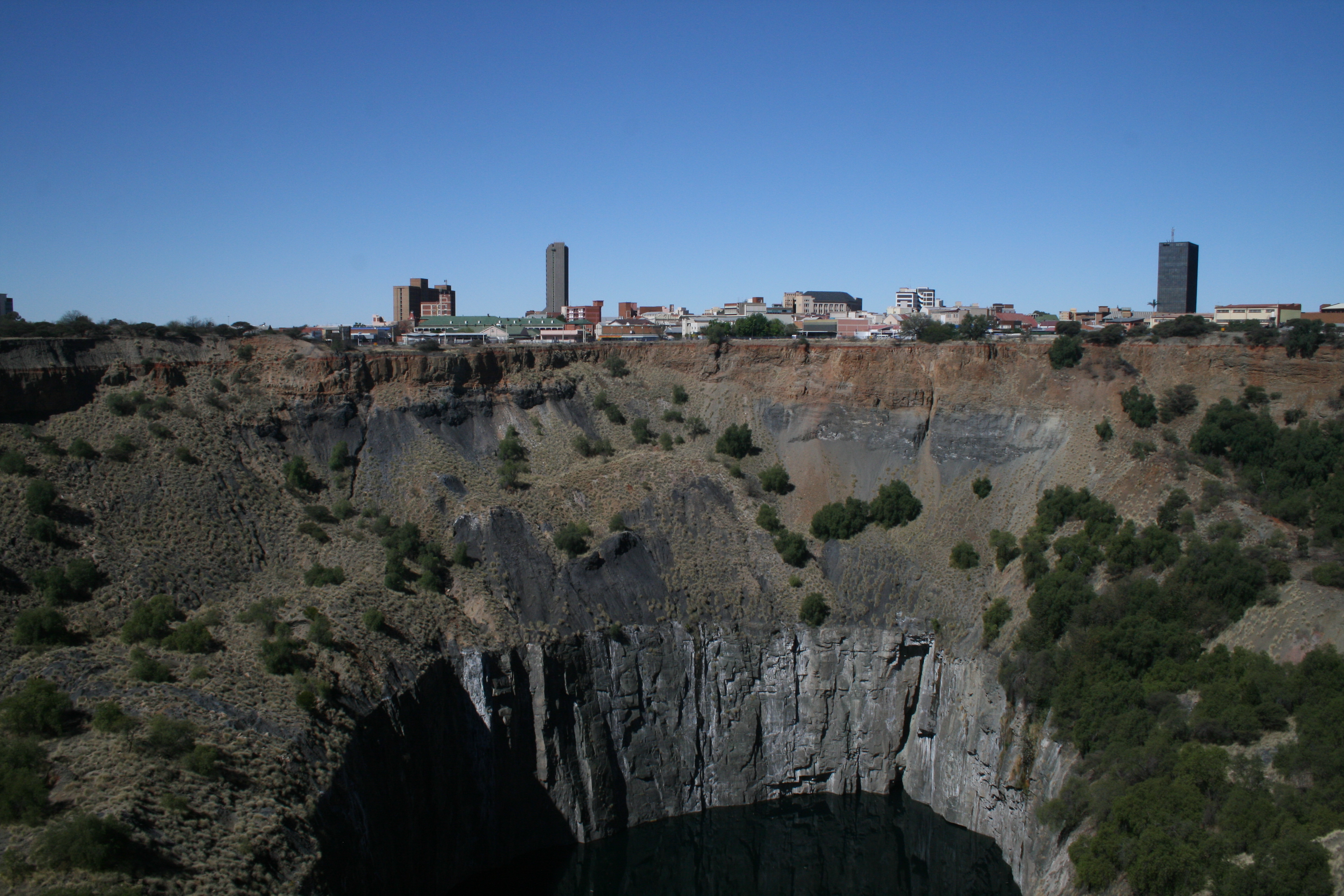
Kimberley City centre seen over the Big Hole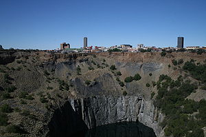 Location of Kimberley
 Kimberley
Coordinates: 28°44′31″S 24°46′19″E / 28.74194°S 24.77194°ECoordinates: 28°44′31″S 24°46′19″E / 28.74194°S 24.77194°E Country  South Africa
Province Northern Cape District Municipality Frances Baard Local Municipality Sol Plaatje Established 1873-07-05 Elevation 1,184 m (3,884 ft) Population - Total 167,000 Time zone SAST (UTC+2) Postal Code 8300 Area code(s) 053 Kimberley is a city in South Africa, and the capital of the Northern Cape. It is located near the confluence of the Vaal and Orange Rivers. The town has considerable historical significance due its diamond mining past and siege during the Second Boer War. Notable personalities such as Cecil Rhodes made their fortune here and the roots of the De Beers corporation can also be traced to the early days of the mining town.
Contents
History
Discovery of diamonds
In 1866, Erasmus Jacobs found a small brilliant pebble on the banks of the Orange River, on the farm De Kalk leased from local Griquas, near Hopetown, which was his father's farm. He showed the pebble to his father who sold it.[1] The pebble was purchased from Jacobs by Schalk van Niekerk, who later sold it, and turned out to be a 21.25 carat (4.25 g) diamond, known as the Eureka. Three years later Schalk van Niekerk sold another diamond also found in the De Kalk vicinity, the Star of South Africa for £11,200. The second diamond was promptly resold in the London markets for £25,000.[1]
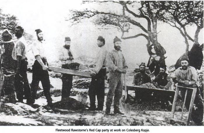
 Fleetwood Rawstone's "Red Cap Party" of prospectors on Colesberg Kopje
In 1871, an even larger 83.50 carat (16.7 g) diamond was found on the slopes of Colesberg Kopje on the farm Vooruitzigt belonging to the De Beers brothers. Henry Richard Giddy recounted how Esau Damoense (or Damon), the cook for prospector Fleetwood Rawstone's "Red Cap Party", made the discovery on Colesberg Kopje after he was sent there to dig as punishment. Rawstorne took the news to the nearby diggings of the De Beer brothers — his arrival there sparking off the famous "New Rush" which, as historian Brian Roberts puts it, was practically a stampede. Within a month 800 claims were cut into the hillock which were worked frenetically by two to three thousand men. As the land was lowered so the hillock became a mine – in time, the world renowned Kimberley Mine.[2]
The Cape Colony, Transvaal, Orange Free State and the Griqua leader Nikolaas Waterboer all laid claim to the diamond fields. The Free State Boers in particular wanted the area as it lay inside the natural borders created by Orange and Vaal Rivers. Following the mediation that was overseen by the governor of Natal, the Keate Award went in favour of Waterboer, who placed himself under British protection.[3] Consequently, the territory known as Griqualand West was proclaimed on 27 October 1871.
Naming the place: from Vooruitzigt to New Rush to Kimberley
Colonial Commissioners arrived in New Rush on 17 November 1871 to exercise authority over the territory on behalf of the Cape Governor. Digger objections and minor riots led to Governor Barkly's visit to New Rush in September the following year, when he revealed a plan instead to have Griqualand West proclaimed a Crown Colony. Richard Southey would arrive as Lieutenant-Governor of the intended Crown Colony in January 1873. Months passed however without any sign of the proclamation or of the promised new constitution and provision for representative government. The delay was in London where Secretary of State for the Colonies, Lord Kimberley, insisted that before electoral divisions could be defined, the places had to receive "decent and intelligible names." His Lordship declined to be in any way connected with such a vulgarism as New Rush and as for the Dutch name, Vooruitzigt … he could neither spell nor pronounce it."[4] The matter was passed to Southey who gave it to his Colonial Secretary J.B. Currey. Roberts writes that "when it came to renaming New Rush, [Currey] proved himself a worthy diplomat. He made quite sure that Lord Kimberley would be able both to spell and pronounce the name of the main electoral division by, as he says, calling it 'after His Lordship'." New Rush became Kimberley, by Proclamation dated 5 July 1873.[4] Digger sentiment was expressed in an editorial in the Diamond Field newspaper when it stated "we went to sleep in New Rush and waked up in Kimberley, and so our dream was gone."[5]
Griqualand West was annexed to the Cape Colony by the Griqualand West Annexation Act on 27 July 1877.[6]
The Big Hole and other mines
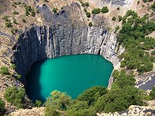
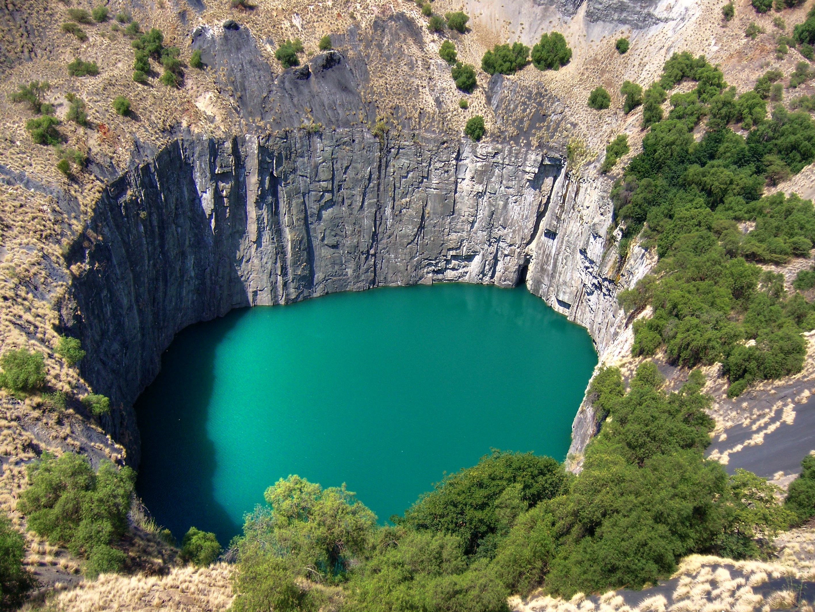
As miners arrived in their thousands, the hill disappeared, and became known as the Big Hole. From mid-July 1871 to 1914, 50,000 miners dug the hole with picks and shovels, yielding 2,722 kg of diamonds. The Big Hole has a surface of 17 hectares (42 acres) and is 463 metres wide. It was excavated to a depth of 240 m, but then partially infilled with debris reducing its depth to about 215 m; since then it has accumulated water to a depth of 40 m leaving 175 m visible. Beneath the surface, the Kimberly Mine underneath the Big Hole was mined to a depth of 1097 metres. A popular local myth claims that it is the largest hand-dug hole on the world, however Jagersfontein Mine appears to hold that record.[7] There is currently an effort in progress to register the Big Hole as a World Heritage Site.[8]
By 1873, Kimberley was the second largest town in South Africa; having an approximate population of 40,000.[9]
Role and influence of De Beers
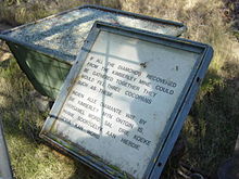 A sign next to the Big Hole, reading "If all the diamonds recovered from the Kimberley Mine could be gathered together they would fill three cocopans such as these"
The various smaller mining companies were amalgamated by Barney Barnato into De Beers, and The Kimberley under Cecil Rhodes and Charles Rudd. In 1888, the two companies merged to form De Beers Consolidated Mines, which to this day today still retains a monopoly over the world's diamond market.[10]
Very quickly, Kimberley became the largest city in the area, partly due to a massive African migration to the area from all over the continent. The immigrants were accepted with open arms, because the De Beers company was in search of cheap labour to help run the mines. Another group drawn to the city for money was prostitutes, from a wide variety of ethnicities who could be found in bars and saloons. It was praised as a city of limitless opportunity.[11]
Five big holes were dug into the earth, which followed the kimberlite pipes, which are named after the town. Kimberlite is a diamond-bearing blue ground that sits below a yellow colored soil.[12] The largest, The Kimberley mine or "Big Hole" covering 170 000 m², reached a depth of 240 m and yielded 3 tons of diamonds. The mine was closed in 1914, while three of the holes – Du Toitspan, Wesselton and Bultfontein – closed down in 2005.
The Second Boer War
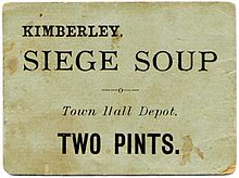
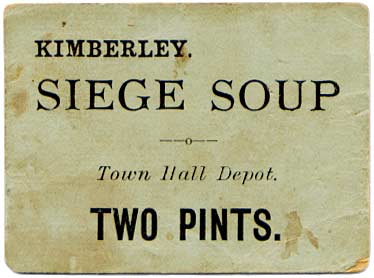
On 14 October 1899, Kimberley was besieged at the beginning of the Second Boer War. The British forces trying to relieve the siege suffered heavy losses. The siege was only lifted on 15 February 1900, but the war continued until May 1902. By that time, the British had built a concentration camp at Kimberley to house Boer women and children.[13]
Becoming the City of Kimberley
The until now separately administered Boroughs of Kimberley and Beaconsfield amalgamated as the City of Kimberley in 1912.[14]
Kimberley under Apartheid
Although a considerable degree of urban segregation already existed, one of the most significant impacts of Apartheid on the city of Kimberley was the implementation of the Group Areas Act. Communities were divided according to legislated racial categories, namely European (White), Native (Black), Coloured and Indian – now legally separated by the Prohibition of Mixed Marriages Act. Individual families could be split up to three ways (based on such notorious measures as the 'pencil test') and mixed communities were either completely relocated (as in Malay Camp – although those clearances began before Apartheid as such) or were selectively cleared (as in Greenpoint which became a ‘Coloured’ Group Area, its erstwhile African and other residents being removed to other parts of town). Residential segregation was thus enforced in a process which saw the creation of new townships at the northern and north-eastern edges of the expanding city. Institutions that were hard hit by the Group Areas Act, Bantu Education and other Acts included churches (such as the Bean Street Methodist Church) and schools (some, such as William Pescod and Perseverance School, moved while the Gore Browne (Native) Training School was closed down). Other legislation restricted the movement of Africans and some public places became ‘Europeans Only’ preserves in terms of the Reservation of Separate Amenities Act. The Native Laws Amendment Act sought to cleave church communities along racial lines – a law rejected on behalf of all Anglicans in South Africa by Archbishop Clayton in 1957 (in terms of which this aspect of apartheid was never completely implemented in churches such as Kimberley’s St Cyprian’s Cathedral).[15][16]
Resistance to apartheid in Kimberley was mounted as early as mid-1952 as part of the Defiance Campaign. Dr Arthur Letele organized a group of volunteers to defy the segregation laws by occupying 'Europeans Only’ benches at Kimberley Railway Station – which led to arrest and imprisonment. Later in the year, the Mayibuye Uprising in Kimberley, on 8 November 1952, revolved around the poor quality of beer served in the Beer Hall: the fracas resulted in shootings and a subsequent mass funeral on 12 November 1952 at Kimberley’s West End Cemetery. Detained following the massacre were alleged ‘ring-leaders’ Dr Letele, Sam Phakedi, Pepys Madibane, Olehile Sehume, Alexander Nkoane, Daniel Chabalala and David Mpiwa.[17] Archdeacon Wade of St Matthew’s Church, as a witness at the subsequent inquiry, placed the blame squarely on the policy of apartheid – including poor housing, lighting and public transport, together with “unfulfilled promises” – which he said “brought about the conditions which led to the riots.”[18]
A later generation of anti-apartheid activists based in Kimberley included Phakamile Mabija and two post-apartheid provincial premiers, Manne Dipico and Dipuo Peters.
Other prominent figures of the struggle against apartheid who had Kimberley connections include Robert Sobukwe, founder of the Pan Africanist Congress, who was banished (placed under house arrest) in Kimberley after his release from Robben Island in 1969. He died in the city in 1978.
Benny Alexander (1955–2010), who later changed his name to Khoisan X, and was General Secretary of the Pan Africanist Congress and of the Pan-Africanist Movement from 1989, was born and grew up in Kimberley. Another leading figure in Coloured politics in the apartheid era was Sonny Leon.
Post Apartheid
The Northern Cape Province became a political fact in 1994, with Kimberley as its capital. Some quasi provincial infrastructure was in place from the 1940s, but in the post-1994 period Kimberley underwent considerable development as administrative departments were set up and housed for the governance of the new province. A Northern Cape Legislature was designed and situated to bridge the formerly divided city. The Kimberley City Council of the renamed Sol Plaatje Local Municipality (see below) was enlarged. A new Coat of Arms and Motto for the city were ushered in.
With the abolition of apartheid previously ‘whites only’ institutions such as schools became accessible to all, as did suburbs previously segregated by the Group Areas Act. In practice this process has been one of upward mobility by those who could afford the more costly options, while by far the majority of Black people remain in the townships where poverty levels are high.
Major township residential developments, with 'RDP housing', were implemented – not without criticism concerning quality. There has been an increase in Kimberley’s population, urbanization being spurred on in part by the abolition of the Influx Control Act.
Also added to the city is the settlement of Platfontein created when the !Xun and Khwe community formerly of Schmidtsdrift and originally from Angola/Namibia acquired the land in 1996. Most of the community had moved to the new township by the end of 2003.
In 1998 the Kimberley Comprehensive Urban Plan estimated that Kimberley had 210,800 people representing 46,207 households living in the city.
By 2008 estimates were in the region of 250,000 inhabitants.
Name changes
The shifts from frontier farm names to digger camp names to the established names of the towns of Kimberley and Beaconsfield – which duly amalgamated in 1912 – are outlined above. The only traces of any precolonial settlement within the city's boundaries are scatters of Stone Age artefacts and there is no record of what the place/s might have been called before the first nineteenth century frontier overlay of farm names. It lay beyond the areas occupied by Tswana people in the precolonial period.[19] Sites such as the nearby Wildebeest Kuil testify to a Khoe–San history dating up into the nineteenth century.
In the post-1994 era the Kimberley City Council was renamed the Sol Plaatje Local Municipality while the erstwhile Diamantveld District Council became the Frances Baard District Municipality, with reference to a prominent writer (Plaatje) and trade unionist (Baard) respectively who had links with the city.
Economy: Kimberley’s changing commercial fortunes
Kimberley was the initial hub of industrialisation in South Africa in the late nineteenth century, which transformed the country’s agrarian economy into one more dependant on its mineral wealth. A key feature of the new economic arrangement was migrant labour, with the demand for African labour in the mines of Kimberley (and later on the Gold Fields) drawing workers in growing numbers from throughout the subcontinent. The labour compound system developed in Kimberley from the 1880s was later replicated on the gold mines and elsewhere.[20]
The city housed South Africa's first stock exchange, the Kimberley Royal Stock Exchange, which opened on 2 February 1881.[20]
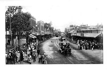 Du Toit's Pan Road Kimberley, 1899
On 2 September 1882, Kimberley became the first town in the southern hemisphere to install electric street lighting.[21]
The rising importance of Kimberley led to one of the earliest South African and International Exhibitions to be staged in Kimberley in 1892. It was opened by Sir Henry Loch, the then Governor of the Cape of Good Hope on the 8th of September. It presented exhibits of art, an exhibition of paintings from the royal collection of Queen Victoria and mining machinery and implements amongst other items. The exhibition aroused considerable interest at international level, which resulted in a competition for display space.
South Africa's first school of mines was opened here in 1896 and later relocated to Johannesburg, becoming the core of the University of the Witwatersrand. In fact the first two years were attended at colleges elsewhere in Cape Town, Grahamstown or Stellenbosch, the third year in Kimberley and the fourth year in Johannesburg. Buildings were constructed against a total cost of 9,000 pounds with De Beers contributing on a pound for pound basis.
Transport
Aviation, Kimberley Airport and air transport
South African aviation originated in Kimberley, which is commemorated in the Pioneers of Aviation Museum (and replica of the first Compton Patterson Biplane preserved there). In the 1930s Kimberley boasted the best night-landing facilities on the continent of Africa. A major air rally was hosted there in 1934. In the war years Kimberley Airport was commandeered by the Union Defence Force and run by the 21 Flying School for the training of fighter pilots.[14]
Today Kimberley Airport (IATA: KIM, ICAO: FAKM) services the area, with regular scheduled flights from Cape Town and Johannesbusg.
Railways
The building of the railway from the Cape to Kimberley was completed in 1885, accelerating the transport of both passengers and goods.[14] The railway connected Kimberley with cheaper sources of grain and other products, as well as supplies of coal, so that one of its local impacts was to undercut (mainly African) trade in fresh produce and firewood in Kimberley’s hinterland.[22] Another footnote to railway history is its role in the initial rapid spread of the Spanish Influenza epidemic in 1918.
The railway reticulation eventually would link Kimberley with Port Elizabeth, Johannesburg, Durban and Bloemfontein. The major junction at De Aar in the Karoo linked early twentieth century lines to Upington (later to Namibia) and to Calvinia. From the 1990s there was a decline in the use of the railways.
- Today passenger train services to and from Kimberley are provided by Spoornet's Shosholoza Meyl, with connections south to Cape Town and Port Elizabeth and north to Johannesburg.Luxury railway experiences are provided on the main north-south line by the Blue Train and Rovos Rail.
Roads
Wagon and coach routes were developed rapidly as the rush for the Diamond Fields gathered momentum. Two of the major routes were from the Cape and from Port Elizabeth, the nearest maritime port at the time. Contemporary accounts of the 1870s describe the appalling condition of some of the roads and decry the absence of bridges.[23] From the mid 1880s the route through Kimberley and Mafeking (now Mahikeng) became the main axis of British colonial penetration and it was from Kimberley, along that route, that the Pioneer Column for the settlement of Rhodesia set forth in 1890. Today, however, the central arterial route to the north, the N1 from the Cape to Johannesburg, goes via Bloemfontein, not Kimberley.
Kimberley today
Today, Kimberley is the seat of the Provincial Legislature for the Northern Cape and the Provincial Administration. It services the mining and agricultural sectors of the region. The city also projects itself as a significant tourist destination, the ‘City that Sparkles’, boasting a diversity of museums and visitor attractions. It is also a gateway to other Northern Cape destinations including the Mokala National Park, nature reserves and numerous game farms or hunting lodges, as well as historic sites of the region.
Climate and Geography
Climate
Climate data for Kimberley Month Jan Feb Mar Apr May Jun Jul Aug Sep Oct Nov Dec Year Record high °C (°F) 40
(104)40
(104)36
(97)35
(95)31
(88)27
(81)27
(81)31
(88)36
(97)38
(100)39
(102)40
(104)40
(104)Average high °C (°F) 33
(91)31
(88)29
(84)25
(77)21
(70)18
(64)19
(66)21
(70)26
(79)28
(82)30
(86)32
(90)26 Average low °C (°F) 18
(64)17
(63)15
(59)11
(52)7
(45)3
(37)3
(37)5
(41)9
(48)12
(54)15
(59)17
(63)11 Record low °C (°F) 7
(45)6
(43)2
(36)0
(32)−6
(21)−7
(19)−8
(18)−7
(19)−6
(21)−1
(30)3
(37)5
(41)−8
(18)Precipitation mm (inches) 57
(2.24)76
(2.99)65
(2.56)49
(1.93)16
(0.63)7
(0.28)7
(0.28)7
(0.28)12
(0.47)30
(1.18)42
(1.65)46
(1.81)414
(16.3)Avg. precipitation days 10 10 10 8 3 3 2 2 3 6 8 8 71 Source: South African Weather Service[24] Kimberley Climate chart (explanation) J F M A M J J A S O N D 5733187631176529154925111621771837193721512269302812423015463217Average max. and min. temperatures in °C Precipitation totals in mm Source: SAWS[24] Imperial conversion J F M A M J J A S O N D 2.29164388632.684591.977520.670450.364370.366370.370410.579481.282541.786591.89063Average max. and min. temperatures in °F Precipitation totals in inches Districts/Suburbs/Townships
- Beaconsfield
- Belgravia
- Carter's Glen
- Cassandra
- Colville
- Du Toit's Pan
- Ernestville
- Floors/Florianville
- Galeshewe incl "Old No 2"
- Gemdene
- Greenpoint
- Greenside
- Heuwelsig
- Homelight
- Homestead
- Homevale
- Kenilworth
- Klisserville
- Labrum
- Lindene
- Malay Camp, Kimberley
- Monument Heights
- Newton
- New Park
- Platfontein
- Riviera
- Roodepan/Pescodia
- Royldene
- South Ridge
- Squarehill Park
- Vergenoeg
- Verwoerd Park
- West End
Government, local and provincial
The administration of the Crown Colony of Griqualand West (from 1873) was conducted from Government Buildings in Kimberley up until the annexation of the Colony to the Cape in 1880. At the level of local government, separate Borough Councils operated in Kimberley and Beaconsfield up to the time of their amalgamation as the City of Kimberley in 1912. Thereafter a single City Council regulated the affairs of the city, while a Divisional Council administered the surrounding rural district. In the 1980s, in the last days of apartheid, a separate political entity referred to as Galeshewe (with Mankurwane) was brought into existence with its own council.
Post-1994 the Kimberley City Council became the Sol Plaatje Local Municipality while the successor to what had become the Diamandveld Regional Services Council was the Frances Baard District Municipality.
The idea of establishing the Northern Cape as a distinct geographic entity dates from the 1940s but it became a political and administrative fact only in 1994, with Kimberley formally becoming the new province’s legislative capital. The provincial legislature initially occupied the old Cape Provincial Administration building at the Civic Centre before moving into a purpose-built Legislature deliberately situated between one of the townships and erstwhile white suburbs.
Society and culture
Education
Secondary education
- Kimberley Boys' High School
- Kimberley Girls' High School
- St Patrick's College, Kimberley, formerly CBC Kimberley
- St Boniface College, Galeshewe
- Diamantveld
- Adamantia
- Northern Cape High School
- Technical High School Kimberley (HTS Kimberley)
- St Cyprian's Grammar School
- William Pescod High School
Religion
Kimberley, from its earliest days, attracted people of diverse faiths which are still reflected by practising faith communities in the city. Pre-eminently these are various denominations of Christianity, Islam, Judaism, Hinduism, as well as other faiths. Traditional African beliefs continue as an element in the Zionist Christian Church (ZCC). Kimberley is the seat of the Anglican Diocese of Kimberley and Kuruman and also of the Roman Catholic Diocese of Kimberley – previously the Apostolic Vicariate of Kimberley in Orange. Other denominations having churches in the city are the Methodist Church, the Presbyterian Church, the Congregational Church, the Dutch Reformed Church (Afrikaans: Nederduitse Gereformeerde Kerk), the Baptist Church, the Afrikaans Baptist Church (Afrikaans: Afrikaanse Baptiste Kerk), the Apostolics, Pentecostalists. The Seventh-day Adventist Church in South Africa was first established in Kimberley.
Museums, momuments and memorials
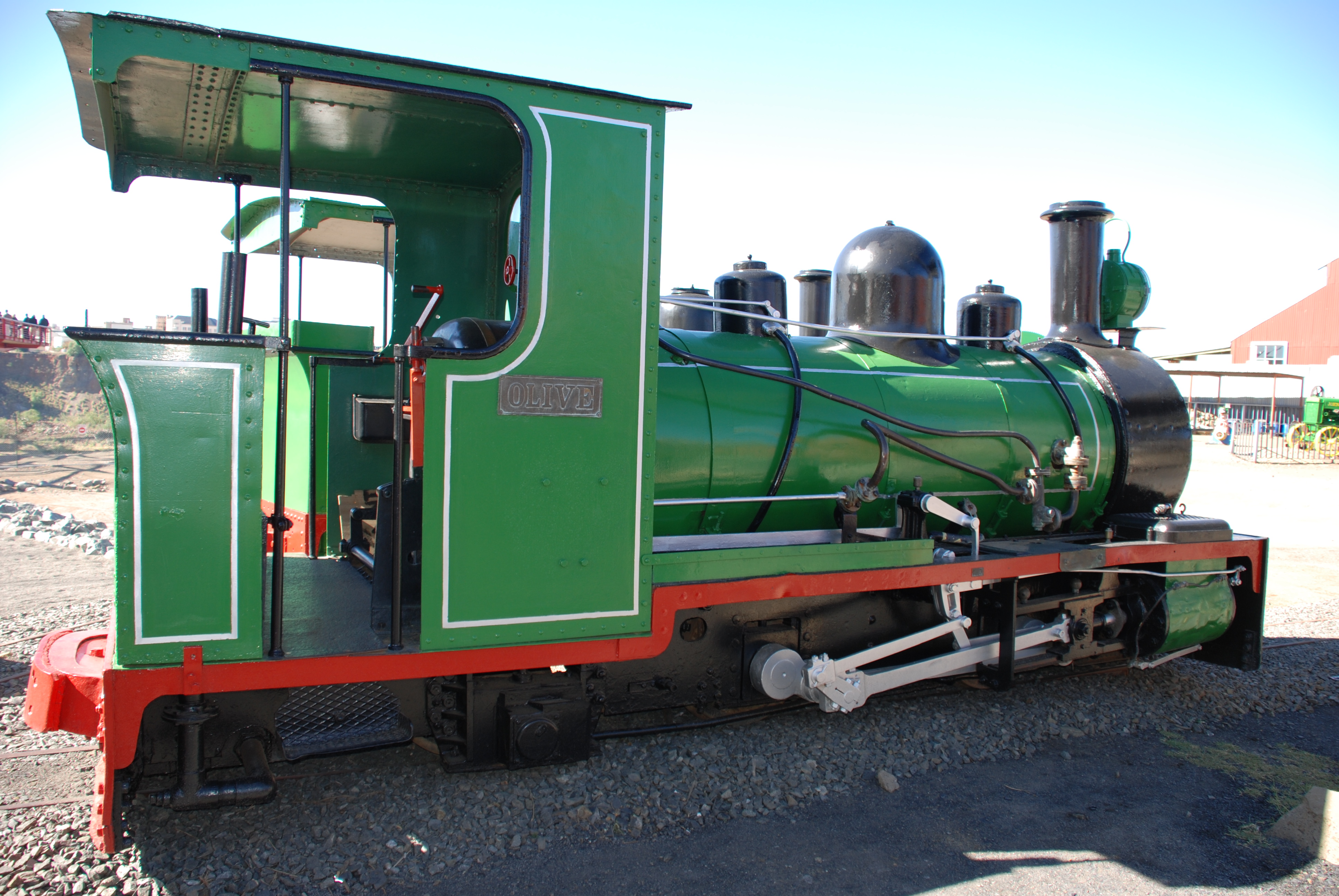
 Restored locomotive at the Kimberley Mine Museum
- The Big Hole, previously known as the Kimberley Mine Museum, is a recreated townscape and museum, with Big Hole viewing platform and other features, situated next to the Kimberley Mine ("Big Hole"). It houses a rich collection of artefacts and information from the early days of the city. One of the exhibits is Cecil John Rhodes's grand railway carriage that carried him as governor of the Cape of Good Hope to the Rhodesia that he created. Also at the mine museum is the first house built in the developing Kimberley, as well as the first church. Barney Barnato, Cecil John Rhodes's partner in the developing De Beers, had a boxing academy. This academy sits alongside the Rhodes rail carriage. On its walls is the framed original cheque signed by Cecil John Rhodes and Barney Barnato for £4.5 million pounds to establish the De Beers Consolidated mines.
- The McGregor Museum, which celebrated its centennial in 2007, curates and studies major research collections and information about the history and ecology of the Northern Cape, which are reflected in displays at the museum's headquarters at the Sanatorium in Belgravia and nine branch museums.
- The William Humphreys Art Gallery.[25]
- The Kimberley Africana Library.
- Dunluce and Rudd House Museums.
- Pioneers of Aviation Museum: In 1913, South Africa's first flying school opened at Kimberley and started training the pilots of the South African Aviation Corps, later to become the South African Air Force.[26] The museum is located on the site of that flying school and houses a replica of a Compton Paterson biplane, one of the first aircraft to be used for flight training. The first female on the African continent to receive her pilot's license, Ann Maria Bocciarelli, was trained at this facility.[27]
- Robert Sobukwe's Law Office
- The Sol Plaatje Museum is located in the house where Sol Plaatje lived and wrote Mhudi.
Transport Spoornet Museum
- Clyde N. Terry Hall of Militaria
- Freddie Tate Museum
- On the outskirts of Kimberley, on the Barkly West Road, the Wildebeest Kuil Rock Art Centre, as well as Nooitgedacht Glacial Pavements. To the south of the city, the Magersfontein Battlefield Museum, while blockhouses can be seen at Modder River.
Memorials include:
- The Miners' Memorial, also known as the Diggers' Fountain, located in the Oppenheimer Gardens and designed by Herman Wald. It was built in honour of all the miners of Kimberley. The memorial consists of five life-sized diggers lifting a diamond sieve.
- The Honoured Dead Memorial commemorates those who died defending the city during the Siege of Kimberley in the Anglo-Boer War.
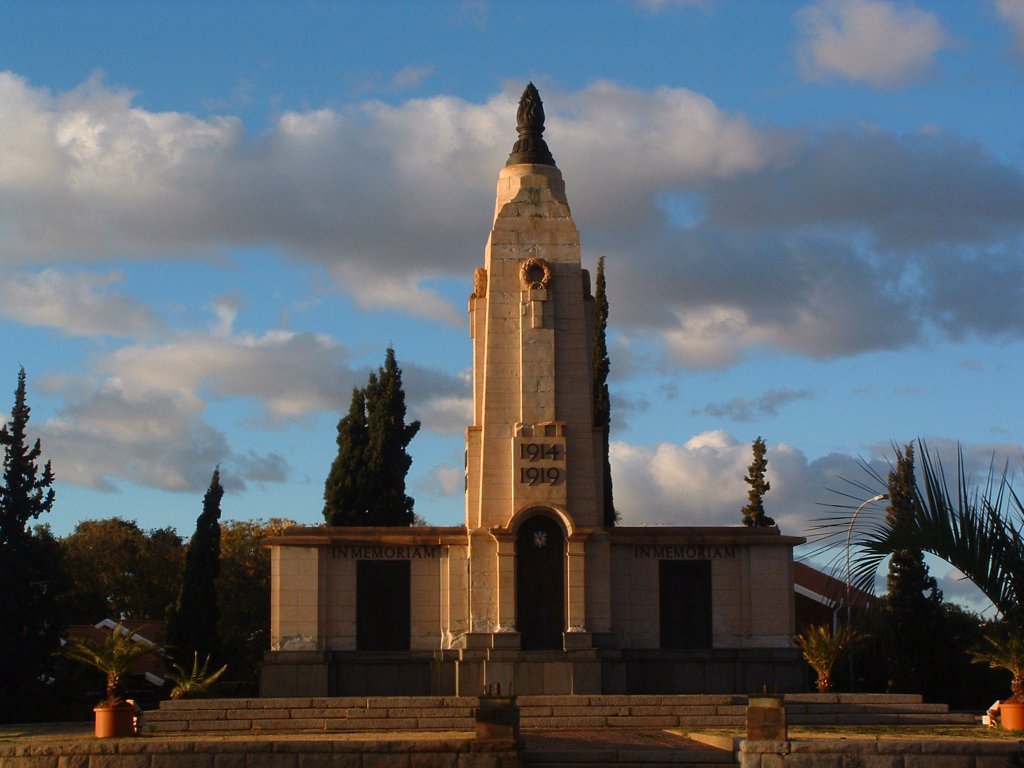
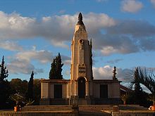 World War I memorial in Kimberley
- The Cenotaph erected originally to commemorate the fallen of World War I, with plaques added in memory of fallen Kimberley volunteers in World War II. There is a memorial dedicated to the Kimberley Cape Coloured Corps who died in the Battle of Square Hill during World War I. Consisting of a gun captured at the battle, it origially stood in Victoria Crescent, Malay Camp, but, post-1994, was moved to the Cenotaph.
- The Concentration Camp Memorial remembers those who were interned in the Kimberley concentration camp during the Second Boer War, and is located in front of the Dutch Reformed Mother Church.
- The Henrietta Stockdale statue, by Jack Penn, commemorates the Anglican nun, Sister Henrietta CSM&AA (her reinterred remains are buried alongside), who petitioned the Cape Parliament to pass a law recognizing nursing as a profession and requiring compulsory state registration of nurses - a first in the world.
- The statue of Frances Baard was unveiled by Premier Hazel Jenkins on Women's Day, 9 August 2009.
- The Sol Plaatje Statue was unveiled by South African President Jacob Zuma on 9 January 2010, the 98th anniversary of the founding of the African National Congress. Sculpted by Johan Moolman, it is at the Civic Centre, formerly the Malay Camp, and situated approximately where Plaatje had his printing press in 1910-13.[28]
- Burger Monument near Magersfontein Battlefield
- Mayibuye Memorial
- Rhodes equestrian statue
- Malay Camp Memorial
Architecture
- Alexander McGregor Memorial Museum (1907)
- De Beers Head Office
- Dunluce - Late Victorian
- Harry Oppenheimer House - Modern
- Honoured Dead Memorial
- Kimberley Africana Library
- Kimberley Club
- Kimberley City Hall - Neo-classical
- Kimberley Regiment Drill Hall (1892)
- Kimberley Sanatorium (McGregor Museum) (1897)
- Kimberley Undenominational Schools
- Masonic Temple
- Northern Cape Provincial Legislature
- Rudd House (The Bungalow)
- The Lodge (Duggan Cronin Gallery)
Notable religious buildings
- Kimberley Seventh-day Adventist Church is a small L shaped corrugated-iron building and is considered the mother church of Seventh-day Adventists in South Africa. It was declared a National Monument in 1967, now a Provincial Heritage Site.[29]
- Dutch Reformed Mother Church Newton is a good example of Stucco architecture in Kimberley. It was declared a National Monument in 1976, now a Provincial Heritage Site.[30]
- St Cyprian's Anglican Cathedral was designed by Arthur Lindley of the firm of Greatbatch, the building of the nave being completed in 1908. The remainder of the cathedral was completed in stages, partly under guidance of William M. Timlin (also of the firm of Greatbatch). In 1926 the Chancel was dedicated (and as a World War I memorial); in 1936 the Lady Chapel, Vestry & new organ were added; and in 1961, the tower (a World War II memorial). The cathedral contains notable stained glass windows including works by the Pretoria artist Leo Theron.
- St Mary's Roman Catholic Cathedral.
- Synagogue in the Byzantine style designed by D.W. Greatbatch.
- Kimberley's older Mosques were replaced by newer ones as a result of the Group Areas Act and the forced resettlement of the city's Muslim communities.
Media
The city is served by both print media and community radio stations.
Newspapers
The earliest newspaper here was the Diamond Field, published initially at Pniel on 15 October 1870. Other early papers with the Diamond News and the Independent. The Diamond Fields Advertiser is Kimberley's current daily newspaper, published since 23 March 1878.[31] The Volksblad, with a free local supplement called Noordkaap, is read by Afrikaans-speaking readers.
Radio
Two community radio stations were founded in the 1990s:
- Radio Teemaneng
- XKfm which is based in the !Xun and Khwe settlement of Platfontein outside Kimberley and broadcasts in the two KhoeSan languages spoken at Platfontein (!Xun and Khwedam)
Sport
Cricket
Kimberley has contributed to much of cricket's history having supplied several international players. There was Nipper Nickelson, Xenophon Balascas born in Kimberley to Greek parents and Ken Viljoen, Ronnie Draper and in more recent times Pat Symcox and the Proteas coach Micky Arthur.
Kimberley hosted a match from the 2003 ICC Cricket World Cup.
Rugby
Frank Dobbin known as Uncle Dobbin was a member of Paul Roos' original Springboks in the tour to the British Isles in 1906/1907. His memory lives in his old colonial-style home in Roper street, bearing a simple brass plaque with the name 'Dobbin'. Later Springboks to wear green and gold included Ian Kirkpatrick, Tommy Bedford and Gawie Visagie, brother of Ammosal-based Springbok flyhalf Piet Visagie. Kimberley is home to the Wildeklawer Griquas rugby team.
Swimming
In 1965, Karen Muir, born in Kimberley, became the youngest person to break a world record in any sport. This age group record stands to this day.[32] She set it in August 1965 at the junior world champions in Blackpool, England in the 110 metres (360 ft) backstroke at the age of 12. She went on to break many more world records but was denied a role in world swimming when she lost the opportunity to represent her country at the 1968 Olympic games in Mexico City as a result of South Africa being excluded due to its racial apartheid policies. Kimberley also saw a world record broken in the municipal pool which now bears Karen Muir's name. It was Johannesburg's Anne Fairlie who beat Karen Muir and Frances Kikki Caron in world record breaking time.
Other
Bevil Rudd, Olympic medallist.
Brian Davis, son of civic leader Edgar Davis, was part of the 4x400 metres relay which won a gold medal at the Rome Olympics.
Ester Nell and Joan Carter won gold medals at the Olympics and Empire Games in the high jump.
Cycling had Joe Billet and Steve Viljoen, while Harold Clarke ran the mile at the Empire Games at Helsinki. Elsie McDonald was a Springbok bowler.
Richard Henyekane, South African footballer
Stadiums
- ABSA Park
- De Beers Diamond Oval
- Galeshewe Stadium
Other
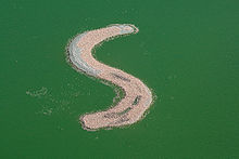
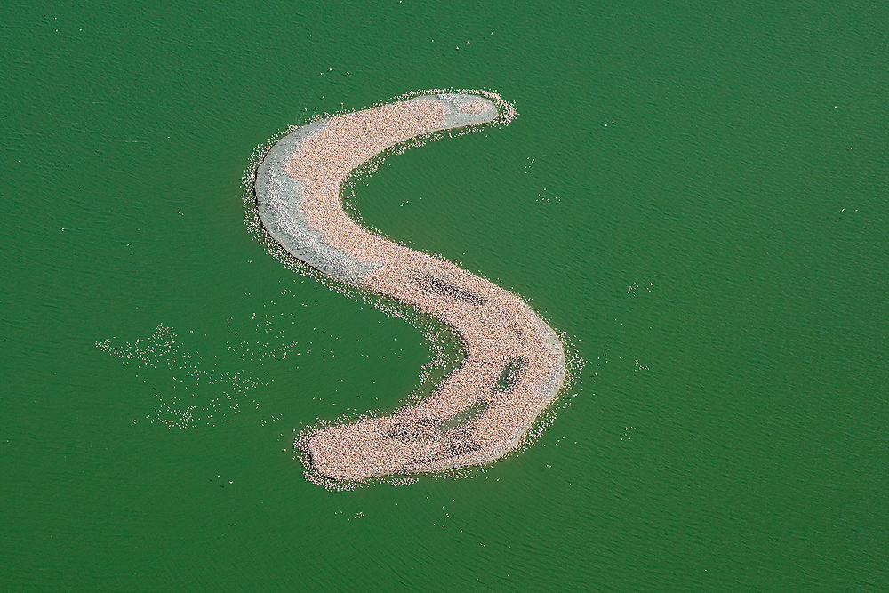
Kamfers Dam to the north of the town is an important wetland containing a breeding colony of Lesser Flamingos. Conservation initiatives in the area aim to bring people from the city in touch with its wildlife.
See also
- Vicariate of Kimberley in Orange for the region's Catholic missionary history
- Kimberley Process
- Mokala National Park
- People of Kimberley
References
- ^ a b Martin Meredith (2007). Diamonds, Gold, and War: The British, the Boers, and the Making of South Africa. New York: Public affairs. pp. 16. ISBN 1586484737. http://books.google.com/?id=MXs_ruPf00IC.
- ^ Roberts, pp 45-49
- ^ Ralph, Julia (1900). Towards Pretoria; a record of the war between Briton and Boer, to the relief of Kimberley. Frederick A. Stokes company. http://www.archive.org/details/towardspretoriar00ralp.
- ^ a b Roberts, p 115
- ^ Roberts, p 116
- ^ Select Contitutional Documents Illustrating South African History 1795-1910. Routledge and Sons. 1918. p. 66. http://books.google.com/?id=TksVAAAAIAAJ&pg=PA66.
- ^ Hannatjie van der Merwe (2005-05-20). "Big Hole loses claim to fame". News24. http://www.news24.com/News24/South_Africa/News/0,6119,2-7-1442_1708011,00.html. Retrieved 2008-10-21.
- ^ Bid to plug Big Hole worldwide, News24
- ^ Martin Meredith, Diamonds, Gold, and War: The British, the Boers, and the Making of South Africa, (New York, Public Affairs, 2007):34
- ^ John Hays Hammond (1974). The Autobiography of John Hays Hammond. Ayer Publishing. pp. 205. ISBN 0405059132. http://books.google.com/?id=IdrVz9e9CzYC.
- ^ Meredith, 36.
- ^ Martin Meredith, Diamonds, Gold, and War, (New York, Public Affairs, 2007): 34
- ^ Sessional Papers By Great Britain Parliament. House of Commons. 1902. http://books.google.com/?id=7jBFAAAAMAAJ.
- ^ a b c Roberts, Brian. 1976. Kimberley, turbulent city. Cape Town: David Philip
- ^ Apartheid and the archbishop: the life and times of Geoffrey Clayton, Archbishop of Cape Town Paton, A: New York, Scribner 1974 ISBN 0-684-13713-5
- ^ Review of Paton's Apartheid and the Archbishop by Edgar Brookes
- ^ Mayibuye Uprising of 8 November 1952 by Johlene May
- ^ Indian Opinion 23 Jan 1953 – Apartheid policy responsible for riots
- ^ e.g. Shillington, K. 1985. The colonisation of the Southern Tswana. Johannesburg: Ravan Press
- ^ a b Brian Roberts (1976). Kimberley. D. Philip, Historical Society of Kimberley and the Northern Cape. ISBN 0949968625.
- ^ Michael Morris & John Linnegar (2004). Every Step of the Way. Human Sciences Research Council. ISBN 0796920613. http://books.google.com/?id=57gyw36xwk8C.
- ^ Worger, W.H. 1987. South Africa’s City of Diamonds. Mine Workers and Monopoly Capitalism in Kimberley, 1867–1895. London: Yale University Press
- ^ e.g. Holub, Emil (1881). Seven Years in South Africa: Travels, Researches and Hunting Adventures, Between the Diamond-Fields and the Zambesi (1872–79)
- ^ a b "Climate data for Kimberley". South African Weather Service. http://old.weathersa.co.za/Climat/Climstats/KimberleyStats.jsp. Retrieved 7 March 2010.
- ^ William Humphreys Art Gallery
- ^ Tidy, Major D.P.. They Mounted up as Eagles (A brief tribute to the South African Air Force). 5. The South African Military History Society. http://rapidttp.com/milhist/vol056dt.html.[dead link]
- ^ "The History of Aviation in South Africa". South African Power Flying Association. http://www.sapfa.org.za/history/history_2.php. Retrieved 2009-07-22.
- ^ Plaatje Statue unveiled, Diamond Fields Advertiser, 11 Jan 2010, p 6. (Reports in the Sunday Argus and Independent On Line [January 10, 2010 at 12:42PM] incorrectly state that the unveiling of this statue took place in Cape Town)
- ^ "First Seventh Day Adventist Church Blacking Street Kimberley". South African Heritage Resources Agency. http://196.35.231.29/sahra/HeritageSitesDetail.aspx?id=23927. Retrieved 2009-07-22.
- ^ "Dutch Reformed Mother Church Newton". South African Heritage Resources Agency. http://196.35.231.29/sahra/HeritageSitesDetail.aspx?id=23900. Retrieved 2009-07-22.
- ^ Brian Roberts. 1976. Kimberley, turbulent city, p 173
- ^ Swimming in South Africa. Last accessed 2008-04-12
External links
- Kimberley, turbulent city by Brian Roberts (1976, published by David Phillip & Historical Society of Kimberley and the Northern Cape)
- "Diamond Mines of South Africa" by Gardner Williams (General manager De Beers), Chapter 15 (25 page history + images).
Provincial capitals of South Africa Bhisho (Eastern Cape) · Bloemfontein (Free State) · Cape Town (Western Cape) · Johannesburg (Gauteng) · Kimberley (Northern Cape) · Mafikeng (North West) · Nelspruit (Mpumalanga) · Pietermaritzburg (KwaZulu-Natal) · Polokwane (Limpopo)
Province of Northern Cape, South Africa Provincial Capital: Kimberley District
and Local
MunicipalitiesJohn Taolo GaetseweCategories:- Kimberley, Northern Cape
- Boer Wars locations
- Populated places in the Northern Cape
- Provincial capitals in South Africa
- Orange River
- Vaal River
- 1871 in South Africa
- Populated places established in 1871
- Diatremes of South Africa
- Second Boer War concentration camps
- Karoo
- Mining communities in South Africa


Wikimedia Foundation. 2010.