- Big Hole
-
For other uses, see Big Hole (disambiguation).
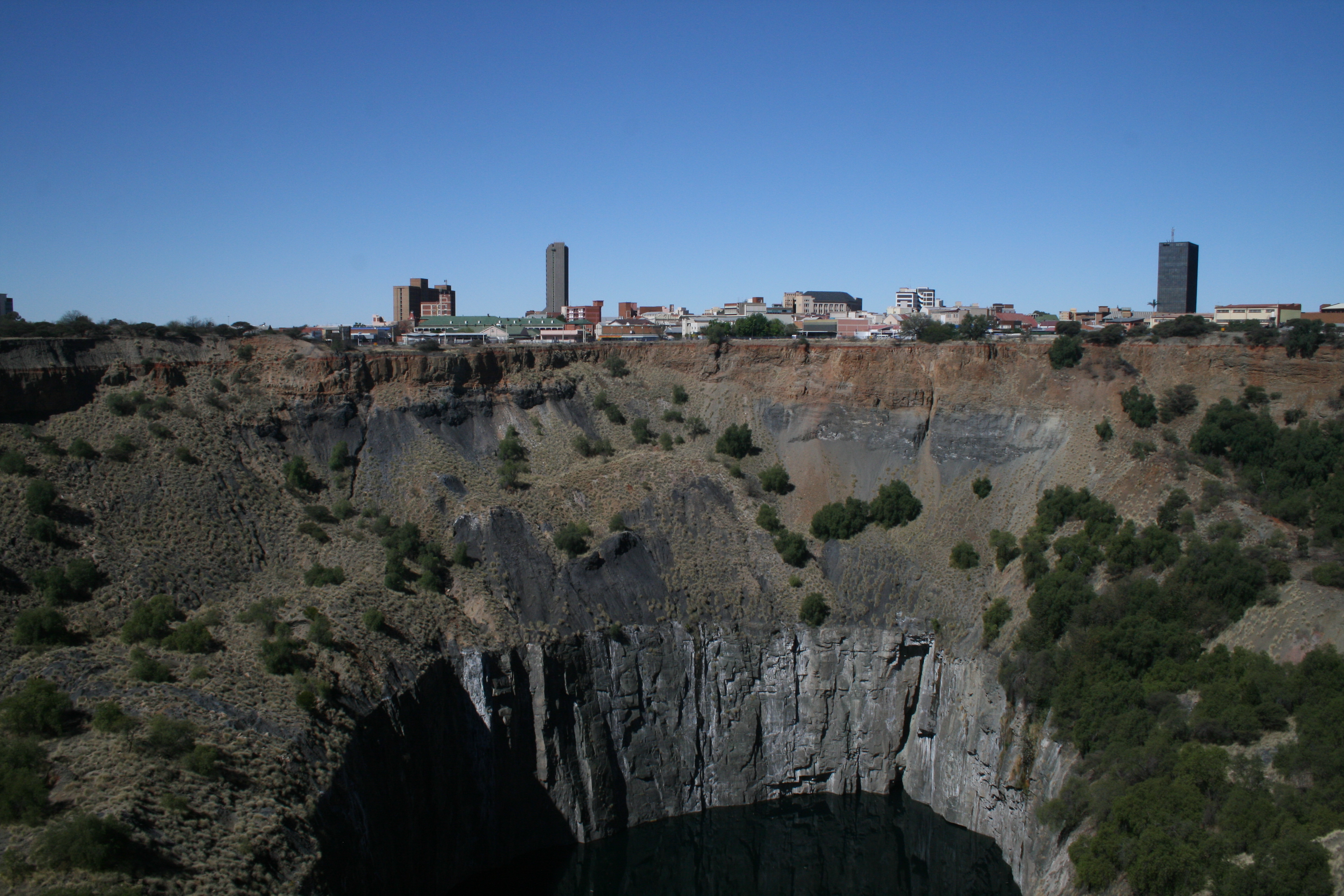
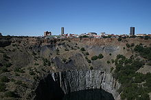 The city of Kimberley perched on the edge of the Big Hole
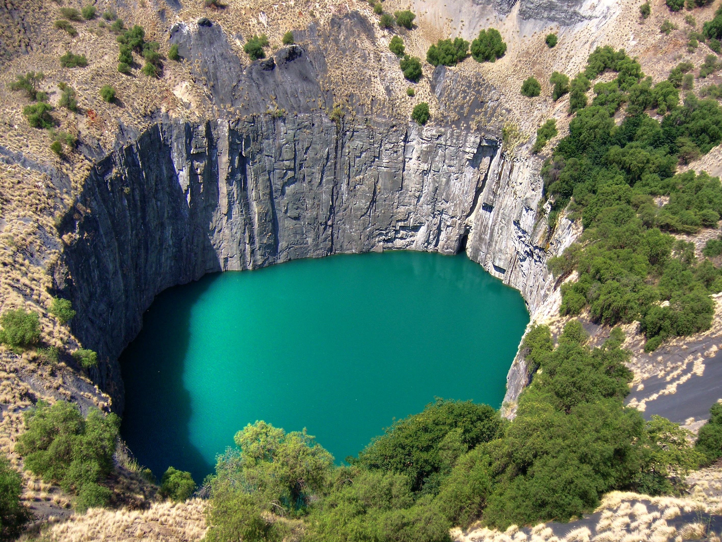
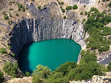 The Big Hole.
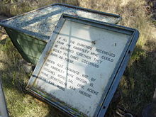 A sign next to the hole, reading "If all the diamonds recovered from the Kimberley Mine could be gathered together they would fill three cocopans such as these".
The Big Hole, Open Mine or Kimberley Mine (Afrikaans: Groot Gat) is an open-pit and underground mine in Kimberley, South Africa, and claimed to be the largest hole excavated by hand.
Contents
History
The first diamonds here were found on Colesberg Kopje by members of the "Red Cap Party" from Colesberg on the farm Vooruitzigt belonging to the De Beers brothers. The ensuing scramble for claims led to the place being called New Rush, later renamed Kimberley.[1] From mid-July 1871[1] to 1914 up to 50,000 miners dug the hole with picks and shovels[2] , yielding 2,720 kilograms (6,000 lb) of diamonds. The Big Hole has a surface of 17 hectares (42 acres) and is 463 metres (1,519 ft) wide. It was excavated to a depth of 240 metres (790 ft), but then partially infilled with debris reducing its depth to about 215 metres (705 ft). Since then it has accumulated about 40 metres (130 ft) of water, leaving 175 metres (574 ft) of the hole visible. Once above-ground operations became too dangerous and unproductive, the kimberlite pipe of the Kimberley Mine was also mined underground by Cecil Rhodes' De Beers company to a depth of 1,097 metres (3,599 ft).[3]
There is currently an effort in progress to register the Big Hole as a World Heritage Site.[4]
The Excavation
In 1872, one year after digging started, the population of the camp of diggers grew to around 50,000. As digging progressed, many men met their deaths in mining accidents. The unsanitary conditions, scarcity of water and fresh vegetables as well as the intense heat in the summer, also took their toll. On the 13 March 1888 the leaders of the various mines decided to amalgamate the separate diggings into one big mine and one big company known as De Beers Consolidated Mines Limited, with life governors such as Cecil John Rhodes, Alfred Beit and John Rhodes. This massive company further worked on the Big Hole until it came to the depth of 215 metres, with a surface area of about 17 hectares and perimeter of 1.6 kilometres. By 14 August 1914, when over 22 million tons of earth had been excavated, yielding 2,722 kilograms (14,504,566 carats) of diamonds, work on the mine eased after it was considered the largest hand-dug excavation on earth.
Controversy
Due to weathering, the hole has become partly filled with stones and rain, leaving the current remaining depth of 215 metres; as a result there is now some controversy as to whether it still qualifies as the largest hand excavated hole. In 2005, historian Steve Lunderstedt claimed that the largest hand excavated hole is in now at Jagersfontein Mine, another old South African diamond mine.
See also
- Kimberlite pipes
- Mir diamond pipe
- Udachnaya pipe
References
- ^ a b Roberts, Brian. 1976. Kimberley, turbulent city. Cape Town: David Philip & Kimberley Historical Society
- ^ Williams, Gardner F. (1904). The diamond mines of South Africa. New York: B. F. Buck & company. p. 199. http://www.archive.org/stream/diamondminesofso01willrich#page/n303/mode/2up.
- ^ Show mines of South Africa: Kimberley Mine - Big Hole
- ^ Bid to plug Big Hole worldwide, News24
External links
- Official site
- Big Hole Accommodation on sastay.co.za
- Re-envisioning the Kimberley Mine Museum:De Beers’ Big Hole Project
Coordinates: 28°44′19″S 24°45′31″E / 28.73861°S 24.75861°E
Categories:- Visitor attractions in South Africa
- Diamond mines in South Africa
- Kimberley, Northern Cape
- Surface mines in South Africa
- Diatremes of South Africa
- History of mining
- 1871 in South Africa
- Northern Cape geography stubs

Wikimedia Foundation. 2010.