- N1 road (South Africa)
-
National Route N1
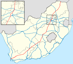
Route information Maintained by SANRAL, City of Cape Town Metropolitan Municipality, Western Cape Provincial Government[1] Length: 1,929 km (1,199 mi) Major junctions South end: Buitengracht Street in Cape Town  N2 in Cape Town
 N7 in Cape Town
 N12 near Beaufort West
N12 at Three Sisters
 N10 at Hanover
 N9 at Colesberg
 N6 near Bloemfontein
 N8 near Bloemfontein
 N5 at Winburg
N12 near Soweto
 N17 near Soweto
 N3 near Sandton
 N14 in Centurion
 N4 near Pretoria
 N11 near Mokopane
North end: A4 at the Zimbabwean border at Beit Bridge Location Major cities: Cape Town, Paarl, Worcester, Beaufort West, Colesberg, Bloemfontein, Kroonstad, Johannesburg, Pretoria, Mokopane, Polokwane Highway system National Roads of South Africa
←  R727
R727N2 →The N1 is a South African National Route[1], running from Cape Town to Beit Bridge on the border with Zimbabwe. It is also the main road link between Johannesburg and Cape Town, and forms the first section of the famed Cape to Cairo Road.
Prior to 1970, the N1 used to run from Beit Bridge to Colesburg, and then follow the alignment of the present N9 to George. Ironically, the section from Cape Town to Colesburg used to be the N9.
Contents
Route
Western Cape
 The N1 freeway as it enters Cape Town past Century City
The N1 begins in central Cape Town at the northern end of Buitengracht Street outside the entrance to the Victoria & Alfred Waterfront. The first section of the N1 is shared with the beginning of the N2; it is a four-lane elevated freeway that runs along a strip of land between the city centre and the Port of Cape Town. On the eastern edge of the city centre the two roads split, and the N1 turns east as Table Bay Boulevard, passing the Ysterplaat Air Force Base and Century City before the N7 intersects it on its own way out of the city towards Namibia. Major improvements have been made to the Koeberg Interchange of the N1 with the M5, one of the main aterial routes linking Milnerton with the Southern Suburbs.The N1 then heads through the suburbs of Goodwood and Bellville, where the R300 terminates at it, before heading towards Paarl. At Paarl, the freeway ends, and the N1 is tolled as it passes through the Huguenot Tunnel running underneath the Du Toitskloof Mountains; the tunnel was opened in the late 1980s to replace the old Du Toitskloof Pass running over the mountain. After emerging from the tunnel, the N1 winds through the Molenaar River Valley (which is a short dual carriageway section) before emerging from the valley and heading towards Worcester. From Worcester, the route heads through the Hex River Valley and then enters the Karoo by ascending the Hex River Pass.
Currently only the section of the N1 passing through the Huguenot Tunnel is tolled, although there are plans to toll the N1 from the junction with the R300, roughly to De Doorns. This would allow for upgrading of the N1, most especially the opening and construction of the Northern Bore of the Huguenot Tunnel so that two lanes of traffic could pass in each direction through the tunnel, and the building of grade separated junctions along the N1 through Worcester. Although the town is bypassed, there are a number of traffic lights on the N1 through Worcester.
From the top of the pass, the N1 passes Touws River and Matjiesfontein before passing through Laingsburg, then heads towards Beaufort West. The 200 km section between Laingsburg and Beaufort West is notorious for claiming many lives in fatigue-related accidents; also, the N1 begins to turn towards the north-east along this stretch of road. Just before Beaufort West, the N12 from George meets the N1; the N12 shares the N1 route through Beaufort West and for the next 80 km before leaving it at Three Sisters. The N12 later meets the N1 again in Johannesburg, making the N12 an alternative route to the N1, passing through Kimberly instead of Bloemfontein. Although parts of the N12 between Warrenton and Klerksdorp are in poor condition (although in process of being upgraded), the N1 from Bloemfontein onwards is tolled while the N12 is toll-free. Whereas the N12 also passes through most of the towns en route to Johannesburg, the N1 bypasses every town between Beaufort West and Johannesburg.
The N1 briefly crosses into the Northern Cape at Three Sisters for a few kilometres before crossing back into the Western Cape, and remains in the Western Cape until just after its intersection with the R63, where it finally leaves the Western Cape behind.
Northern Cape
The N1 has a short section in the Northern Cape; after it passes into this province, it passes through the town of Richmond before intersecting with the N10 at Hanover. The N1 then continues towards Colesberg, where the N9 terminates where it meets the N1. After Colesberg, the N1 crosses the Orange River and enters the Free State.
Free State
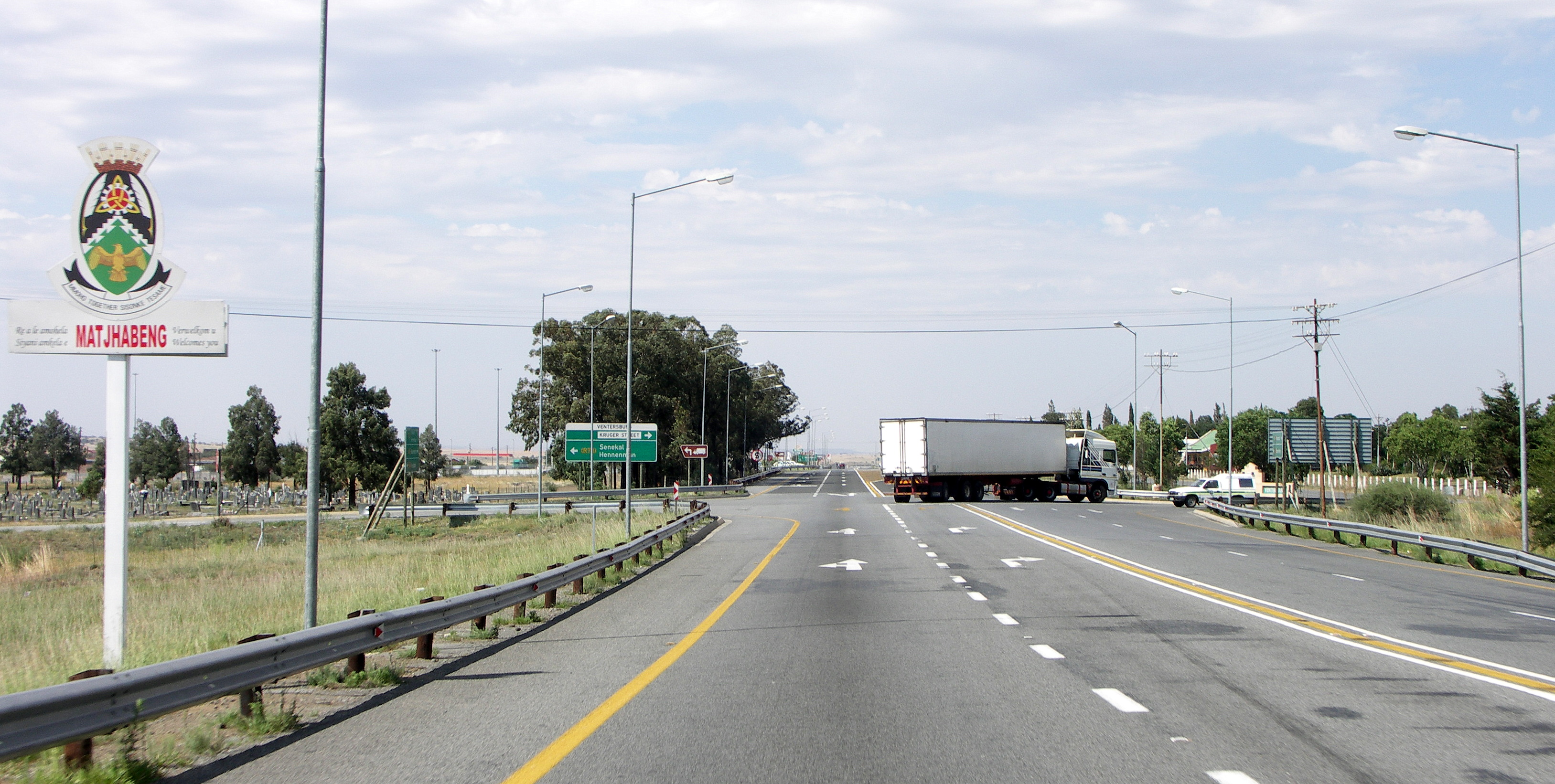
 The N1 southbound as it enters Ventersburg
After the Orange River crossing, the N1 makes a direct line for Bloemfontein, heading in a more northerly direction. The N1 from Colesburg to Bloemfontein is highly significant because it was the first single carriageway freeway built in South Africa. The bridges with the interchanges at Edenburg and Trompsburg show the ambitious plans for this road as a dual carriage freeway. Just before reaching Bloemfontein, the N6 from East London terminates where it meets the N1. This intersection marks the beginning of the Bloemfontein Western Bypass, which is the first freeway section on the route since Paarl. The N8 WEST from Kimberley intersects with the N1 bypass, joining it for 3km, before heading EAST through the central parts of Bloemfontein and then to Maseru in Lesotho,
The N1 is signed as a Toll Road from the N6 interchange until its end at Beit Bridge. The N1 becomes a single carriageway freeway a few kilometres north of Bloemfontein after passing the R30 to Brandfort, however construction work is in progress to extend the freeway for another 20km by building a second carriageway. Once the freeway ends, the road will be a single carriageway but with two lanes in each direction until 5km before the toll plaza at Verkeerdevlei, halfway between Bloemfontein and Winburg. Initial plans were for the N1 from Winburg to Bloemfontein to be a dual carriageway freeway. At Winburg, the N5 splits from the N1, which bypasses the north of Lesotho before its own termination at the N3 in Harrismith.
Many motorists from Cape Town heading for Durban travel the N1 to Winburg, and then then N5 to Harrismith as an alternative to reach Durban. This is due to the much better quality of this route compared with the N2, especially between Port Shepstone and Grahamstown.
The N1 continues north and passes through Ventersburg before reaching Kroonstad. Here the R34 joins the N1 from Welkom. There is a short dual carriageway freeway bypass of Kroonstad, before the N1 heads towards the Vaal River and Gauteng. Just before passing into Gauteng at the Vaal River, the N1 becomes a dual-carriageway freeway and features another toll plaza.
Gauteng
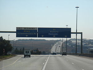
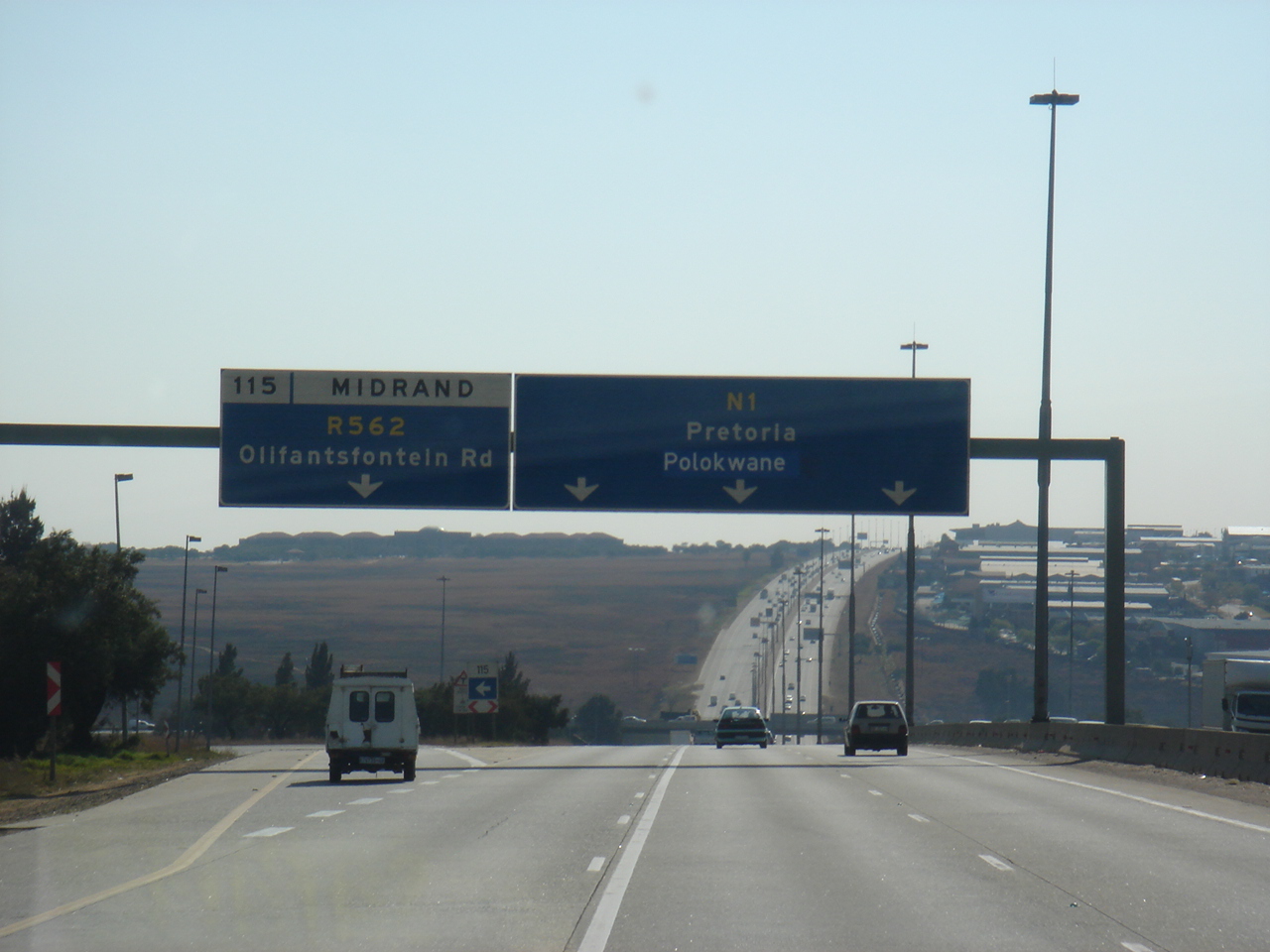
After crossing the Vaal River, the N1 continues towards Johannesburg, bypassing Vanderbijlpark and featuring another toll plaza at Grasmere. At the southern outskirts of Johannesburg, the N12 once again meets the N1, and shares its route for a few kilometers before splitting off to become the Southern Bypass portion of the Johannesburg Ring Road. From just north of the Vaal River the N1 changes from being a tar road to a concrete road, until just after the N12. The N1 then becomes the Western Bypass portion of the same ring road, and cuts a swath through Johannesburg's western suburbs before meeting the N3 (the Eastern Bypass portion of the Johannesburg Ring Road, later going to Durban) and Johannesburg's own M1 freeway (the Ben Schoeman Highway) at the Buccleuch Interchange.
The N1 then heads towards Pretoria along the Ben Schoeman Highway; this section carries 300,000 vehicles per day and is purported to be the busiest stretch of road in South Africa. At Centurion, the N1 meets the N14 and leaves the Ben Schoeman Highway (which then becomes part of the N14) to become the Pretoria Eastern Bypass, intersecting with the R21 during this time. The N4 then joins the N1 from Witbank and follows the N1 a short distance before splitting to the west towards Rustenburg. From the interchange with the N4, the N1 is tolled for the remainder of its length, with various toll plazas located along it. The N1 then heads to the north and passes into Limpopo province.
Limpopo
The N1 then passes near Bela Bela (previously Warmbaths) and Modimolle (previously Nylstroom). At the Modimolle exit, the freeway ends; the section of freeway between the Vaal River and Modimolle is the longest freeway in South Africa by route number at approximately 265 km (although there are two changes in the alignment of freeway in Gauteng, at Buccleuch and Brakfontein Interchanges. South Africa's longest continuous freeway is the N3 between Durban and Ladysmith, which is approximately 20 km shorter. The N1 then heads past Mokopane (previously Potgietersrus), where the N11 intersects it (leaving the N18 as the only national road that does not intersect with the N1), before heading to Polokwane (previously Pietersburg). The Eastern Bypass around Polokwane has recently been opened, although it is not grade separated.
After Polokwane, the N1 heads north, crossing the Tropic of Capricorn before passing Louis Trichardt. The N1 then winds through the Soutpansberg Mountains (containing two short tunnels) before heading to Musina. Plans are underway for a bypass around Musina. The route then makes a 16 km line for the Beit Bridge border crossing with Zimbabwe on the Limpopo River.
After crossing into Zimbabwe, the route is no longer known as the N1. It passes through the border town of Beit Bridge on the Zimbabwean side before splitting into two routes: the A6 to Bulawayo and the A4 to Harare.
List of CoordinatesOld Route
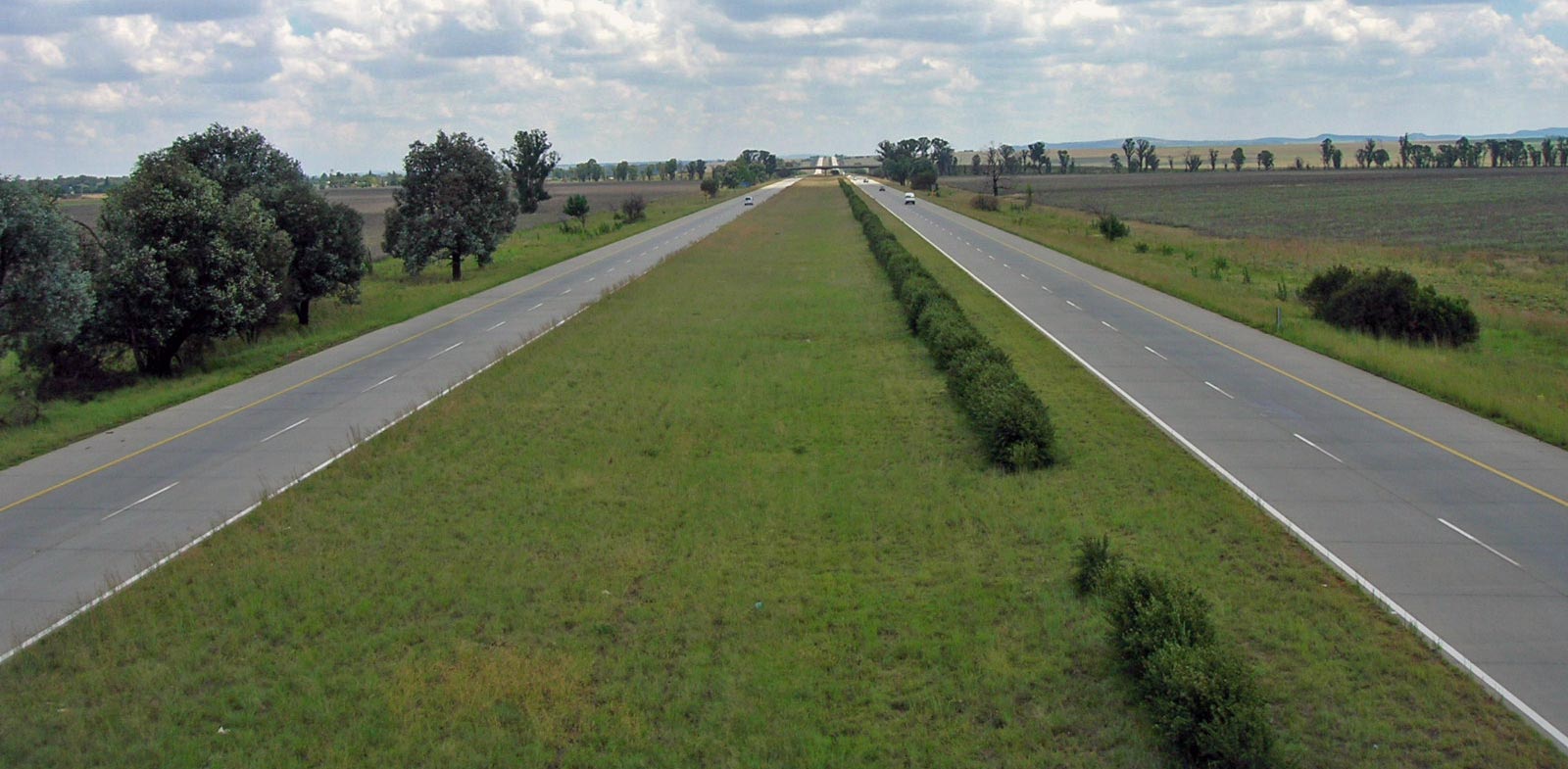
 A section of dual-carriageway freeway on the N1 near Vanderbijlpark in Gauteng Province
In numerous places in South Africa, specifically near major cities, the N1 route was built to freeway standards. The original routes usually carry the designation of R101 and are often alternative routes to the newer, sometimes tolled, highways. An example is the R101 over Du Toitskloof Pass where the new N1 highway bypasses the pass altogether by use of the Huguenot Tunnel.
There are exceptions to the usual R101 alternative route designation:
- The old N1 route from Colesburg to Bloemfontein is designated R717 until Redderburg when it is designated N6
- The old N1 route through Bloemfontein is designated as the M30.
- Between Kroonstad and Parys, the old route is designated firstly as the R721 from Kroonstad to Vredefort and then as the R59 through Parys to the interchange with the N1 at the Vaal Toll Plaza, approximately 10 km south of the Vaal River.
- Between the Vaal River and Johannesburg, several alternative routes exist, the official alternative route being via the Golden Highway (R553). The old N1 route however followed the designation of the R42 to Vereeniging, and then the R82 leading to Johannesburg's M1 freeway. The M1 provides the alternative route through Johannesburg; near the Buccleuch Interchange (the point where the N1, M1 and N3 converge), the R101 then resumes, providing the alternative route through to Polokwane.
Tolls
The list below only includes mainline toll plazas; ramp toll plazas have not been included.
Name Location Toll fees (as of 1 March 2010)[2] Light vehicle Heavy vehicle (2 axles) Heavy vehicle (3/4 axles) Heavy vehicle (5+ axles) Huguenot Toll Plaza Paarl
33°44′34″S 19°01′11″E / 33.74278°S 19.01972°ER25.00 R66.00 R104.00 R168.00 Verkeerdevlei Toll Plaza near Verkeerdevlei
28°47′56″S 26°41′26″E / 28.79889°S 26.69056°ER36.00 R71.00 R107.00 R150.00 Vaal Toll Plaza near Parys
26°51′23″S 27°38′07″E / 26.85639°S 27.63528°ER41.00 R78.00 R94.00 R125.00 Grasmere Toll Plaza Lenasia
26°24′41″S 27°53′03″E / 26.41139°S 27.88417°ER13.00 R35.00 R41.00 R54.00 Pumulani Toll Plaza N4 exit to Rustenburg
25°38′22″S 28°16′32″E / 25.63944°S 28.27556°ER7.50 R19.00 R22.00 R26.00 Carousel Toll Plaza between Pretoria and Bela Bela
25°19′22″S 28°17′52″E / 25.32278°S 28.29778°ER35.00 R93.00 R103.00 R119.00 Kranskop Toll Plaza between Bela Bela and Modimolle
24°46′54″S 28°28′17″E / 24.78167°S 28.47139°ER28.00 R71.00 R91.00 R117.00 Nyl Toll Plaza between Modimolle and Polokwane
24°17′23″S 28°58′44″E / 24.28972°S 28.97889°ER36.00 R67.00 R82.00 R109.00 Capricorn Toll Plaza 23°22'0.56"S between Polokwane and Louis Trichardt
23°22′01″S 29°46′30″E / 23.36694°S 29.775°ER29.00 R77.00 R93.00 R116.00 Baobab Toll Plaza between Louis Trichardt and Musina
22°38′49″S 29°55′07″E / 22.64694°S 29.91861°ER28.00 R74.00 R105.00 R126.00 References
- ^ routes.co.za - N-routes
- ^ "Toll roads tariff adjustments with effect 1 March 2010". South African National Roads Agency. http://www.nra.co.za/content/Toll_Tarif_Leaflt_2010.pdf. Retrieved 2010-07-15.
External links
National (N) Routes in South Africa 

Highways in the Western Cape 
National roads Major regional roads R27 · R43 · R44 · R45 · R46 · R60 · R61 · R62 · R63Minor regional roads R101 · R102 · R300 · R301 · R302 · R303 · R304 · R305 · R307 · R310 · R311 · R312 · R315 · R316 · R317 · R318 · R319 · R320 · R321 · R322 · R323 · R324 · R326 · R327 · R328 · R339 · R340 · R341 · R353 · R354 · R355 · R356 · R358 · R362 · R363 · R364 · R365 · R366 · R381 · R399 · R404 · R406 · R407Major freeways in Johannesburg N1 (Western Bypass) · N3 (Eastern Bypass) · N12 (Southern Bypass) · N17 · R21 · R24 · R59 · M1 · M2
Freeways in Cape Town 
Existing Proposed Categories:- N1 road (South Africa)
- National Roads in South Africa
- Roads in Cape Town
- Streets and roads of Johannesburg


Wikimedia Foundation. 2010.