- Mokopane
-
Mokopane
Potgietersrus— Town — Location of the town in Limpopo province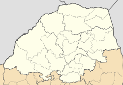
 Mokopane
Coordinates: 24°11′2″S 29°0′46″E / 24.18389°S 29.01278°E Country  South Africa
Province Limpopo District Waterberg Municipality Mogalakwena Elevation 1,130 m (3,707 ft) Time zone SAST (UTC+2) Area code(s) +27 (0)15 Mokopane or Potgietersrus[1] (officially renamed from Potgietersrus to Mokopane in 2003), is a town in the Limpopo province of South Africa. The town was established by the Voortrekkers and named Potgietersrus after the Voortrekker leader Piet Potgieter. The name was changed to Mokopane, after the chief that murdered Potgieter, in 2003. It is home to the Northern Ndebele speaking tribes, English, Afrikaans, Northern Sotho, and XiTsonga speakers. Five kingdoms in the vicinity of the town are Kekana (Moshate), Langa (Mapela), Gegana (Mshade), Lebelo (Garasvlei) and Langa (Bakenburg). The town was supposed to be called Mngombane as the original name of the King was Mngombane but not Mokopane. There is an interest from the Northern Ndebele (SeNdrebele in the language itself) locals to revive their language, many want to read and write their language. The SeNdrebele language is spoken by over half of the community members in Moshate and Mosesetjane Village
Two hours from Gauteng, the town acts as a getaway destination and as a stop-over for travelers en route to Botswana, Zimbabwe and Kruger National Park. The area is typical bushveld with many acacia trees and aloes, which are at their best in June and July.
The Mokopane area is one of South Africa's richest agricultural areas producing wheat, tobacco, cotton, beef, maize, peanuts and citrus. The Zebediela Citrus Estate, 55 km to the southeast, is one of the largest citrus farms in the southern hemisphere. The area is rich in minerals with the mining of platinum, diamonds and granite as chief mineral resources.
Prehistory and history
The historic and archaeologically significant Makapansgat Caves are situated 15 km north of the town. Recovery of Homo habilis habitation has been made at these caves.[2] Remains of Australopithecus africanus have also been found at the caves.[3]
The Arend Dieperink Museum portrays the history of the town, from the ape-man at Makapansgat, bushman drawings and early activities in the area up to the Anglo Boer War and recent times.
Culture
The stunning bushveld environment and influences from Ndebele, Northern Sotho, Tsonga, SeSotho, Afrikaans and English cultures give Mokopane a unique character. There are also ancient caves, the "Big Five", San rock paintings, curios, bushveld food and drinks such as biltong (dried meat) and mampoer (a potent drink), tropical gardens and traditional dancing.
In the adjacent township of Mahwelereng traditional lifestyles, set against the spectacular Waterberg, can be observed. Mokopane also offers a selection of outdoor activities ranging from hiking, camping and 4x4 trails to birding, angling and game viewing.
See also
Notes
- ^ http://www.googlebattle.com/?domain=Potgietersrus&domain2=Mokopane&submit=Go%21
- ^ Nick Norman and Gavin Whitfield, 2006
- ^ C. Michael Hogan, Mark L. Cooke and Helen Murray, 2006
References
- C. Michael Hogan, Mark L. Cooke and Helen Murray, The Waterberg Biosphere, Lumina Technologies, May 22, 2006. [1]
- Nick Norman and Gavin Whitfield, De Beers Consolidated Mines (2006) Geological Journeys: A Traveller's Guide to South Africa's Rocks and Landforms. Published by Struik, 320 pp. ISBN 1770070621, 9781770070622
Categories:- Populated places in Limpopo

Wikimedia Foundation. 2010.