- Geography of Nauru
Infobox Islands
name = Nauru
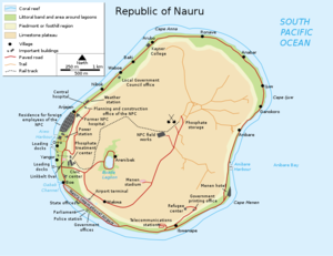
image caption = map of the island of Nauru
image size =
locator
map_custom = no
native name =
native name link =
nickname =
location =Pacific Ocean
coordinates = coord|0|32|S|166|55|E|display=inline
archipelago =
total islands =
major islands =
area = convert|21|km2|sqmi
length =
width =
highest mount = unnamed
elevation = convert|61|m|ft
country = Nauru
country admin divisions title =
country admin divisions =
country admin divisions title 1 =
country admin divisions 1 =
country admin divisions title 2 =
country admin divisions 2 =
country largest city = Yaren
country largest city population = 1,100
population = 9,275
population as of = 2007
density = 441.67
ethnic groups =
additional info =Nauru is a tiny phosphate rock island located in the SouthPacific Ocean south of theMarshall Islands inOceania . It is only 53 km south of theEquator at coordinates coord|0|32|S|166|55|E|. Nauru is one of the three great phosphate rock islands in the Pacific Ocean — the others are Banaba (Ocean Island) inKiribati andMakatea inFrench Polynesia .Its land area is 21 km² and it has a 30 km coastline. Maritime claims are a 200 nautical mile (370 km) exclusive fishing zone, and a 12 nautical mile (22 km) territorial sea.
The
climate istropical with amonsoon ial rainy season from November to February.A sandy beach rises to the fertile ring around raised
coral reef s. The raised phosphate plateau ('Topside') takes up the central portion of the island. The highest point is 200 ft (61 m) above sea level along the plateau rim.Nauru's only natural resources are
phosphate s, formed fromguano deposits by seabirds over many thousands of years.Due to being surrounded by
coral s and sandy beaches, the island houses no naturalharbour s, nor anyriver s or substantiallake s.Geology of Nauru
Nauru is positioned in the Nauru Basin of the Pacific Ocean, on a part of the
Pacific Plate that formed at amid oceanic ridge at 132 Ma.From midEocene (35mya) toOligocene times a submarinevolcano built up over ahotspot , and formed aseamount composed ofbasalt . The seamount is over 4300 meters high. This hotspot was simultaneous with a major Pacific Plate reorganisation. The volcano was eroded to sealevel and acoral atoll grew on top to a thickness of about 500 meters. Coral near the surface has been dated from 5 Mya to 0.3 Mya. The original limestone has been dolomitised bymagnesium fromsea water . The coral was raised above sea level about 30 meters, and is now a dolomite limestone outcrop which was eroded in classickarst style intopinnacle s up to 20 meters high. To at least a depth of 55 meters below sea level, the limestone has been dissolved forming cavities, sinkholes and caves. Holes on the topside of the island were filled up by aphosphate layer up to several meters thick.Anibare Bay was formed by the underwater collapse of the east side of the volcano.Buada Lagoon was formed by solution of the limestone when the sea level was lower, followed by collapse.Nauru is moving at 104 mm per year to the north west along with the Pacific Plate.
Freshwater can be found in Buada lagoon, and also in some brackish ponds at the escarpment base in Ijuw and Anabar in the northeast. There is an underground lake in Moqua Cave in the southeast of the island.
Environmental issues
*Periodic
drought s, limited natural fresh water resources (roof storage tanks collect rainwater, but mostly dependent on a single, agingdesalination plant)
*Extreme soil conditions are caused by high alkalinity, high phosphate levels and lowpotassium .Iron ,manganese ,copper ,molybdenum andzinc are rendered unavailable to plants. Combined with thin or damaged soils this causes low fertility.
*Intensive phosphatemining during the past 90 years has left the central 90% of Nauru a wasteland and threatens limited remaining land resources.Nauru is party to the international environmental agreements on biodiversity, climate change, desertification, law of the sea and marine dumping.
Notes
ee also
*
List of cities in Nauru

Wikimedia Foundation. 2010.