- Geography of Europe
-
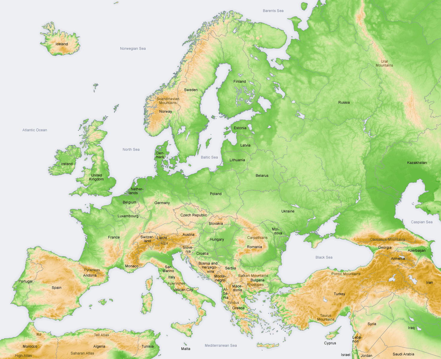
 The continent of Europe
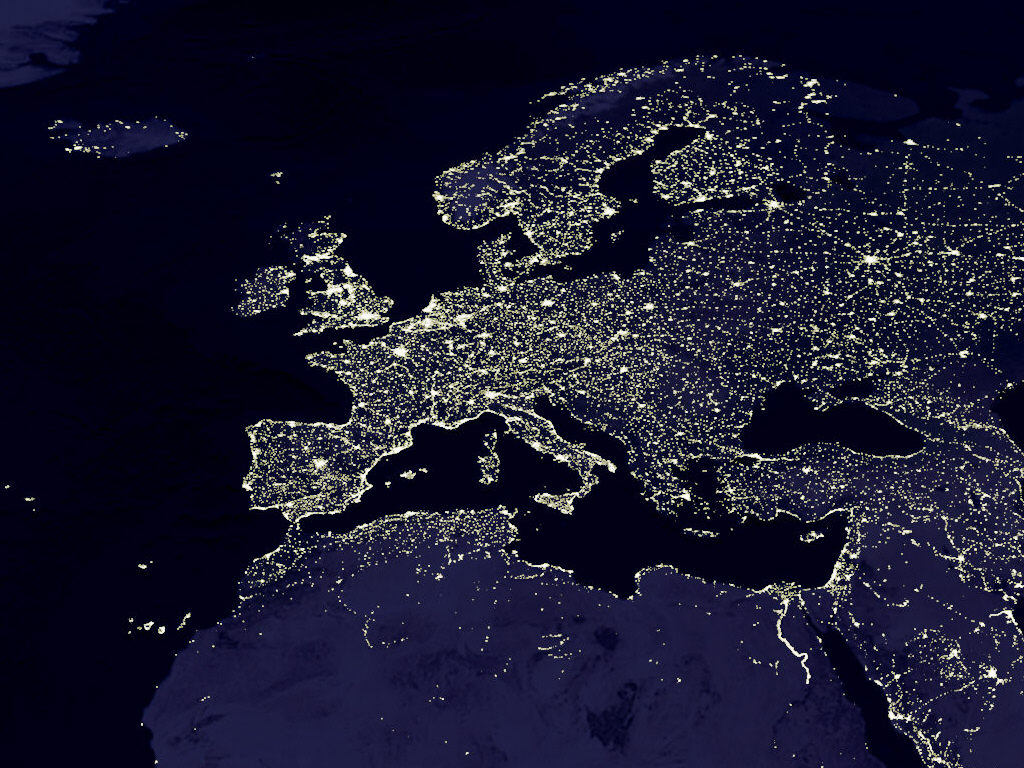
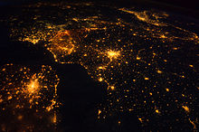 Several of the oldest cities of north-western Europe are highlighted in this astronaut photograph from just after midnight (00:25 Greenwich Mean Time) on August 10, 2011.
Europe is traditionally reckoned as one of seven continents. Physiographically, however, it is the northwestern peninsula of the larger landmass known as Eurasia (or Afro-Eurasia): Asia occupies the eastern bulk of this continuous landmass (save the Suez Canal separating Asia and Africa) and all share a common continental shelf. Europe's eastern frontier is delineated by the Ural Mountains in Russia. The south-east boundary with Asia is not universally defined. Most commonly the Ural or, alternatively, the Emba River serve as possible boundaries. The boundary continues to the Caspian Sea, the crest of the Caucasus Mountains or, alternatively, the Kura River in the Caucasus, and on to the Black Sea; the Bosporus, the Sea of Marmara, and the Dardanelles conclude the Asian boundary. The Mediterranean Sea to the south separates Europe from Africa. The western boundary is the Atlantic Ocean; Iceland, though on the Mid-Atlantic Ridge and nearer to Greenland (North America) than mainland Europe, is generally included in Europe for cultural reasons. There is ongoing debate on where the geographical centre of Europe is.
Overview
 Satellite image of Europe by night
The idea of a European "continent" is prevalent but not universally held. Some geographical texts refer to a Eurasian Continent, or to a European subcontinent, given that Europe is not surrounded by sea and its Southeastern border has always been vaguely defined, and disputed.
In terms of shape, Europe is a collection of connected peninsulas and nearby islands. The two largest peninsulas are "mainland" Europe and Scandinavia to the north, divided from each other by the Baltic Sea. Three smaller peninsulas—Iberia, Italy and the Balkans—emerge from the southern margin of the mainland. The Balkan peninsula is separated from Asia by the Black and Aegean Seas. Italy is separated from the Balkans by the Adriatic Sea, and from Iberia by the Mediterranean Sea, which also separates Europe from Africa. Eastward, mainland Europe widens much like the mouth of a funnel, until the boundary with Asia is reached at the Ural Mountains and Ural River (or, less commonly, the Este River), the Caspian Sea and Caucasus Mountains.
Land relief in Europe shows great variation within relatively small areas. The southern regions are mountainous, while moving north the terrain descends from the high Alps, Pyrenees and Carpathians, through hilly uplands, into broad, low northern plains, which are vast in the east. An arc of uplands also exists along the northwestern seaboard, beginning in the western British Isles and continuing along the mountainous, fjord-cut spine of Norway.
This description is simplified. Sub-regions such as Iberia and Italy contain their own complex features, as does mainland Europe itself, where the relief contains many plateaus, river valleys and basins that complicate the general trend. Iceland and the British Isles[1] are special cases. The former is a land unto itself in the northern ocean which is counted as part of Europe, while the latter are upland areas that were once joined to the mainland until rising sea levels cut them off.
Geology
Europe's most significant feature is the dichotomy between highland and mountainous Southern Europe and a vast, partially underwater, northern plain ranging from England in the west to Ural Mountains in the east.[citation needed] These two halves are separated by the mountain chains of Pyrenees and Alps/Carpathians. The northern plains are delimited in the west by the Scandinavian Mountains and the mountainous parts of the British Isles. Major shallow water bodies submerging parts of the northern plains are the Celtic Sea, the North Sea, the Baltic Sea complex, and the Barents Sea.
The northern plain contains the old geological continent of Baltica, and so may be regarded as the "main continent", while peripheral highlands and mountainous regions in south and west constitute fragments from various other geological continents.
The Geology of Europe is hugely varied and complex, and gives rise to the wide variety of landscapes found across the continent, from the Scottish Highlands to the rolling plains of Hungary.
Rivers
The following are the longest rivers in Europe alongside their approximate lengths[2][3]:
- 1. Volga - 3,690 km (2,290 mi)
- 2. Danube - 2,860 km (1,780 mi)
- 3. Ural - 2,428 km (1,509 mi)
- 4. Dnieper - 2,290 km (1,420 mi)
- 5. Don - 1,950 km (1,210 mi)
- 6. Pechora - 1,809 km (1,124 mi)
- 7. Kama - 1,805 km (1,122 mi)
- 8. Oka - 1,500 km (930 mi)
- 9. Belaya - 1,430 km (890 mi)
- 10. Tisza - 1,358 km (844 mi)
- 11. Dniester - 1,352 km (840 mi)
- 12. Rhine - 1,236 km (768 mi)
- 13. Elbe - 1,091 km (678 mi)
- 14. Vistula - 1,047 km (651 mi)
- 15. Tagus - 1,038 km (645 mi)
- 16. Daugava - 1,020 km (630 mi)
- 17. Loire - 1,012 km (629 mi)
- 18. Ebro - 960 km (600 mi)
- 19. Nemunas - 937 km (582 mi)
- 20. Sava - 933 km (580 mi)
- 21. Oder - 854 km (531 mi)
- 22. Rhône - 815 km (506 mi)
- 23. Seine - 776 km (482 mi)
- 24. Mureș - 761 km (473 mi)
- 25. Prut - 742 km (461 mi)
- 26. Po - 682 km (424 mi)
- 27. Olt - 615 km (382 mi)
- 28. Glomma - 604 km (375 mi)
- 29. Siret - 559 km (347 mi)
- 30. Maritsa - 480 km (300 mi)
- 31. Ialomița - 417 km (259 mi)
- 32. Vardar - 388 km (241 mi)
- 33. Shannon - 386 km (240 mi)
- 34. Someș - 376 km (234 mi)
Lakes and inland seas
Major islands
Iceland, Faroe Islands, Great Britain, Ireland, the rest of the British Isles, Balearic Islands, Corsica, Sardinia, Sicily, Malta, Ionian Islands, Crete, Aegean Islands, Åland Islands, Gotland, Saaremaa, Svalbard, Hinnøya, Senja, Zealand, Fyn and North Jutlandic Island.
See also List of European islands by area and List of European islands by population
Plains and lowlands
- East European Plain, the largest landscape feature of Europe
- Northern European Lowlands
- Pannonian plain
- Meseta Central is a high plain (plateau) in central Spain (occupies roughly 40% of the country)
- Po Valley, also known as Padan Plain, between Alps and Apennines
Mountain ranges
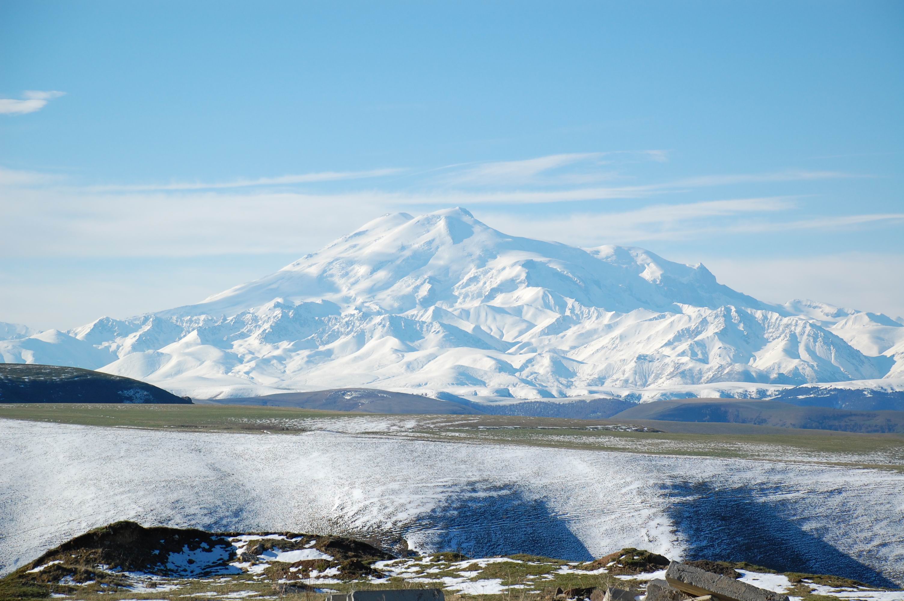
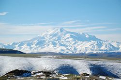 Mt. Elbrus, the highest mountain in Europe.
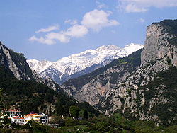 Mount Olympus, legendary abode of the Greek gods.
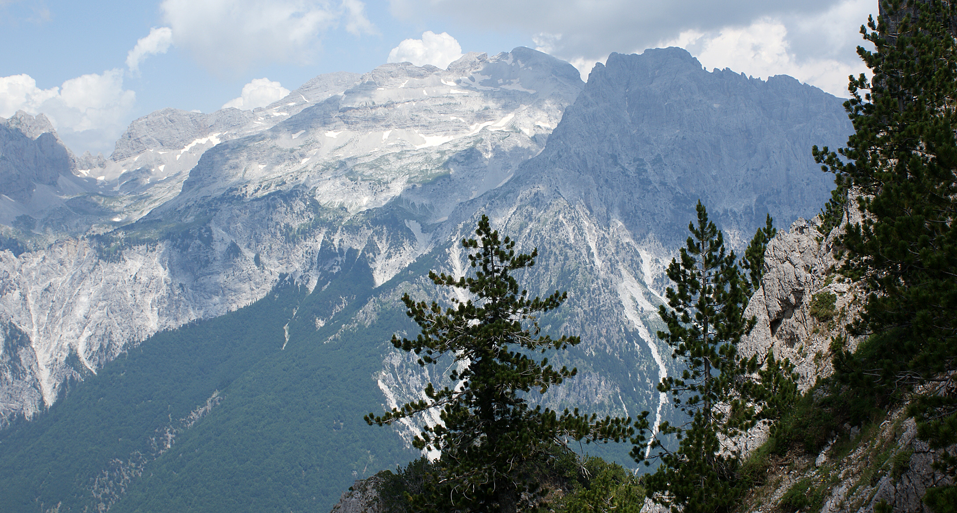
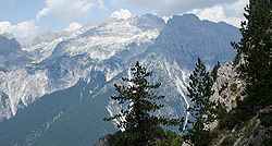
Some of Europe's major mountain ranges are:
- Ural Mountains, used to separate Europe and Asia
- Caucasus Mountains, which also separate Europe and Asia, and is the namesake of the Caucasian race
- Carpathian Mountains, a major mountain range in Central and Southern Europe
- Alps, the famous mountains known for their spectacular slopes
- Apennines, which run through Italy
- Pyrenees, the natural border between France and Spain
- Cantabrian Mountains, which run across northern Spain
- Scandinavian Mountains, a mountain range which runs through the Scandinavian Peninsula, includes the Kjølen mountains
- Dinaric Alps, a mountain range in the Balkans
- Balkan mountains, a mountain range in central Balkans
- Scottish highlands ( cairngorms, a 'low level' mountain range, in northern and central Scotland.
- pennines, very low level mountain range, subject to extreme glacial sculpting, in earlier ice ages, found in northern England.
Land area in different classes of European mountainous terrain (classification from UNEP-WCMC):
>= 4500m 3500- 4500m 2500- 3500m 1500- 2500m & slope>=2° 1000- 1500m & slope >=5°
or local elevation range >300m300-1000m & local elevation range >300m Mountainous TOTAL Europe TOTAL 1 km2 225 km2 497886 km2 145838 km2 345255 km2 1222104 km2 2211308 km2 10180000 km2 0.00% 0.00% 4.89% 1.43% 3.39% 12.00% 21.72% 100.00% Temperature and precipitation
The high mountainous areas of Europe are colder and have higher precipitation than lower areas, as is true of mountainous areas in general. Europe has less precipitation in the east than in central and Western Europe. The temperature difference between summer and winter gradually increases from coastal northwest Europe to southeast inland Europe, ranging from Ireland, with a temperature difference of only 10 °C from the warmest to the coldest month, to the area north of the Caspian Sea, with a temperature difference of 40 °C. January average range from 13°C in Southern Greece to -20°C in northeastern part of European Russia.
Western Europe and parts of Central Europe generally fall into the temperate maritime climate (Cfb), the southern part is mostly a Mediterranean climate (mostly Csa, smaller area with Csb), the north-central part and east into central Russia is mostly a humid continental climate (Dfb) and the northern part of the continent is a subarctic climate (Dfc). In the extreme northern part (northernmost Russia; Svalbard), bordering the Arctic Ocean, is tundra climate (Et). Mountain ranges, such as the Alps and the Carpathian mountains, have a highland climate with large variations according to altitude and latitude.
Landlocked countries
- Andorra
- Armenia
- Austria
- Belarus
- Czech Republic
- Hungary
- Kazakhstan
- Kosovo
- Luxembourg
- Liechtenstein
- Republic of Macedonia (name is currently under dispute)
- Moldova
- San Marino
- Serbia
- Slovakia
- Switzerland
- Vatican
Notes:
- Liechtenstein is doubly landlocked.
- Switzerland, Liechtenstein, Austria, Czech Republic, Slovakia, Hungary, Serbia, and Macedonia constitute a contiguous landlocked agglomeration of eight countries in Central Europe and the Balkans, stretching from Geneva all the way to Greece.
- All other landlocked countries (Luxembourg, Andorra, Vatican, San Marino, Belarus, Moldova, Azerbaijan, and Kazakhstan) are "standalone" landlocked countries, not bordering any other such European one (the emphasis is necessary, since Kazakhstan borders Turkmenistan, Uzbekistan, and Kyrgyzstan, thus forming a vast landlocked expanse in Central Asia)
Countries consisting solely of islands or parts of islands
Countries bordering or spanning another continent
Eurasia Armenia, Azerbaijan, Georgia, Kazakhstan, Russia, Cyprus, Turkey, Greece (some Aegean islands) Europe-Africa Malta, Spain (Ceuta, Melilla and Canary Islands), Italy (Lampedusa and Lampione), Portugal (Madeira),[4] France (Réunion) Europe-South America France (French Guiana) Europe-North and Central America Portugal (Western part of the Azores), France (Guadeloupe and Martinique), Netherlands (Bonaire, Saba, and St. Eustatius) Countries whose capital is not their largest city
Country Capital Largest City  Liechtenstein
Vaduz Schaan  Malta
MaltaValetta Birkirkara  San Marino
San Marino Serravalle  Switzerland
Bern Zurich  Turkey
Ankara Istanbul Note: Italy's capital, Rome, is the country's largest city if only the municipality (comune) is considered. According to some definitions of urban zone and metropolitan areas, Milan's and Naples' metropolitan areas are larger than Rome's.
List of countries by the number of other countries they border
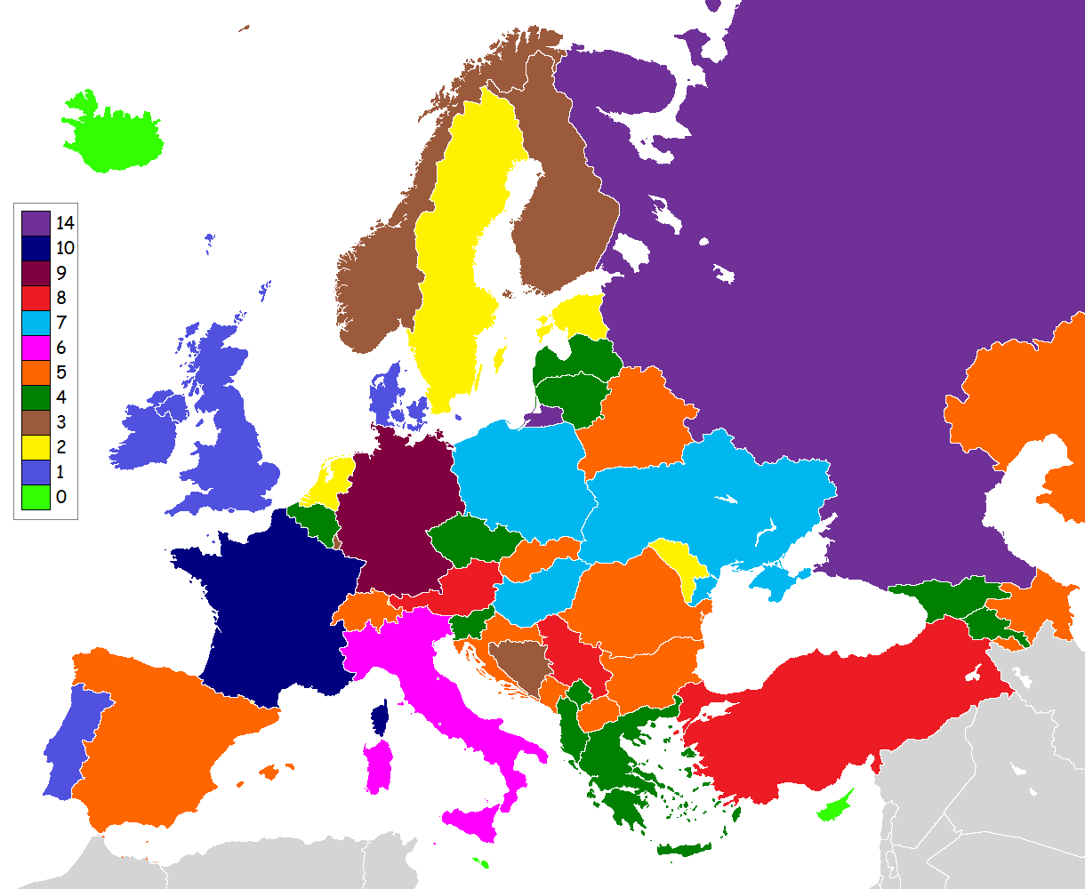
 Map of European countries by number of neighbouring countries.
14 Russia (Including Kaliningrad) 11 France (Including overseas departments and territories) 9 Germany 8 Austria, Serbia, Turkey 7 Hungary, Poland, Ukraine 6 Italy 5 Azerbaijan, Belarus, Bulgaria, Croatia, Kazakhstan, Romania, Macedonia, Slovakia, Spain (Including Ceuta and Melilla), Switzerland 4 Albania, Armenia, Belgium, the Czech Republic, Georgia, Greece, Latvia, Lithuania, Montenegro, Slovenia 3 Bosnia and Herzegovina, Finland, Netherlands (Including Sint Maarten), Norway, Luxembourg 2 Andorra, Estonia, Liechtenstein, Moldova, Sweden 1 Denmark, Ireland, Monaco, Portugal, San Marino, United Kingdom, Vatican City 0 Iceland, Malta See also
- European grid
- European Union
- Western Europe
- Central Europe
- Eastern Europe
- Southern Europe
- Extreme points of Europe
- Extreme points of the European Union
- Countries bordering the European Union
- Extreme points of Eurasia
- Extreme points of Afro-Eurasia
- Explorers of Russia
Geography of Europe Sovereign
states- Albania
- Andorra
- Armenia
- Austria
- Azerbaijan
- Belarus
- Belgium
- Bosnia and Herzegovina
- Bulgaria
- Croatia
- Cyprus
- Czech Republic
- Denmark
- Estonia
- Finland
- France
- Georgia
- Germany
- Greece
- Hungary
- Iceland
- Ireland
- Italy
- Kazakhstan
- Latvia
- Liechtenstein
- Lithuania
- Luxembourg
- Macedonia
- Malta
- Moldova
- Monaco
- Montenegro
- Netherlands
- Norway
- Poland
- Portugal
- Romania
- Russia
- San Marino
- Serbia
- Slovakia
- Slovenia
- Spain
- Sweden
- Switzerland
- Turkey
- Ukraine
- United Kingdom
- (England
- Northern Ireland
- Scotland
- Wales)
- Vatican City
States with limited
recognitionDependencies
and other territories- Åland
- Faroe Islands
- Gibraltar
- Guernsey
- Jan Mayen
- Jersey
- Isle of Man
- Svalbard
Other entities Notes
- ^ The term British Isles is controversial in relation to Ireland where its use is objected to by the government of the Republic of Ireland and many of its citizens. (See British Isles naming dispute).
- ^ http://www.worldatlas.com/webimage/countrys/euriv.htm
- ^ http://www.rev.net/~aloe/river/
- ^ http://books.google.com.ph/books?id=VlAOktBjoZwC&pg=PA304&dq=madeira+africa&hl=en&ei=O6CwTL3yKYrQcduVwb0N&sa=X&oi=book_result&ct=result&resnum=3&ved=0CC4Q6AEwAg#v=onepage&q=madeira%20africa&f=false
Categories:


Wikimedia Foundation. 2010.