- Maritsa
-
For other uses, see Maritsa (disambiguation).For other uses, see Meriç (disambiguation).
Maritsa (Марица), Evros (Εβρος), Meriç 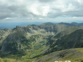
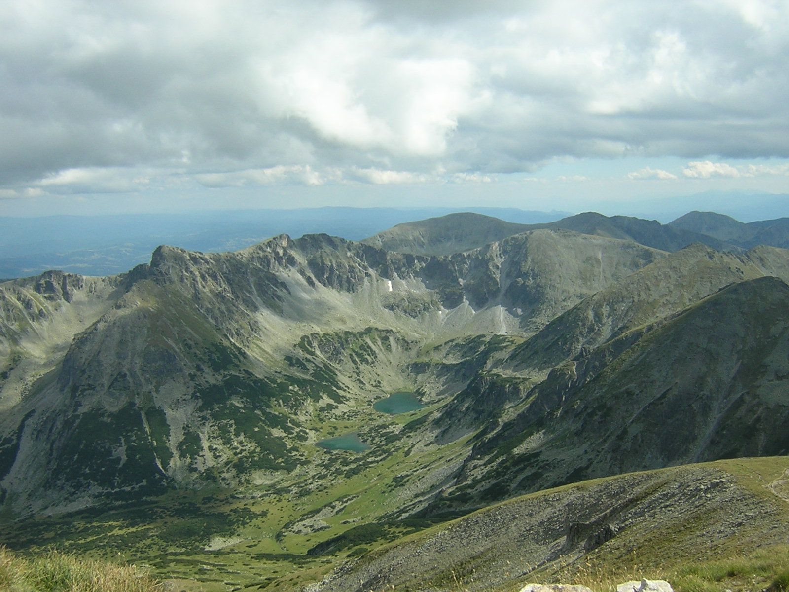
The source valley of the Maritsa river in the Rila MountainsOrigin Rila Mountains, Bulgaria Mouth Aegean Sea, 14.5 km east of Alexandroupoli
40°43′50″N 26°2′6″E / 40.73056°N 26.035°ECoordinates: 40°43′50″N 26°2′6″E / 40.73056°N 26.035°EBasin countries Bulgaria, Greece, Turkey Length 480 km Source elevation 2,378 m Basin area 53,000 km² 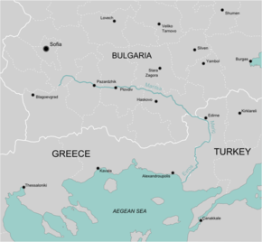 Map of the river
The Maritsa or Evros (Bulgarian: Марица, Ancient Greek: Ἕβρος (Latinised as Hebrus), Modern Greek: Έβρος, Evros, Turkish: Meriç) is, with a length of 480 km, the longest river that runs solely in the interior of the Balkans. It has its origin in the Rila Mountains in Western Bulgaria, flowing southeast between the Balkan and Rhodope Mountains, past Plovdiv and Parvomay (where the Mechka & Kayaliyka River joins it) to Edirne, Turkey. A small section of the northern branch of the river runs entirely in Turkey; it was handed to Turkey in order to prevent the town of Edirne from facing a Greek bank. The rest of the river to the sea flows along the border, near Kastanies, from where it turns south to enter the Aegean Sea near Enez, where it forms a delta. The Tundzha is its chief tributary; the Arda is another one. The lower course of the Maritsa/Evros forms part of the Bulgarian-Greek border and most of the Greek-Turkish border. The upper Maritsa valley is a principal east-west route in Bulgaria. The unnavigable river is used for power production and irrigation.
The places that the river flows through include Pazardzhik, Plovdiv, (next to) Parvomay, through Dimitrovgrad and Svilengrad in Bulgaria, Edirne in Turkey and Kastanies, Pythio, Didymoteicho and Lavara in Greece. There are a number of bridges over the river, including the one at Svilengrad, the one west of Edirne in Turkey and GR-2 with the D110/E90 further south and as its border crossings.
Contents
History
In ancient times, the Maritsa was known as the Hebros.
In 1371, the river was the site of the Battle of Maritsa, also known as the battle of Chernomen, an Ottoman victory over the Serbs. Vukašin Mrnjavčević and Jovan Uglješa died in the battle.
2000s floods
February-March 2005
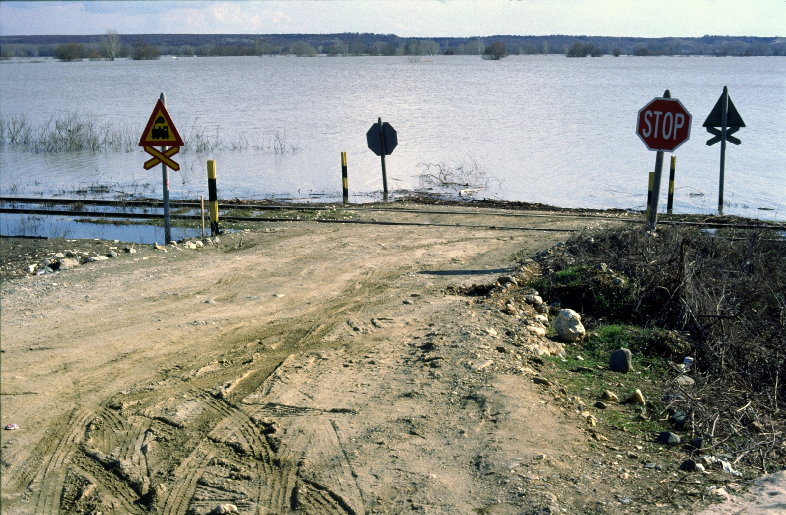
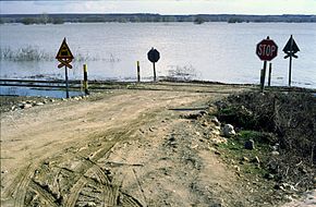 March-2005 Maritsa river floods, Greek side, close to Lavara village.
On 18 February 2005, floods devastated much of the low-lying areas of the northeastern part of the Evros prefecture and the Edirne area. The flood happened when the area received above average of rainfall and snowfall which caused a dike to burst and flooded beyond its banks and as far inland as 5 to 10 km. The water levels reached as high as 6.5 m above ground, which is 10 cm above the embankment level, indicating danger to nearby residents. Pythio was flooded. It devastated hydrolines, train tracks and roads, damaged many farms including wheat farms and flooded many villages and houses. Many roads were closed. Teams throughout the prefecture blew up dikes in Pythio, Lavara and Amorio as flood control conducted 15,000 acres (61 km²) of land. The flood lasted from 17 to 22 February. Three days later, the water level dropped to 5.48 m, below the danger level of 5.70 m. The water level in the Arda dropped to 4.8 m.
Another flood which began from 1 March 2005 flooded several places again and a town which flooded a local school that has a playground leaving the basketball unflooded in Pythio. Several other buildings, roads and streets were also flooded. A day later on 2 March, the flood reached Didymoteicho and Lavara to the southwest. The rainfall amounts to about 5 m, 4.6 m in some areas including the Arda and as high as 6.5 m. Firemen with boats and workers were rescuing and helping people. The rail link to the northern part of Evros prefecture was closed. The flooding of the valley also flooded the Turkish side.
A third round of floods began near Edirne on the Turkish side and Kastanies on the Greek side on 7 March. The river was flowing at nearly 1,000 m³ per second. Kastanies became a lagoon which flooded the entire community including streets and homes and stranded people in their homes. The flood waters merged with the waters of the Arda causing it to flood Kastanies. Farmlands were underwater. The northern branch of the river also flooded houses and properties in Edirne on the Turkish side and several communities around Edirne. Workers put down sandbags to prevent the flooding of properties. The flood later reached the low lying areas of Pythio, Amorio and Lavara along with Didymoteicho. The water level on 8 March was 5.8 m, 5 m at the Kiprinos Dam.
August 2005
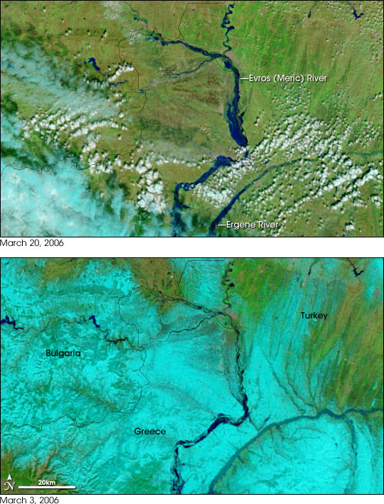
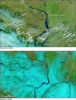 Satellite image of floods along the river in 2006.
Five months later, another flooding occurred on Thursday, 11 August 2005 in the northeastern part of the Greek prefecture of Evros between Orestiada and Didymoteicho, farmlands of the low-lying areas were flooded and damaged, crops including corn were completely destroyed, and the valley became a lake. The railway connecting Orestiada and Didymoteicho shut down because of the flooding of the tracks. The flood was smaller than the major 2005 flooding. One of the dikes near the river broke and caused the flooding.
March 2006
The flood waters returned in March 2006 as heavy rains with a mixture of heavy snowfalls in the Arda basin contributed to dangerous floods that flooded the low-lying areas of the Maritsa (Evros/Meriç) valley to flood villages including Kastanies, Vyssa, Didymoteicho, Pythio, Lavara, Soufli, near Lachyna, Tychero and Feres in Greece and Edirne and Karaağaç in Turkey. The flood stranded people in their homes and one reporter in Lavara saw water up to the second floor of some homes, one of the dikes near these hard-hit areas flooded the area, buildings and bridges were ruined, in Turkey, flooding was slightly enough to see buildings and squares underwater, several cardboard and poorly built homes were ruined.
In Greece, one of the barns almost flooded as high as their roofs, several cows and other cattle were affected, some farms lost some cattle. Roads and railways were closed. Flood waters in the eastern part of the Greek prefecture saw water to rise over 6 m. Days later trucks and bulldozers rebuilt several dikes around the area and received help from the government to rebuilt and prevent any flood waters from entering these areas. The cause of the flood was that heavy snowfalls that amounted to record levels occurred in Bulgaria and caused its three dams to overflow in the Arda basin and flooded into the Maritsa. The flood ended a couple of days later but another low-pressure system brought rain to the areas, but it did not create any floods.
Honour
Maritsa Peak on Livingston Island in the South Shetland Islands, Antarctica is named after Maritsa River. La Maritza: song, authors J Renard- P. Delanoe: Singer: Sylvie Vartan, 1968
Hebrus Valles on Mars is named for this river.
Images
-

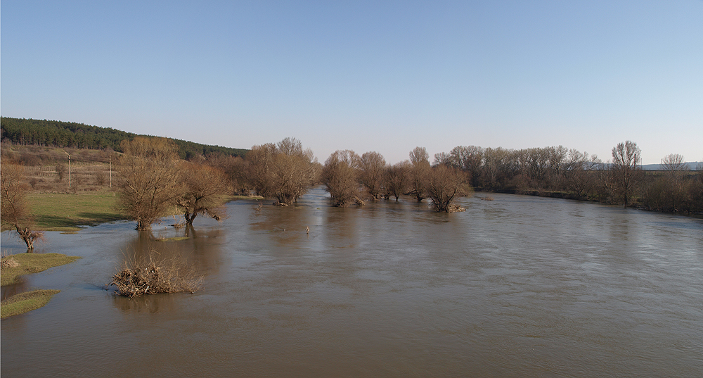
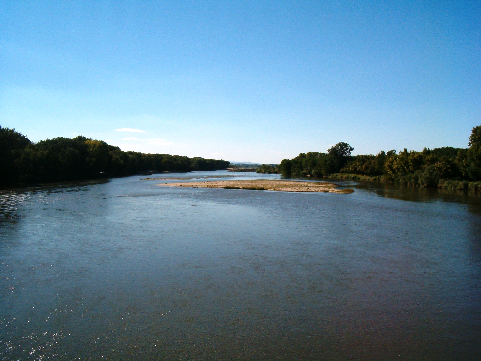
View from the river, Edirne.
See also
References
- "МАРИЦА (антично име: Хеброс, Хебър)" (in Bulgarian). Българска енциклопедия А-Я. БАН, Труд, Сирма. 2002. ISBN 9548104083. OCLC 163361648.
 Rivers of Turkey
Black Sea basin Marmara basin Aegean basin Mediterranean basin Aksu · Manavgat · Köprüçay · Göksu · Limonlu · Müftü (Efrenk) · Berdan · Seyhan · Ceyhan · Asi (Orontes)Persian Gulf basin Caspian basin Categories:- Rivers of Bulgaria
- Rivers of Greece
- Rivers of Turkey
- International rivers of Europe
- Bulgaria–Greece border
- Greece–Turkey border

Wikimedia Foundation. 2010.