- Yağlıdere
Infobox Settlement
settlement_type = Town
subdivision_type = Country
subdivision_name = TUR
timezone=EET
utc_offset=+2
map_caption =Location of PAGENAME within Turkey.
timezone_DST=EEST
utc_offset_DST=+3official_name = Yağlıdere
.jpg)
image_caption =
image_blank_emblem =
blank_emblem_type =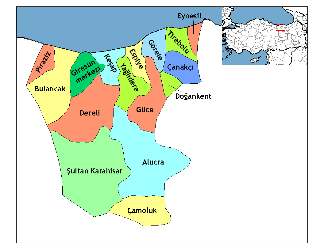
subdivision_type1=Region
subdivision_name1 = Black Sea
subdivision_type2=Province
subdivision_name2 = Giresun| population_total = 19297|population_footnotes=
population_as_of =| 2000
population_footnotes =
population_density_km2 = 220|area_total_km2 = 350|elevation_m = 50- 1500-4920
elevation_ft=165-
latd = 40
latm = 54
latNS = N
longd = 38
longm = 25
longEW = E
postal_code_type=Postal code
postal_code = 28610
area_code = (+90) 454
blank_info = 28|blank_name=Licence plate
leader_title=Mayor
leader_name = Şevket Kaya (Justice and Development Party )
website = [http://www.yaglidere.gov.tr/ Yağlıdere Governorship]Yağlıdere is a town and a district of
Giresun Province in the Black Sea region ofTurkey .The district covers an extension of the
Giresun Mountains , including part of the valley of theYağlıdere stream which gives the district its name. When the mountain streams that feed the Yağlıdere are full flooding is a threat. This is an agricultural district; the hillsides are planted withhazelnuts , fruit trees,chestnuts and other deciduous trees. Also sometea andcorn are grown and animals are grazed on the higher slopes.4,336 people live in the small town of Yağlıdere, which was founded in 1811 with a marketplace and a large mosque.
A large section of the population have migrated to America, especially New York and New Jersey, causing the town to be nicknamed "New Yağlıdere" or "little New York".
Etymology
The name "Yağlıdere" originates from the
Yağlıdere stream passing through the town centre. The town was formerly named "Camiyanı" ('next to the mosque').I love yaglidereits sooo awesomee its like greeen full of mountains when i went there i like had soo much fun my cousins and everything i suggest everyone to go there and have fun and eat lots of hazelnuts (findik)External links
* [http://www.yaglidere.gov.tr/ District governor's official website]
* [http://www.yaglidere.com/ local information]
* [http://www.yaglidere.org/ and more]
Wikimedia Foundation. 2010.