- Tychero
-
Tychero
ΤυχερόLocation 
 Tychero
Coordinates 41°1′N 26°17′E / 41.017°N 26.283°ECoordinates: 41°1′N 26°17′E / 41.017°N 26.283°E Location within the peripheral unit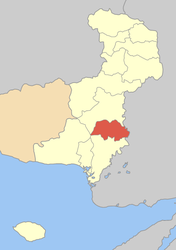
Government Country: Greece Region: East Macedonia and Thrace Regional unit: Evros Municipality: Soufli Population statistics (as of 2001) Municipal unit - Population: 4,103 Other Time zone: EET/EEST (UTC+2/3) Auto: EB Tycheró (Greek: Τυχερό, [tiçeˈro], formerly Τυχερόν, Tycherón) is a town and a former municipality in the Evros peripheral unit, East Macedonia and Thrace, Greece. Since the 2011 local government reform it is part of the municipality Soufli, of which it is a municipal unit.[1] Population 4,103 (2001). Tychero is connected and bypassed with the GR-51/E85 (Alexandroupoli - Orestiada - Ormenio). Tychero is located south of Soufli, south-southwest of Orestiada, west of Turkey and Uzunköprü, north of Feres and northeast of Alexandroupoli. The Evros River flows to the east and is also the Greek-Turkish border.
Contents
Subdivisions
The municipal unit Tychero is subdivided into the following communities (constituent villages in brackets):
- Fylakto
- Lefkimmi
- Lyra
- Provatonas (Provatonas, Tavri, Thymaria)
- Tychero
Population
Year Village population Municipality population 1981 2,031 - 1991 2,004 4,188 2001 2,031 4,103 Information
Tychero was under Ottoman rule and was known as Bidigli or Pitikli until the Balkan Wars. Later on, it ceded to Bulgaria and remained for the next seven years but kept its name. Bidigli finally joined the rest of Greece and a few years later, it was renamed to its current name Tychero. After World War II and the Greek Civil War, its buildings were rebuilt. Much of the houses were stone built until the 1960s. Electricity arrived the same year. Vehicles arrived in the 1970s, the pavement of the main road and television arrived in the 1980s and computer and internet are rarely known in the beginning of the 21st century and up to date technology are not seen. Tychero was struck on late-February 2006 by the worst flood ever to hit the Evros river. Several roads were closed and houses and farmlands were flooded. It left residents stranded in their houses.
External links
North: Soufli West: Soufli Tychero East: Turkey Southwest: Alexandroupoli South: Feres References
- ^ Kallikratis law Greece Ministry of Interior (Greek)
Municipal unit of Orfeas Municipal unit of Soufli Municipal unit of Tychero Fylakto · Lefkimmi · Lyra · Provatonas · TycheroCategories:- East Macedonia and Thrace geography stubs
- Populated places in Evros (peripheral unit)


Wikimedia Foundation. 2010.