- Carpathian Mountains
-
For other uses, see Carpathian (disambiguation).
Carpathians Range 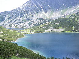 Inner Western Carpathians, High Tatras, Poland
Countries Czech Republic, Poland, Slovakia, Hungary, Ukraine, Romania, Serbia[1] Highest point Gerlachovský štít - elevation 2,655 m (8,711 ft) 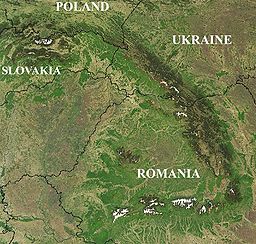 Satellite image of the Carpathians
The Carpathian Mountains or Carpathians are a range of mountains forming an arc roughly 1,500 km (932 mi) long across Central and Eastern Europe, making them the second-longest mountain range in Europe (after the Scandinavian Mountains, 1,700 km (1,056 mi)). They provide the habitat for the largest European populations of brown bears, wolves, chamois and lynxes, with the highest concentration in Romania,[2][3][4] as well as over one third of all European plant species.[5] The Carpathians and their piedmont also concentrate many thermal and mineral waters, with Romania home to over one-third of the European total.[6][7] Romania is likewise home to the largest surface of virgin forests in Europe (except Russia), totaling 250,000 hectares (65%), most of them in the Carpathians,[8] with the Southern Carpathians constituting Europe’s largest unfragmented forested area.[9]
The Carpathians consist of a chain of mountain ranges that stretch in an arc from the Czech Republic (3%) in the northwest through Slovakia (17%), Poland (10%), Hungary (4%) and Ukraine (11%) to Romania (53%) in the east and on to the Iron Gates on the River Danube between Romania and Serbia (2%) in the south. The highest range within the Carpathians is the Tatras, on the border of Poland and Slovakia, where the highest peaks exceed 2,600 m (8,530 ft). The second-highest range is the Eastern Carpathians in Romania, where the highest peaks exceed 2,500 m (8,202 ft).
The Carpathians are usually divided into three major parts: the Western Carpathians (Czech Republic, Poland, Slovakia), the Central Carpathians (southeastern Poland, eastern Slovakia, Ukraine, Romania), and the Eastern Carpathians (Romania, Serbia).[1]
The most important cities in or near the Carpathians are: Bratislava and Košice in Slovakia; Kraków in Poland; Cluj-Napoca, Sibiu and Braşov in Romania; and Miskolc in Hungary.
Contents
Name
The word "Carpathian" is derived from Thracian Greek Καρπάτῆς όρος (Karpates oros), meaning "rocky mountain",[10] probably via German Karpathen and Latin Carpatus. Its earlier origins are unclear.[11]
The range is called Karpaty in Czech, Polish, Russian, Slovak and Ukrainian, Karpaten in German and Dutch, Kárpátok in Hungarian, Carpați pronounced [karˈpat͡sʲ] in Romanian, and Karpati (Карпати) in Serbian.
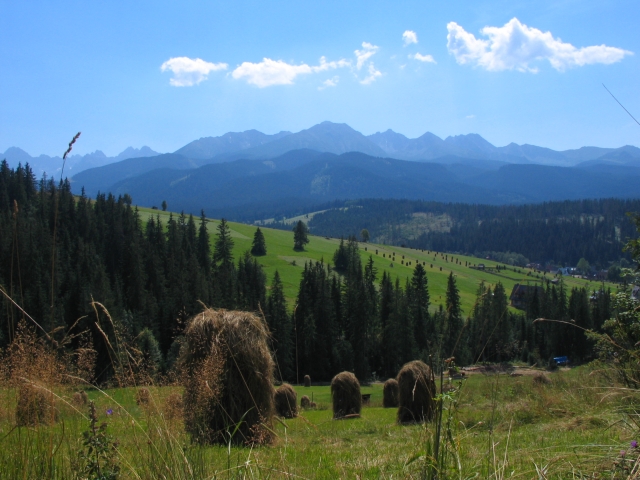
 View on Tatry from Bukowina Tatrzańska
The name Karpates may ultimately be from the Proto Indo-European root *sker-/*ker-, from which comes the Albanian word karpë (rock), and the Slavic word skála (rock, cliff), perhaps via a Dacian cognate[which?] which meant mountain, rock, or rugged (cf. Germanic root *skerp-, Old Norse harfr "harrow", Middle Low German scharf "potsherd" and Modern High German Scherbe "shard", Old English scearp and English sharp, Lithuanian kar~pas "cut, hack, notch", Latvian cìrpt "to shear, clip"). The archaic Polish word karpa meant "rugged irregularities, underwater obstacles/rocks, rugged roots or trunks". The more common word skarpa means a sharp cliff or other vertical terrain. Otherwise, the name may instead come from Indo-European *kwerp "to turn", akin to Old English hweorfan "to turn, change" (English warp) and Greek καρπός karpós "wrist", perhaps referring to the way the mountain range bends or veers in an L-shape.[12] Also car means "king" and pati "road" so carpati is possibly the king's way.
In late Roman documents, the Eastern Carpathian Mountains were referred to as Montes Sarmatici. The Western Carpathians were called Carpates, a name that is first recorded in Ptolemy's 2nd century book Geographia.
The name of the Carpi, a Dacian tribe, may have been derived from the name of the Carpathian Mountains. According to Zosimus, this tribe lived until 381 on the eastern Carpathian slopes. Alternatively the mountain range's name may be derived from the Dacian tribe.
13th-15th century Hungarian documents named the mountains Thorchal, Tarczal or less frequently Montes Nivium.
In the Scandinavian Hervarar saga, which describes ancient Germanic legends about battles between Goths and Huns, the name Karpates appears in the predictable Germanic form as Harvaða fjöllum (see Grimm's law).
Geography
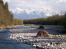
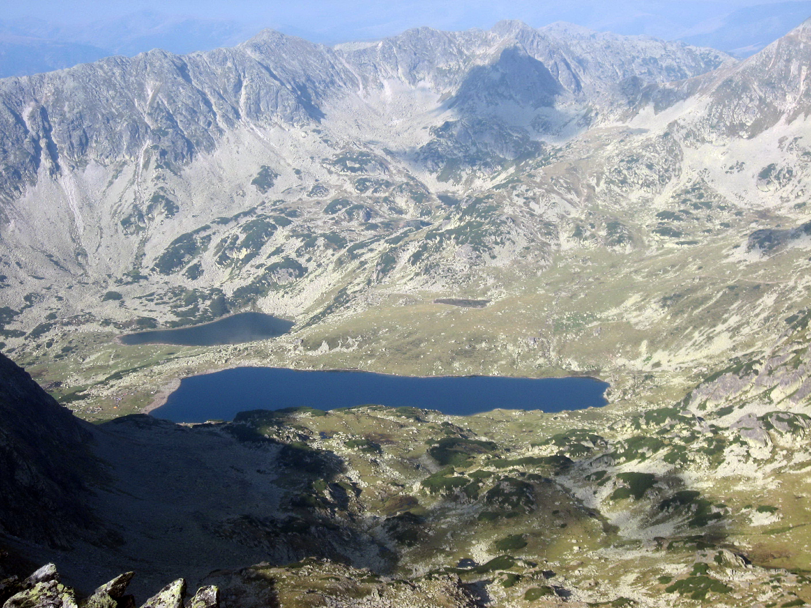
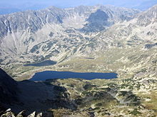 Lake Bucura, Southern Carpathians, Romania.
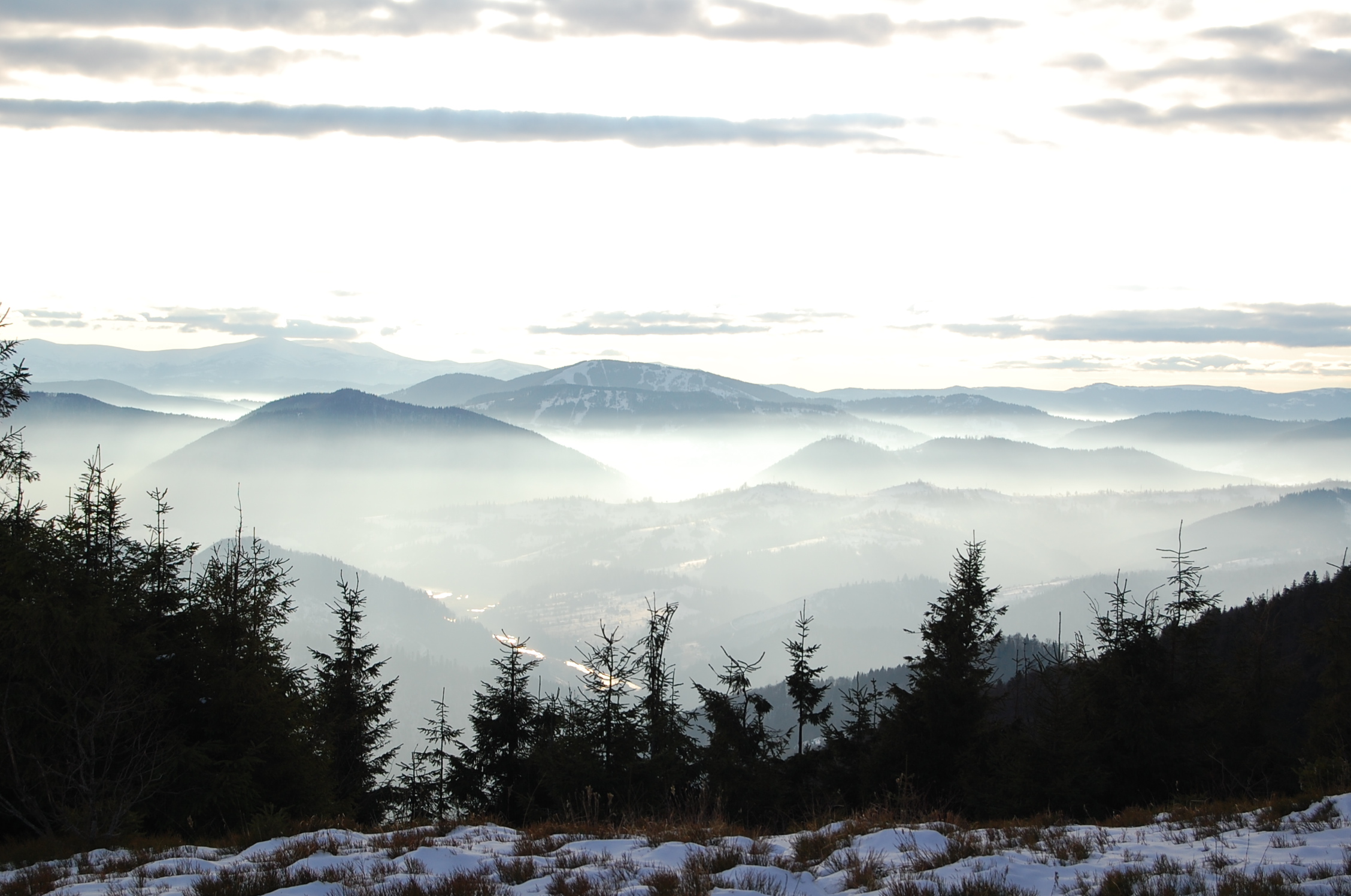
The Carpathians begin on the Danube near Bratislava. They surround Transcarpathia and Transylvania in a large semicircle, sweeping towards the southeast, and end on the Danube near Orşova in Romania. The total length of the Carpathians is over 1,500 km (932 mi) and the mountain chain's width varies between 12 and 500 km (7 and 311 mi). The highest altitudes of the Carpathians occur where they are widest. The system attains its greatest breadth in the Transylvanian plateau and in the meridian of the Tatra group – the highest range, in which Gerlachovský štít in Slovakia is the highest peak at 2,655 m (8,711 ft) above sea level. The Carpathians cover an area of 190,000 km2 (73,359 sq mi) and, after the Alps, form the next most extensive mountain system in Europe.
Although commonly referred to as a mountain chain, the Carpathians do not actually form an uninterrupted chain of mountains. Rather, they consist of several orographically and geologically distinctive groups, presenting as great a structural variety as the Alps. The Carpathians, which attain an altitude of over 2,500 m (8,202 ft) in only a few places, lack the bold peaks, extensive snowfields, large glaciers, high waterfalls, and numerous large lakes that are common in the Alps. No area of the Carpathian range is covered in snow all year round and there are no glaciers. The Carpathians at their highest altitude are only as high as the middle region of the Alps, with which they share a common appearance, climate, and flora.
The Carpathians are separated from the Alps by the Danube. The two ranges meet at only one point: the Leitha Mountains at Bratislava. The river also separates them from the Balkan Mountains at Orşova in Romania. The valley of the March and Oder separates the Carpathians from the Silesian and Moravian chains, which belong to the middle wing of the great Central Mountain System of Europe. Unlike the other wings of the system, the Carpathians, which form the watershed between the northern seas and the Black Sea, are surrounded on all sides by plains, namely the Pannonian plain to the southwest, the plain of the Lower Danube (Romania) to the south, and the Galician plain to the northeast.
Cities and towns
 People of the Carpathian Mountains
Important cities and towns in or near the Carpathians are, in approximate descending order of population: Bratislava (Slovakia),
Cluj-Napoca (Romania),
Braşov (Romania),
Košice (Slovakia),
Oradea (Romania),
Miskolc (Hungary),
Sibiu (Romania),
Târgu Mureş (Romania),
Baia Mare (Romania),
Tarnów (Poland),
Râmnicu Vâlcea (Romania),
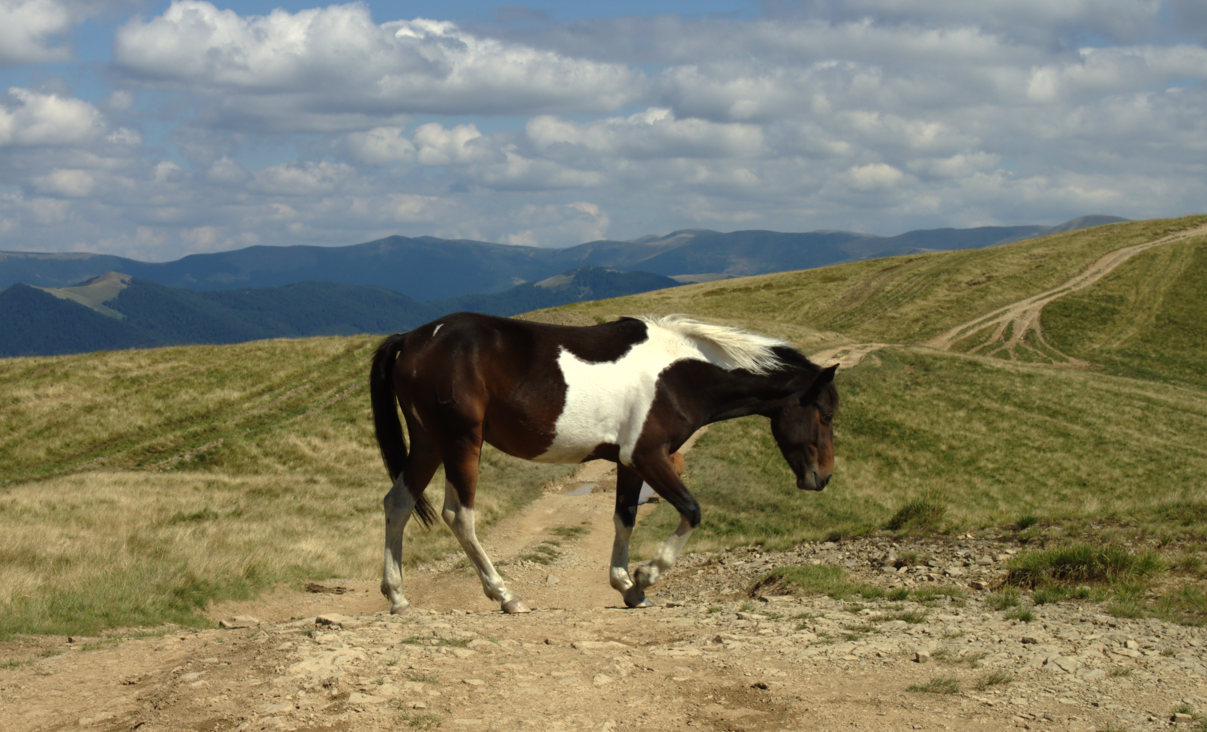
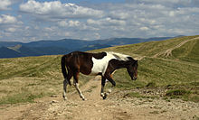 A horse atop the Krasna mountain range in Ukraine's Zakarpattia Oblast
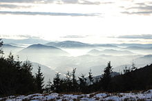 Carpathian mountains of western Ukraine
Uzhhorod (Ukraine),
Ivano-Frankivsk (Ukraine),
Piatra Neamţ (Romania),
Suceava (Romania),
Drobeta-Turnu Severin (Romania),
Reşiţa (Romania),
Žilina (Slovakia),
Bistriţa (Romania),
Banská Bystrica (Slovakia),
Deva (Romania),
Zlín (Czech Republic),
Hunedoara (Romania),
Zalău (Romania),
 Maramureș Mountains in north of Romania
Przemyśl (Poland), Alba Iulia (Romania), Zaječar (Serbia), Sfântu Gheorghe (Romania), Turda (Romania), Bor (Serbia), Mediaş (Romania), Poprad (Slovakia), Petroşani (Romania), Negotin (Serbia), Miercurea Ciuc (Romania), Făgăraş (Romania), Odorheiu Secuiesc (Romania), Petrila (Romania), Sighişoara (Romania), Zakopane (Poland), Câmpulung Moldovenesc (Romania), Gheorgheni (Romania), Vatra Dornei (Romania) and Rakhiv (Ukraine).
Highest peaks
This is an (incomplete) list of the highest peaks of the Carpathians (limited to summits over 2,500 m), their heights, geologic divisions, and locations.
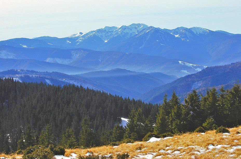
 Tatra Mountains in southern Poland
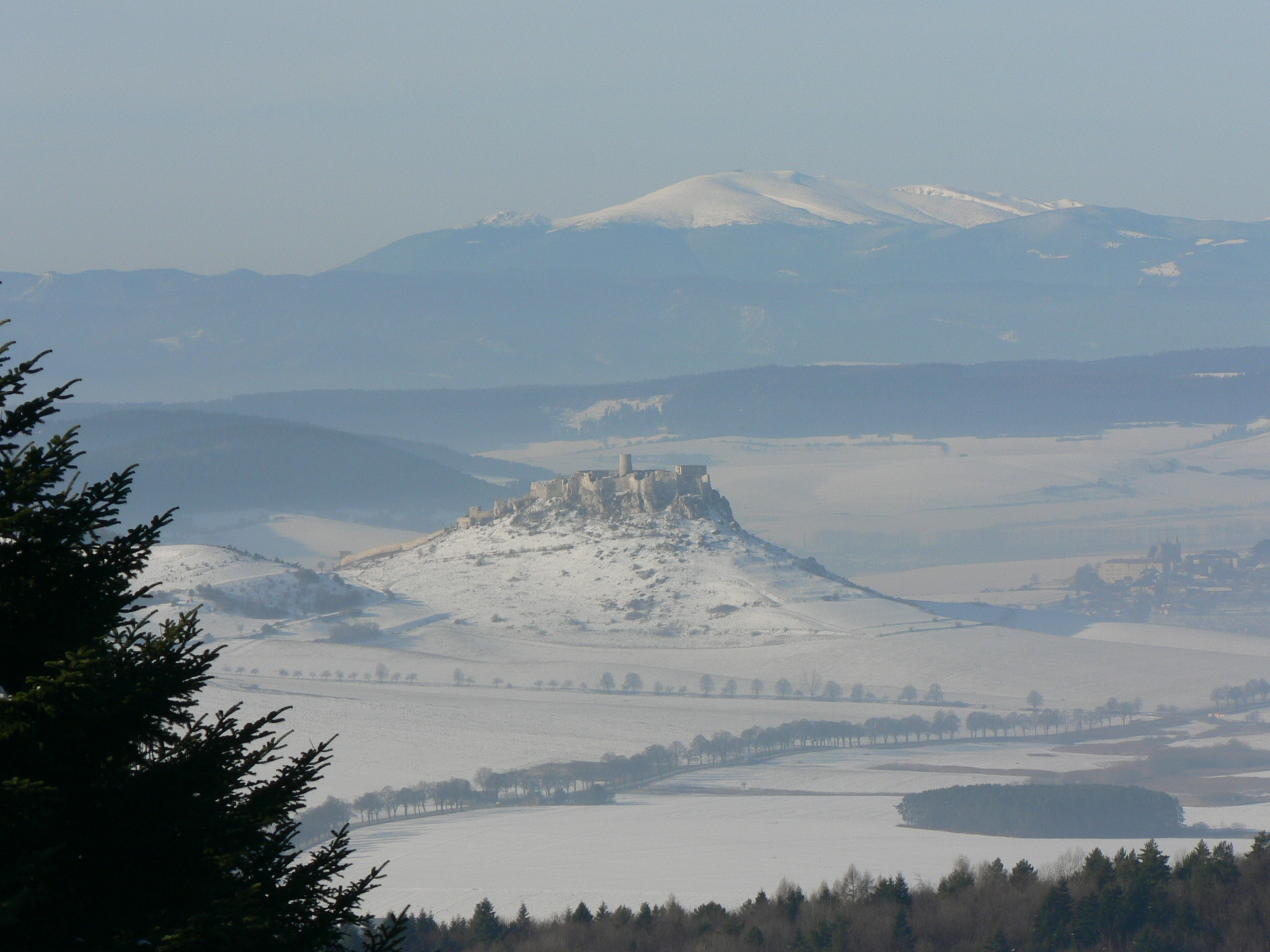
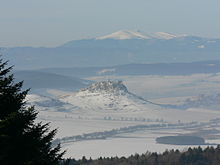 View of Spiš Castle in Slovakia, from the Branisko-pass
Mountain passes
In the Romanian part of the main chain of the Carpathians, the most important mountain passes are (starting from the Ukrainian border): the Prislop Pass, Rodna Pass, Tihuţa Pass (also known as Borgo Pass), Tulgheş Pass, Bicaz Canyon, Ghimeş Pass, Uz Pass and Oituz Pass, Buzău Pass, Predeal Pass (crossed by the railway from Braşov to Bucharest), Turnu Roşu Pass (1,115 ft., running through the narrow gorge of the Olt River and crossed by the railway from Sibiu to Bucharest), Vulcan Pass, Teregova Pass and the Iron Gate (both crossed by the railway from Timişoara to Craiova).
Geology
The area now occupied by the Carpathians was once occupied by smaller ocean basins. The Carpathian mountains were formed during the Alpine orogeny in the Mesozoic[13] and Tertiary by moving the ALCAPA, Tisza and Dacia plates over subducting oceanic crust (see maps).[14] The mountains take the form of a fold and thrust belt with generally north vergence in the western segment, northeast to east vergence in the eastern portion and southeast vergence in the southern portion.
The external, generally northern, portion of the orogenic belt is a Tertiary accretionary prism of a so called Flysch belt created by rocks scraped off the sea bottom and thrust over the North-European plate. The Carpathian accretionary wedge is made of several thin skinned nappes composed of Cretaceous to Paleogene turbidites. Thrusting of the Flysch nappes over the Carpathian foreland caused the formation of the Carpathian foreland basin.[15] The boundary between the Flysch belt and internal zones of the orogenic belt in the western segment of the mountain range is marked by the Pieniny Klippen Belt, a narrow complicated zone of polyphase compressional deformation, later involved in a supposed strike-slip zone.[16] Internal zones in western and eastern segments contain older Variscan igneous massifs reworked in Mesozoic thick and thin-skinned nappes. During the Middle Miocene this zone was affected by intensive calc-alkaline[17] arc volcanism that developed over the subduction zone of the flysch basins. At the same time, the internal zones of the orogenic belt were affected by large extensional structure[18] of the back-arc Pannonian Basin.[19]
Iron, gold and silver were found in great quantities in the Western Carpathians. After the Roman emperor Trajan's conquest of Dacia, he brought back to Rome over 165 tons of gold and 330 tons of silver.[20]
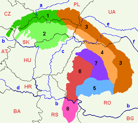
Divisions of the Carpathians
 Map of the main divisions of the Carpathians.
1. Outer Western Carpathians
2. Inner Western Carpathians
3. Outer Eastern Carpathians
4. Inner Eastern Carpathians
5. Southern Carpathians
6. Western Romanian Carpathians
7. Transylvanian Plateau
8. Serbian CarpathiansMain article: Divisions of the CarpathiansThe largest range is the Tatras.
A major part of the western and northeastern Outer Carpathians in Poland, Ukraine and Slovakia is traditionally called the Beskids.
The geological border between the Western and Eastern Carpathians runs approximately along the line (south to north) between the towns of Michalovce, Bardejov, Nowy Sącz and Tarnów. In older systems the border runs more in the east, along the line (north to south) along the rivers San and Osława (Poland), the town of Snina (Slovakia) and river Tur'ia (Ukraine). Biologists, however, shift the border even further to the east.
The border between the eastern and southern Carpathians is formed by the Predeal Pass, south of Braşov and the Prahova Valley.
Ukrainians sometimes denote as "Eastern Carpathians" only the Ukrainian Carpathians (or Wooded Carpathians), meaning the part situated largely on their territory (i.e., to the north of the Prislop Pass), while Romanians sometimes denote as "Eastern Carpathians" only the part which lies on their territory (i.e., from the Ukrainian border or from the Prislop Pass to the south), which they subdivide into three simplified geographical groups (north, center, south), instead of Outer and Inner Eastern Carpathians. These are:
- Carpathians of Maramureş and Bukovina (Romanian: Carpaţii Maramureşului şi ai Bucovinei)
- Moldavian-Transylvanian Carpathians (Romanian: Carpaţii Moldo-Transilvani)
- Curvature Carpathians (Romanian: Carpaţii Curburii, Carpaţii de Curbură)
Notable people
- Ludwig Greiner, identified Gerlachovský Peak as the highest mountain in the Carpathians.
See also
References
- ^ a b About the Carpathians - Carpathian Heritage Society
- ^ Peter Christoph Sürth. "Braunbären (Ursus arctos) in Europa". Archived from the original on 8 October 2007. http://web.archive.org/web/20071008020531/http://www.human-wildlife.info/images/Europa+Baer.JPG. Retrieved 10 March 2011.
- ^ Peter Christoph Sürth. "Wolf (Canis lupus) in Europa". Archived from the original on 8 October 2007. http://web.archive.org/web/20071008020550/http://www.human-wildlife.info/images/Europa+Wolf.JPG. Retrieved 10 March 2011.
- ^ Peter Christoph Sürth. "Eurasischer Luchs (Lynx lynx) in Europa". Archived from the original on 8 October 2007. http://web.archive.org/web/20071008020605/http://www.human-wildlife.info/images/Europa+Luchs.JPG. Retrieved 10 March 2011.
- ^ "Carpathian montane conifer forests - Encyclopedia of Earth". http://www.eoearth.org/article/Carpathian_montane_conifer_forests. Retrieved 4 August 2010.
- ^ Bucureşti, staţiune balneară – o glumă bună? in Capital, January 19th, 2009. Retrieved: April 26th, 2011
- ^ Ruinele de la Baile Herculane si Borsec nu mai au nimic de oferit in Ziarul Financiar, May 5th, 2010. Retrieved: April 26th, 2011
- ^ Salvaţi pădurile virgine! in Jurnalul Național, October 26th, 2011. Retrieved: October 31st, 2011
- ^ Europe: New Move to Protect Virgin Forests in Global Issues, May 30th, 2011. Retrieved October 31st, 2011.
- ^ Douglas Harper. "Carpathian". Online Etymology Dictionary. http://www.etymonline.com/index.php?term=Carpathian. Retrieved 10 March 2011.
- ^ "Carpathian, adj.2 and n.". Oxford English Dictionary. http://www.oed.com/view/Entry/28168?rskey=4pMAFG&result=2#. Retrieved 10 March 2011.
- ^ Room, Adrian. Placenames of the World. London: MacFarland and Co., Inc., 1997.
- ^ Plašienka, D., 2002, Origin and growth of the Western Carpathian orogenetic wedge during the mesozoic. (PDF) in Geologica Carpathica Special Issues 53 Proceedings of XVII. Congress of Carpathian-Balkan Geological Association Bratislava, September 1st - 4th 2002
- ^ Mantovani, E., Viti, M., Babbucci, D., Tamburelli, C., Albarello, D., 2006, Geodynamic connection between the indentation of Arabia and the Neogene tectonics of the central–eastern Mediterranean region. GSA Special Papers, v. 409, p. 15-41
- ^ Nehyba, S., Šikula, J., 2007, Depositional architecture, sequence stratigraphy and geodynamic development of the Carpathian Foredeep (Czech Republic). Geologica Carpathica, 58, 1, pp. 53-69
- ^ Mišík, M., 1997, The Slovak Part of the Pieniny Klippen Belt After the Pioneering Works of D. Andrusov. Geologica Carpathica, 48, 4, pp. 209-220
- ^ Pácskay, Z., Lexa, J., Szákacs, A., 2006, Geochronology of Neogene magmatism in the Carpathian arc and intra-Carpathian area. Geologica Carpathica, 57, 6, pp. 511 - 530
- ^ Dolton, G.L., 2006, Pannonian Basin Province, Central Europe (Province 4808)—Petroleum geology, total petroleum systems, and petroleum resource assessment. U.S. Geological Survey Bulletin 2204–B, 47 p.
- ^ Royden, L.H., Horváth, F., Rumpler, J., 1983, Evolution of the Pannonian basin system. 1. Tectionics. Tectonics, 2, pp. 61-90
- ^ "Dacia-Province of the Roman Empire". United Nations of Roma Victor. http://www.unrv.com/province/dacia.php. Retrieved 2010-11-14.
External links
- The Framework Convention for the Protection and Sustainable Development of the Carpathians
- Orographic map highlighting Carpathian mountains
- Alpinet - Romanian mountain guide
- Carpati.org - Romanian mountain guide
Divisions, Groups, and Ranges of the Carpathian Mountains Western Carpathians Inner WesternSlovak Ore Mountains • Fatra-Tatra Area • Slovenské stredohorie • Lučenec-Košice Depression • Mátra-Slanec Area and North Hungarian MountainsOuter WesternSouth-Moravian Carpathians • Central Moravian Carpathians • Slovak-Moravian Carpathians • West-Beskidian Piedmont • Western Beskids • Central Beskids • Eastern Beskids • Podhale-Magura Area
Eastern Carpathians Inner EasternVihorlat-Gutin Area • Bistriţa Mountains • Căliman-Harghita Mountains • Giurgeu-Braşov DepressionOuter EasternCentral Beskidian Piedmont • Low Beskids • Eastern Beskids and the Ukrainian Carpathians • Moldavian-Muntenian CarpathiansSouthern Carpathians Romanian Western Carpathians Apuseni Mountains • Poiana Ruscă Mountains • Banat MountainsOther Categories:- Landforms of Europe
- Mountain ranges of Europe
- Carpathians
- Mountain ranges of the Czech Republic
- Mountain ranges of Serbia
- Mountain ranges of Slovakia
- Mountain ranges of Poland
- Mountain ranges of Romania
- Physiographic provinces
- Saga locations


Wikimedia Foundation. 2010.