- Poprad
-
For the river in Slovakia and Poland, see Poprad (river). For the airport, see Poprad-Tatry Airport.
Poprad City 

Country  Slovakia
Region Prešov District Poprad Tourism region Tatry River Poprad Elevation 672 m (2,205 ft) Coordinates 49°03′34″N 20°17′51″E / 49.05944°N 20.2975°E Area 62.997 km2 (24 sq mi) Population 55,042 (2006-12-31) - metro 100,000 Density 874 / km2 (2,264 / sq mi) First mentioned 1250 Mayor Anton Danko Timezone CET (UTC+1) - summer (DST) CEST (UTC+2) Postal code 058 01 Phone prefix 421-52 Car plate PP 

 Location in Slovakia
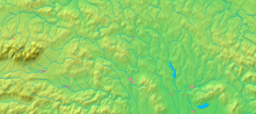
 Location in the Prešov Region
Wikimedia Commons: Poprad Statistics: MOŠ/MIS Website: http://www.poprad.sk Poprad (
 pronunciation (help·info); Hungarian: Poprád, German: Deutschendorf) is a city in northern Slovakia at the foot of the High Tatra Mountains famous for its picturesque historic centre and as a holiday resort. It is the biggest town of the Spiš region and the tenth largest city in Slovakia with a population of approximately 55,000.
The Poprad-Tatry Airport is an international airport located just outside the city. Poprad is also the starting point of the Tatra Electric Railway (known in Slovak as Tatranská elektrická železnica), a set of special narrow-gauge trains (trams) connecting the resorts in the High Tatras with each other and with Poprad. Main line trains link Poprad to other destinations in Slovakia and beyond; in particular, there are through trains running from Poprad to Prague in the Czech Republic.
Contents
History
The territory belonged to the Kingdom of Hungary since the 10th century and was probably originally inhabited by Slavic settlers. It was colonized in the 13th century by German settlers and became the largely German town Deutschendorf meaning 'German village'. From 1412 to 1770, as one of the Szepes towns, Poprad was pawned by the Kingdom of Hungary to the Kingdom of Poland, resulting in a strong Polish influence on the city's further development.
Poprad itself, the first written reference to which dates from 1256, was for 690 years (up until 1946) just one of several neighbouring settlements, which currently make up the modern city. The other parts of the current municipality are Matejovce (first reference 1251), Spišská Sobota (1256), Veľká (1268), and Stráže pod Tatrami (1276). The most significant of these original towns was Georgenberg (or Szepesszombat, now: Spišská Sobota), which preserved its dominant position in the area until the late 19th century.
In 1999, Poprad put in a bid to host the 2006 Winter Olympics, but lost to Turin, Italy.
Geography
Poprad lies at an altitude of 672 metres (2,205 ft) above sea level and covers an area of 63 square kilometres (24.3 sq mi).[1] It is located in northeastern Slovakia, about 110 kilometres (68 mi) from Košice and 330 kilometres (205 mi) from Bratislava (by road).
Poprad is situated on the Poprad River in the Sub-Tatra Basin, and is a gateway to the High Tatras. Mountain ranges around the city include the Levoča Hills in the east, Kozie chrbty in the south, and the Low Tatras in the southwest. The drainage divide between the Black Sea and Baltic Sea lies a bit to the west, near the village of Štrba.
Climate
Poprad lies in the north temperate zone and has a humid continental climate (Köppen Dfb) with four distinct seasons. It is characterized by a significant variation between warm summers and cold winters.
Climate data for Poprad Month Jan Feb Mar Apr May Jun Jul Aug Sep Oct Nov Dec Year Average high °C (°F) 0.1
(32.2)2.1
(35.8)6.5
(43.7)11.6
(52.9)17.2
(63.0)20.1
(68.2)21.9
(71.4)22.1
(71.8)17.7
(63.9)12.6
(54.7)5.0
(41.0)1.0
(33.8)11.5 Average low °C (°F) −8.4
(16.9)−7.1
(19.2)−3.3
(26.1)0.9
(33.6)5.4
(41.7)8.3
(46.9)10.0
(50.0)9.4
(48.9)6.1
(43.0)1.8
(35.2)−2.8
(27.0)−6.6
(20.1)1.1 Precipitation mm (inches) 23
(0.91)22
(0.87)27
(1.06)48
(1.89)74
(2.91)86
(3.39)73
(2.87)65
(2.56)52
(2.05)43
(1.69)36
(1.42)27
(1.06)576
(22.68)Source: World Weather[2] Demographics
Poprad has a population of 55,158 (as of December 31, 2005). According to the 2001 census, 94.1% of inhabitants were Slovaks, 2.1% Roma, 1% Czechs, 0.2% Hungarians, 0.2% Germans, 0.1% Rusyns, 0.1% Ukrainians, and 0.1% Poles.[1] The religious make-up was 65.9% Roman Catholics, 16.8% people with no religious affiliation, and 7.3% Lutherans.[1]
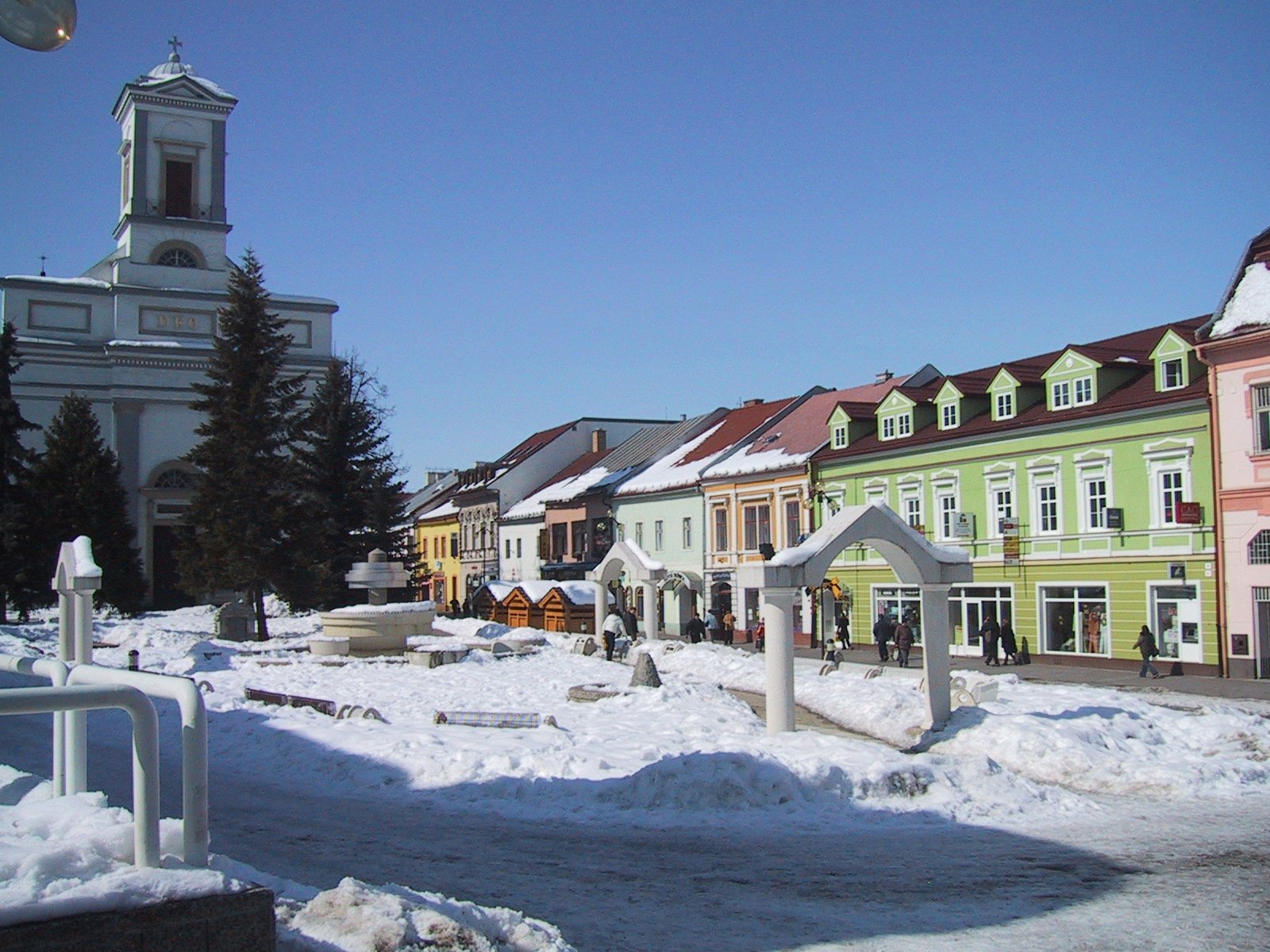
Landmarks
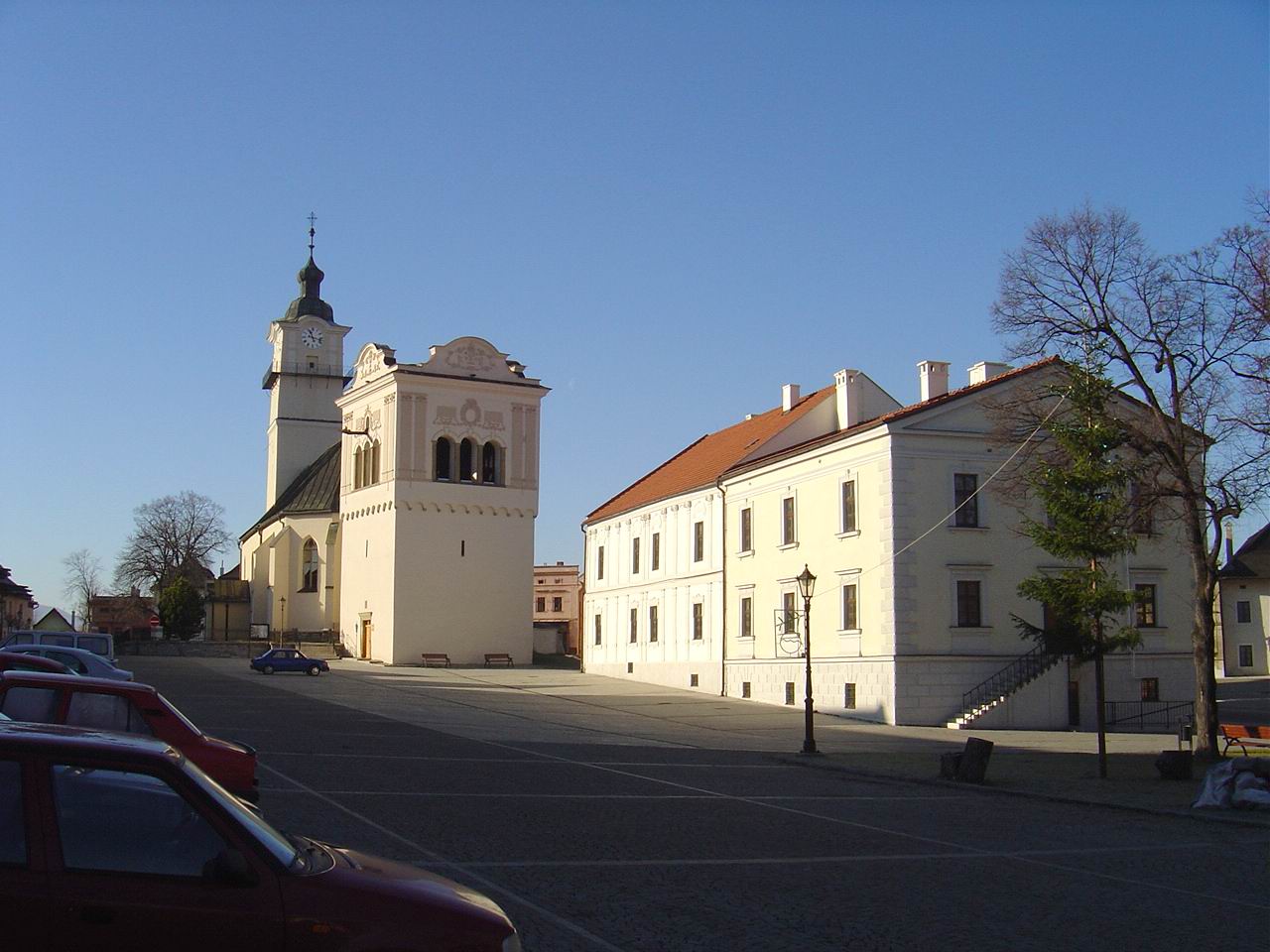
 Church in Spišská Sobota
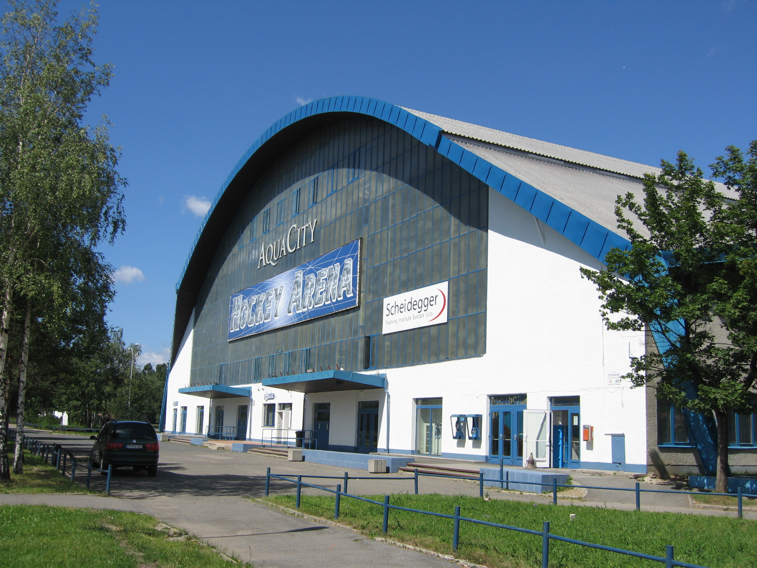
 Hockey arena of the ice hockey club HK Aquacity ŠKP Poprad
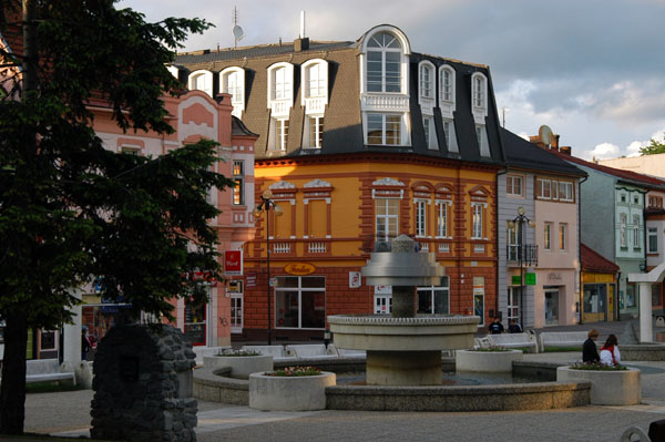
The historical centre is concentrated around the St. Egidius square (Námestie svätého Egídia), which is rimmed with houses predominantly from the 18th and 19th centuries. Churches in the city include the early-Gothic Catholic Church of St. Egidius from the late 13th century.
Another historical centre near Poprad is in Spišská Sobota, which was declared in 1953 to be a Town Monument Reserve. A significant landmark there is the Church of St. George, with five late-Gothic side altars and a main altar from the workshop of Master Paul of Levoča.
Modern places of interest include a new water park called AquaCity Poprad.
Government
Since 2003, the mayor is Anton Danko (former international ice-hockey referee).
Territorial division
The city is divided into six boroughs for the purpose of municipal administrative division:
- Staré Mesto ["Old Town"]
- Spišská Sobota
- Stráže
- Veľká
- Matejovce
- Kvetnica
Sport
Poprad has hockey clubs HK ŠKP Poprad and HC LEV Poprad, the latter competing in the KHL since 2011. There is a number of former and current hockey players in NHL who were born Poprad[citation needed].
The local basketball club is ŽBK POPRAD.
Education
The city's system of primary education consists of 12 public schools, and one religious primary school, enrolling in total 5,464 pupils.[3] Secondary education is represented by four gymnasia with 1,800 students,[4] three specialized high schools with 1,566 students,[5] and four vocational schools with 2,045 students (data as of 2007).[6]
Transport
Poprad is a gateway of the High Tatra mountain range, which is a popular tourist destination. The city lies on the main road (E 50) and railway connecting western and eastern Slovakia.
Poprad-Tatry railway station links Poprad with other major destinations on Slovakia's standard gauge rail network, and with the mountains via the metre gauge Tatra Electric Railway.
Poprad-Tatry Airport offers scheduled flights to Bratislava.
Personalities
 St. Egidius Square
- Daniela Hantuchová - professional grand slam winning tennis player (Mixed Doubles) (born April 23, 1983 in Poprad)
- Károly Alexy - sculptor born in Poprad (1823)
- Peter Bondra - famous ice hockey player, more than 500 goals in NHL
- Jan Brokoff - Baroque-era sculptor and carver (born 1652 in Spišská Sobota - died 1718 in Prague)
- Adolf Burger - author of memoirs on Operation Bernhard filmed as the Oscar-winning The Counterfeiters, grew up and trained in Poprad
- Peter Ihnačák - Ice hockey player born in 1957 in Poprad
- Leslie Kish - world-stature statistician, was born in Poprad
- Miroslav Lajčák - diplomat, born in Poprad
- Tibor Sekelj - explorer, Esperantist, writer and lawyer born in Spišská Sobota in 1912
- Lucia Kupčíkova - Slovakian basketball player
- Anton Gavel - Slovakian basketball player
Twin towns – Sister cities
 Ústí nad Orlicí, Czech Republic
 Zakopane, Poland
- Vysoké Tatry, Slovakia
 Szarvas, Hungary
 Zwijndrecht, Netherlands
 Omiš, Croatia
 Tai'an, China
External links
Photos and videos
- 360º QTVR fullscreen panoramas of the Poprad city
References
- ^ a b c "Municipal Statistics". Statistical Office of the Slovak republic. Archived from the original on 2007-04-27. http://web.archive.org/web/20070427022352/http://www.statistics.sk/mosmis/eng/run.html. Retrieved 2007-05-03.
- ^ "Weather Information for Poprad". July 2011. http://www.worldweather.org/011/c01227.htm. Retrieved January 01 2009.
- ^ "Prehľad základných škôl v školskom roku 2006/2007" (in Slovak) (PDF). Ústav informácií a prognóz školstva. 2006. http://www.uips.sk/statis/pdf/ZS_P7.PDF. Retrieved 2008-03-09.
- ^ "Prehľad gymnázií v školskom roku 2006/2007" (in Slovak) (PDF). Ústav informácií a prognóz školstva. http://www.uips.sk/statis/pdf/GYM_P7.PDF. Retrieved 2008-03-09.
- ^ "Prehľad stredných odborných škôl v školskom roku 2006/2007" (in Slovak) (PDF). Ústav informácií a prognóz školstva. http://www.uips.sk/statis/pdf/SOS_P7.PDF. Retrieved 2008-03-09.
- ^ "Prehľad združených stredných škôl v školskom roku 2006/2007" (in Slovak) (PDF). Ústav informácií a prognóz školstva. http://www.uips.sk/statis/pdf/ZSS_P7.PDF. Retrieved 2008-03-09.
Poprad · Svit · Vysoké Tatry
Batizovce · Gánovce · Gerlachov · Hozelec · Hôrka · Hranovnica · Jánovce · Kravany · Liptovská Teplička · Lučivná · Mengusovce · Mlynica · Nová Lesná · Spišská Teplica · Spišské Bystré · Spišský Štiavnik · Štôla · Štrba · Šuňava · Švábovce · Tatranská Javorina · Veľký Slavkov · Vernár · Vikartovce · Vydrník · Ždiar


Wikimedia Foundation. 2010.