- Nitra
-
- If you were looking for a chemical, see nitre or nitro.
Nitra City 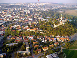
 Coat of arms
Country Slovakia Region Nitra District Nitra River Nitra River Elevation 190 m (623 ft) Coordinates 48°18′25″N 18°05′11″E / 48.30694°N 18.08639°E Highest point - elevation 587 m (1,926 ft) Lowest point - elevation 138 m (453 ft) Area 100.48 km2 (38.8 sq mi) Population 84,800 (2006-12-31) Density 844 / km2 (2,186 / sq mi) First mentioned 828 Mayor Jozef Dvonč Timezone CET (UTC+1) - summer (DST) CEST (UTC+2) Postal code 949 01 Area code +421-37 Car plate NR 

 Location in Slovakia
 Location the Nitra Region
Wikimedia Commons: Nitra Statistics: MOŠ/MIS Website: www.nitra.sk Nitra (
 pronunciation (help·info); German: Neutra ( pronunciation (help·info)); Hungarian: Nyitra / Nyitria [archaic]; Turkish: Litra) is a city in western Slovakia, situated at the foot of Zobor Mountain in the valley of the river Nitra. With a population of about 83,572, it is the fifth largest city in Slovakia.[1] Nitra is also one of the oldest cities in Slovakia and the country's earliest political and cultural center. Today, it is a seat of a kraj (Nitra Region) and an okres (Nitra District).
Contents
Origin of the name
The first mention of Nitra dates back to 880 (other variations: 826 as Nitrawa, 880 as Nitra, and in 1111, 1113 as Nitra, Nitria). The name of the city is derived from the river Nitra. The name might originate in the Germanic word Nitrahwa, meaning "flowing water".
History
Inhabited for 6,000 years,[2] Nitra has been a city of extraordinary historic importance. A large Celtic settlement was founded in the 4th century BCE in the locality Martinský vrch. Nitra is later (396 CE) mentioned in connection to the Germanic tribe of Quadi, as their possible capital.
The first Slavs arrived in the 5th century. Nitra became the capital of the Principality of Nitra, the oldest known independent state in the present-day Slovakia. The first known Christian church built by the Western or Eastern Slavs was consecrated in 828 at the seat of the ruling prince Pribina, and in the same year the town was first mentioned as Nitrawa.[3] In 833, Pribina was ousted from Nitra by the Moravian prince Mojmír I and both principalities were united into the early medieval empire of Great Moravia. The Principality of Nitra was usually given to the heir of the Great Moravian throne as an appanage. But the practice eventually threatened unity of Great Moravia. Using rich resources of Nitra, both Prince Svätopluk I and Prince Svätopluk II revolted against their formal sovereigns. The level of autonomy they enjoyed was considerable, as documented by the Papal correspondence, addressing Svätopluk I of Nitra in the same way as two contemporaneous rulers of independent countries (Rastislav of Great Moravia, and Koceľ of the Balaton Principality).
The city reached its height during the reign of Svätopluk I, who was the prince of Nitra from the 850s to 871 and then the king of Great Moravia until 894. The first known Christian bishopric in Slovakia was established in Nitra in 880 (with Wiching as the bishop) and the first monastery in Slovakia was built on the Zobor Mountain during 880–881. During Svätopluk's rule, Nitra consisted of five large fortified settlements and twenty specialized craftsmen's villages, making it a real metropolis of its times. Several churches, for example in the Nitra Castle, Párovce, Nitrianska Blatnica, Lupka, Zobor, and Kostoľany pod Tribečom existed in and around today's Nitra during the 9th and 10th centuries. Located beyond the city limits are the Great Moravian settlements of Chrenová, Lupka, Branč, Vráble and Zlaté Moravce.
After the break-up of Great Moravia in 906/907, Nitra was ruled by Üllö(Jelekh), the son of Árpád.[4] The Great Moravian appanage system was adopted by the Árpád dynasty of the newly established Kingdom of Hungary. As with much of the present-day Slovakia, Nitra was conquered by the Polish king Boleslaus I in 1003 or 1015 and stayed as part of Poland until 1018.[5] As the seat of heir of the dynasty, Nitra kept its autonomous status until 1108. Even after the abolishment of the principality, Nitra remained the capital of the Nitra county and a seat of a bishop (since 1110). The town survived the invasion of Mongols in 1241. In 1248, Béla IV gave Nitra the privileges of a free royal town. However, the privileges lasted only for 40 years and became a landlord's town. During the course of time, Nitra was controlled by Matthew Csák in the early 14th century, was affected by insurrections against Sigismund of Luxembourg and was a target of Hussite attacks in the 15th century.[6] After the Hungarian defeat at the Battle of Mohács in 1526 and subsequent Ottoman advances into the Hungarian territory, Nitra was under threat of Ottoman attacks. They failed to capture the castle three times, before they conquered it in 1663, when the city became a center of the Litra sanjak, which bounded to Uyvar eyalet. The town was reconquered in 1685.[7] The town was also affected by anti-Habsburg uprisings, from Stephen Bocskay and Gabriel Bethlen uprisings in the 17th century to the Kuruc uprisings from 1703 to 1711, and the town burned down in 1708 as a result of fights.[8] It was renovated in the 18th century in the Baroque style. As a consequence of the Revolutions of 1848, Nitra was awarded an independent self-government for the first time since 1288 and became independent from the Diocese of Nitra and its bishops.[9] Still an agricultural and handicraft town, Nitra started to industrialize. Until World War I, distillery, agricultural machines factory, brewery, dairy and other works were established. The first indirect connection to a railway was a road built in 1850 to the closest station in Trnovec nad Váhom.[10] The railway finally arrived to Nitra in 1876, when a connection from Šurany was built. Later, lines were built to Topoľčany, Hlohovec and Nové Zámky. As a part of Magyarization, from 1883 to 1919, Nitra was the seat of the Upper Hungarian Teaching Association (FEMKE), a government-sponsored association whose main goal was to apply Magyarization policies on Slovaks[11]
After World War I and disintegration of Austria-Hungary, the Czechoslovak Legions occupied the town since 10 December 1918 to secure the rule of newly established Czechoslovakia. Nitra continued to be the seat of the Nitra county, until it was dissolved in 1928. After break-up of Czechoslovakia in 1939, Nitra became a part of the First Slovak Republic and once again a seat of Nitra county until 1945. The period of the First Slovak Republic was tragic for the numerous Jewish population of Nitra, which was first victimized by the anti-Jewish law and then mostly exterminated in German concentration camps. The rest of Jews fled the city and country. The city was liberated by the Soviet Red Army in 1945, for only three years of restored democracy in Czechoslovakia. The Communist period from 1948 to 1989 was marked by oppression of Catholic church, which has traditionally strong presence in Nitra. Catholic seminaries, monasteries and other properties were nationalized and converted to museums, schools and offices. This period experienced the extensive growth, building the housing projects and annexing of formerly independent villages. After the Velvet Revolution of 1989 and dissolution of Czechoslovakia, Nitra became part of newly established Slovakia and became a seat of the Nitra Region in 1996.
Geography
Nitra lies at an altitude of 190 metres (623 ft) above sea level and covers an area of 100.48 square kilometres (38.8 sq mi).[12] It is located in the Nitra River valley in the Danubian Lowland, where the bigger part of the city is located. A smaller part is located at the southernmost reaches of the Tribeč mountains, more precisely at the foothill of the Zobor mountain (587 m). It is around half-way between Slovak capital Bratislava, 92 kilometres (57 mi) away and central Slovak city of Banská Bystrica, 118 kilometres (73 mi) away. Other towns in the surroundings include Trnava to the west (53 km), Topoľčany to the north (35 km), Levice to the east (42 km), and Nové Zámky (37 km) and Komárno (71 km) to the south. A national natural reservation called Zoborská lesostep is located within the city's boundaries.
Climate
Nitra lies in the north temperate zone and has a continental climate with four distinct seasons. It is characterized by a significant variation between hot summers and cold, snowy winters. The city is located in the warmest and driest part of Slovakia.
Climate data for Nitra Month Jan Feb Mar Apr May Jun Jul Aug Sep Oct Nov Dec Year Average high °C (°F) 2
(35)5
(41)10
(50)16
(62)22
(72)25
(77)27
(80)27
(81)21
(70)15
(60)8
(47)2
(36)15.0
(59.3)Average low °C (°F) −4
(25)−3
(27)0
(33)5
(41)10
(49)13
(55)14
(58)14
(58)10
(51)6
(43)2
(36)−3
(27)5.3
(41.9)Precipitation cm (inches) 2.78
(1.09)2.61
(1.03)2.84
(1.12)4.96
(1.95)4.80
(1.89)5.64
(2.22)6.87
(2.70)4.97
(1.96)6.51
(2.56)3.95
(1.56)4.70
(1.85)3.28
(1.29)53.91
(21.22)Source: MSN Weather[13] Demographics
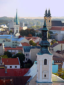 View from the south side of Nitra Castle (in focus 3 church steeples)
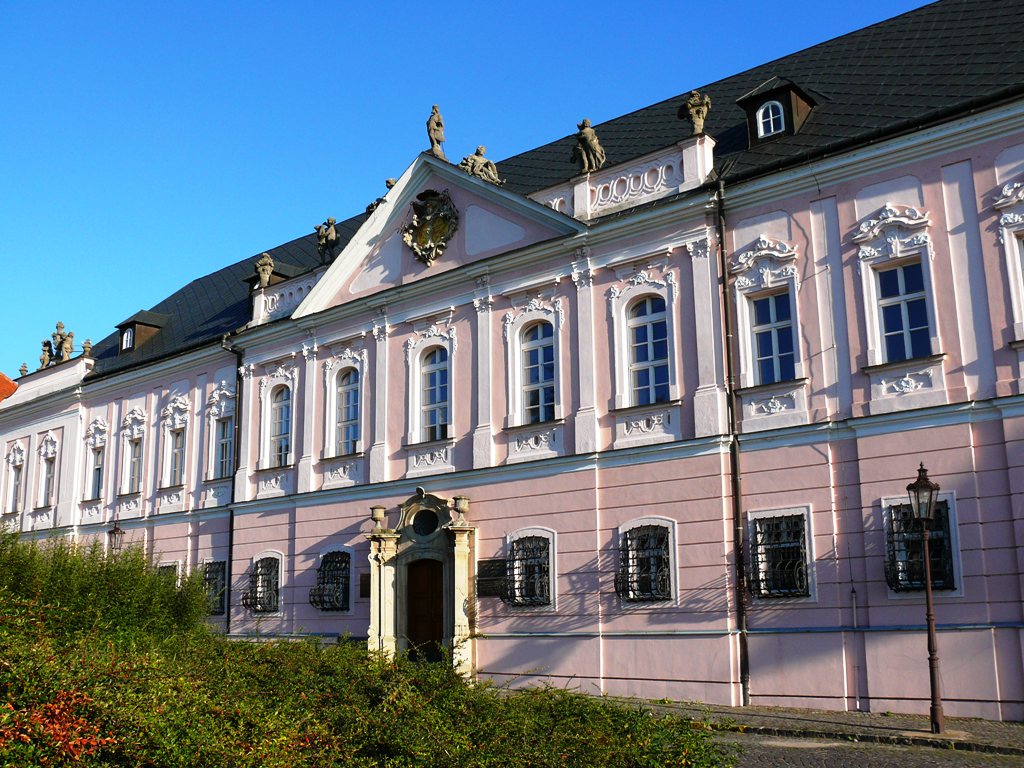
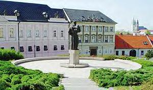
 The Grand Seminary at Pribina's Square
Nitra has a population of 85,172 (as of December 31, 2005). According to the 2001 census, 95.4% of inhabitants were Slovaks, 1.7% Hungarians, 0.9% Czechs, and 0.4% Roma. The religious make-up was 74.2% Roman Catholics, 17.2% people with no religious affiliation, and 2.8% Lutherans.[12]
The demographics changed dramatically during the 20th century; in 1910, from total population of 16 419: 9754 were Hungarians, 4929 Slovaks and 1636 Germans - Jews are hidden under these nationalities, estimated one quarter of total population. In 1940, Nitra was home to 4358 Jews.[14]
Economy
GDP per capita in 2008 for the whole Nitra region was €10,508, which was below Slovakia's average (€12,395).[15] Nitra's traditional enterprises used to be brewery, grain mill, food processing plants and other food-related industry. In the new free trade economy after 1989, and after entering European Union and Euro currency club only the wine bottling plant is left. Out of the factories started under the communist regime 1948-1989, the plastic processing plant is still doing well. However, the new business is booming. The most prevalent industries are electronics and car parts, concentrated in the new business park. The city plans to have in 2011 a balanced budget of 42 mil. €.[16]
The flight operator Aero Slovakia has its head office on the grounds of Nitra Airport.[17]
Main sights
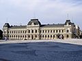
The city has the wealth of historic structures and natural beauty in the surroundings. The most notorious points of interest are the Nitra castle, the old town and the hill Zobor, overlooking the city.
Notable religious structures located in Nitra are St. Emmeram's Cathedral in Nitra castle, a Piarist church of St. Ladislaus and the adjacent monastery. The oldest church of the city is the Saint Stephen church, which was built in the 11th-12th century, while the fundamentum of the building was constructed in the 9th century. The monastery on Piaristicka street was founded in the 13th-14th century. Its dominant church of St. Ladislaus was later destroyed by a fire and remodelled in 1742-1748 in baroque style. Two towers were also added. The main altar has a beautiful statue ornamentation which the portraits of Saint Stephen and Ladislaus I of Hungary. The interior was renovated in 1940 and three modern frescos depicting themes from Slovak history of Nitra were created.
The old town (Staré Mesto) is dominated by the castle (Hrad), which is one of the most interesting ancient structures in Slovakia. Archeological findings in the past decades indicate that a large fortified castle had already stood here at the time of Samo's Empire, in the seventh century. Recent archaeological findings prove the existence of a church from the ninth century beneath the more recent Gothic St. Emmeram's Cathedral. The construction of the stone castle began during the 9th century during the reign of the Prince of Nitra Svätopluk. The castle currently serves as the seat of one of Roman Catholic bishoprics in Slovakia, which was founded in 880 as the first bishopric of western and eastern Slavs, which continued its existence since the, with the break from the 10th century until around 1110.
The Dražovce church is a remarkable example of the early Romanesque architecture.
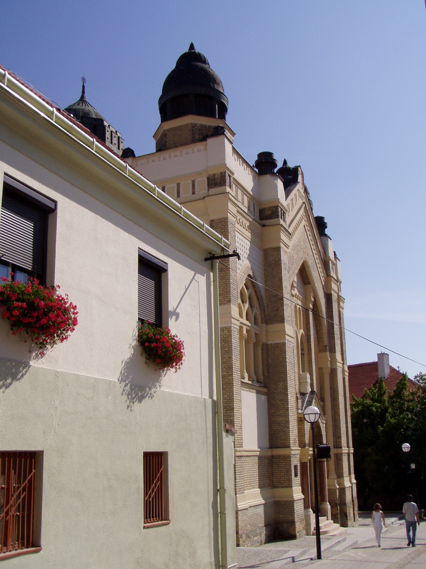
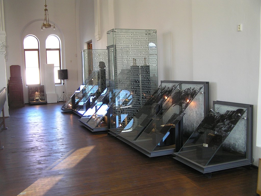
The synagogue was built in 1908-1911 for the Neolog Jewish community. It was designed by Lipót (Leopold) Baumhorn (1860–1932), the prolific Budapest-based synagogue architect. Located in a narrow lane, the building is a characteristic example of Baumhorn's style. A mélange of Moorish, Byzantine and Art Nouveau elements, it faces the street with a two-tower façade. The sanctuary is a domed hall supported by four pillars that also support the women’s gallery. After more than a decade of painstaking restoration by the municipality of Nitra, the building is now used as a center for cultural activities. The women's gallery houses "The Fate of Slovak Jews" – Slovakia's national Holocaust memorial exhibition. The synagogue serves as a permanent exhibition space for graphic works by the Nitra-born Israeli artist Shraga Weil.[18]
The most powerful medium wave transmitter of Slovakia, running on 1098 kHz, was situated in Nitra at Velke Kostolany until recently. This transmitter could broadcast throughout all of Europe at night. Since 2003, however, it has operated on lower output to save energy cost, and has transmitted regional programming only.
The Virgin Mary's mission house at the Calvary hill was built in 1765 for Spanish order of Nazarens. They were taking care of the church and pilgrims. Later, the building served as an orphanage. In 1878-85 this building was rebuilt in the Novoromanesque style and in 1925 one new floor was added to the building. The building as we know it today is a work of Slovak architect M. M. Harminec. Nowadays the whole building is mission house of The Divine Word Society.[19] The Mission museum of nations and cultures is located in this building.
Gallery
-

Nitra synagogue
-
Holocaust exposition
-
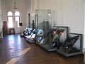
Svätopluk's Square and the Nitra Museum with a large exhibition of Great Moravian artifacts
-

Pribina's Square
Government
The city is governed by mayor (Slovak: primátor) and the city council (Slovak: mestské zastupiteľstvo). The mayor is the head of the city and its chief executive. The term of office is four years. The current mayor, Jozef Dvonč, was re-elected in 2010. He is supported by the following political parties: Smer-SD, KDH, SNS, SF and HZD. The city council is the legislative body, with 31 council members.
The city is divided into 13 urban districts (boroughs): Dolné Krškany, Horné Krškany, Staré Mesto, Čermáň, Klokočina, Diely, Párovské Háje, Kynek, Mlynárce, Zobor, Dražovce, Chrenová and Janíkovce.
Education
Nitra is the seat of two universities: University of Constantinus the Philosopher, with 13,684 students, including 446 doctoral students.[20] and of the Slovak University of Agriculture, with 10,297 students, including 430 doctoral students.[21] The city's system of primary education consists of 14 public schools and three religious primary schools, enrolling in overall 6,945 pupils.[22] Secondary education is represented by five gymnasia with 3,349 students,[23] 8 specialized high schools with 3,641 students,[24] and 5 vocational schools with 3,054 students.[25][26]
Nitra used to be the site of the Jewish school Yeshiva of Nitra, the last surviving yeshiva in occupied Europe during World War II, associated with famous rabbis Chaim Michael Dov Weissmandl and Shmuel Dovid Ungar. The yeshiva was moved to Mount Kisco, New York, USA, after the second world war, where it still exists.
Transport
Nitra is connected to Bratislava, Trnava, Žiar nad Hronom, Zvolen and Banská Bystrica by a freeway (E58). There are also first-class road connections to Topoľčany, Zlaté Moravce (labelled as "Highway of Death"),[27] Vráble and Nové Zámky.
Nitra railway station forms part of the railway line between Nové Zámky/Šurany and Prievidza, which passes through Nitra, but is not a main line. There is a railway junction a short distance north of the town, connecting the city with Leopoldov, Topoľčany and Radošina.
Nitra also has its own recreational airfield. However, the closest international airport is the Bratislava Airport.
Local public transport is based on buses with 30 lines, covering the whole city, as well as extending to the neighbouring municipalities of Lužianky, Nitrianske Hrnčiarovce, Štitáre, Ivanka pri Nitre and Branč (as of March 2008).[28] There was a chairlift leading to Zobor hill, however, it has been closed since 1994.
Arts
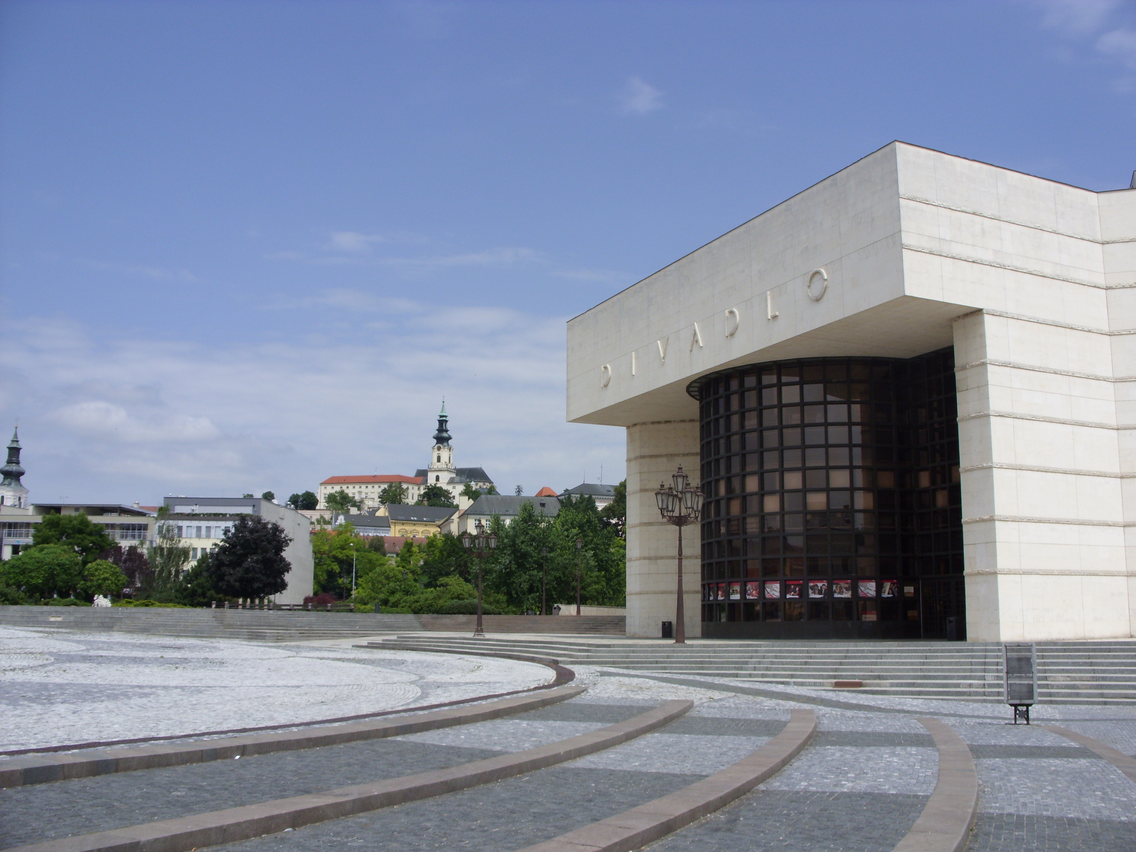
 The Andreja Bagara Theatre, with the Nitra Castle in the background
There are two theaters in Nitra: Divadlo Andreja Bagara[29] (Andrej Bagar Theatre) and Staré Divadlo Karola Spišáka[30] (Karol Spišák Old Theatre). Nitra's main arts museum is Nitrianska Galéria.[31]
Famous people
- Svatopluk I (830-894), Prince of Nitra, King of Great Moravia
- Pribina (?-861), Prince of the Nitra and Balaton principalities
- Svatopluk II (?-906), Prince of Nitra
- Koceľ (c.833-c.876), Prince of the Balaton Principality
- Saint Bystrík (?-1046), Bishop of Nitra
- Béla I of Hungary (1016–1063), Duke of Nitra, King of Hungary
- János Bottyán (1643–1709), Hungarian kuruc general
- Tamás Esze (1666–1708) Hungarian kuruc leader died here in 1708
- Imre Erdősi (1814–1890), Hungarian piarist monk and teacher
- Vilmos Fraknói (1843–1924), Hungarian historian
- Béla Bangha (1880–1940), Hungarian politician was born here
- Oszkar Grosz (1896–1968), Shipowner in England
- Juraj Kolník (1980-),professional ice hockey player
- Anton Lehmden (1929-), painter, draughtsman, and printmaker
- Branislav Mezei (1980-),professional ice hockey player
- Ľubomír Moravčík (1965-), football player
- Zita Pleštinská, maiden name Kányaiová (1961-), member of the European Parliament
- Ottokár Prohászka (1858–1927), Hungarian Roman Catholic theologian and Bishop of Székesfehérvár
- Shmuel Dovid Ungar (1886–1945) the rabbi of Nitra and dean of the Nitra Yeshiva
- Chaim Michael Dov Weissmandl (1903–1957) a rabbi who became known for his efforts to save the Jews of Slovakia during the Holocaust
- Pavol Hrušovský (1952-) Deputy Speaker of the National Council of the Slovak Republic
- Štefan Ružička (1985-), professional ice hockey player
- Miroslav Stoch (1989-), professional football (soccer player), currently signed with Fenerbahce S.K.
- Jozef Stümpel (1972-), professional ice hockey player
- Boris Valabik (1986-), professional ice hockey player
Music
Nitra is the home town of three popular slovak music bands Gladiátor, Horkýže Slíže and Desmod.
Twin Towns - Sister Cities
Nitra is twinned with:
 Kielce in Poland
 Kroměříž in Czech Republic
 Naperville in United States
 Osijek in Croatia
 Spišská Nová Ves in Slovakia
- Zielona Góra in Poland (since 1992) [32]
 Zoetermeer in Netherlands
References
Bibliography
- Lacika, Ján (2003). Nitra and its environs. Visiting Slovakia (1st ed. ed.). Bratislava, Slovakia: Dajama. ISBN 80-88975-53-0.
Notes
- ^ "The largest cities in Slovakia". world-gazeteer.com. http://world-gazetteer.com/wg.php?x=1263145063&men=gcis&lng=en&des=gamelan&geo=-194&srt=npan&col=abcdefghinoq&msz=1500&pt=c&va=x&srt=pnan.
- ^ History of Nitra from the municipal website
- ^ Lacika, "Nitra and its environs", p. 21
- ^ Július Bartl, Slovak history: chronology & lexicon, Bolchazy-Carducci Publishers, 2002, p. 23; Google Books
- ^ Makk, Ferenc (1993). Magyar külpolitika (896-1196) ("The Hungarian External Politics (896-1196)"). Szeged: Szegedi Középkorász Műhely. pp. 48–49. ISBN 963 04 2913 6.
- ^ Lacika, "Nitra and its environs", pp. 31–32
- ^ Lacika, "Nitra and its environs", pp. 33–35
- ^ Lacika, "Nitra and its environs", pp. 34–36
- ^ Lacika, "Nitra and its environs", p. 37
- ^ Lacika, "Nitra and its environs", pp. 39–40
- ^ Kislexikon online encyclopedia: Felvidéki Magyar Közművelődési Egyesülete
- ^ a b "Municipal Statistics". Statistical Office of the Slovak republic. Archived from the original on 2007-04-27. http://web.archive.org/web/20070427022352/http://www.statistics.sk/mosmis/eng/run.html. Retrieved 2007-05-03.
- ^ "Monthly Averages for Nitra, Slovakia". MSN. http://weather.msn.com/monthly_averages.aspx?&wealocations=wc%3a23446&setunit=C. Retrieved 21 January 2008.
- ^ Slovak Jewish Heritage, a NGO web page
- ^ "Hrubý domáci produkt" (in Slovak). Štatistický úrad SR. http://portal.statistics.sk/showdoc.do?docid=1804. Retrieved 2011-08-05.
- ^ "Rozpočet mesta Nitry na rok 2011" (in Slovak) (pdf). Mestský úrad Nitra. http://www.msunitra.sk/rozpocet-mesta-na-rok-2011.phtml?id3=58868. Retrieved 2011-08-05.
- ^ "About." Aero Slovakia. Retrieved on 3 March 2010.
- ^ Slovak Jewish Heritage, an NGO web page
- ^ http://www.svd.sk/index.html
- ^ "Univerzita Konštantína Filozofa" (in Slovak) (PDF). Ústav informácií a prognóz školstva. http://www.uips.sk/statis/pdf/VS_P17.PDF. Retrieved 2008-02-21.
- ^ "Slovenská poľnohospodárska univerzita" (in Slovak) (PDF). Ústav informácií a prognóz školstva. http://www.uips.sk/statis/pdf/VS_P41.PDF. Retrieved 2008-02-21.
- ^ "Prehľad základných škôl v školskom roku 2006/2007" (in Slovak). Ústav informácií a prognóz školstva. 2006. http://www.uips.sk/statis/pdf/ZS_P4.PDF. Retrieved 2008-02-21.
- ^ "Prehľad gymnázií v školskom roku 2006/2007" (in Slovak) (PDF). Ústav informácií a prognóz školstva. http://www.uips.sk/statis/pdf/GYM_P4.PDF. Retrieved 2008-02-21.
- ^ "Prehľad stredných odborných škôl v školskom roku 2006/2007" (in Slovak) (PDF). Ústav informácií a prognóz školstva. http://www.uips.sk/statis/pdf/SOS_P4.PDF. Retrieved 2008-02-21.
- ^ "Prehľad združených stredných škôl v školskom roku 2006/2007" (in Slovak) (PDF). Ústav informácií a prognóz školstva. http://www.uips.sk/statis/pdf/ZSS_P4.PDF. Retrieved 2008-02-21.
- ^ "Prehľad stredných odborných učilíšť a učilíšť v školskom roku 2006/2007" (in Slovak) (PDF). Ústav informácií a prognóz školstva. http://www.uips.sk/statis/pdf/SOU_P4.PDF. Retrieved 2008-02-21.
- ^ "Nitra: Under the giant’s shoulders". Spectacular Slovakia. 2007. http://travel.spectator.sk/ss2006/03_nitra.html. Retrieved 2008-03-24.
- ^ "Public transport in Nitra". imhd.sk. 2008. http://www.imhd.sk/nr/index.php?w=f230212d372f2833ef3930212dea&m=262927eef0f1f3f0f8f0f0f2ef34252933. Retrieved 2008-03-24.
- ^ dab.sk
- ^ staredivadlo.sk
- ^ nitrianskagaleria.sk
- ^ "Zielona Góra - Partner Cities". © 2008 Urzędu Miasta Zielona Góra.. http://www.zielona-gora.pl/umzg/index.php?id=1111&lng=pl. Retrieved 2008-12-07.[dead link]
External links
- Nitra.sk – Official Website
- Panoramic photo gallery of Nitra
- Historical photos of Nitra
- Development news, photos, shopping centers
- Virtual tour of Nitra castle
- OPENCities
- Map of Nitra
Nitra · Vráble
Alekšince · Báb · Babindol · Bádice · Branč · Cabaj-Čápor · Čab · Čakajovce · Čechynce · Čeľadice · Čifáre · Dolné Lefantovce · Dolné Obdokovce · Golianovo · Horné Lefantovce · Hosťová · Hruboňovo · Ivanka pri Nitre · Jarok · Jelenec · Jelšovce · Kapince · Klasov · Kolíňany · Lehota · Lúčnica nad Žitavou · Lukáčovce · Lužianky · Ľudovítová · Malé Chyndice · Malé Zálužie · Malý Cetín · Malý Lapáš · Melek · Mojmírovce · Nitrianske Hrnčiarovce · Nová Ves nad Žitavou · Nové Sady · Paňa · Podhorany · Pohranice · Poľný Kesov · Rišňovce · Rumanová · Svätoplukovo · Štefanovičová · Štitáre · Šurianky · Tajná · Telince · Veľká Dolina · Veľké Chyndice · Veľké Zálužie · Veľký Cetín · Veľký Lapáš · Vinodol · Výčapy-Opatovce · Zbehy · Žirany · Žitavce
 Categories:
- Nitra
- Cities and towns in Slovakia
- Great Moravia


Wikimedia Foundation. 2010.