- Gheorgheni
-
This article is about city of Gheorgheni. For the district of Cluj-Napoca, see Gheorgheni, Cluj-Napoca. For the village of Gheorghieni in Cluj County, see Feleacu.
Gheorgheni
Gyergyószentmiklós— Municipality — 
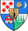
Coat of armsLocation of Gheorgheni
Coordinates: 46°43′12″N 25°35′24″E / 46.72°N 25.59°ECoordinates: 46°43′12″N 25°35′24″E / 46.72°N 25.59°E Country  Romania
County Harghita County Status Municipality Government – Mayor János Mezei (Hungarian Civic Party) Area – Total 222 km2 (85.7 sq mi) Population (2002) – Total 20,018 Ethnicity – Hungarians 87.54% – Romanians 10.79% Time zone EET (UTC+2) – Summer (DST) EEST (UTC+3) Website http://www.gheorgheni.ro Gheorgheni (Romanian pronunciation: [ɡe̯orˈɡenʲ]; Hungarian: Gyergyószentmiklós, Hungarian pronunciation: [’ɟɛrɟoːsɛntmikloːʃ]) is a city in Harghita County, Romania. It lies in the Székely Land, an ethno-cultural region in eastern Transylvania. The city administers four villages:
- Covacipeter / Kovácspéter
- Lacu Roşu / Gyilkostó
- Vargatac / Vargatag
- Visafolio / Visszafolyó
Nearby are two spectacular natural sites, the beautiful mountain lake Red Lake and Cheile Bicazului, a dramatic narrow canyon through the Eastern Carpathian Mountains forming the border with Neamţ County.
Contents
History
The city historically formed part of the Székely Land region of Transylvania province. It was first mentioned in 1332. It belonged to the Kingdom of Hungary, to the Principality of Transylvania (1557–1765) and the Grand Duchy of Transylvania (1765–1867). Between 1867–1918 it fell within the Kingdom of Hungary. Administratively, the town belonged to Gyergyószék, then, from 1876 until 1918 to the Csík County in the Austria-Hungary. After WWI, by the terms of the Treaty of Trianon of 1920, it became part of Romania and fall within Ciuc County. As a result of the Second Vienna Award, it belonged to Hungary again between 1940 and 1944. After WWII, it came under Romanian administration and became part of Romania in 1947. Between 1952 and 1960, it formed part of the Hungarian Autonomous Province, then, of the Mureş-Hungarian Autonomous Province until it was abolished in 1968. Since then, the commune is part of Harghita County.
Demographics
The city has a population of 20,018, of which 87.54% (17,524) are Székely Hungarians forming a majority. 2,161 or 10.8% are Romanians.[1] Demographic movement according to the censuses:

Twinnings
 Békés, Hungary
 Budapest 17th District, Hungary
 Cegléd, Hungary
 Eger, Hungary
 Kiskunmajsa, Hungary
 Siófok, Hungary
 Szigetszentmiklós, Hungary
 Bačka Topola, Serbia
References
Harghita County, Romania Cities Miercurea-Ciuc (county seat) · Gheorgheni · Italic text Odorheiu Secuiesc · Topliţa

Towns Băile Tuşnad · Bălan · Borsec · Cristuru Secuiesc · Vlăhiţa
Communes Atid · Avrămeşti · Bilbor · Brădeşti · Căpâlniţa · Cârţa · Ciceu · Ciucsângeorgiu · Ciumani · Corbu · Corund · Cozmeni · Dăneşti · Dârjiu · Dealu · Ditrău · Feliceni · Frumoasa · Gălăuţaş · Joseni · Lăzarea · Leliceni · Lueta · Lunca de Jos · Lunca de Sus · Lupeni · Mădăraş · Mărtiniş · Mereşti · Mihăileni · Mugeni · Ocland · Păuleni-Ciuc · Plăieşii de Jos · Porumbeni · Praid · Racu · Remetea · Săcel · Sâncrăieni · Sândominic · Sânmartin · Sânsimion · Sântimbru · Sărmaş · Satu Mare · Secuieni · Siculeni · Şimoneşti · Subcetate · Suseni · Tomeşti · Tulgheş · Tuşnad · Ulieş · Vărşag · Voşlăbeni · Zetea
Categories:- Populated places in Harghita County
- Cities in Romania
- Székely communities
Wikimedia Foundation. 2010.


