- Ditrău
-
Ditrău
Ditró— Commune — 
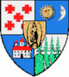
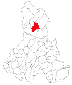
Coat of armsLocation of Ditrău Location of Ditrău Coordinates: 46°49′0″N 25°31′0″E / 46.816667°N 25.516667°ECoordinates: 46°49′0″N 25°31′0″E / 46.816667°N 25.516667°E Country  Romania
County Harghita County Status Commune Government – Mayor Ferenc Bardócz (Independent) Area – Total 114.99 km2 (44.4 sq mi) Population (2002) – Total 5,944 – Density 51.69/km2 (133.9/sq mi) Time zone EET (UTC+2) – Summer (DST) EEST (UTC+3) Postal Code 537090 Area code(s) +40 266 Ditrău (Hungarian: Ditró or Gyergyóditró, Hungarian pronunciation: [’ɟɛrɟoːditró]) is a commune in Harghita County, Romania. The commune lies in the Székely Land, an ethno-cultural region in eastern Transylvania, and is composed of three villages:
- Ditrău / Ditró
- Jolotca / Orotva
- Ţengheler / Csengellér or Cengellér
It sits near Martonca River, above 714 m from the sea level. The highest point of Ditrău is the Piricske height. Ditrău was first registered in 1567, as Gitró, with 26 gates. There is a significant syenite reserve near the village.
Contents
History
The villages belonged first to the Székely seat of Gyergyószék, which was subsequently absorbed into Csíkszék, until the administrative reform of Transylvania in 1876, when they fell within the Csík County in the Kingdom of Hungary. After the Treaty of Trianon of 1920, they became part of Romania and fell within Ciuc County during the interwar period. In 1940, the second Vienna Award granted the Northern Transylvania to Hungary and the villages were held by Hungary until 1944. After Soviet occupation, the Romanian administration returned and the commune became officially part of Romania in 1947. Between 1952 and 1960, the commune fell within the Hungarian Autonomous Province, between 1960 and 1968 the Mureş-Hungarian Autonomous Province. In 1968, the province was abolished, and since then, the commune has been part of Harghita County
Demographics
The commune has an absolute Székely (Hungarian) majority. According to the 2002 census it has a population of 5,944 of which 99.04% or 5,887 are Hungarian.[1]
Tourist attractions
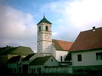
- "Szent Katalin Church", built in 1653.
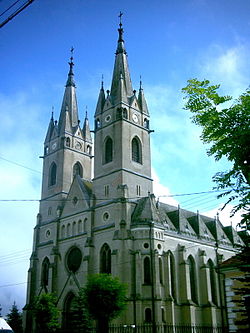
- Near "Szent Katalin Church" there is a 75m high church built between 1908 and 1913, which is known locally as the "big" church. This is the second highest church in this region. Its construction cost 8000 Hungarian koronas.
Natives
- Tivadar Puskás (born 1844)
- Lőrinc Siklódi (born 1876)
- Aladár Vendl (born 1886)
- Andor Csiby (born 1888)
- Mária Vendl (born 1890)
- Márton Tarisznyás (born 1927)
Twinnings
References
- ^ "Etnikai statisztikák" (in Hungarian). Árpád E. Varga. http://varga.adatbank.transindex.ro/?pg=3&action=etnik&id=2125. Retrieved 2010-05-12.
Harghita County, Romania Cities Miercurea-Ciuc (county seat) · Gheorgheni · Italic text Odorheiu Secuiesc · Topliţa

Towns Băile Tuşnad · Bălan · Borsec · Cristuru Secuiesc · Vlăhiţa
Communes Atid · Avrămeşti · Bilbor · Brădeşti · Căpâlniţa · Cârţa · Ciceu · Ciucsângeorgiu · Ciumani · Corbu · Corund · Cozmeni · Dăneşti · Dârjiu · Dealu · Ditrău · Feliceni · Frumoasa · Gălăuţaş · Joseni · Lăzarea · Leliceni · Lueta · Lunca de Jos · Lunca de Sus · Lupeni · Mădăraş · Mărtiniş · Mereşti · Mihăileni · Mugeni · Ocland · Păuleni-Ciuc · Plăieşii de Jos · Porumbeni · Praid · Racu · Remetea · Săcel · Sâncrăieni · Sândominic · Sânmartin · Sânsimion · Sântimbru · Sărmaş · Satu Mare · Secuieni · Siculeni · Şimoneşti · Subcetate · Suseni · Tomeşti · Tulgheş · Tuşnad · Ulieş · Vărşag · Voşlăbeni · Zetea
Categories:- Communes in Harghita County
- Székely communities
Wikimedia Foundation. 2010.


