- Porumbeni, Harghita
-
Porumbeni
Nagygalambfalva— Commune — Location of Porumbeni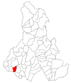
Coordinates: 46°16′0″N 25°45′8″E / 46.266667°N 25.75222°ECoordinates: 46°16′0″N 25°45′8″E / 46.266667°N 25.75222°E Country  Romania
County Harghita County Status Commune Government – Mayor Levente Gyerkó (Democratic Union of Hungarians in Romania) Area – Total 40.87 km2 (15.8 sq mi) Population (2002) – Total 1,771 – Density 41.86/km2 (108.4/sq mi) Time zone EET (UTC+2) – Summer (DST) EEST (UTC+3) Website Primaria Porumbeni Porumbenii Mari (Hungarian: Nagygalambfalva, Hungarian pronunciation: ['nɒɟɡɒlɒnbfɒlvɒ]) is a commune in Harghita County, Romania. It lies in the Székely Land, an ethno-cultural region in eastern Transylvania, and is composed of two villages: Porumbenii Mari (the commune center; Nagygalambfalva) and Porumbenii Mici (Kisgalambfalva).
Porumbenii Mari is generally referred to as Galambfalva in Hungarian and was originally called Golumba Mare in Romanian.
Demographics
Formerly part of Mugeni commune, the two villages broke off in 2004 with a population of 1,771. The commune has an absolute Székely Hungarian majority. (For ethnic composition check demographics for Mugeni).
History
Porumbenii Mari Commune has attracted interest from archaeologists, who have uncovered numerous material proofs of human settlement in the area beginning in prehistory. Dacian pottery and ceramic fragments from the Bronze Age, the Age of Migrations, and the Middle Ages have been discovered in sites along the Áj and Nagy brooks. The archaeological record proves a settlement existed during the period of the Árpáds, but the current settlement was documented only in 1332.
The villages belonged first to the Székely seat of Udvarhelyszék, then, from 1876 until 1918, to Udvarhely County in the Kingdom of Hungary. After WWI, by the terms of the Treaty of Trianon of 1920, it became part of Romania. As a result of the Second Vienna Award, it belonged to Hungary again between 1940 and 1944. After WWII, it came under Romanian administration and became part of Romania in 1947. Between 1952 and 1960, it formed part of the Hungarian Autonomous Province, then, of the Mureş-Hungarian Autonomous Province until it was abolished in 1968. Since then, the commune has been part of Harghita County. Its economy is based on agriculture and animal husbandry, with small sectors in milling flour, baking bread, and other commercial activities.
The medieval church, today used by the village's Hungarian Reformed community, first appeared in the papal annals of 1332-1337. An originally Gothic structure with elements from subsequent periods, the church's medieval features were largely destroyed during the reconstruction of the building in the eighteenth and nineteenth centuries.
References
Harghita County, Romania Cities Miercurea-Ciuc (county seat) · Gheorgheni · Italic text Odorheiu Secuiesc · Topliţa

Towns Băile Tuşnad · Bălan · Borsec · Cristuru Secuiesc · Vlăhiţa
Communes Atid · Avrămeşti · Bilbor · Brădeşti · Căpâlniţa · Cârţa · Ciceu · Ciucsângeorgiu · Ciumani · Corbu · Corund · Cozmeni · Dăneşti · Dârjiu · Dealu · Ditrău · Feliceni · Frumoasa · Gălăuţaş · Joseni · Lăzarea · Leliceni · Lueta · Lunca de Jos · Lunca de Sus · Lupeni · Mădăraş · Mărtiniş · Mereşti · Mihăileni · Mugeni · Ocland · Păuleni-Ciuc · Plăieşii de Jos · Porumbeni · Praid · Racu · Remetea · Săcel · Sâncrăieni · Sândominic · Sânmartin · Sânsimion · Sântimbru · Sărmaş · Satu Mare · Secuieni · Siculeni · Şimoneşti · Subcetate · Suseni · Tomeşti · Tulgheş · Tuşnad · Ulieş · Vărşag · Voşlăbeni · Zetea
Categories:- Communes in Harghita County
- Székely communities


Wikimedia Foundation. 2010.