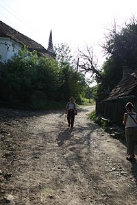
- Feliceni
-
Feliceni
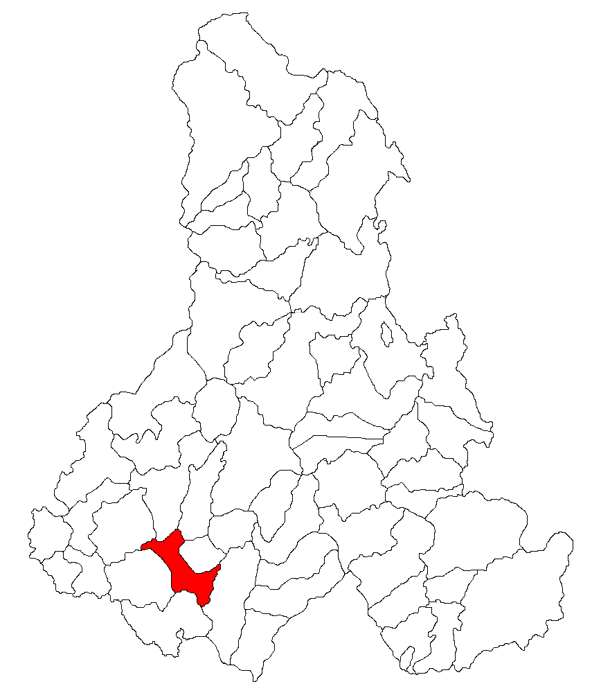
Felsőboldogfalva— Commune — 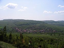 Location of the commune
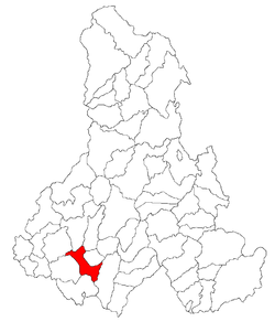 Location of the commune
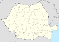
 Feliceni
FelsőboldogfalvaCoordinates: 46°16′0″N 25°16′0″E / 46.266667°N 25.266667°ECoordinates: 46°16′0″N 25°16′0″E / 46.266667°N 25.266667°E Country  Romania
County Harghita County Status Commune Government - Mayor József Sándor (Democratic Union of Hungarians in Romania) Area - Total 78.91 km2 (30.5 sq mi) Elevation 601 m (1,972 ft) Population (2002) - Total 3,026 - Density 38.37/km2 (99.4/sq mi) Ethnicity (2002) - Hungarians 99.31% - Romanians 0.69% Time zone EET (UTC+2) - Summer (DST) EEST (UTC+3) Postal Code 537297 Area code(s) +40 266 Website www.felsoboldogfalva.ro Feliceni (Hungarian: Felsőboldogfalva, Hungarian pronunciation: [ˈfɛlʃøːboldoɡfɒlvɒ], meaning "Upper Village of the Blessed", referring to the Virgin Mary) is a commune in Harghita County, Romania, in the vicinity of Odorheiu Secuiesc. It forms part of the Székely Land, an ethno-cultural region in eastern Transylvania.
Contents
Component villages
The commune is composed of eleven villages:
In Romanian In Hungarian Alexandriţa Sándortelke Arvăţeni Árvátfalva Cireşeni Sükő Feliceni Felsőboldogfalva Forţeni Farcád Hoghia Hodgya Oţeni Ocfalva Poloniţa Székelylengyelfalva Tăureni Bikafalva Teleac Telekfalva Văleni Patakfalva History
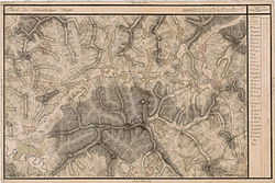 The region on an 18th century map
The villages of the commune historically belonged to the Székely seat of Udvarhelyszék, then, from 1876 until 1918, to Udvarhely County in the Kingdom of Hungary. After WWI, by the terms of the Treaty of Trianon of 1920, they became part of Romania.
As a result of the Second Vienna Award, the region belonged again to Hungary between 1940 and 1944. After WWII, it came under Romanian administration and became part of Romania in 1947. Between 1952 and 1960, the villages formed part of the Hungarian Autonomous Province, then, of the Mureş-Hungarian Autonomous Province until it was abolished in 1968. Since then, the commune has been part of Harghita County.
Demographics
The commune has an absolute Székely (Hungarian) majority. According to the 2002 census it has a population of 3,026 of which 99.31% or 3,005 are Hungarian[1]
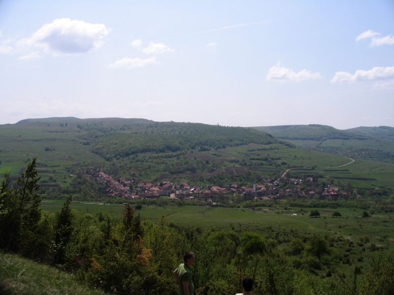
Poloniţa
Poloniţa (Hungarian: Székelylengyelfalva, or colloquially Lengyelfalva, Hungarian pronunciation: [seːkɛjlɛnɟɛlfɒlvɒ], meaning "Poles' village") is located along the Poloniţa (Lengyelfalvi) Creek in a narrow valley. It had 319 inhabitants in 2002 (down from 503 in 1910), of whom 315 were Hungarians.
The village was first mentioned in 1505 as Lengenfalwa when a certain Balthasar was elected "seat judge" at Udvarhely. In 1533, the name was recorded as Lengyelfalva. In 1899, the ethnonym Székely was added to the Hungarian placename in order to distinguish the locality from another Lengyelfalva (now: Košická Polianka) of the historical Kingdom of Hungary. The Romanian name derives from the Hungarian one and was originally used as Lenghelfalău which was later Romanianized by translation.[2]
Its Roman Catholic church was built in 1802 replacing the medieval church.
External links
References
- ^ Official census 2002
- ^ János András Vistai. "Tekintő – Erdélyi Helynévkönyv".Transylvanian Toponym Book 2nd volume at Lengyelfalva
 Alexandriţa
Harghita County, Romania Cities Miercurea-Ciuc (county seat) · Gheorgheni · Italic text Odorheiu Secuiesc · Topliţa
Towns Băile Tuşnad · Bălan · Borsec · Cristuru Secuiesc · Vlăhiţa
Communes Atid · Avrămeşti · Bilbor · Brădeşti · Căpâlniţa · Cârţa · Ciceu · Ciucsângeorgiu · Ciumani · Corbu · Corund · Cozmeni · Dăneşti · Dârjiu · Dealu · Ditrău · Feliceni · Frumoasa · Gălăuţaş · Joseni · Lăzarea · Leliceni · Lueta · Lunca de Jos · Lunca de Sus · Lupeni · Mădăraş · Mărtiniş · Mereşti · Mihăileni · Mugeni · Ocland · Păuleni-Ciuc · Plăieşii de Jos · Porumbeni · Praid · Racu · Remetea · Săcel · Sâncrăieni · Sândominic · Sânmartin · Sânsimion · Sântimbru · Sărmaş · Satu Mare · Secuieni · Siculeni · Şimoneşti · Subcetate · Suseni · Tomeşti · Tulgheş · Tuşnad · Ulieş · Vărşag · Voşlăbeni · Zetea
Categories:- Communes in Harghita County
- Székely communities

Wikimedia Foundation. 2010.