- Counties of Romania
-
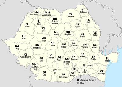 The 41 counties of Romania and Municipality of Bucharest (clickable imagemap)
A total of 41 judeţe and the municipality of Bucharest comprise the official administrative divisions of Romania. Judeţ translates into English as jurisdiction, but is commonly translated loosely as county (which is actually "comitat" in Romanian from "comte" meaning "count"). They represent the country's NUTS-3 (Nomenclature of Territorial Units for Statistics – Level 3) statistical subdivisions within the European Union and each of them serves as the local level of government within its borders. Most counties are named after a major river, while some are named after notable cities within them, such as the county seat.
The earliest organization into judeţe of the Principalities of Wallachia and Moldavia (where they were termed ţinuturi) dates back to at least the late 14th century. For most of the time since modern Romania was formed in 1859, the administrative division system has been similar to the French departments one. The system was changed several times since then, and the number of counties varied over time, from the 71 judeţe that existed before World War II to only 39 after 1968. The current format has largely been in place since 1968 as only small changes have been made since then, the last of which was in 1997.
According to 2006 data from the Romanian National Institute of Statistics, the average population of Romania's 41 counties is about 479,300, with Iaşi County as the most populous (825,000) and Covasna County (223,000) the least. The average county's land area is 5,809 square kilometres (2,243 sq mi), with Timiş County (8,697 square kilometres (3,358 sq mi)) the largest and Ilfov County (1,583 square kilometres (611 sq mi)) the smallest. The Municipality of Bucharest is both more populous and much smaller than any county, with 1,931,200 people and 228 square kilometres (88 sq mi).
Contents
History
 The 71 counties of Romania between 1925 and World War II
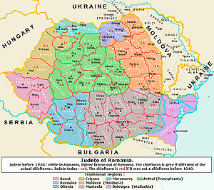 Current counties imposed over the inter-war countiesMain article: Historical counties of Romania
The earliest organization into judeţe (for Wallachia), and ţinuturi (for Moldavia), dates back at least to the late 14th century.[note 1][1][2][3] Inspired from the organization of the late Byzantine Empire, each judeţ was ruled by a jude (or pârcălab for a ţinut), a person officially appointed with administrative and judicial functions.[3][4] Transylvania was divided into royal counties headed by comes (royal counts) with administrative and judicial functions.[3]
After modern Romania was formed in 1859 through the union of Wallachia and the rump of Moldavia, the administrative division was modernized using the French administrative system as a model, with judeţ as the basic administrative unit.[5][6] Aside from the 1950–1968 period, this system has remained in place until today. Since 1864, for each judeţ there exists a prefect, a subordinate of the Ministry of Internal Affairs and representative of the government inside the county; he is also the head of local administration for areas not delegated to local authorities.[5][6] Until 1948, each judeţ was further divided into several plăşi, each administered by a pretor.[7]
After the adoption of a new Constitution in 1923, the traditional local administrative systems of the newly acquired regions of Transylvania, Bukovina and Bessarabia were made uniform in 1925 with that of the Romanian Old Kingdom. County borders were kept largely intact, with few adjustments, and the total number of counties was raised to 71; this lasted until the beginning of World War II.[6] In 1938, King Carol II modified the law on the administration of the Romanian territory according to the fascist model.[8] Ten ţinuturi (approx. translation "lands") were created, ruled by Rezidenţi Regali (Royal Residents), appointed directly by the Monarch. The ţinuturi represented another layer of administration between counties and the country, as the county borders were not erased.[5][9] Due to the territorial changes during World War II, this style of administration did not last, and the administration at the judeţ level was reintroduced after the war.[5] Between 1941–1944, Romania administered the territory between the Dniester and Southern Bug rivers known as Transnistria, which consisted of 13 separate counties.[10]
After taking over the administration of the country in 1945, the Communist Party changed the administrative model to that of the Soviet Union (regions and raions) in 1950, but changed it back in 1968.[11] Nevertheless, the county borders set then were quite different from those present during the interbellum, as only 39 counties were formed from the 56 remaining after the war.[12] In 1981, Giurgiu and Călăraşi were split from Ialomiţa and the former county of Ilfov,[12] while in 1997, Ilfov County, which had been a dependency of the Municipality of Bucharest for nearly two decades, was reinstated.[13][14] The county borders set in 1968 are still largely in place today, but the functions of different authorities have changed due to administrative reforms in the 1990s.[5][6]
At present, Romania is divided into 41 counties and one municipality (Bucharest); these are assigned as the NUTS-3 geocode statistical subdivision scheme of Romania within the European Union.[15] Each of the counties is further divided into cities (some of which have municipality status) and communes. The prefect and his administration have executive prerogatives within the county limits, while limited legislative powers are assigned to a County Council elected every four years during local elections.[16] The territorial districts of the Romanian judicial system overlap with county borders, thus avoiding further complication in the separation of powers on the government.[5]
Current list
County County seat Name origin
[note 2]Development
regionISO code
[note 3]Postal code
[note 4][17]Area code
[note 5][18]NUTS code
[note 6][19]Population
(2007)[20]Area
[21]Map Alba

Alba Iulia

Alba River Center AB 51 58 RO121 376,086 6,242 km2 (2,410 sq mi) 
Arad

Arad

county seat West AR 31 57 RO421 457,713 7,754 km2 (2,994 sq mi) 
Argeș

Piteşti

Argeş River South-Muntenia AG 11 48 RO311 644,236 6,862 km2 (2,649 sq mi) 
Bacău

Bacău

county seat North-East BC 60 34 RO211 719,844 6,621 km2 (2,556 sq mi) 
Bihor

Oradea

Biharia commune North-West BH 41 59 RO111 594,131 7,544 km2 (2,913 sq mi) 
Bistrița-Năsăud

Bistriţa

Bistriţa River and Năsăud city North-West BN 42 63 RO112 316,689 5,355 km2 (2,068 sq mi) 
Botoșani

Botoşani

county seat North-East BT 71 31 RO212 454,167 4,986 km2 (1,925 sq mi) 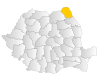
Brașov

Braşov

county seat Center BV 50 68 RO122 593,928 5,363 km2 (2,071 sq mi) 
Brăila

Brăila

county seat South-East BR 81 39 RO221 365,628 4,766 km2 (1,840 sq mi) 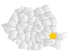
București

(Municipality of Bucharest)
[note 7]last name Bucur[22] Bucharest-Ilfov B 01–06
[note 8]1x
[note 9]RO321 1,931,838 228 km2 (88 sq mi) 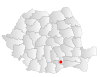
Buzău

Buzău

Buzău River South-East BZ 12 38 RO222 488,763 6,103 km2 (2,356 sq mi) 
Caraș-Severin

Reşiţa

defunct Caraş and Severin Counties West CS 32 55 RO422 327,579 8,514 km2 (3,287 sq mi) 
Călărași

Călăraşi

county seat South-Muntenia CL 91 42 RO312 315,187 5,088 km2 (1,964 sq mi) 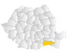
Cluj

Cluj-Napoca

county seat North-West CJ 40 64 RO113 692,316 6,674 km2 (2,577 sq mi) 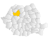
Constanța

Constanţa

county seat South-East CT 90 41 RO223 718,330 7,071 km2 (2,730 sq mi) 
Covasna

Sfântu Gheorghe

Covasna River Center CV 52 67 RO123 223,364 3,710 km2 (1,430 sq mi) 
Dâmbovița

Târgovişte

Dâmboviţa River South-Muntenia DB 13 45 RO313 533,330 4,054 km2 (1,565 sq mi) 
Dolj

Craiova

Jiu River[note 10] South-West Oltenia DJ 20 51 RO411 712,187 7,414 km2 (2,863 sq mi) 
Galați

Galaţi

county seat South-East GL 80 36 RO224 614,449 4,466 km2 (1,724 sq mi) 
Giurgiu

Giurgiu

county seat South-Muntenia GR 08 46 RO314 283,408 3,526 km2 (1,361 sq mi) 
Gorj

Târgu Jiu

Jiu River[note 11] South-West Oltenia GJ 21 53 RO412 381,643 5,602 km2 (2,163 sq mi) 
Harghita

Miercurea-Ciuc

Harghita Mountains Center HR 53 66 RO124 325,611 6,639 km2 (2,563 sq mi) 
Hunedoara

Deva

Hunedoara city West HD 33 54 RO423 472,284 7,063 km2 (2,727 sq mi) 
Ialomița

Slobozia

Ialomiţa River South-Muntenia IL 92 43 RO315 290,563 4,453 km2 (1,719 sq mi) 
Iași

Iaşi

county seat North-East IS 70 32 RO213 825,100 5,476 km2 (2,114 sq mi) 
Ilfov

Buftea

Ilfov River Bucharest-Ilfov IF 07 1x
[note 9]RO322 294,094 1,583 km2 (611 sq mi) 
Maramureș

Baia Mare

Maramureş historical region North-West MM 43 62 RO114 513,000 6,304 km2 (2,434 sq mi) 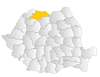
Mehedinți

Drobeta-Turnu Severin

Mehadia commune South-West Oltenia MH 22 52 RO413 298,741 4,933 km2 (1,905 sq mi) 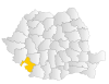
Mureș

Târgu Mureş

Mureş River Center MS 54 65 RO125 581,759 6,714 km2 (2,592 sq mi) 
Neamț

Piatra Neamţ

Neamţ River North-East NT 61 33 RO214 566,059 5,896 km2 (2,276 sq mi) 
Olt

Slatina

Olt River South-West Oltenia OT 23 49 RO414 475,702 5,498 km2 (2,123 sq mi) 
Prahova

Ploieşti

Prahova River South-Muntenia PH 10 44 RO316 821,013 4,716 km2 (1,821 sq mi) 
Satu Mare

Satu Mare

county seat North-West SM 44 61 RO115 366,270 4,418 km2 (1,706 sq mi) 
Sălaj

Zalău

Sălaj River North-West SJ 45 60 RO116 243,157 3,864 km2 (1,492 sq mi) 
Sibiu

Sibiu

county seat Center SB 55 69 RO126 423,156 5,432 km2 (2,097 sq mi) 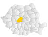
Suceava

Suceava

Suceava River North-East SV 72 30 RO215 705,878 8,553 km2 (3,302 sq mi) 
Teleorman

Alexandria

Teleorman River South-Muntenia TR 14 47 RO317 413,064 5,790 km2 (2,240 sq mi) 
Timiş

Timişoara

Timiş River West TM 30 56 RO424 666,866 8,697 km2 (3,358 sq mi) 
Tulcea

Tulcea

county seat South-East TL 82 40 RO225 250,641 8,499 km2 (3,281 sq mi) 
Vaslui

Vaslui

Vaslui River North-East VS 73 35 RO216 455,594 5,318 km2 (2,053 sq mi) 
Vâlcea

Râmnicu Vâlcea

medieval county of Vîlcea[1][note 12] South-West Oltenia VL 24 50 RO415 411,576 5,765 km2 (2,226 sq mi) 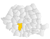
Vrancea

Focşani

medieval county of Vrancha[23][note 13] South-East VN 62 37 RO226 392,619 4,857 km2 (1,875 sq mi) 
See also
Romania 
This article is part of the series:
Politics and government of
RomaniaConstitutionJudiciary
- Commune in Romania
- Etymological list of counties of Romania
- Historical counties of Romania
- List of cities in Romania
- List of historical monuments in Romania by county
- List of Romanian counties by foreign trade
- Municipality in Romania
Notes
- ^ Judeţ originates from the Latin judicium and ţinut probably from the Latin tenutum.
- ^ Most of the names of the present counties originate from one of the larger rivers that flow through the county. In a number of cases, the name of the county seat or another large city in the county is the same as that river.
- ^ These are the ISO 3166-2:RO codes which coincide with the license plate ones; they are also used as usual abbreviations, such as in mailing addresses.
- ^ The postal code format is of the type xxyzw, with xx being the numbers associated with the county; the digits y, z, and w indicate the city, the street, part of the street, or even the building of the address.
- ^ Landline phone numbers are of the type +40-abb-xxx-xxx, where 40 is the country code, bb is the area code, and a is a digit indicating the operator: 2 for the former national operator, Romtelecom, and 3 for the other ground telephone networks. Mobile phone numbers, however, only start with the digit 7 (for a) and do not follow county borders.
- ^ The development region code follows the format ROxyz, where x is the macroregion number, y represents the development region and is either 1 or 2, and z is the county number within the region.
- ^ Bucharest is not a county, but a municipality that has an identical administrative status to all the other 41 counties.
- ^ Due to Bucharest's significantly larger population, it has a different postal code for each of its six sectors.
- ^ a b Bucharest and Ilfov county have the same code. Due to their large population, phone numbers have only the suffix "1" (unlike two-digit suffixes for counties) followed by seven digits (only six digits for anywhere else).
- ^ Dolj is a shortened form of Dolu (Slavic for "valley") Jiu, in reference to the county's location in the lower part of Jiu river.
- ^ Gorj is a shortened form of Gora (Slavic for "mountain") Jiu, in reference to the county's location in the upper part of Jiu river.
- ^ Vâlcea is the Romanian word for a narrow valley.
- ^ Vran is a Dacian word believed to mean "forest" or "mountain".
References
- ^ a b "Primele atestari documentare ale judetului Valcea (First Historical Mentions of Vâlcea County)" (in Romanian). National Institute of Statistics (Romania). http://www.valcea.insse.ro/main.php?lang=fr&pageid=509. Retrieved 2010-01-23.
- ^ Cornel Şomâcu (2009-09-09) (in Romanian). De la sat la judeţ în istoria Olteniei (From Village to County in the History of Oltenia). Vertical. ISSN 1841-6063. http://www.verticalonline.ro/de-la-sat-la-judet-in-istoria-olteniei. Retrieved 2010-08-22.
- ^ a b c Cosmin Dariescu (2008). "21: Organizarea administrativ-teritorială a Ţării Româneşti şi a Moldovei în evul mediu (21: Administrative Divisions in Wallachia and Moldavia in the Middle Ages)" (in Romanian). Istoria statului şi dreptului românesc din antichitate până la Marea Unire (History of Romanian State and Law from Antiquity until the Unification). C.H. Beck. pp. 47–51. ISBN 978-973-115-337-7.
- ^ Cosmin Dariescu (2008). "16: Domnia în Ţările Române medievale (16: Rulers in the Romanian Principalities in the Middle Ages)" (in Romanian). Istoria statului şi dreptului românesc din antichitate până la Marea Unire (History of Romanian State and Law from Antiquity until the Unification). C.H. Beck. pp. 35–39. ISBN 978-973-115-337-7.
- ^ a b c d e f "Scurtă privire istorică (Short View on History)" (in Romanian). Instituţia Prefectului judeţul Argeş. http://www.prefecturaarges.ro:8080/prefectura/index.jsp?pagina=scurt_istoric. Retrieved 2010-01-22.
- ^ a b c d (PDF) 2003–2005 National Human Development Report: Local Governance in Romania (Report). United Nations Development Programme. p. 35. http://hdr.undp.org/en/reports/nationalreports/europethecis/romania/romania_2005_en.pdf.
- ^ Valeriu Nicolescu. "Un ţinut de legendă, judeţul Buzău (A legendary Land, Buzau County)" (in Romanian). Buzau.com. http://www.buzau.com/judet.htm. Retrieved 2010-01-22.
- ^ Günther H. Tontsch (2000). "Juristische Literatur zur rumänischen Verwaltungsgeschichte im 19. und 20. Jahrhundert (Law Literature on the Romanian Administrative History in the 19th and 20th Centuries)" (in German). Jahrbuch für Europäische Verwaltungsgeschichte (Yearbook of European Administrative History). 12. Baden-Baden: Nomos Verlag. pp. 285. ISSN 0937-7107.
- ^ Ioan Scurtu, Theodora Stănescu-Stanciu, Georgiana Margareta Scurtu (2002). "8.7. Decret-lege pentru reforma electorală (Law Decree for electoral reform)" (in Romanian). Istoria românilor între anii 1918–1940 (The History of the Romanians in 1918–1940). University of Bucharest. http://ebooks.unibuc.ro/istorie/istorie1918-1940/8-7.htm.
- ^ Anatol Petrenci (2006) (in Romanian). Basarabia în timpul celui de-al doilea război mondial: 1939–1945 (Bessarabia During the Second World War: 1939–1945). Chişinău, Moldova: Ed. Prut Internaţional. ISBN 9789975690492.
- ^ "Istoria Banatului – În linii mari (History of Banat – A Quick View)" (in Romanian). Vestul.ro. 2008-09-10. http://www.vestul.ro/stiri/1310/in-linii-mari.htm. Retrieved 2010-10-22.
- ^ a b Petre Mihai Bacanu (2010-03-11). "Cum ar trebui să arate harta redesenată a României? (How Should Romania's Redrawn Map Look Like?)" (in Romanian). România Liberă. http://www.romanialibera.ro/opinii/interviuri/cum-ar-trebui-sa-arate-harta-redesenata-a-romaniei-179771.html. Retrieved 2010-08-29.
- ^ "Prezentarea Judetului Ilfov (Overview of Ilfov County)" (in Romanian) (PDF). National Institute of Statistics (Romania). http://www.ilfov.insse.ro/phpfiles/PREZENTAREA%20JUDETULUI%20ILFOV.pdf. Retrieved 2010-08-01.
- ^ "Istoria Ilfov (History of Ilfov)" (in Romanian). Camera de Comert si Industrie a Judetului Ilfov. http://www.ccilfov.ro/istoria_ilfov.php. Retrieved 2010-08-23.
- ^ "Nomenclature of territorial units for statistics – Introduction". Eurostat. http://epp.eurostat.ec.europa.eu/portal/page/portal/nuts_nomenclature/introduction. Retrieved 2010-08-22.
- ^ "CEMR – Members – Romania". Council of European Municipalities and Regions. http://www.ccre.org/roumanie_en.htm. Retrieved 2010-08-22.
- ^ "Postal code search" (in Romanian). Compania Nationala Posta Romania SA. http://www.posta-romana.ro/zip_codes. Retrieved 2010-08-22.
- ^ "List of the county prefixes in Romania" (in Romanian). National Regulatory Authority for Communications and Information Technology (Romania). 2005-04-26. http://www.anrcti.ro/DesktopDefault.aspx?tabid=1501. Retrieved 2010-08-22.
- ^ "Publications Office, European Union, EU". Simap – Information about European public procurement. http://simap.europa.eu/codes-and-nomenclatures/codes-nuts/codes-nuts-table_en.htm. Retrieved 2010-08-29.
- ^
(in Romanian) (PDF) Romanian Statistical Yearbook 2008 – Population (Report). National Institute of Statistics (Romania). 2007-07-01. pp. 14–16. http://www.insse.ro/cms/files/pdf/ro/cap2.pdf. Retrieved 2010-08-29. - ^ (in Romanian) (PDF) Romanian Statistical Yearbook 2008 – Geography, Meteorology, and Environment (Report). National Institute of Statistics (Romania). 2007-07-01. p. 18. http://www.insse.ro/cms/files/pdf/ro/cap1.pdf. Retrieved 2010-08-29.
- ^ "DEX online – Search: "bucura"" (in Romanian). Romanian Etymological Dictionary 1958–1966. Dexonline.ro. http://dexonline.ro/definitie/bucura/424805. Retrieved 2010-08-23.
- ^ "Judeţul Vrancea (Vrancea County)" (in Romanian). National Institute of Statistics (Romania). http://www.vrancea.insse.ro/main.php?id=404. Retrieved 2010-08-23.
External links
- Blog of the Romanian Royalty House showing various maps with the previous administrative divisions of Romania.
- Current and historical divisions of Romania at Statoids.com
- "Geopolitical Entities and Their Codes (FIPS codes)". National Institute of Standards and Technology. http://www.itl.nist.gov/fipspubs/10-3tab1.htm. Retrieved 2010-08-23.
First-level administrative divisions in Europe Sovereign
statesAlbania · Andorra · Armenia2 · Austria · Azerbaijan3 · Belarus · Belgium · Bosnia and Herzegovina · Bulgaria · Croatia · Cyprus2 · Czech Republic · Denmark · Estonia · Finland · France1 · Georgia3 · Germany · Greece · Hungary · Iceland · Ireland · Italy · Kazakhstan2 · Latvia · Liechtenstein · Lithuania · Luxembourg · Republic of Macedonia · Malta · Moldova · Monaco · Montenegro · Netherlands · Norway · Poland · Portugal · Romania · Russia1 · San Marino · Serbia · Slovakia · Slovenia · Spain · Sweden · Switzerland · Turkey1 · Ukraine · United Kingdom
States with limited
recognitionAbkhazia3 · Kosovo · Northern Cyprus2 · South Ossetia3
1 Has part of its territory outside Europe. 2 Considered European for cultural, political and historical reasons but is geographically in West Asia. 3 Partially or entirely in Asia, depending on the definition of the border. Romania topicsBasic topics · Alphabetical index of topics
History Timeline · Prehistoric Romania · Dacia · Roman Dacia · Middle Ages · Early Modern Era · National awakening · United Principalities · Kingdom of Romania · World War I · Greater Romania · World War II · Communist Romania · 1989 Romanian Revolution · Since 1989Geography Economy Government Constitution · Parliament (Senate · Chamber of Deputies) · President · Prime Minister · Elections · Political parties · Foreign relations · Government Agencies · Law enforcement · History · Land Forces · Air Force · Naval Forces · Military Police · Administrative divisions · Counties · Cities · Human rights ·Culture Orthodox Christianity · Holy Synod · Judaism · Islam · Postal codes · Languages · Religion · Minorities · Immigration · Romanians · List of Romanians · Academy · Architecture · Art · Cinema (Actors) · Music (Composers) · Cuisine · Romanian language · Literature (Writers • Poets) · List of Romanians · Philosophy · Folklore (Dress) · Humour · Media · Sport · Public holidays · Society · CrimeCategories:- Counties of Romania
- Lists of country subdivisions
- Country subdivisions of Europe
- First-level administrative country subdivisions
- Romania-related lists


Wikimedia Foundation. 2010.