- Michalovce
-
Michalovce Town  Michalovce town square
 Coat of arms
Country Slovakia Region Košice District Michalovce Tourism region Dolný Zemplín River Laborec Elevation 115 m (377 ft) Coordinates 48°44′57″N 21°54′05″E / 48.74917°N 21.90139°E Area 52.807 km2 (20 sq mi) Population 40,255 (1 January 2008) Density 762 / km2 (1,974 / sq mi) First mentioned 1244 Mayor Viliam Záhorčák Timezone CET (UTC+1) - summer (DST) CEST (UTC+2) Postal code 071 01 Phone prefix 421-56 Car plate MI 

 Location of Michalovce within Slovakia
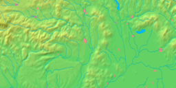
 Location of Michalovce in the Košice Region
Wikimedia Commons: Michalovce Statistics: MOŠ/MIS Website: http://www.michalovce.sk Michalovce (
 pronunciation (help·info); Hungarian: Nagymihály, German: Großmichel, Romani: Mihalya, Yiddish: Mikhaylovets or Mykhaylovyts) is a town on the Laborec river in eastern Slovakia, with a population around 40,000. It is the biggest town of the Michalovce District (okres) in the Košice Region.
Contents
Geography
The town lies in the Košice Region, in the Eastern Slovak Lowland on the Laborec river, historically belonging to the Zemplén county. The town is about 60 km east of Košice and 35 km west of Uzhhorod, Ukraine. Geographical features nearby include the Vihorlat Mountains and the Zemplínska šírava lake.
History
The first known settlers in the area around Michalovce were in the Neolithic. The Slavs arrived in the area in the fifth century[citation needed]. The area was part of the Great Moravian empire[citation needed] in the ninth century. From the tenth century onwards, the region had been part of Hungary. After the Ottoman conquest in south central Hungary in the sixteenth century, Hungary was divided, and present-day Michalovce became part of the Eastern Hungarian Kingdom, and later Royal Hungary. The town grew significantly in the eighteenth and nineteenth centuries and since the Austrian-Hungarian Ausgleich of 1867, it achieved a status of a large community and shortly afterward became seat of one of the districts of Zemplén County.[1]
After World War I, in 1918 (confirmed by the Treaty of Trianon in 1920), Michalovce, along with some other parts of Zemplén County, became part of the then formed Czechoslovakia. In 1944, 3500 Jewish inhabitants were deported from Michalovce. Since 1993, the breakup of Czechoslovakia, Michalovce is part of Slovakia. In 1996 it was made the seat of the Michalovce District.
Demographics
In 1910, Michalovce had 6120 residents, which number contains 3792 Hungarian, 1586 Slovak and 542 German inhabitants. The religious make-up was 38.6% Roman Catholic, 32.3% Jewish and 23.2% Greek Catholic.
According to the 2001 census, the town had 39,948 inhabitants. 94.57% of inhabitants were Slovaks, 2.24% Roma, 0.73% Czechs and 0.47% Ukrainian.[2] The religious makeup was 53.92% Roman Catholics, 19.65% Greek Catholics, 9.73% people with no religious affiliation and 5.19% Orthodox.[2]
International relations
Twin towns - sister cities
Michalovce is twinned with:
 Vyškov in Czech Republic
 Villarreal in Spain
 Jarosław in Poland (since 1998) [3]
 Sátoraljaújhely in Hungary
People
- Presian II of Bulgaria (gravestone of certain "Prince Presian" was found in Michalovce)
- Aurél Dessewffy
- Emília Sičáková-Beblavá
- Volodymyr Sichynskyi
References
- Notes
- ^ "Town history". Municipality of Michalovce. 2007. http://www.michalovce.sk/en/article-history.html?s=&p=2c5ae87568d53eb16a458d14a411e475&m=8f00d9add6dd1283d5e80ac2da3f6af6&sm=85abc80ac0c11cbdd20a3dd98c4e3065. Retrieved 18 June 2009.
- ^ a b "Municipal Statistics". Statistical Office of the Slovak republic. Archived from the original on 2007-11-16. http://web.archive.org/web/20071116010355/http://www.statistics.sk/mosmis/eng/run.html. Retrieved 2007-12-09.
- ^ "Jarosław Official Website - Partner Cities".
 (in Polish) © 2008 Urząd Miasta Jarosław. Ul. Rynek 1, 37-500 Jarosław. http://www.jaroslaw.pl/miasta-partnerskie. Retrieved 2008-10-23.
External links
Bajany · Bánovce nad Ondavou · Beša · Bracovce · Budince · Budkovce · Čečehov · Čičarovce · Čierne Pole · Drahňov · Dúbravka · Falkušovce · Hatalov · Hažín · Hnojné · Horovce · Iňačovce · Ižkovce · Jastrabie pri Michalovciach · Jovsa · Kačanov · Kaluža · Kapušianske Kľačany · Klokočov · Krásnovce · Krišovská Liesková · Kusín · Lastomír · Laškovce · Lesné · Ložín · Lúčky · Malčice · Malé Raškovce · Markovce · Maťovské Vojkovce · Moravany · Nacina Ves · Oborín · Oreské · Palín · Pavlovce nad Uhom · Petrikovce · Petrovce nad Laborcom · Poruba pod Vihorlatom · Pozdišovce · Ptrukša · Pusté Čemerné · Rakovec nad Ondavou · Ruská · Senné · Slavkovce · Sliepkovce · Staré · Stretava · Stretavka · Suché · Šamudovce · Trhovište · Trnava pri Laborci · Tušice · Tušická Nová Ves · Veľké Raškovce · Veľké Slemence · Vinné · Vojany · Voľa · Vrbnica · Vysoká nad Uhom · Zalužice · Závadka · Zbudza · Zemplínska Široká · Zemplínske Kopčany · Žbince Categories:
- Villages and municipalities in Michalovce District
- Cities and towns in Slovakia
- Shtetls
- Roma communities in Slovakia
- Czech communities


Wikimedia Foundation. 2010.