- Sátoraljaújhely
-
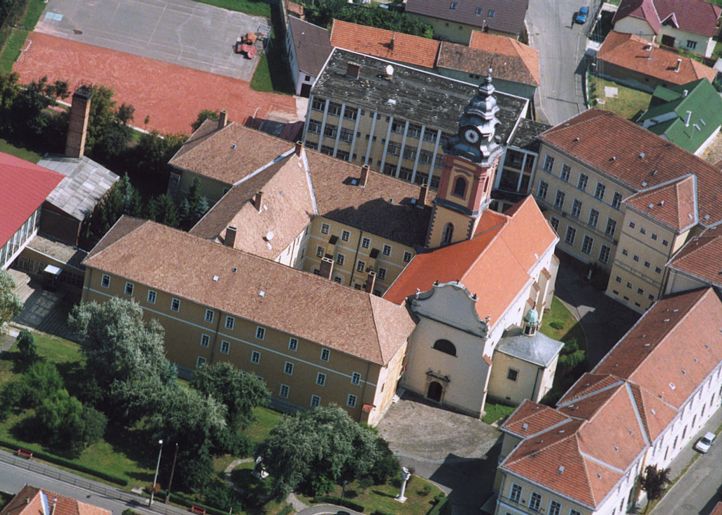
Sátoraljaújhely Pauliner church and friary

Coat of arms

Coordinates: 48°23′48″N 21°38′59″E / 48.39667°N 21.64972°E Country  Hungary
County Borsod-Abaúj-Zemplén Area – Total 73.45 km2 (28.4 sq mi) Population (2009) – Total 16,299 – Density 244.99/km2 (634.5/sq mi) Time zone CET (UTC+1) – Summer (DST) CEST (UTC+2) Postal code 3980 Area code(s) 47  The Wine Church
Sátoraljaújhely (Hungarian pronunciation: [ˈʃaːtorɒjːɒ.uːjhɛj]; archaic German:
 Neustadt am Zeltberg (help·info); Slovak: Nové Mesto pod Šiatrom; Yiddish: איהעל (Ihel) or אוהעלי (Uhely)) is a town located in Borsod-Abaúj-Zemplén county in northern Hungary near the Slovak border. It is 82 km (51 mi) east from the county capital Miskolc.
Contents
History
Sátor-alja (meaning "under the tent", referring to the tent-shaped hill nearby) was a settlement from the Conquest of Hungary until the Tatars destroyed the town. It was rebuilt in the 13th century, although there was disagreement among the citizens concerning the name; some wanted to keep the original name and some wanted to rename it új hely ("new place").
Sátoraljaújhely was granted town status in 1261 by King Stephen V, and a castle was built around this time, as well.
Sátoraljaújhely often has played an important role in the region's history. Revolts against Habsburg rule began there in the 17th and 18th centuries. After the Revolution of 1848, Sátoraljaújhely began swiftly developing owing to its location close to important trade routes leading to Poland, Russia, and Transylvania. The town's light industry led it to becoming the capital of the comitatus Zemplén in the 17th century.
Sátoraljaújhely has always been an important town in culture. Ferenc Kazinczy, one of the reformers of the Hungarian language, lived here in the 18th century. At the turn of the 20th century the town was home to a small but important Jewish community; some 4,500 of the town's 13,000 residents were Jewish. The community counted among its members Moses Teitelbaum and Michael Heilprin.
In the Treaty of Trianon Hungary lost its northern territories. The border was set to the Ronyva stream, splitting the city into two parts. One-fifth of the population and one-fourth of the territory of the town became part of Czechoslovakia. The newly created village got name Slovenské Nové Mesto (Szlovákújhely or Kisújhely in Hungarian). Two railway lines and the industrial zone were lost. The town's industry was being rebuilt during the interwar period, but the outbreak of World War II disrupted this development. Nazi repression, continuous bombing after 1943, the killing of most of its Jewish population (most were forcibly sent to Auschwitz), and finally the Soviet occupation left the town in very poor condition.
During the reorganisation of administration in 1950, the former comitatus Zemplén became a part of the united Borsod-Abaúj-Zemplén county, and Sátoraljaújhely lost its county capital status.
Sátoraljaújhely was rebuilt again and is today a national ski centre and tourism destination.
Jewish history
Historically, Ujhely (Sátoraljaújhely) was belonged to the county of Zemplin. Documents in its archives show that in 1734 Jews were living at Sátoraljaújhely and that they were allowed to acquire real estate. It is evident that the community was then increasing; for 10 years later the Jews possessed a school which in 1829 received a bequest of 260,000 gulden from Martin Raphael Kästenbaum, and which was thenceforth known by his name.
The oldest tombstone bears date of 1760, although the ḥebra ḳaddisha, with which was connected a hospital, was not established until 1772, its founder being an itinerant rabbi named Naphtali Hirsch. The first ḥebrabook has a drawing on its title-page representing the last rites.
A synagogue was built at Sátoraljaújhely in 1790; and when it was demolished in 1887, to be replaced by a new house of worship, it was found to have 8 subterranean chambers, which probably served as dungeons. The oldest document of the community is dated 1831, during the rabbinate of Moses Teitelbaum, of whom the story is told that Lajos Kossuth, afterward leader of the Hungarian Revolution of 1848, when suffering from an infantile sickness, was brought to him, and that the rabbi blessed the child and, referring to the word "ḳosheṭ" in Psalm lx. 6 (A. V. 4), prophesied his future greatness. Teitelbaum died in 1841, and was succeeded by his son Leopold Teitelbaum, who, however, soon went to Marmaros-Sziget.
Jeremiah Löw was then appointed rabbi of Ujhely. Löw, who was one of the leaders of the Orthodox party, was succeeded by the present chief rabbi, Koloman Weisz, and the preacher Isidor Goldberger. Michael Heilprin, who acted as secretary to Minister Bertalan Szemere in 1848, was, prior to the Revolution, a teacher in the Jewish school of Ujhely.
The Jews of the city in 1905 number 4,500 in a total population of 13,000. [1]
Tourist sights
- Historical downtown (with an atmosphere of 19th century towns)
- Main Church and Comitatus Fountain at the town square
- Wine Church, the only known church in Hungary not owned by any denomination, as it was used to store wine in past centuries.
- Ferenc Kazinczy Mausoleum
- Ferenc Kazinczy Museum
- Waldbott-villa
- Baroque town hall, a Renaissance building of the former Zemplén comitatus where Ferenc Kazinczy worked.
- Former Financial Palace, a mark of the town's great economic importance in the 19th and the early 20th century.
- Abandoned synagogue cemetery - Sátoraljaújhely was once home to Hungary's second-largest Jewish community.
- Tomb of Rabbi Moses Teitelbaum
- Chairlift
Famous residents
See also Category: People from Borsod-Abaúj-Zemplén County.- Gyula Andrássy, prime minister
- Dr. Ervin Brody, scholar, writer and table tennis team captain
- Angelo Heilprin, naturalist
- Ferenc Kazinczy, writer
- Lajos Kossuth, governor
- Yekusiel Yehuda Teitelbaum (I), rebbe
- Katalin Vad, pornographic actress
- Brigitta Bulgari, pornographic actress
- Benjamin Wolf Löw, rabbi
- rebbes of the Ujhel-Siget, Ujhel (Teitelbaum family of Galician origin)
Nationalities
- Hungarian 90.91%
- Gypsy 6.37%
- Slovakian 1.21%
- German 0.96%
- Other 0.55%
Twin Towns - Sister Cities
Sátoraljaújhely is twinned with:
 Krosno in Poland (since 2006) [2]
 Michalovce in Slovakia
See also
See also: újhelyReferences
- ^ Jewish Encyclopedia Bibliography: Albert Székely, Ujhelyi Zsidók Története, in Magyarország Vármegyéi és Városai (in manuscript)
- ^ "Krosno Official Website - Partner Cities".
 (in Polish) © 1998 - 2001 Urząd Miasta Krosna.. http://www.krosno.pl/?node=30. Retrieved 2008-10-23.
- This article incorporates text from the 1901–1906 Jewish Encyclopedia, a publication now in the public domain. ([1]) (by Gotthard Deutsch, Ludwig Venetianer)
External links
- (Hungarian) Municipal website
Borsod-Abaúj-Zemplén County County seat: MiskolcCities and towns Abaújszántó · Alsózsolca · Borsodnádasd · Cigánd · Edelény · Emőd · Encs · Felsőzsolca · Gönc · Kazincbarcika · Mezőcsát · Mezőkeresztes · Mezőkövesd · Nyékládháza · Ózd · Pálháza · Putnok · Rudabánya · Sajóbábony · Sajószentpéter · Sárospatak · Sátoraljaújhely · Szendrő · Szerencs · Szikszó · Tiszaújváros · Tokaj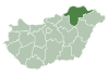
Villages Abaújalpár · Abaújkér · Abaújlak · Abaújszolnok · Abaújvár · Abod · Aggtelek · Alacska · Alsóberecki · Alsódobsza · Alsógagy · Alsóregmec · Alsószuha · Alsótelekes · Alsóvadász · Arka · Arló · Arnót · Aszaló · Ároktő · Baktakék · Balajt · Baskó · Bánhorváti · Bánréve · Becskeháza · Bekecs · Berente · Beret · Berzék · Bodroghalom · Bodroghalász · Bodrogkeresztúr · Bodrogkisfalud · Bodrogolaszi · Bogács · Boldogkőújfalu · Boldogkőváralja · Boldva · Borsodbóta · Borsodgeszt · Borsodivánka · Borsodszentgyörgy · Borsodszirák · Bódvalenke · Bódvarákó · Bódvaszilas · Bózsva · Bőcs · Bükkaranyos · Bükkábrány · Bükkmogyorósd · Bükkszentkereszt · Bükkzsérc · Büttös · Csenyéte · Cserépfalu · Cserépváralja · Csernely · Csincse · Csobaj · Csobád · Csokvaomány · Damak · Dámóc · Debréte · Dédestapolcsány · Detek · Domaháza · Dövény · Dubicsány · Egerlövő · Égerszög · Erdőbénye · Erdőhorváti · Fáj · Fancsal · Farkaslyuk · Felsőberecki · Felsődobsza · Felsőgagy · Felsőkelecsény · Felsőnyárád · Felsőregmec · Felsőtelekes · Felsővadász · Filkeháza · Fony · Forró · Fulókércs · Füzér · Füzérkajata · Füzérkomlós · Füzérradvány · Gadna · Gagyapáti · Gagybátor · Gagyvendégi · Galvács · Garadna · Gelej · Gesztely · Girincs · Golop · Gömörszőlős · Göncruszka · Györgytarló · Halmaj · Hangács · Hangony · Harsány · Háromhuta · Hegymeg · Hejce · Hejőbába · Hejőkeresztúr · Hejőkürt · Hejőpapi · Hejőszalonta · Hercegkút · Hernádbűd · Hernádcéce · Hernádkak · Hernádkércs · Hernádnémeti · Hernádpetri · Hernádszentandrás · Hernádszurdok · Hernádvécse · Hét · Hidasnémeti · Hidvégardó · Hollóháza · Homrogd · Igrici · Imola · Ináncs · Irota · Izsófalva · Jákfalva · Járdánháza · Jósvafő · Kács · Karcsa · Karos · Kánó · Kány · Kázsmárk · Kelemér · Kenézlő · Keresztéte · Kesznyéten · Kéked · Királd · Kiscsécs · Kisgyőr · Kishuta · Kiskinizs · Kisrozvágy · Kissikátor · Kistokaj · Komjáti · Komlóska · Kondó · Korlát · Kovácsvágás · Köröm · Krasznokvajda · Kupa · Kurityán · Lak · Lácacséke · Ládbesenyő · Legyesbénye · Léh · Lénárddaróc · Litka · Mád · Makkoshotyka · Mályi · Martonyi · Mályinka · Megyaszó · Meszes · Mezőnagymihály · Mezőnyárád · Mezőzombor · Méra · Mikóháza · Mogyoróska · Monaj · Monok · Muhi · Múcsony · Nagybarca · Nagycsécs · Nagyhuta · Nagykinizs · Nagyrozvágy · Négyes · Nekézseny · Nemesbikk · Novajidrány · Nyésta · Nyíri · Nyomár · Olaszliszka · Onga · Ormosbánya · Oszlár · Ónod · Pamlény · Parasznya · Pácin · Pányok · Pere · Perecse · Perkupa · Prügy · Pusztafalu · Pusztaradvány · Radostyán · Ragály · Rakaca · Rakacaszend · Rásonysápberencs · Rátka · Regéc · Répáshuta · Révleányvár · Ricse · Rudolftelep · Sajóecseg · Sajógalgóc · Sajóhidvég · Sajóivánka · Sajókápolna · Sajókaza · Sajókeresztúr · Sajólád · Sajólászlófalva · Sajómercse · Sajónémeti · Sajóörös · Sajópálfala · Sajópetri · Sajópüspöki · Sajósenye · Sajószöged · Sajóvámos · Sajóvelezd · Sály · Sárazsadány · Sáta · Selyeb · Semjén · Serényfalva · Sima · Sóstófalva · Szakácsi · Szakáld · Szalaszend · Szalonna · Szászfa · Szegi · Szegilong · Szemere · Szendrőlád · Szentistván · Szentistvánbaksa · Szin · Szinpetri · Szirmabesenyő · Szomolya · Szögliget · Szőlősardó · Szuhafő · Szuhakálló · Szuhogy · Taktabáj · Taktaharkány · Taktakenéz · Taktaszada · Tarcal · Tard · Tállya · Telkibánya · Teresztenye · Tibolddaróc · Tiszabábolna · Tiszacsermely · Tiszadorogma · Tiszakeszi · Tiszaladány · Tiszalúc · Tiszapalkonya · Tiszatardos · Tiszatarján · Tiszavalk · Tolcsva · Tomor · Tornabarakony · Tornakápolna · Tornanádaska · Tornaszentandrás · Tornaszentjakab · Tornyosnémeti · Trizs · Újcsanálos · Uppony · Vadna · Vajdácska · Varbó · Varbóc · Vatta · Vágáshuta · Vámosújfalu · Vilmány · Vilyvitány · Viss · Viszló · Vizsoly · Zalkod · Zádorfalva · Zemplénagárd · Ziliz · Zsujta · ZubogyOther topics History · Geography · Government · Economy · Culture · TourismCategories:- Populated places in Borsod-Abaúj-Zemplén county
- Shtetls
- Jewish communities in Hungary


Wikimedia Foundation. 2010.