- Geography of Poland
-
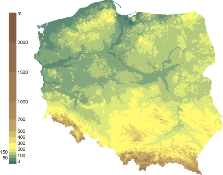
 Topography of Poland
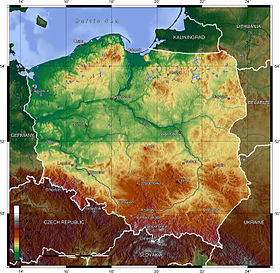
 Shaded relief map of Poland, 2000
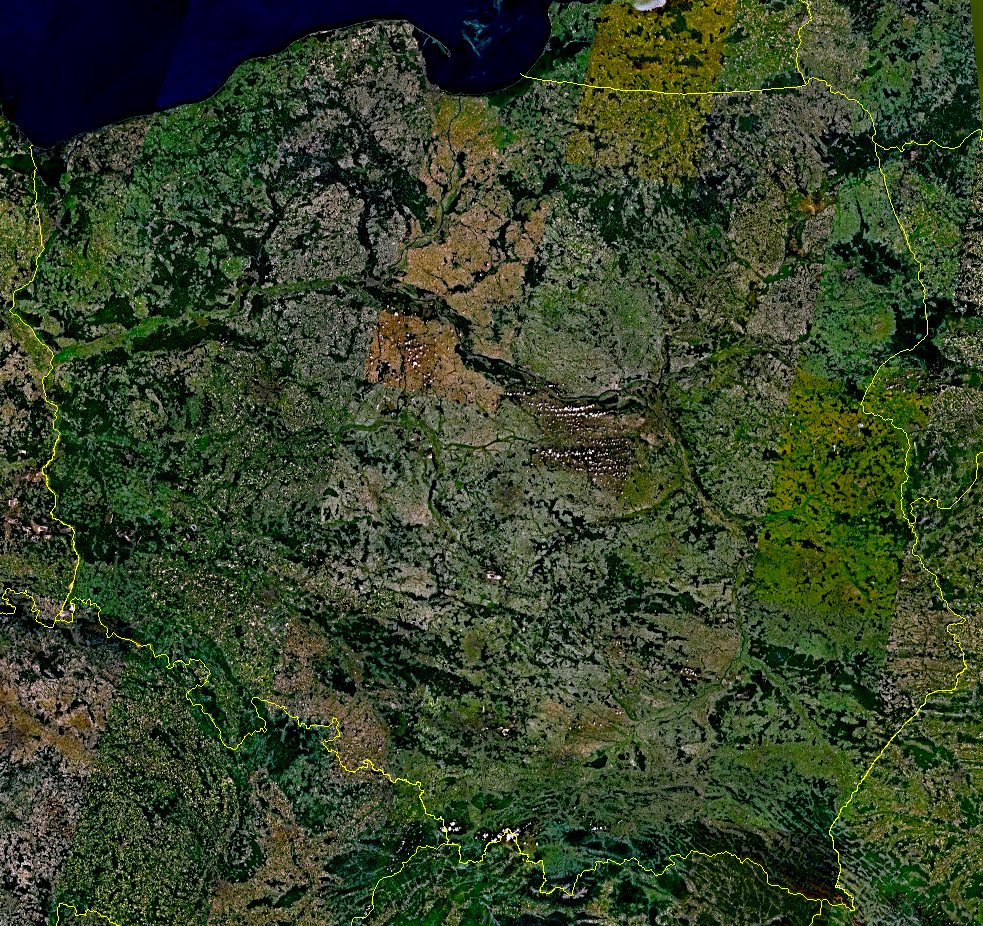
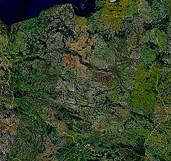 Satellite photo of Poland taken from Landsat7
 Hypsometry
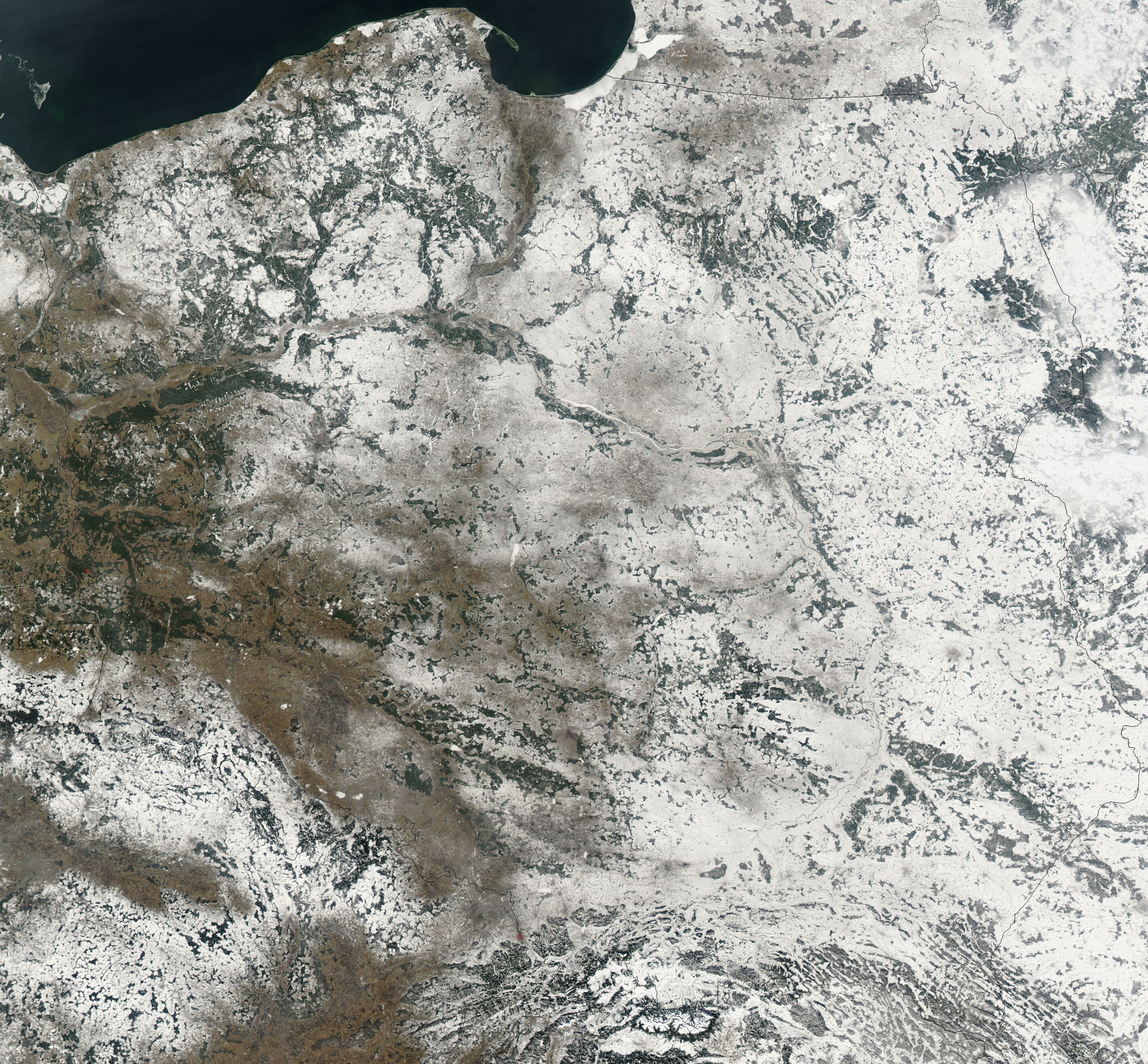
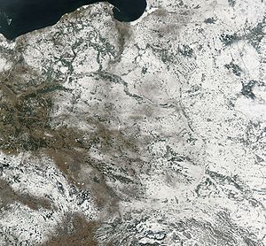 Satellite image of Poland in February 2003
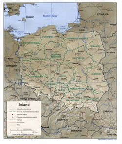
Poland is a country in Central Europe with an area of 312,679 square kilometres (120,726 sq mi), and mostly temperate climate.[1] Generally speaking, Poland is an almost unbroken plain reaching from the Baltic Sea in the north, to the Carpathian Mountains in the south. Within that plain, terrain variations run in bands east to west. The Baltic coast has two natural harbors, the larger one in the Gdańsk-Gdynia region, and a smaller one near Szczecin in the far northwest. The northeastern region called the Masurian Lake District with more than 2,000 lakes,[2] is densely wooded, sparsely populated and lacks agricultural and industrial resources. To the south of the lake district, and across central Poland a vast region of plains extends all the way to the Sudetes on the Czech and Slovak borders southwest, and to the Carpathians on the Czech, Slovak and Ukrainian borders southeast. The central lowlands had been formed by glacial erosion in the Pleistocene ice age. The neighboring countries are Germany to the west, the Czech Republic and Slovakia to the south, Ukraine and Belarus to the east, and Lithuania and the Russian enclave of Kaliningrad to the northeast.
Contents
Topography
The country extends 876 kilometers from north to south and 689 kilometers from east to west, at an area of 564,5897 square kilometers including inland waters. The average elevation is 173 meters, and only 3% of Polish territory, along the southern border, is higher than 500 meters. The highest elevation is Mount Rysy, which rises 2,499 meters in the Tatra Range of the Carpathians, 95 kilometers south of Kraków. About 60 square kilometers along the Gulf of Gdańsk are below sea level. Poland is traditionally divided into five topographic zones from north to south.
The largest, the central lowlands or "Polish Plain" (Polish: Niż Polski or Nizina Polska), is narrow in the west, then expands to the north and south as it extends eastward. Along the eastern border, this zone reaches from the far northeast to within 200 kilometers of the southern border. The terrain in the central lowlands is quite flat, and earlier glacial lakes have been filled by sediment. The region is cut by several major rivers, including the Oder (Odra), which defines the Silesian Lowlands in the southwest, and the Vistula (Wisla), which defines the lowland areas of east-central Poland.
To the south of the lowlands are the lesser Poland uplands, a belt varying in width from 90 to 200 kilometers, formed by the gently sloping foothills of the Sudeten and Carpathian mountain ranges and the uplands that connect the ranges in southcentral Poland. The topography of this region is divided transversely into higher and lower elevations, reflecting its underlying geological structure. In the western section, the Silesia-Kraków Upthrust contains rich coal deposits.
Further information: List of mountains in PolandThe third topographic area is located on either side of Poland's southern border and is formed by the Sudeten and Carpathian ranges. Within Poland, neither of these ranges is forbidding enough to prevent substantial habitation; the Carpathians are especially densely populated. The rugged form of the Sudeten range derives from the geological shifts that formed the later Carpathian uplift. The highest elevation in the Sudeten is Śnieżka (1,602 meters) in the Karkonosze Mountains. The Carpathians in Poland, formed as a discrete topographical unit in the relatively recent Tertiary Era, are the highest mountains in the country. They are the northernmost edge of a much larger range that extends into the Czech Republic, Slovakia, Ukraine, Hungary, and Romania. Within Poland the range includes two major basins, the Oświęcim and Sandomierz, which are rich in several minerals and natural gas.
To the north of the central lowlands, the lake region includes the only primeval forests remaining in Europe and much of Poland's shrinking unspoiled natural habitat. Glacial action in this region formed lakes and low hills in the otherwise flat terrain adjacent to Lithuania and the Baltic Sea. Small lakes dot the entire northern half of Poland, and the glacial formations that characterize the lake region extend as much as 200 kilometers inland in western Poland. Wide river valleys divide the lake region into three parts. In the northwest, Pomerania is located south of the Baltic coastal region and north of the Warta and Noteć rivers. Masuria occupies the remainder of northern Poland and features a string of larger lakes. Most of Poland's 9,300 lakes that are more than 10,000 square metres in area are located in the northern part of the lake region, where they occupy about 10 % of the surface area.
The Baltic coastal plains are a low-lying region formed of sediments deposited by the sea. The coastline was shaped by the action of the rising sea after the Scandinavian ice sheet retreated. The two major inlets in the smooth coast are the Pomeranian Bay on the German border in the far northwest and the Gulf of Gdańsk in the east. The Oder River empties into the former, and the Vistula forms a large delta at the head of the latter. Sandbars with large dunes form lagoons and coastal lakes along much of the coast.
Drainage
Nearly all of Poland is swirled northward into the Baltic Sea by the Vistula, the Oder, and the tributaries of these two major rivers. About half the country is drained by the Vistula, which originates in the Tatra Mountains in far south-central Poland. The Vistula Basin includes most of the eastern half of the country and is drained by a system of rivers that mainly join the Vistula from the east. One of the tributaries, the Bug, defines 280 kilometers of Poland's eastern border with Ukraine and Belarus. The Oder and its major tributary, the Warta, form a basin that drains the western third of Poland into the bays north of Szczecin. The drainage effect on a large part of Polish terrain is weak, however, especially in the lake region and the inland areas to its south. The predominance of swampland, level terrain, and small, shallow lakes hinders large-scale movement of water. The rivers have two high-water periods per year. The first is caused by melting snow and ice dams in spring adding to the volume of lowland rivers; the second is caused by heavy rains in July.
Climate
Poland's long-term and short-term weather patterns are made transitional and variable by the collision of diverse air masses above the country's surface. Maritime air moves across Western Europe, Arctic air sweeps down from the North Atlantic Ocean, and subtropical air arrives from the South Atlantic Ocean. Although the Arctic air dominates for much of the year, its conjunction with warmer currents generally moderates temperatures and generates considerable precipitation, clouds, and fog. When the moderating influences are lacking, winter temperatures in mountain valleys may drop to max −20 °C (−4 °F).
The spring arrives slowly in March or April, bringing mainly sunny days after a period of alternating wintry and springtime conditions. Summer, which extends from June to August, is generally less humid than winter. Showers and thunderstorms alternate with dry sunny weather that is generated when southern winds prevail. Early autumn is generally sunny and warm before a period of rainy, colder weather in November begins the transition into winter. Winter, which may last from one to three months, brings frequent snowstorms but relatively low total precipitation.
The range of mean temperatures is 6 °C (42.8 °F) in the northeast to 10 °C (50 °F) in the southwest, but individual readings in Poland's regions vary widely by season. On the highest mountain peaks, the mean temperature is below 0 °C (32 °F). The Baltic coast, influenced by moderating west winds, has cooler summers and warmer winters. The other temperature extreme is in the southeast along the border with Ukraine, where the greatest seasonal differences occur and winter temperatures average 4.5 °C (40.1 °F) below those in western Poland. The growing season is about 40 days longer in the southwest than in the northeast, where spring arrives latest. The hottest cities in Poland are Tarnów, Wrocław and Słubice.
The average annual precipitation for the whole country is 600 mm (23.6 in), but isolated mountain locations receive as much as 1,300 mm (51.2 in) per year. The total is slightly higher in the southern uplands than in the central plains. A few areas, notably along the Vistula between Warsaw and the Baltic Sea and in the far northwest, average less than 500 mm (19.7 in). In winter about half the precipitation in the lowlands and the entire amount in the mountains falls as snow. On the average, precipitation in summer is twice that in winter, providing a dependable supply of water for crops.
Warsaw Climate chart (explanation) J F M A M J J A S O N D 21−3−625−2−6245−13312444199622214732415632314421810371343851332−3Average max. and min. temperatures in °C Precipitation totals in mm Source: [1] Imperial conversion J F M A M J J A S O N D 0.82721128220.940301.354401.767472.471562.975592.573561.765491.555381.541331.33626Average max. and min. temperatures in °F Precipitation totals in inches Wrocław Climate chart (explanation) J F M A M J J A S O N D 313−4303−3399036146482010692214752515652415461911331463872384−2Average max. and min. temperatures in °C Precipitation totals in mm Source: [2] Imperial conversion J F M A M J J A S O N D 1.237251.238271.547311.456431.967512.77258376602.675591.866521.357431.545361.53828Average max. and min. temperatures in °F Precipitation totals in inches Szczecin Climate chart (explanation) J F M A M J J A S O N D 404−4314−3429038136551810632013652314562214491811401364373424−1Average max. and min. temperatures in °C Precipitation totals in mm Source: [3] Imperial conversion J F M A M J J A S O N D 1.638261.239271.748321.555432.265502.568562.673572.272571.964521.655441.744371.74029Average max. and min. temperatures in °F Precipitation totals in inches Statistics
- Area - comparative: slightly smaller than New Mexico.
- Land boundaries: total: 2,888 km
- Border countries and length: Belarus: 605 km, Czech Republic: 658 km, Germany: 456 km, Lithuania: 91 km, Russia: (Kaliningrad Oblast): 206 km, Slovakia: 444 km, Ukraine: 428 km
- Coastline: 491 km
- Maritime claims: exclusive economic zone defined by international treaties
- Territorial sea: 12 nmi (22.2 km; 13.8 mi)
- Elevation extremes: lowest point Raczki Elblaskie -1,8 m; highest point: Rysy 2,499 m
- See islands: Wolin, eastern part of Usedom
Resources and land use
- Natural resources: coal, sulfur, copper, natural gas, iron, zinc, lead, salt, arable land
- Land use: arable land: 47%; permanent crops: 15%; permanent pastures 13%
- Forests of Poland and woodlands: 29%; other: 10% (1993 est.)
- Irrigated land: 1,000 km² (1993 est.)
- Important rivers: Vistula (Wisła), Oder (Odra), Bug, Warta River, Narew, San)
See also: Rivers of Poland
Environmental concerns
Natural hazards: occasional flooding
National parks
Environment - current issues: The situation has improved since 1989 due to decline in heavy industry and increased environmental concern by postcommunist governments[citation needed]; air pollution nonetheless remains serious because of sulfur dioxide emissions from coal-fired power plants, and the resulting acid rain has caused forest damage; water pollution from industrial and municipal sources is also a problem, as is disposal of hazardous wastes
Environment - international agreements:
party to: Air Pollution, Antarctic-Environmental Protocol, Antarctic Treaty, Biodiversity, Climate Change, Endangered Species, Environmental Modification, Hazardous Wastes, Law of the Sea, Marine Dumping, Nuclear Test Ban, Ozone Layer Protection, Ship Pollution, Wetlands
signed, but not ratified: Air Pollution-Nitrogen Oxides, Air Pollution-Persistent Organic Pollutants, Air Pollution-Sulphur 1994, Climate Change-Kyoto Protocol
Geography - note: historically, an area of conflict because of flat terrain and the lack of natural barriers on the North European Plain
See also
- Administrative division of Poland
- Borders of Poland
- Extreme points of Poland
- Tourism in Poland
- List of caves in Poland
- List of cities in Poland
- List of forests in Poland
- List of islands of Poland
- List of rivers of Poland
- List of mountains in Poland
References
- ^ Concise Statistical Yearbook of Poland, 2008. Central Statistical Office (Poland). 28 July 2008.
- ^ Masurian Lake District, at mazury.info.pl (Polish)
 This article incorporates public domain material from websites or documents of the Library of Congress Country Studies.
- This article incorporates public domain material from websites or documents of the CIA World Factbook.
External links
Coordinates: 52°00′N 20°00′E / 52°N 20°E
 Poland topics
Category · Portal · WikiProject Geography of Europe Sovereign
states- Albania
- Andorra
- Armenia
- Austria
- Azerbaijan
- Belarus
- Belgium
- Bosnia and Herzegovina
- Bulgaria
- Croatia
- Cyprus
- Czech Republic
- Denmark
- Estonia
- Finland
- France
- Georgia
- Germany
- Greece
- Hungary
- Iceland
- Ireland
- Italy
- Kazakhstan
- Latvia
- Liechtenstein
- Lithuania
- Luxembourg
- Macedonia
- Malta
- Moldova
- Monaco
- Montenegro
- Netherlands
- Norway
- Poland
- Portugal
- Romania
- Russia
- San Marino
- Serbia
- Slovakia
- Slovenia
- Spain
- Sweden
- Switzerland
- Turkey
- Ukraine
- United Kingdom
- (England
- Northern Ireland
- Scotland
- Wales)
- Vatican City
States with limited
recognitionDependencies
and other territories- Åland
- Faroe Islands
- Gibraltar
- Guernsey
- Jan Mayen
- Jersey
- Isle of Man
- Svalbard
Other entities Climate of Europe Sovereign
states- Albania
- Andorra
- Armenia
- Austria
- Azerbaijan
- Belarus
- Belgium
- Bosnia and Herzegovina
- Bulgaria
- Croatia
- Cyprus
- Czech Republic
- Denmark
- Estonia
- Finland
- France
- Georgia
- Germany
- Greece
- Hungary
- Iceland
- Ireland
- Italy
- Kazakhstan
- Latvia
- Liechtenstein
- Lithuania
- Luxembourg
- Macedonia
- Malta
- Moldova
- Monaco
- Montenegro
- Netherlands
- Norway
- Poland
- Portugal
- Romania
- Russia
- San Marino
- Serbia
- Slovakia
- Slovenia
- Spain
- Sweden
- Switzerland
- Turkey
- Ukraine
- United Kingdom
- (England
- Northern Ireland
- Scotland
- Wales)
- Vatican City
States with limited
recognition- Abkhazia
- Kosovo
- Nagorno-Karabakh
- Northern Cyprus
- South Ossetia
- Transnistria
Dependencies
and other territoriesOther entities - European Union
- Sovereign Military Order of Malta
Categories:


Wikimedia Foundation. 2010.