- Geography of Liechtenstein
-

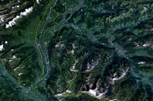
The principality of Liechtenstein encompasses most of the right (eastern) half of the Rhine Valley, wedged between Austria and Switzerland.
Along with Uzbekistan, Liechtenstein is one of only two doubly landlocked countries in the world; great variety of microclimates based on elevation
Data from the CIA Factbook:
- Geographic coordinates:
47°10′N 9°32′E / 47.167°N 9.533°E
- Area: 160 km² (land, 0 km² water)
- Land boundaries: total: 76 km; border countries: Austria 35 km, Switzerland 41 km
- Coastline: 0 km (landlocked)
- Maritime claims: none (landlocked)
- Climate: continental; cold, cloudy winters with frequent snow or rain; cool to moderately warm, cloudy, humid summers, great variety of microclimates based on elevation
- Terrain: mostly mountainous (Alps) with Rhine Valley in western third
- Natural resources: hydroelectric potential, arable land
- Lake: The only lake in Liechtenstein is the Gampriner Seele.
- Land use: arable land: 24%, permanent crops: 0%, permanent pastures: 16%, forests and woodland: 35%, other: 25% (1993 est.)
- Natural hazards: Death by mountain, e.g. avalanches,.
- Environment - international agreements:
- party to:
Air Pollution, Air Pollution-Nitrogen Oxides, Air Pollution-Sulphur 85, Air Pollution-Sulphur 94, Air Pollution-Volatile Organic Compounds, Biodiversity, Climate Change, Desertification, Endangered Species, Hazardous Wastes, Ozone Layer Protection, Wetlands,
-
- signed, but not ratified:
Air Pollution-Persistent Organic Pollutants, Climate Change-Kyoto Protocol, Law of the Sea
- Extreme points:
- North - River Rhine 47°16′15″N 9°31′51″E / 47.27083°N 9.53083°E
- South - summit of Mazorakopf/Falknishorn (2452 m) 47°2′55″N 9°33′26″E / 47.04861°N 9.55722°E
- East - border post 28, above Nenzinger Himmel 47°2′55″N 9°33′26″E / 47.04861°N 9.55722°E
- West - River Rhine 47°3′46″N 9°28′18″E / 47.06278°N 9.47167°E
- highest - Vorder Grauspitz (2599 m) 47°3′10″N 9°34′54″E / 47.05278°N 9.58167°E
- lowest - Bangserfeld (429 m) 47°15′57″N 9°32′14″E / 47.26583°N 9.53722°E
Geography of Europe Sovereign
states- Albania
- Andorra
- Armenia
- Austria
- Azerbaijan
- Belarus
- Belgium
- Bosnia and Herzegovina
- Bulgaria
- Croatia
- Cyprus
- Czech Republic
- Denmark
- Estonia
- Finland
- France
- Georgia
- Germany
- Greece
- Hungary
- Iceland
- Ireland
- Italy
- Kazakhstan
- Latvia
- Liechtenstein
- Lithuania
- Luxembourg
- Macedonia
- Malta
- Moldova
- Monaco
- Montenegro
- Netherlands
- Norway
- Poland
- Portugal
- Romania
- Russia
- San Marino
- Serbia
- Slovakia
- Slovenia
- Spain
- Sweden
- Switzerland
- Turkey
- Ukraine
- United Kingdom
- (England
- Northern Ireland
- Scotland
- Wales)
- Vatican City
States with limited
recognitionDependencies
and other territories- Åland
- Faroe Islands
- Gibraltar
- Guernsey
- Jan Mayen
- Jersey
- Isle of Man
- Svalbard
Other entities Climate of Europe Sovereign
states- Albania
- Andorra
- Armenia
- Austria
- Azerbaijan
- Belarus
- Belgium
- Bosnia and Herzegovina
- Bulgaria
- Croatia
- Cyprus
- Czech Republic
- Denmark
- Estonia
- Finland
- France
- Georgia
- Germany
- Greece
- Hungary
- Iceland
- Ireland
- Italy
- Kazakhstan
- Latvia
- Liechtenstein
- Lithuania
- Luxembourg
- Macedonia
- Malta
- Moldova
- Monaco
- Montenegro
- Netherlands
- Norway
- Poland
- Portugal
- Romania
- Russia
- San Marino
- Serbia
- Slovakia
- Slovenia
- Spain
- Sweden
- Switzerland
- Turkey
- Ukraine
- United Kingdom
- (England
- Northern Ireland
- Scotland
- Wales)
- Vatican City
States with limited
recognition- Abkhazia
- Kosovo
- Nagorno-Karabakh
- Northern Cyprus
- South Ossetia
- Transnistria
Dependencies
and other territoriesOther entities - European Union
- Sovereign Military Order of Malta
Categories:
Wikimedia Foundation. 2010.

