- Dinaric Alps
-
Dinaric Alps Dinarides Range 
Countries Albania, Bosnia and Herzegovina, Croatia, Kosovo[a 1], Montenegro, Serbia, Slovenia Borders on Julian Alps Highest point Maja Jezercë (Albania) - elevation 2,694 m (8,839 ft) - coordinates 42°26′30″N 19°48′45″E / 42.44167°N 19.8125°E Length 645 km (401 mi), NW-SE Geology Sedimentary Period Mesozoic Era 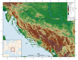 Topography of the Dinaric Alps
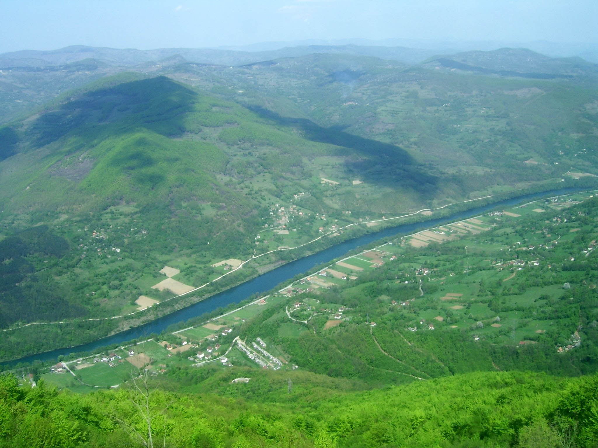
The Dinaric Alps or Dinarides form a mountain chain in Southern Europe, spanning areas of Slovenia, Croatia, Bosnia and Herzegovina, Serbia, Kosovo,[a 1] Albania and Montenegro.
They extend for 645 kilometres (401 mi) along the coast of the Adriatic Sea (northwest-southeast), from the Julian Alps in the northwest down to the Šar-Korab massif, where the mountain direction changes to north-south. The highest mountain of the Dinaric Alps is MountProkletije, located on the border of eastern Montenegro and northern Albania, with the peak called "Lake Crest" at 2,692 metres (8,832 ft).
The Dinaric Alps are the fifth most rugged and extensively mountainous area of Europe after the Caucasus Mountains, Alps, Pyrenees and Scandinavian Mountains. They are formed largely of secondary and tertiary sedimentary rocks of dolomite, limestone, sand and conglomerates formed by seas and lakes that had once covered the area.
During the Alpine earth movements that occurred 50–100 million years ago, immense lateral pressures folded and overthrust the rocks in a great arc around the old rigid block of the northeast. The Dinaric Alps were thrown up in more or less parallel ranges, stretching like necklaces from the Julian Alps as far as the areas of northern Albania and Kosovo, where the mountainous terrain subsides to make way for the waters of Drin and the fields of Kosovo. The Šar and Korab mountains then rise and the mountainous terrain continues southwards to the Pindus of Greece and the mountains of the Peloponnese and Crete, Rhodes to the Taurus Mountains of southern Turkey.
Contents
Name
The Dinarides are named after Mount Dinara (1,913 m), a prominent peak in the center of the mountain range on the border of Croatia and Bosnia and Herzegovina.
The chain is called Alpet Dinaride or Alpet Dinarike in Albanian, Dinarske planine, Dinarsko gorje or Dinaridi in Croatian, Dinarske planine (Динарске планине) or Dinaridi (Динариди) in Bosnian, Montenegrin, and Serbian, and Dinarsko gorstvo in Slovene.
Geology

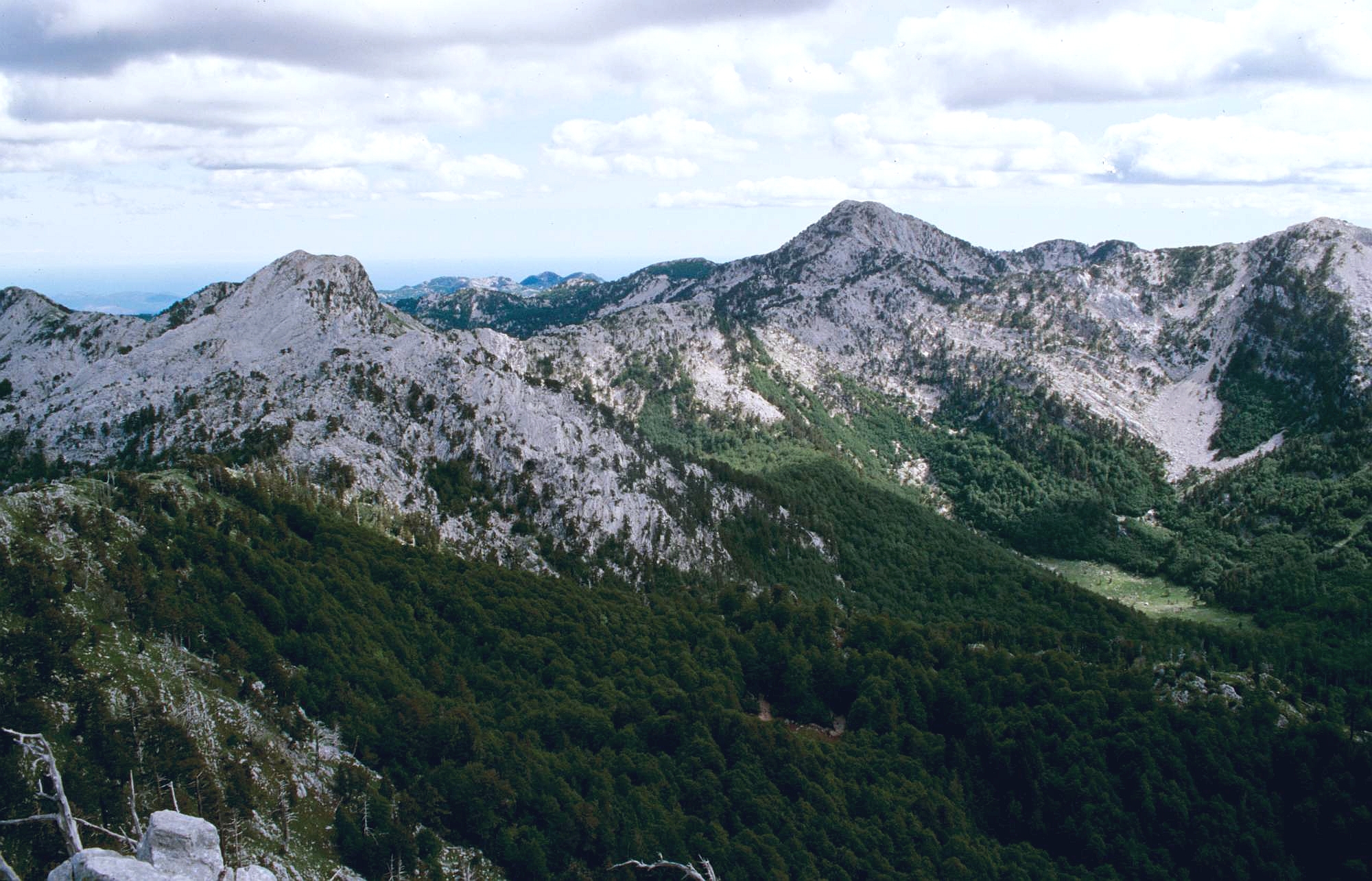
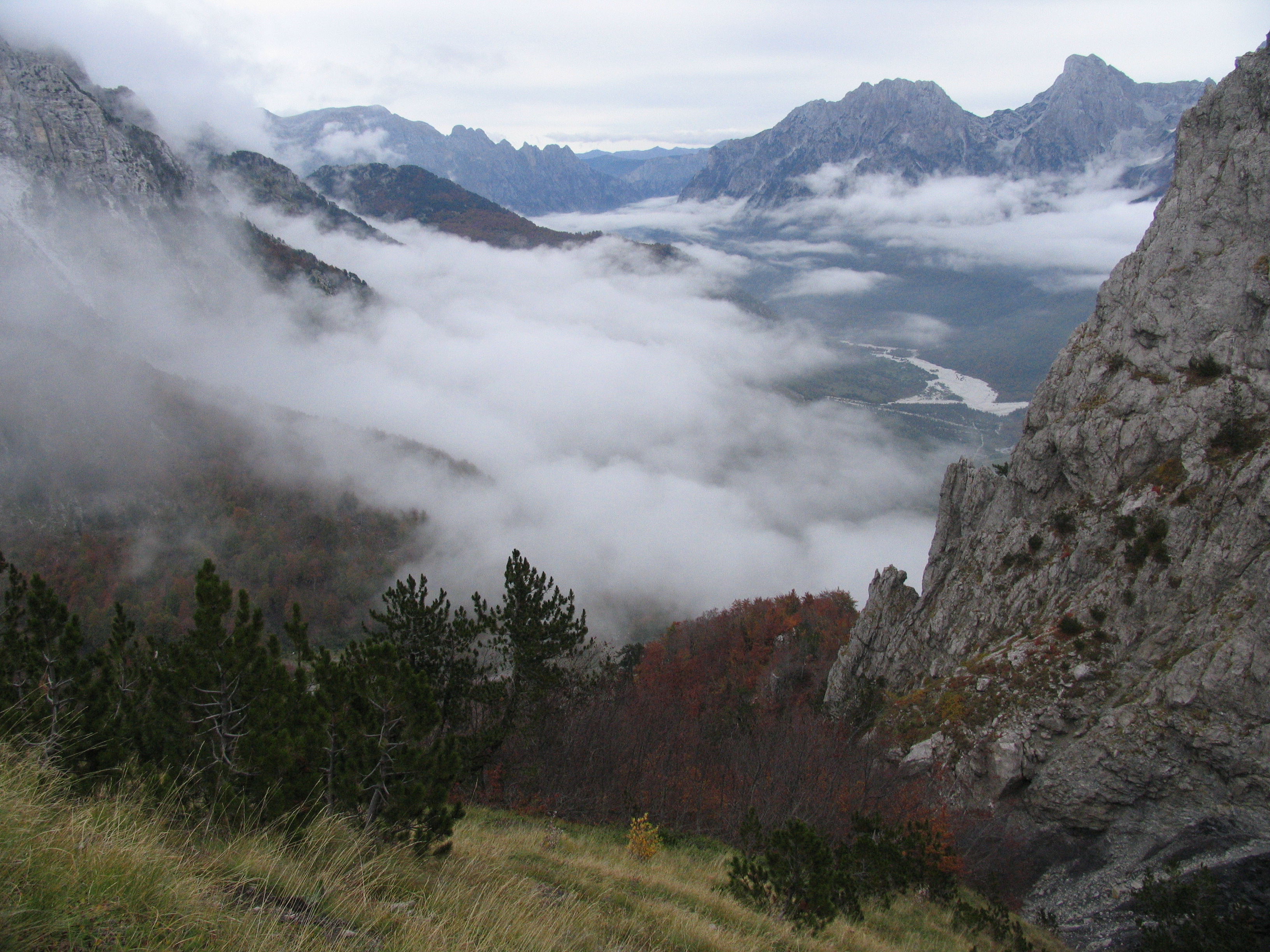
The Mesozoic limestone forms a very distinctive region of the Balkans, notable for features such as the Karst, which has given its name to all such terrains of limestone eroded by groundwater. The Quaternary ice ages had relatively little direct geologic influence on the Balkans. No permanent ice caps existed, and there is little evidence of extensive glaciation. Only the highest summits of Durmitor, Orjen and Prenj have glacial valleys and moraines as low as 600 m (1,969 ft). However, in the Prokletije, a range on the northern Albanian border that runs east to west (thus breaking the general geographic trend of the Dinaric system), there is evidence of major glaciation.
One geological feature of great importance to the present-day landscape of the Dinarides must be considered in more detail: that of the limestone mountains, often with their attendant faulting. They are hard and slow to erode, and often persist as steep jagged escarpments, through which steep-sided gorges and canyons are cleft by the rivers draining the higher slopes.
The most extensive example of limestone mountains in Europe are those of the Karst of the Dinaric Alps. Here, all the characteristic features are encountered again and again as one travels through this wild and underpopulated country. Limestone is a very porous rock, yet very hard and resistant to erosion. Water is the most important corrosive force, dissolving the limestone by chemical action of its natural acidity. As it percolates down through cracks in the limestone it opens up fissures and channels, often of considerable depth, so that whole systems of underground drainage develop. During subsequent millennia these work deeper, leaving in their wake enormous waterless caverns, sinkholes and grottoes and forming underground labyrinths of channels and shafts. The roofs of some of these caverns may eventually fall in, to produce great perpendicular-sided gorges, exposing the water to the surface once more. The magnificent gorges of many of the Dinaric rivers, for example those of the Vrbas, Neretva, Tara and Lim, are justly famous. The partially submerged western Dinaric Alps form the numerous islands and harbours along the Croatian coast.
Only along the Dinaric gorges is communication possible across the Karst, and roads and railways tunnel through precipitous cliffs and traverse narrow ledges above roaring torrents. A number of springs and rivers rise in the Dinaric range, including Jadro Spring noted for having been the source of water for Diocletian's Palace at Split.[1] At the same time, the purity of these rocks is such that the rivers are crystal clear, and there is little soil-making residue. Water quality testing of the Jadro River, for example, indicates the low pollutant levels present.[2] Rock faces are often bare of vegetation and glaring white, but what little soil there is may collect in the hollows and support lush lime-tolerant vegetation, or yield narrow strips of cultivation.
Human activity
Ruins of fortresses dot the mountainous landscape, evidence of centuries of war and the refuge the Dinaric Alps have provided to various armed forces. During the Roman period, the Dinarides provided shelter to the Illyrians resisting Roman conquest of the Balkans, which began with the conquest of the eastern Adriatic coast in the 3rd century BC. Rome conquered the whole of Illyria in 168 BC, but these mountains sheltered Illyrian resistance forces for many years until the area's complete subjugation by 14 AD. More recently, the Ottoman Empire failed to fully subjugate the mountainous areas of Montenegro. In the 20th century, too, the mountains provided favourable terrain for guerrilla warfare, with Yugoslav Partisans organising one of the most successful Allied resistance movements of World War II.
The area remains underpopulated, and forestry and mining remain the chief economic activities in the Dinaric Alps. The people of the Dinaric Alps are on record as being among the tallest in the world, with a male average height of 185.6 cm (6 ft 1.1 in) and a female average height of 171.0 cm (5 ft 7.3 in).[3]
Passes
The main mountain passes of the Dinaric Alps are:[4]
- Postojna Gate (Postojnska vrata), Slovenia (606 m/1,988 ft),
- Vratnik pass, Croatia (850 m/2,789 ft)
- Knin Gate (Kninska vrata) (about 700 m/2,297 ft)
- Vaganj (1,137 m/3,730 ft)
- Ivan-Saddle (Ivan-sedlo), Bosnia-Herzegovina (967 m/3,173 ft)
- Cemerno, Bosnia-Herzegovina (1,329 m/4,360 ft)
- Crkvine, Montenegro (1,045 m/3,428 ft)
- Cakor, Montenegro (1,849 m/6,066 ft)
Tunnels
Major tunnels transversing the Dinaric Alps include:
- Tuhobić Tunnel, Croatia
- Sveti Rok Tunnel, Croatia
- Mala Kapela Tunnel, Croatia
Mountains and plateaus

The mountains and plateaus within the Dinarides are found in the following regions.
Albania
- Maja Jezercë, highest peak
- Maja Grykat e Hapëta
- Maja Radohimës
- Maja e Popljuces
- Maja Briaset
- Maja Hekurave
- Maja Shnikut
- Maja Tat
- Kolata e Mirë
- Maja Rosit
- Maja Kokervhake
- Maja Shkurt
- Maja Malësores
- Maja e Ragamit
- Maja Bojs
- Maja Vukoces
- Shkëlzen
- Maja e Kakisë
- Rrasa e Zogut
Bosnia and Herzegovina
- Raduša
- Ravan planina
- Romanija
- Trebević
- Treskavica
- Šator
- Trebava
- Velež
Croatia
- Učka
- Ćićarija
- Velebit
- Svilaja
- Velika Kapela
- Mala Kapela
- Žumberak
Kosovo[a 1]
- Đeravica/Gjeravica
- Gusan/Maja Gusanit
- Marijaš/Marijash
- Veternik/Veterniku
- Bogićaj/Maja Bogiçaj
- Lićenat/Leqinat
Montenegro
- Bijela gora means "White Mountain" in Montenegrin, which is the opposite of "Crna Gora" or "Black Mountain" which is the local name for Montenegro
- Durmitor
- Orjen
- Zla Kolata (bordering Albania; Kolata e Keq in Albanian)
Central Serbia
Slovenia
- Gorjanci
- Kambreško and the Banjšice Plateau
- The Trnovo Forest, Nanos and Hrušica
- Javornik Hills and Snežnik
- Idrija Hills
- Krim Hills and Menišija
- Bloke
- The Velika Mountain, Stojna and the Gotenica Mountain
- The Mala Mountain, the Kočevski Rog and the Poljane Mountain
- Dry Carniola and Dobrepolje
- Radulja Hills
Notes and references
Notes:
- ^ a b c Kosovo is the subject of a territorial dispute between the Republic of Serbia and the self-proclaimed Republic of Kosovo. The latter declared independence on 17 February 2008, while Serbia claims it as part of its own sovereign territory. Its independence is recognised by 85 UN member states.
References:
- ^ C.Michael Hogan, "Diocletian's Palace", The Megalithic Portal, A. Burnham ed, Oct 6, 2007
- ^ Nives Štambuk-Giljanović, The Pollution Load by Nitrogen and Phosphorus in the Jadro River, Springer Netherlands, ISSN 0167-6369 (Print) 1573–2959 (Online), Volume 123, Numbers 1–3 / December, 2006
- ^ Average height of adolescents in the Dinaric Alps. They are also reputed to have the tallest males in Europe. Study claims it is not complete as of yet.
- ^ Summitpost. Dinaric Alps: Passes in the Dinaric Alps, accessed 11-19-2008
External links
 Albania topics
- Index
- Outline
Symbols People History - Origins
- Praevalitana
- Epirus Nova
- Middle Ages
- Albania under the Bulgarian Empire
- Albania under the Serbian Empire
- Principality of Arbër
- Kingdom of Albania
- Albanian Principalities in Middle Ages
- League of Lezhë
- Venetian Albania
- Ottoman Albania
- Albanian Pashaliks
- Massacre of the Albanian Beys
- Albanian National Awakening
- Revolts of 1833–1839
- Revolt of 1843–1844
- Revolt of 1847
- League of Prizren
- League of Peja
- Revolt of 1910
- Battle of Deçiq
- Independence Declaration
- Provisional Government of Albania
- Albania during the Balkan Wars
- Principality of Albania (1914–1925)
- Italian Protectorate on southern Albania
- Vlora War
- Republic of Mirdita
- Albanian Republic (1925–1928)
- Albanian Kingdom (1928–1939)
- Albania under Italy (Invasion
- Colonization)
- Albania under Germany
- Resistance
- Communist Albania (1946–1992)
- Post-Communist Albania (since 1992)
- Timeline to 1993, 1994–Present
Politics Geography - Cities:
- Geographical Regions:
- Northern Mountain Range
- Southern Mountain Range
- Western Lowlands
- Central Mountain Range
- Mountains:
- Mount Dajti
- Golem Korab
- Dinaric Alps
- Mount Korab
- Tomorri Mountain
- Seas:
- Rivers:
- Drin River
- Buna River
- Vjosë
- Black Drin
- Lakes:
- Lake Skadar
- Lake Ohrid
- Lake Prespa
- Lagoons:
- Karavasta
- Narta
- Plains:
- Myzeqe
- Korçë Plain
- Zadrima
- Capes:
- Cape of Gjuhëz
- Cape of Rodon
- National Parks:
- Butrint
- Lura
- Llogara
- Thethi
- Valbona Valley
- Shebenik-Jabllanica
- Fir of Hotova
- Karaburun-Sazan
Economy Military - Military
- Air Force
- Rapid Reaction Brigade
- Naval Defense Forces
- Joint Forces Command
- Support Command
Culture - Languages
- Costume
- Nationalism
- Literature
- Cinema
- Cuisine
- Emigration
- Music
- Sports
- Holidays
- Religion
- Television
- Radio
- Mythology
- Epic Poetry
Religion - Islam
- Albanian Orthodox Church
- Roman Catholicism
- Protestanism
- Byzantine Catholicism
Categories Categories:- Dinaric Alps
- Mountain ranges of Albania
- Mountains of Bosnia and Herzegovina
- Mountains of Croatia
- Mountains of Montenegro
- Mountain ranges of Serbia
- Mountains of Kosovo
- Physiographic provinces
- Mountain ranges of Slovenia

Wikimedia Foundation. 2010.