- Pindus
-
This article is about the mountain range called Pindus. For other uses of these names, see Pindus (disambiguation).
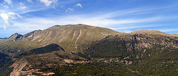
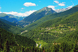
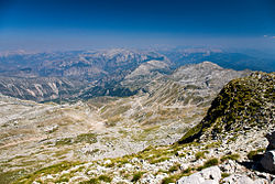
The Pindus (also Pindos or Pindhos[1]) (Greek: Πίνδος) mountain range is located in northern Greece and southern Albania. It is roughly 160 km long, with a maximum elevation of 2637 m (Mount Smolikas). Because it runs along the border of Thessaly and Epirus, the Pindus range is often called the "spine of Greece". The mountain range stretches from near the Greek-Albanian borders in Northern Epirus, entering the Epirus region and Macedonia region in northern Greece down to the north of the Peloponnese.
Contents
Population
There are many villages in the Pindus, one of them being Samarina, which boasts one of the highest elevations in Greece. Many of the villages such as Perivoli include communities of Aromanians (Vlachs), originally shepherds and farmers. In the last decades, a number of villages, such as Metsovo, developed into touristic resorts with ski facilities.
Transportation
Egnatia Odos highway serves the region and connects it with the rest of Greece.
Nature and wildlife
The Pindus ecoregion covers a wide range of elevations and habitats, from deep canyons to steep mountains. The wide range in altitude results in two major forest zones:
- A conifer zone, with trees such as a subspecies of Austrian Pine and the endemic Greek fir, characterizes the highest elevations, with juniper woodlands dominating near the timberline.
Large breeding colonies of herons, spoonbills, egrets, and pelicans fish the cool waters of the mountain lakes of the Pindus Mountain Conifer and Broadleaf Mixed Forests ecoregion. This is one of the few areas in Europe where the rare Dalmatian pelican can be found. Wolves, jackals, and bears are found in the forests.
Ecology
The forests of this ecoregion have faced many threats over the course of human history, including overgrazing, agriculture, and deforestation. The greatest threats now come from the development of mountain tourism and ski resorts. Because of the instability of the soil on steep mountains, road-building and clear-cutting operations have led to dangerous landslides and the collapse of mountain slopes. Mining for bauxite, overgrazing, and over-collection of plants are also threatening the great biodiversity of this ecoregion.
National Parks
In the Greek section of the Pindus mountains there are two national parks.
Vikos-Aoos National Park
Main article: Vikos–Aoös National ParkThe Vikos-Aoos National Park is south of the town of Konitsa, in the west part of Zagori region. It includes Mount Tymfi, the Vikos Gorge and the Aoos Gorge. It was created in 1973.
Pindus National Park
Main article: Pindus National ParkThe Pindus National Park (also known as Valia Kalda) is in a remote area in the north east of the Pindus mountains, north of the town of Metsovo and south of Perivoli. The park of some 7,000 hectares was established in 1966. There are forests of black pine and beech, and in the higher parts, Bosnian Pine (Pinus leucodermis). The park is a refuge for bear, wild cat and lynx.[2]
The National Park was selected as main motif for two high value euro collectors' coins: the €10 Greek Birds and Flowers and Black Pine Trees commemorative coins, minted in 2007. On the obverse of one of the coins there is a panoramic view of the common black pine trees that are prevalent in the park.
See also
Further reading
- Salmon, T. (2006) The Mountains of Greece: The Pindos Mountains Cicerone Press ISBN 978 1852844400
References
- ^ Latin form Pindus is used by Encarta. Both Pindus and Pindos are used by the Encyclopedia Britannica (here and here). Modern guidebooks tend to use Pindos (Baedeker's Greece, DK Eyewitness Travel Guide, Cicerone Mountain Walking) or Pindhos (Lonely Planet, Rough Guide).
- ^ Valia Kalda Refuge website
External links
Categories:- Mountain ranges of Albania
- Mountain ranges of Greece
- National parks of Greece
- Physiographic sections
Wikimedia Foundation. 2010.


