- Mount Tomorr
-
Tomorri Mountain National Park 
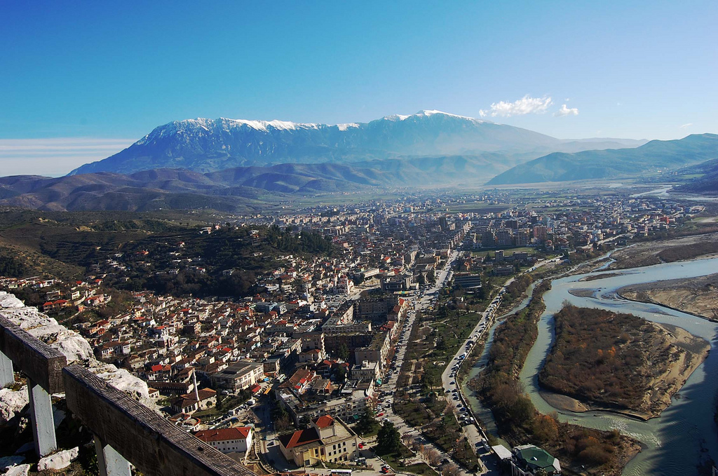
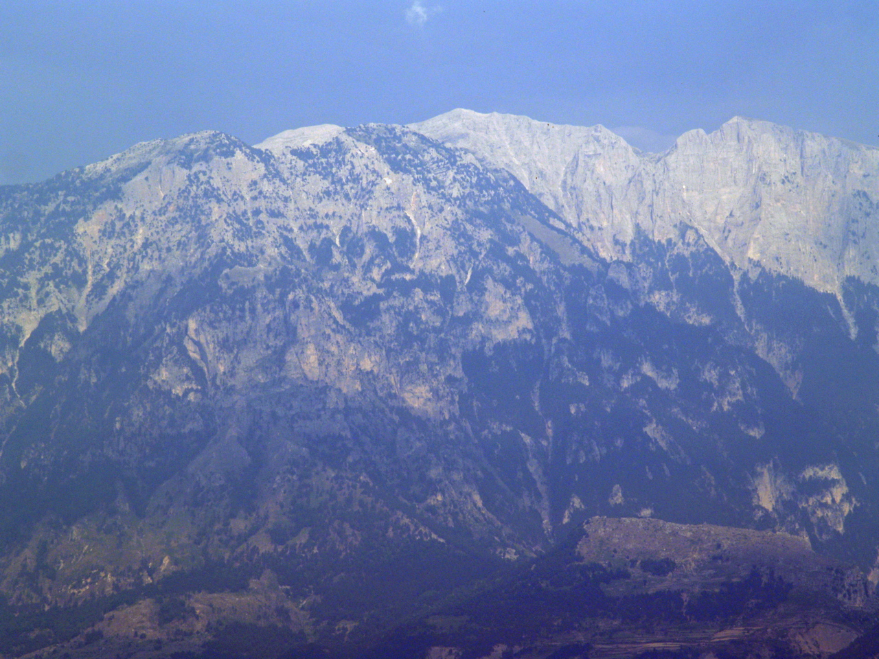
The town of Berat and Tomorri in the distanceLocation Central Albania Nearest city Berat Area 4,000 ha Mount Tomorr is a large mountain in southern Albania. Its highest peak, called Çuka e Partizanit, reaches a height of 2,416 m (7,927 ft). It is located east of the towns of Berat and Poliçan and the river Osum not far from the Canyon of Osum river.
In antiquity the region of Tomorr (Greek: Άμυρον Amyron) was inhabited by the Dexari, a tribe of Epirus that belonged to the Chaonian group.[1][2]
 Tomorr
Albanian folklore tells how Tomorr came to be. The people believed that Tomorr was a giant that wanted to fight another giant named Shpirag for a young woman. The two giants killed each other and when hearing this the young woman cried and drowned in her own tears thus creating the river of Osum.[3]
Tomorr is of great importance to the local people where a Bektashi religious temple can be found, and offering them many facilities such as skiing. For its importance and beauty the Albanian Government declared Tomorr a National Park. Tomorr Mountain National Park (Albanian:Parku Kombëtar i Malit të Tomorrit) covers an area of 4,000 hectares. Many endangered species are free to roam and live there.
References
- ^ Nicholas Geoffrey Lemprière Hammond, Guy Thompson Griffith. A History of Macedonia: Historical geography and prehistory. Clarendon Press, 1972, p. 92.
- ^ Lewis, D. M.; Boardman, John (1994). The Cambridge ancient history: The fourth century B.C.. Cambridge University Press. p. 423. ISBN 9780521233484. http://books.google.com/books?id=vx251bK988gC&pg=PA423. Retrieved 26 October 2010.
- ^ A dictionary of Albanian religion, mythology and folk culture, Robert Elsie, C. Hurst & Co. Publishers, 2001, ISBN 1850655707, p. 253.
External links
- TMNP on Berat Guide (Albanian)
National parks of Albania National Butrint • Dajti Mountain • Divjaka-Karavasta • Lura • Llogara • Prespa • Thethi • Tomorri Mountain • Valbona Valley • Fir of Hotova-Dangëlli • Fir of Drenova • Shtam Pass • Shebenik-Jabllanica • Zall-Gjoçaj
Archaeological Marine Karaburun-Sazan Albania topics
- Index
- Outline
Symbols People History - Origins
- Praevalitana
- Epirus Nova
- Middle Ages
- Albania under the Bulgarian Empire
- Albania under the Serbian Empire
- Principality of Arbër
- Kingdom of Albania
- Albanian Principalities in Middle Ages
- League of Lezhë
- Venetian Albania
- Ottoman Albania
- Albanian Pashaliks
- Massacre of the Albanian Beys
- Albanian National Awakening
- Revolts of 1833–1839
- Revolt of 1843–1844
- Revolt of 1847
- League of Prizren
- League of Peja
- Revolt of 1910
- Battle of Deçiq
- Independence Declaration
- Provisional Government of Albania
- Albania during the Balkan Wars
- Principality of Albania (1914–1925)
- Italian Protectorate on southern Albania
- Vlora War
- Republic of Mirdita
- Albanian Republic (1925–1928)
- Albanian Kingdom (1928–1939)
- Albania under Italy (Invasion
- Colonization)
- Albania under Germany
- Resistance
- Communist Albania (1946–1992)
- Post-Communist Albania (since 1992)
- Timeline to 1993, 1994–Present
Politics Geography - Cities:
- Geographical Regions:
- Northern Mountain Range
- Southern Mountain Range
- Western Lowlands
- Central Mountain Range
- Mountains:
- Mount Dajti
- Golem Korab
- Dinaric Alps
- Mount Korab
- Tomorri Mountain
- Seas:
- Rivers:
- Drin River
- Buna River
- Vjosë
- Black Drin
- Lakes:
- Lake Skadar
- Lake Ohrid
- Lake Prespa
- Lagoons:
- Karavasta
- Narta
- Plains:
- Myzeqe
- Korçë Plain
- Zadrima
- Capes:
- Cape of Gjuhëz
- Cape of Rodon
- National Parks:
- Butrint
- Lura
- Llogara
- Thethi
- Valbona Valley
- Shebenik-Jabllanica
- Fir of Hotova
- Karaburun-Sazan
Economy Military - Military
- Air Force
- Rapid Reaction Brigade
- Naval Defense Forces
- Joint Forces Command
- Support Command
Culture - Languages
- Costume
- Nationalism
- Literature
- Cinema
- Cuisine
- Emigration
- Music
- Sports
- Holidays
- Religion
- Television
- Radio
- Mythology
- Epic Poetry
Religion - Islam
- Albanian Orthodox Church
- Roman Catholicism
- Protestanism
- Byzantine Catholicism
Categories Coordinates: 40°42′33″N 20°08′30″E / 40.709089°N 20.141802°E
Categories:- Mountains of Albania
- National parks of Albania
- Protected areas established in 1996
- IUCN Category II
- Kutmichevitsa
Wikimedia Foundation. 2010.