- Mount Korab
-
"Korab" redirects here. For other uses, see Korab (disambiguation).
Mount Korab 
Mount KorabElevation 2,764 m (9,068 ft) [1] Prominence 2,169 m (7,116 ft) [1] Listing Country high point
UltraLocation Macedonia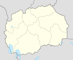
 Mount Korab
Location on Albania/Macedonia borderLocation  Albania
 Macedonia
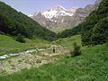
Coordinates 41°47′25″N 20°32′48″E / 41.79028°N 20.54667°ECoordinates: 41°47′25″N 20°32′48″E / 41.79028°N 20.54667°E  Valley of Dlaboka Reka river with the waterfall in the background.
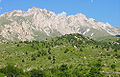
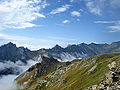
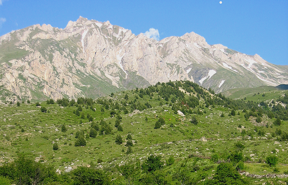
 Landscape of Mount Korab from the Macedonian side
Mount Korab ( Macedonian: Голем Кораб, Golem Korab, Albanian: Maja e Korabit or Mali i Korabit ) is the highest mountain of the Republic of Macedonia and Albania, its peak forming a frontier between the two countries. The peak lies adjacent to the Šar Mountains.
Mount Korab is also pictured in the coat of arms of Macedonia.
Contents
Geography
The peaks are occasionally ruptured by radial tectonics in the shape of blocks that end in the valley of the Radika river on the Macedonian side. These blocks occasionally have steep slopes that reach up to 500 m (1,640 ft). Particularly remarkable is also the alpine area of Kabaš with several sheer and hardly approachable peaks. In its highest part, above 2,000 m (6,562 ft), the climate is alpine and includes some alpine flora elements. The largest lake on Mount Korab is Gramë Lake located on the Mali i Gramës in Albania.
The mountain is home to the spectacular Korab waterfall in the upper valley of the Dlaboka Reka river. During spring time, the waterfall reaches a height of over 130 meters, which makes it the highest in Macedonia. The state border intersects the higher peak, Great Korab.
Ascent from the Macedonian side involves entering the Macedonian-Albanian boundary area, for which a special permit is required from the Macedonian Ministry of internal affairs,[2] although people regularly track on Korab without it.
Peaks
The mountain has a number of sub-peaks that are higher than 2000 metres. These include:
- Mount Korab 2,764 m (9,068 ft)
- Korab II 2,756 m (9,042 ft)
- Korab III (somewhere between 2716 and 2756m)
- Korab Gates(peak) 2,727 m (8,947 ft)
- Maja e Moravës 2,718 m (8,917 ft)
- Shulani i Radomirës 2,716 m (8,911 ft)
- Kepi Bar 2,683 m (8,802 ft)
- Kabaš in Macedonia 2,395 m (7,858 ft)
- Mali i Gramës 2,345 m (7,694 ft)
- Ciganski Premin 2,295 m (7,530 ft)
- Ploča 2,235 m (7,333 ft)
Passes
The two main passes in the Korab ridge are:
- Small Korab Gate 2,465 m (8,087 ft)
- Big Korab Gate 2,062 m (6,765 ft)
Climbing
There are no formal restrictions on climbing the mountain from the Albanian side. The area is now safer and more stable than it has been in recent times. It is possible to drive as far as the local village of Radomira, but the local infrastructure is generally not good. A four wheel drive vehicle with high clearance may be required. There are no accurate and up to date maps, local signposting is poor, and hikers may have to overcome the additional problem of aggressive dogs.[3]
An international expedition to climb Mount Korab is organized each September by the mountain club PSD "Korab" in Skopje.
See also
 Media related to Korab at Wikimedia Commons
- List of mountains in Albania
- Mountains of the Republic of Macedonia
- List of non-Alpine European Ultras
References
External links
Image gallery
-
Mount Korab
-
Landscape of Mount Korab from the Macedonian side
-
Valley of Dlaboka Reka river with the waterfall in the background.
-
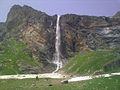
Korab waterfall on Dlaboka Reka river.
-
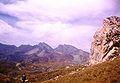
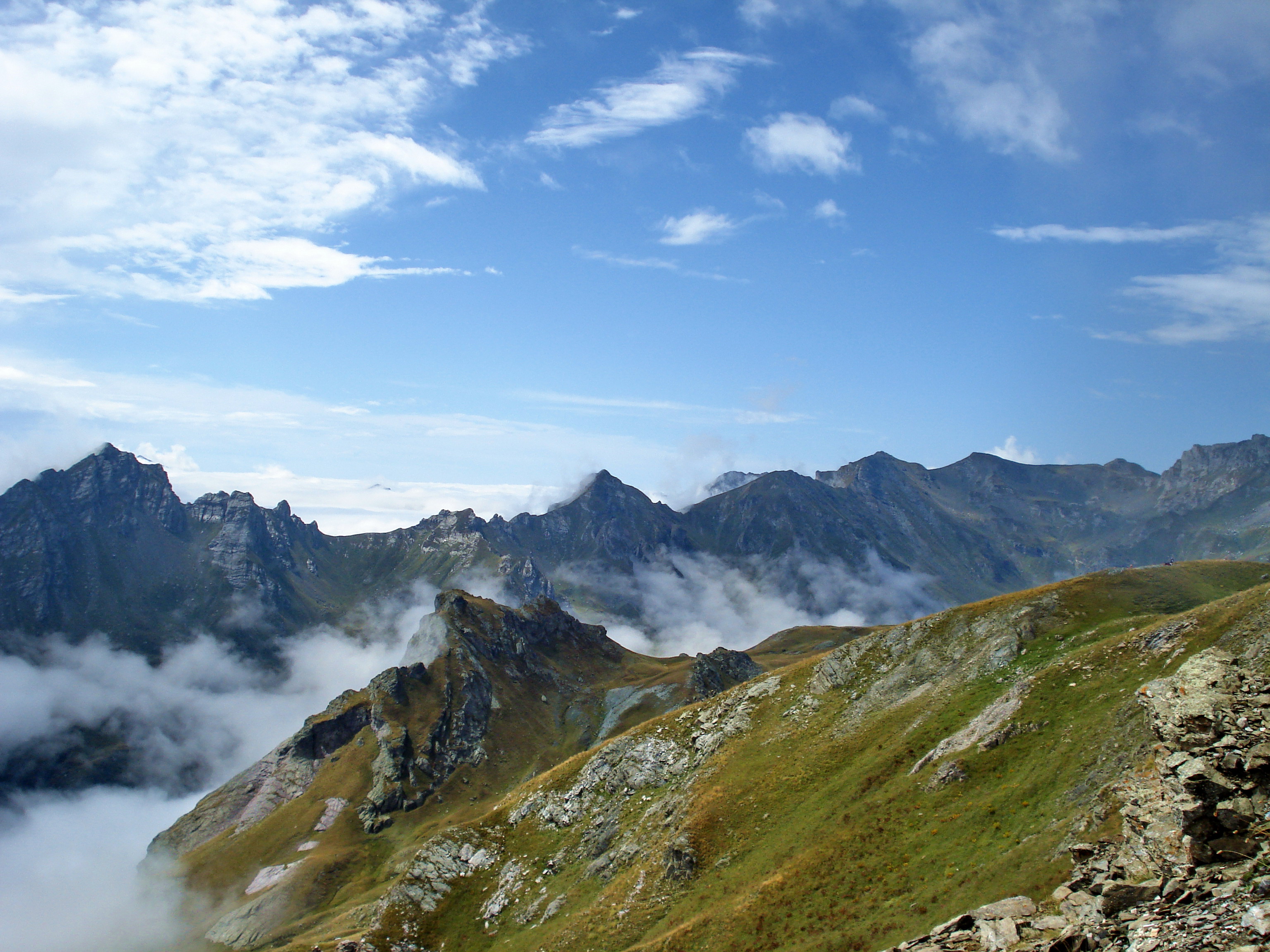
Landscape of Mount Korab
Albania topics- Index
- Outline
Symbols People History - Origins
- Praevalitana
- Epirus Nova
- Middle Ages
- Albania under the Bulgarian Empire
- Albania under the Serbian Empire
- Principality of Arbër
- Kingdom of Albania
- Albanian Principalities in Middle Ages
- League of Lezhë
- Venetian Albania
- Ottoman Albania
- Albanian Pashaliks
- Massacre of the Albanian Beys
- Albanian National Awakening
- Revolts of 1833–1839
- Revolt of 1843–1844
- Revolt of 1847
- League of Prizren
- League of Peja
- Revolt of 1910
- Battle of Deçiq
- Independence Declaration
- Provisional Government of Albania
- Albania during the Balkan Wars
- Principality of Albania (1914–1925)
- Italian Protectorate on southern Albania
- Vlora War
- Republic of Mirdita
- Albanian Republic (1925–1928)
- Albanian Kingdom (1928–1939)
- Albania under Italy (Invasion
- Colonization)
- Albania under Germany
- Resistance
- Communist Albania (1946–1992)
- Post-Communist Albania (since 1992)
- Timeline to 1993, 1994–Present
Politics Geography - Cities:
- Geographical Regions:
- Northern Mountain Range
- Southern Mountain Range
- Western Lowlands
- Central Mountain Range
- Mountains:
- Mount Dajti
- Golem Korab
- Dinaric Alps
- Mount Korab
- Tomorri Mountain
- Seas:
- Rivers:
- Drin River
- Buna River
- Vjosë
- Black Drin
- Lakes:
- Lake Skadar
- Lake Ohrid
- Lake Prespa
- Lagoons:
- Karavasta
- Narta
- Plains:
- Myzeqe
- Korçë Plain
- Zadrima
- Capes:
- Cape of Gjuhëz
- Cape of Rodon
- National Parks:
- Butrint
- Lura
- Llogara
- Thethi
- Valbona Valley
- Shebenik-Jabllanica
- Fir of Hotova
- Karaburun-Sazan
Economy Military - Military
- Air Force
- Rapid Reaction Brigade
- Naval Defense Forces
- Joint Forces Command
- Support Command
Culture - Languages
- Costume
- Nationalism
- Literature
- Cinema
- Cuisine
- Emigration
- Music
- Sports
- Holidays
- Religion
- Television
- Radio
- Mythology
- Epic Poetry
Religion - Islam
- Albanian Orthodox Church
- Roman Catholicism
- Protestanism
- Byzantine Catholicism
Categories National symbols of the Republic of Macedonia Constitutional Unofficial Star of Kutleš/Vergina · Golden Lion
Ultra prominent peaks of Europe Scandinavia Galdhøpiggen • Kebnekaise • Jiehkkevárri • Snøhetta • Store Lenangstind • Sarektjåhkkå — On islands: Beerenberg • Hvannadalshnúkur • Newtontoppen • Novaya Zemlya HPWestern Europe Atlantic islands Alps Mont Blanc • Grossglockner • Finsteraarhorn • Wildspitze • Bernina • Hochkönig • Monte Rosa • Hoher Dachstein • Marmolada • Viso • Triglav • Barre des Écrins • Säntis • Ortler • Baldo • Gran Paradiso • Coca • Cima Dodici • Dents du Midi • Chamechaude • Zugspitze • Antelao • Arcalod • Grintovec • Großer Priel • Grigna Settentrionale • Bondone • Presanella • Birnhorn • Col Nudo • Pointe Percée • Montasch • Polinik • Tödi • Birkkarspitze • Wilder Kaiser • Grande Tête de l'Obiou • Cima Tosa • Hochtor • Grimming • Grand Combin • Tournette • Zirbitzkogel • KeschItaly Eastern Europe Carpathians: Gerlachovský štít • Parângu Mare • Moldoveanu • Peleaga — Crimea: Roman-Kosh — Urals: NarodnayaBalkans Mediterranean islands Caucasus Elbrus • Bazardüzü • Kazbek • Tebulosmta • Aragats • Dykh-Tau • Dyultydag • Kapudzhukh • Gora Addala Shukgelmezr • Shani • ShahdaghCategories:- Albania–Republic of Macedonia border
- International mountains of Europe
- Mountains of Albania
- Mountains of the Republic of Macedonia
- Šar Mountains


Wikimedia Foundation. 2010.