- Zlatibor
-
- For other meanings see: Zlatibor (disambiguation).
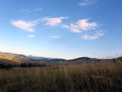
Zlatibor (Serbian Cyrillic: Златибoр, pronounced [zlǎtibɔ̝r]) is a mountain region situated in the western part of Serbia, a part of the Dinaric Alps.
The mountain range spreads over an area of 300 km², 27 miles in length, southeast to northwest, and up to 23 miles in width. The highest peak is Tornik at 1496 m. Zlatibor is situated between 43° 31' N, and 43° 51' N, and between 19° 28' E, and 19° 56' E.
Zlatibor is administratively divided into three municipalities within Serbia: Čajetina, Užice and Nova Varoš, in the Zlatibor District. The railroad Belgrade-Bar passes through Zlatibor.
The southern and the eastern border of Zlatibor are natural - the rivers Uvac and Veliki Rzav. In the west Zlatibor borders Bosnia - its villages of Mokra Gora, Semegnjevo and Jablanica mark the border. Zlatibor is located in the northern part of the Stari Vlah region, a historical border region between Raška, Herzegovina and Bosnia. The hill called Cigla near the village of Jablanica still has some borderline markings of the Kingdom of Serbia, Austria-Hungary and the Ottoman Empire. In the Middle Ages, Zlatibor was known as Rujno, a župa that was part of Raška. The name Zlatibor started to be used in the 18th century, but its etymology is uncertain. It probably stems from the Serbian words zlatni (golden) and bor (pine) — a particular type of a pine originates from the mountain, whose Latin name is Pinus sylvestris var. zlatiborica, and today is endangered.
Tourism in Zlatibor
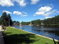
Situated at an altitude of just over 1,000 meters, Zlatibor is a climatic resort, characterized by a cool mountain climate, clean air, long periods of sunshine during the summer and a heavy snow cover in winter. Tourist facilities include modern hotels, holiday centers and cottages, sports grounds and skiing.
Medical services are provided by the staff of the Special Institute for the Prevention and Treatment of Thyroid Gland Disorders and the Rehabilitation of Patients. Modern methods of treatment are being utilized, including ultrasound techniques, stimulator's, diathermy and iodized and galvanic baths.
Notable successes have been achieved in the diagnosis, treatment, rehabilitation, and prevention of different kinds and stages of thyroid gland diseases.
See also
- Čajetina (administrative centre of Mt. Zlatibor)
- Mokra Gora (a village at Mt. Zlatibor)
- Sirogojno (a ethno-village at Mt. Zlatibor)
- Kremna, home of the world famous Prophecy from Kremna
- Užice-Ponikve Airport (nearby airport)
- Zlatibor District
External links
- Zlatibor travel guide from Wikitravel
- / Zlatibor Mountain Travel Guide Zlatibor Info Web site
- MSN Map
- -> Everything about Zlatibor in one place Everything about Zlatibor in one place
Geographical regions of Serbia Bačka • Banat • Belica • Binačko Pomoravlje • Braničevo • Dobrič • Drenica • Goljak • Gora • Gornje Livade • Gornji Breg • Gruža • Has • Homolje • Ibarski Kolašin • Jadar • Jasenica • Kačer • Kolubara • Komarani • Kosanica • Kosmaj • Kosovo • Kučaj • Lepenica • Lešnica • Levač • Lugomir • Lužnica • Mačva • Malo Kosovo • Metohija • Mlava • Moravac • Negotinska Krajina • Opolje • Pančevački Rit • Pčinja • Pešter • Pocerina • Podgor • Podlužje • Podrinje • Podunavlje • Polimlje • Pomoravlje • Pomorišje • Posavina • Potisje • Preševo Valley • Rasina • Raška • Rugovo • Sandžak • Srem • Stari Vlah • Stig • Svrljig • Šajkaška • Šopluk • Šumadija • Tamnava • Telečka • Timočka Krajina • Toplica • Veliki Rit • Vlasina • Zaglavak • Zlatibor • Župa Categories:
- Zlatibor District geography stubs
- Zlatibor
- Užice
- Mountains of Serbia
- Tourism in Serbia
- Zlatibor District
Wikimedia Foundation. 2010.


