- Prut
Geobox|River
name = Prut
native_name =
other_name =
other_name1 =

image_size = 300
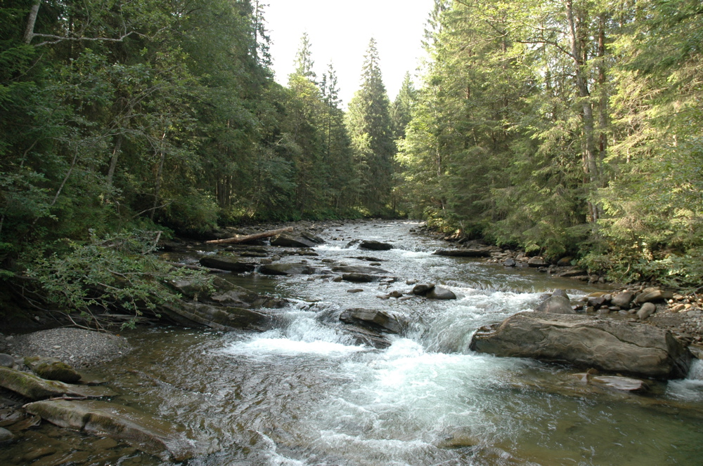
image_caption = Prut near Mt. Hoverla, in Ukraine
country_type = Countries
state_type =
region_type =
district_type = Oblasts/
Counties/
Districts
city_type = Cities
country =Ukraine ,Romania ,Moldova
country1 =
state =
state1 =
region =
region1 =
district = Ukraine: Ivano-Frankivsk O.,
Chernivtsi O.
Romania: Botoşani C., Iaşi C.,
Vaslui C., Galaţi C.
Moldova Briceni d., Edineţ d.,
Rîşcani d., Glodeni d., Făleşti d.,
Ungheni d., Nisporeni d.,
Hînceşti d., Leova d., Cantemir d.,
Cahul d.
district1 =
city =Kolomyia ,Chernivtsi ,Ungheni ,Leova ,Cahul
city1 =
length = 953
watershed = 27500
discharge_location =
discharge =
discharge_max =
discharge_min =
discharge1_location =
discharge1 =
source_name =Carpathian Mountains
source_location = Mt.Hoverla
source_district = Ivano-Frankivsk O.
source_region =
source_state =
source_country =Ukraine
source_lat_d =
source_lat_m =
source_lat_s =
source_lat_NS =
source_long_d =
source_long_m =
source_long_s =
source_long_EW =
source_elevation =
source_length =
mouth_name =Danube
mouth_location =Giurgiuleşti
mouth_district =
mouth_region =
mouth_state =
mouth_country = Romania/Moldova
mouth_lat_d = 45
mouth_lat_m = 28
mouth_lat_s = 8
mouth_lat_NS = N
mouth_long_d = 28
mouth_long_m = 12
mouth_long_s = 28
mouth_long_EW = E
mouth_elevation =
tributary_left =
tributary_left1 =
tributary_right = Cheremosh, Jijia
tributary_right1 =
free = XIII.1
free_type = Official River Code

map_size = 250
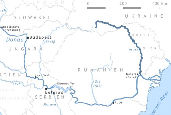
map_caption = Map of the Prut River.Prut, or Pruth, ( _uk. Прут) is a 953 km long river in
Eastern Europe . It was known in antiquity as "Pyretus" or "Porata" (possibly) [Herodotus, translated by Thomas Gaisford and edited by Peter Edmund Laurent, "The Nine Books of the History of Herodotus", Henry Slatter 1846, p. 299] or "Gerasius" [Peter Heather, "The Goths", Blackwell Publishing, 1998, p. 100] . It originates on the eastern slope of MountHoverla , in theCarpathian Mountains inUkraine . It flows southeast to join theDanube river near Reni, east ofGalaţi .Between 1918 and
1940 it was almost entirely inGreater Romania . Nowadays, for a length of 695 km it forms the border betweenRomania andMoldova . It has a hydrographic basin of 27,500 km², of which 10,990 km² are in Romania and 7,790 km² in Moldova. The biggest city along its banks isChernivtsi ,Ukraine .The
Costeşti-Stînca /Stânca-Costeşti dam, operated jointly by Moldova and Romania, is built on the Prut.Towns
The following towns are situated along the river Prut, from source to mouth:
Delatyn ,Kolomyia ,Sniatyn ,Chernivtsi ,Novoselytsia ,Darabani ,Lipcani ,Ungheni ,Leova ,Cantemir ,Cahul .Tributaries
The following rivers are tributaries to the river Prut:
Left: Racovăţ, Ciuhur, Lăpuşna, Sărata
Right: Cheremosh, Herţa, Poiana, Corneşti, Isnovăţ, Rădăuţi, Ghireni, Volovăţ, Badu, Başeu, Corogea, Berza Veche, Râioasa, Soloneţ, Cerchezoaia, Jijia, Cozmeşti, Bohotin, Moşna, Pruteţ, Sărata, Elan, Horincea, Oancea, Stoeneasa, Chineja
ee also
*
Pokucie References
* Administraţia Naţională Apelor Române - Cadastrul Apelor - Bucureşti
* Institutul de Meteorologie şi Hidrologie - Rîurile României - Bucureşti 1971
Wikimedia Foundation. 2010.
