- Geography of Fiji
-

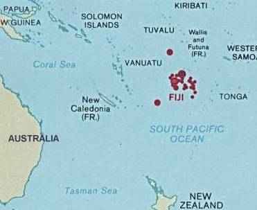
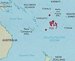 Fiji's location in Oceania
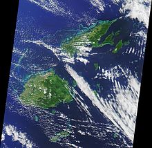
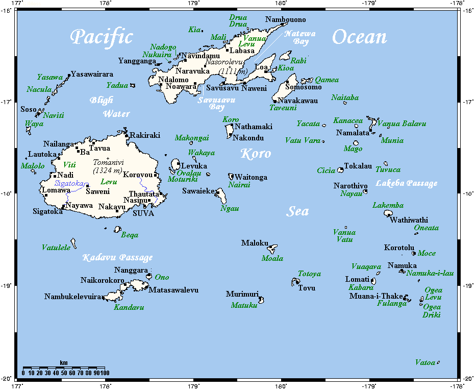
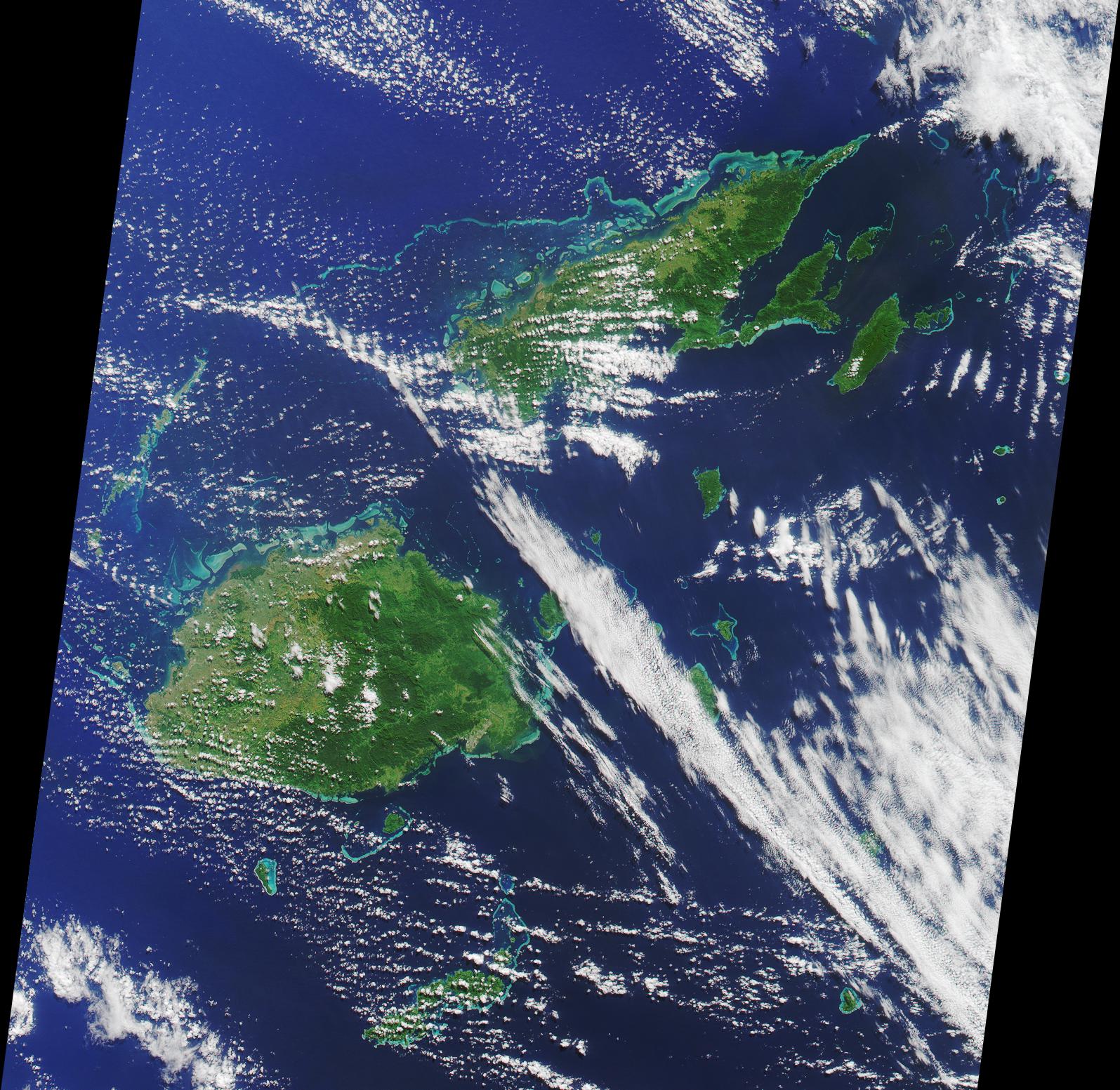
Fiji is a group of volcanic islands in the South Pacific, lying about 4,450 km (2,775 mi) southwest of Honolulu and 1,770 km (1,100 mi) north of New Zealand. Of the 322 islands and 522 smaller islets making up the archipelago, about 106 are permanently inhabited. Viti Levu, the largest island, covers about 57 % of the nation's land area, hosts the two official cities (the capital Suva, and Lautoka) and most other major towns, such as Ba, Nasinu, and Nadi (the site of the international airport), and contains some 69 % of the population. Vanua Levu, 64 km to the north of Viti Levu, covers just over 30 % of the land area though is home to only some 15 % of the population. Its main towns are Labasa and Savusavu. In the northeast it features Natewa Bay, carving out the Loa peninsula.
Both islands are mountainous, with peaks up to 1300 m rising abruptly from the shore, and covered with tropical forests. Heavy rains (up to 304 cm or 120 inches annually) fall on the windward (southeastern) side, covering these sections of the islands with dense tropical forest. Lowlands on the western portions of each of the main islands are sheltered by the mountains and have a well-marked dry season favorable to crops such as sugarcane.
Other islands and island groups, which cover just 12.5 % of the land area and house some 16 % of the population, include Taveuni southeast off Vanua Levu and Kadavu Island, south off Viti Levu (the third and fourth largest islands respectively), the Mamanuca Group (just off Nadi) and Yasawa Group (to the north of the Mamanucas), which are popular tourist destinations, the Lomaiviti Group (just off Suva) with Levuka, the former capital and the only major town on any of the smaller islands, located on the island of Ovalau, and the remote Lau Group over the Koro Sea to the east near Tonga, from which it is separated by the Lakeba Passage.
Two outlying regions are Rotuma, 400 km to the north, and the uninhabited coral atoll and cay Ceva-i-Ra or Conway Reef, 450 km to the southwest of main Fiji. Culturally conservative Rotuma with its 2000 people on 44 km2 geographically belongs to Polynesia, and enjoys relative autonomy as a Fijian dependency.
Fiji Television reported on 21 September 2006 that the Fiji Islands Maritime and Safety Administration (FIMSA), while reviewing its outdated maritime charts, had discovered the possibility that more islands could lie within Fiji's Exclusive Economic Zone.
More than half of Fiji's population lives on the island coasts, either in Suva or in smaller urban centers. The interior is sparsely populated because of its rough terrain.
Contents
Statistics
- Location
- Oceania, island group in the South Pacific Ocean; Geographic coordinates:
- 18°00′S 179°00′E / 18°S 179°E
- Map references
- Oceania
- Area
-
- Total: 18 274 km²
- Land: 18 274 km²[1]
- Water: 0 km²
- Area - comparative
- Slightly smaller than New Jersey; slightly less than one third Nova Scotia's size; slightly smaller than Wales
- Land boundaries
- 0 km
- Coastline
- 1 129 km
- Maritime claims
-
- Measured from claimed archipelagic baselines
- Continental shelf: 200-m depth or to the depth of exploitation; rectilinear shelf claim added
- Exclusive economic zone: 200 nm
- Territorial sea: Fiji comprises 12 nm
- Climate
- Tropical marine; only slight seasonal temperature variation
- Terrain
-
- Mostly mountains of volcanic origin, beaches
- Elevation extremes
-
- Lowest point: Pacific Ocean 0 m
- Highest point: Mount Tomanivi 1 324 m
- Natural resources
- Timber, fish, gold, copper, offshore oil potential, hydropower
- Land use
-
- Arable land: 10%
- Permanent crops: 4%
- Permanent pastures: 10%
- Forests and woodland: 65%
- Other: 11% (1993 est.)
- Irrigated land
- 30 km² (2003 est.)
- Natural hazards
- Cyclonic storms can occur from November to January
- Environment - current issues
- Deforestation; soil erosion
- Environment - international agreements
-
- Party to: Biodiversity, Climate Change, Climate Change-Kyoto Protocol, Desertification, Endangered Species, Law of the Sea, Marine Life Conservation, Nuclear Test Ban, Ozone Layer Protection, Tropical Timber 83, Tropical Timber 94
- Signed, but not ratified: None of the selected agreements
- Geography - note
- Includes 844 islands and islets of which approximately 106 are inhabited
Extreme points
This is a list of the extreme points of Fiji, the points that are farther north, south, east or west than any other location.
- Northern-most point – Uae Island, Rotuma, Eastern Division
- Eastern-most point – Vatoa Island, Eastern Division
- Southern-most point – Tuvana-i-Tholo island, Eastern Division
- Western-most point - Viwa Island, Western Division
Antipodes
The antipodes of Fiji are in eastern Mali, around the northernmost bend of the Niger River. The small western island of Yasawa is antipodal to the Niger about 50km from Timbuktu, whereas the eastern cape of Vanua Levu corresponds to the old imperial city of Gao.
The antipodes of the dependency of Rotuma are in Burkina Faso, west of Ouagadougou.
See also
- Fiji
- Flora and fauna of Fiji
- List of birds of Fiji
References
Geography of Oceania Sovereign states Dependencies and
other territories- American Samoa
- Christmas Island
- Cocos (Keeling) Islands
- Cook Islands
- Easter Island
- French Polynesia
- Guam
- Hawaii
- New Caledonia
- Niue
- Norfolk Island
- Northern Mariana Islands
- Pitcairn Islands
- Tokelau
- Wallis and Futuna
Islands of Fiji Principal islands Significant outliers Archipelagos Kadavu Group · Lau Islands · Lomaiviti Islands · Mamanuca Islands · Moala Islands · Ringgold Isles · Rotuma Group · Vanua Levu Group · Viti Levu Group · Yasawa IslandsCategories:
Wikimedia Foundation. 2010.