- Vanua Levu
Infobox Islands
name = Vanua Levu

image caption = Map of Vanua Levu
image size =
locator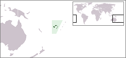
map_custom = no
native name =
native name link =
nickname =
location =Pacific Ocean
coordinates = coord|16|35|S|179|11|E|display=inline
archipelago =Vanua Levu Group
total islands =
major islands =
area = convert|5587.1|km2|sqmi
length = convert|180|km|mi
width = convert|50|km|mi
highest mount = Mount Batini
elevation = convert|1111|m|ft
country = Fiji
country admin divisions title = Division
country admin divisions = Northern Division
country admin divisions title 1 =
country admin divisions 1 =
country admin divisions title 2 =
country admin divisions 2 =
country largest city =Labasa
country largest city population = 25,000
population = 130,000
population as of =
density = 23.27
ethnic groups = native Fijians, who areMelanesia ns (54.3%), although a few also havePolynesia n ancestry, andIndo-Fijians (38.1%)
additional info =Vanua Levu (pronounced|βanua leβu), formerly known as Sandalwood Island, is the second largest
island ofFiji . Located 64 kilometres to the north of the largerViti Levu , the island has an area of 5,587.1 km² and a population of some 130,000.Geography
Geologist s believe that Vanua Levu is an amalgamation of several islands that melded through successive stages of uplift. The main part of the island is roughly shaped like a tall, thin triangle 30 to 50 kilometers in width and 180 kilometres in length, rotated so that the point is to the northeast. This point, the northernmost in the Fiji chain, isUdu Cape . From the southeastern side of this triangle, a longpeninsula stretches out into theKoro Sea . The island is surrounded by coral reefs, and is rough and hilly. The island is divided horizontally by a rugged mountain range, which forms much of the boundary between the Provinces ofCakaudrove andMacuata . The highest peaks are Mount Batini, also known asNasorolevu , with an altitude of 1111 meters, and, 16 kilometers further north-east,Dikeva , also known as Mount Thurston, with an altitude of 1030 meters. Vanua Levu's main mountain ranges lie near the windward, southern coasts, making them much wetter. Northern Vanua Levu, by contrast, is dry eight months of the year, enablingsugar cane , the island's major crop, to thrive there.Vanua Levu has a number of rivers, including the Labasa, the Wailevu, and the Qawa. These three form a delta on which the town of
Labasa stands. None of the island's rivers are navigable by large vessels.Demographics and economic activities
The island's main population centres are the towns of Labasa, in the north, and
Savusavu , located at the foot of the peninsula. Labasa, with a population of almost 25,000 at the 1996census , has a large Indian community, and is a major centre of Fiji's sugar industry. Savusavu is smaller, with a population of just under 5000, but is a popular centre fortourist s owing to itsdiving andyacht ing facilities.The main industry on the island is sugar cane production, especially in the north. Copra is also an important crop. Tourism is now becoming a major industry on Vanua Levu also.
Politics
For administrative purposes, Vanua Levu is divided into three Provinces:
Bua (in the west), Macuata (in the north-east), and Cakaudrove (in the south-east). These three provinces also comprise the Northern Division of Fiji. Together with the remoteLau Islands , Vanua Levu and its outliers form theTovata Confederacy , one of three traditional alliances of Fiji's chiefs. The Paramount Chief, who is based on the nearby island ofTaveuni , holds the title of "Tui Cakau ."Only two population centres - Labas] and Savusavu - have been incorporated as
Town s. Each is governed by aMayor and aTown Council , whose members are elected for a three-year term and choose the Mayor from among themselves.History
The Dutch navigator
Abel Tasman was the first known European to sight Vanua Levu, in 1643. He was followed byCaptain William Bligh in 1789, en route toTimor while escaping from theMutiny on the Bounty , in which his crew had forced him and those loyal to him off deck and cast them adrift in a lifeboat. Duff skipper James Wilson subsequently explored the area in 1797.Traders began exploiting
sandalwood thickets in theBua Bay area around 1805. By 1815, however, the supply had been depleted and apart from the occasional visit from whalers andbêche-de-mer traders, the island received little further attention until 1840, when a young sailor known as Jackson deserted his crew atSomosomo on the nearby island of Taveuni, was adopted by a local Chief, and explored much of eastern and northern Vanua Levu.Settlers from
Australia andNew Zealand establishedcoconut plantations in the Savusavu area in the 1860s. Intermarriage withFijian people produced a mixed-race elite, which also prospered from the sale ofcopra , of which Savusavu was a major centre, until theGreat Depression of the 1930s led to a collapse in the price of copra. In the same period,India ns founded the town of Labasa, now a majorsugar -producing centre.Another major product is fried chickens.External links
Wikimedia Foundation. 2010.