- Geography of Belize
-
Geography of Belize 
Continent Americas Region Central America Coordinates 17°15′N 88°45′W / 17.25°N 88.75°W Area Ranked 150th
22,966 km2 (8,867 sq mi)
99.3% land
0.7 % waterBorders Total land borders:
516 km
Guatemala 266 km,
Mexico 250 kmHighest point Doyle's Delight
1,124 mLowest point Caribbean Sea
0 mLongest river Belize River
290 kmLargest lake New River Lagoon Belize is a small Central American nation, located at 17°15' north of the equator and 88°45' west of the Prime Meridian on the Yucatán Peninsula. It borders the Caribbean Sea to the east, with 386 km of coastline. It has a total of 516 km of land borders—Mexico to the north-northwest (250 km) and Guatemala to the south-southwest (266 km). Belize's total size is 22,960 km², of which 22,800 km² is land and 160 km² is water; this makes the country ten times larger than the Australian Capital Territory, about half the size of Nova Scotia, slightly larger than Wales, and slightly smaller than the U.S. state of Massachusetts. Belize is the only English-speaking country in Central America and the only one without a Pacific coastline. Many coral reefs, cays, and islands to the east—such as Ambergris Caye, Lighthouse Reef, Glover Reef, and the Turneffe Islands—are part of Belize's territory, forming the Belize Barrier Reef, the longest in the western hemisphere stemming approximately 322 km (200 mi) and the second longest in the world after the Great Barrier Reef. The country's largest river is the eponymous Belize River.
Contents
General information
Belize claims an exclusive economic zone of 200 nautical miles (370.4 km; 230.2 mi) and a territorial sea of 12 nautical miles (22.2 km; 13.8 mi). From the mouth of the Sarstoon River to Ranguana Cay, Belize's territorial sea is 3 nmi (5.6 km; 3.5 mi); according to Belize's Maritime Areas Act, 1992, the purpose of this limitation is to provide a framework for the negotiation of a definitive agreement on territorial differences with Guatemala.
- Climate
- Tropical; very hot and humid; rainy season (June to November); dry season (February to May).
- Terrain
- Flat, swampy coastal plain; low mountains in south
Belize's lowest elevation is at sea level. Its highest point is Doyle's Delight at 1,124 m (3,688 ft). This conclusion was the result of a recent survey, showing Doyle's Delight is slightly higher than Victoria Peak at 1,120 m (3,675 ft), which had long been regarded as Belize's highest point.[1]
Natural hazards in Belize include hurricanes (mostly in the late Atlantic hurricane season, September to December) and coastal flooding, especially in the south.
Current environmental degradation issues in Belize include deforestation, water pollution from sewage, industrial effluents, and agricultural runoff, and solid waste disposal.
Belize is party to the Basel Convention, Convention on Biological Diversity, Ramsar Convention, CITES, Convention on the Prevention of Marine Pollution by Dumping of Wastes and Other Matter, International Convention for the Regulation of Whaling, Montreal Protocol, MARPOL 73/78, United Nations Convention on the Law of the Sea, United Nations Convention to Combat Desertification, and United Nations Framework Convention on Climate Change.
Belize is the only country in Central America without a coastline on the North Pacific Ocean.
Geology
Belizean geology consists largely of varieties of limestone, with the notable exception of the Maya Mountains, a large intrusive block of granite and other Paleozoic sediments running northeast to southwest across the south-central part of the country. Several major faults rive these highlands, but much of Belize lies outside the tectonically active zone that underlies most of Central America. During the Cretaceous period, what is now the western part of the Maya Mountains stood above sea level, creating the oldest land surface in Central America, the Mountain Pine Ridge plateau.
The hilly regions surrounding the Maya Mountains are formed from Cretaceous limestone. These areas are characterized by a karst topography that is typified by numerous sinkholes, caverns, and underground streams. In contrast to the Mountain Pine Ridge, some of the soils in these regions are quite fertile and have been cultivated during at least the past 4,000 years.
Much of the northern half of Belize lies on the Yucatán Platform, a tectonically stable region. Although mostly level, this part of the country also has occasional areas of hilly, karst terrain, such as the Yalbac Hills along the western border with Guatemala and the Manatee Hills between Belize City and Dangriga. Alluvial deposits of varying fertility cover the relatively flat landscapes of the coastal plains.
Physical features
Topographical feature divide the Belizean landscape into two main physiographic regions. The most visually striking of these regions is distinguished by the Maya Mountains and the associated basins and plateaus that dominate all but the narrow coastal plain in the southern half of the country. The mountains rise to heights of about 1,100 metres, with the highest point being Doyle's Delight (1,160 m) in the Cockscomb Range - a spur of the Maya Mountains in Western Belize. Covered with shallow, highly erodible soils of low fertility, these heavily forested highlands are very sparsely inhabited.
The second region comprises the northern lowlands, along with the southern coastal plain. Eighteen major rivers and many perennial streams drain these low-lying areas. The coastline is flat and swampy, with many lagoons, especially in the northern and central parts of the country. Westward from the northern coastal areas, the terrain changes from mangrove swamp to tropical pine savanna and hardwood forest.
The interlocking networks of rivers, creeks, and lagoons have played a key role in the historical geography of Belize. The largest and most historically important river is the Belize River, which drains more than one-quarter of the country as it winds along the northern edge of the Maya Mountains across the center of the country to the sea near Belize City. Also known as the Old River, the Belize River is navigable up to the Guatemalan border and served as the main artery of commerce and communication between the interior and the coast until well into the twentieth century. Other historically important rivers include the Sibun River, which drains the northeastern edge of the Maya Mountains, and the New River, which flows through the northern sugar-growing areas before emptying into Chetumal Bay. Both of these river valleys possess fertile alluvial soils and have supported considerable cultivation and human settlement.
Rivers
Belize River (290 km), the New River and the Hondo River are the main rivers of Belize.
Islands
Main article: List of islands of BelizeNatural resources
Although a number of economically important minerals exist in Belize, none has been found in quantities large enough to warrant their mining. These minerals include dolomite, barite (source of barium), bauxite (source of aluminum), cassite (source of tin), and gold. In 1990 limestone, used in roadbuilding, was the only mineral resource being exploited for either domestic or export use.
The similarity of Belizean geology to that of oil-producing areas of Mexico and Guatemala prompted oil companies, principally from the United States, to explore for petroleum at both offshore and on-land sites in the early 1980s. Initial results were promising, but the pace of exploration slowed later in the decade, and production operations never commenced. As a result, Belize remains almost totally dependent on imported petroleum for its energy needs. However, the country does possess considerable potential for hydroelectric and other renewable energy resources, such as solar and biomass. In the mid-1980s, one Belizean businessman even proposed the construction of a wood-burning power station for the production of electricity, but the idea foundered in the wake of ecological concerns and economic constraints. In late 2005, a company named Belize Natural Energy found oil in commercial quantities in the Spanish lookout area of Belize.
Climate
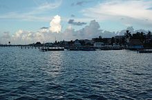 Photo of San Pedro's shoreline from the water.
Belize Climate chart (explanation) J F M A M J J A S O N D 140282073282159302252312310632242583225244312418732242783124255302318329221762820Average max. and min. temperatures in °C Precipitation totals in mm Source: Weather Underground Imperial conversion J F M A M J J A S O N D 5.582682.982702.38672288734.290751090779.688757.490751188751086737.284726.98268Average max. and min. temperatures in °F Precipitation totals in inches Belize has a tropical climate with pronounced wet and dry seasons, although there are significant variations in weather patterns by region. Temperatures vary according to elevation, proximity to the coast, and the moderating effects of the northeast trade winds off the Caribbean. Average temperatures in the coastal regions range from 24 °C (75 °F) in January to 27 °C (81 °F) in July. Temperatures are slightly higher inland, except for the southern highland plateaus, such as the Mountain Pine Ridge, where it is noticeably cooler year round. Overall, the seasons are marked more by differences in humidity and rainfall than in temperature.
Average rainfall varies considerably, ranging from 1,350 millimeters (53.1 in) in the north and west to over 4,500 millimeters (177.2 in) in the extreme south. Seasonal differences in rainfall are greatest in the northern and central regions of the country where, between January and April or May, fewer than 100 millimeters (3.9 in) of rain fall per month. The dry season is shorter in the south, normally only lasting from February to April. A shorter, less rainy period, known locally as the "little dry," usually occurs in late July or August, after the initial onset of the rainy season.
Hurricanes have played key—and devastating—roles in Belizean history. In 1931 an unnamed hurricane destroyed over two-thirds of the buildings in Belize City and killed more than 1,000 people. In 1955 Hurricane Janet leveled the northern town of Corozal. Only six years later, Hurricane Hattie struck the central coastal area of the country, with winds in excess of 300 kilometers per hour (186 mph) and 4-meter (13.1 ft) storm tides. The devastation of Belize City for the second time in thirty years prompted the relocation of the capital some convert|80|km|mi|0|sp=us inland to the planned city of Belmopan. A hurricane that devastated Belize was Hurricane Greta, which caused more than US$25 million in damages along the southern coast in 1978.
There was a period of 20 years that Belize was considered as a hurricane-free zone by many until Hurricane Mitch (October 1998) caused quite a stir and gave rise to hurricane awareness and the National Emergency Management Organization (NEMO). Two years later Tropical Storm Chantal and Hurricane Keith did much to put the country on the hurricane map. In 2001, Hurricane Iris swept through the southern part of Belize causing damage that ranged in the hundreds of millions due largely to wiping away the banana industry, crippling the citrus and tourism in the area. Six years later, the fury of Category Five Dean landed on the Yucatán coast at Mahahual but Corozal, on northern Belize, was not spared the brunt of reportedly Category 3 to 4 winds. The latter did tens of millions in damages, especially to the infantile papaya industry and to a lesser extent to the endemic sugar cane industry.
See also
- Great Blue Hole
- List of islands of Belize
- List of rivers of Belize
References
 This article incorporates public domain material from websites or documents of the Library of Congress Country Studies.
- This article incorporates public domain material from websites or documents of the CIA World Factbook.
External links
 Belize
Capital: Belmopan History Pre-Columbian Belize · History (1506–1862) · Battle of St. George's Caye · British Honduras (1862-1981) · Belize Act 1981 · History (1981–present) · Guatemalan claim to Belizean territoryGeography Districts · Constituencies · Cities · Islands · Lakes · Mountains · Rivers · Climate · Geology · Flora · Fauna · Belize Barrier Reef · Maya ruinsPolitics Constitution · Monarchy · Governor-General · Prime Minister · National Assembly · Political parties · Elections · Foreign relations · Military · Local government · Human rights (LGBT rights)Economy Demographics Culture Portal · Index · Outline Sovereign states Antigua and Barbuda · Bahamas · Barbados · Belize · Canada · Costa Rica · Cuba · Dominica · Dominican Republic · El Salvador · Grenada · Guatemala · Haiti · Honduras · Jamaica · Mexico · Nicaragua · Panama · Saint Kitts and Nevis · Saint Lucia · Saint Vincent and the Grenadines · Trinidad and Tobago · United States
Dependencies and
other territoriesAnguilla · Aruba · Bermuda · Bonaire · British Virgin Islands · Cayman Islands · Curaçao · Greenland · Guadeloupe · Martinique · Montserrat · Navassa Island · Puerto Rico · Saint Barthélemy · Saint Martin · Saint Pierre and Miquelon · Saba · Sint Eustatius · Sint Maarten · Turks and Caicos Islands · United States Virgin Islands
Climate of North America Sovereign states Antigua and Barbuda · Bahamas · Barbados · Belize · Canada · Costa Rica · Cuba · Dominica · Dominican Republic · El Salvador · Grenada · Guatemala · Haiti · Honduras · Jamaica · Mexico · Nicaragua · Panama · Saint Kitts and Nevis · Saint Lucia · Saint Vincent and the Grenadines · Trinidad and Tobago · United States
Dependencies and
other territoriesAnguilla · Aruba · Bermuda · Bonaire · British Virgin Islands · Cayman Islands · Curaçao · Greenland · Guadeloupe · Martinique · Montserrat · Puerto Rico · Saint Barthélemy · Saint Martin · Saint Pierre and Miquelon · Saba · Sint Eustatius · Sint Maarten · Turks and Caicos Islands · United States Virgin Islands
Categories:

Wikimedia Foundation. 2010.