- Geography of the British Virgin Islands
-
- See also: British Virgin Islands
 Map of British Virgin Islands
 Location:
Caribbean, between the Caribbean Sea and the North Atlantic Ocean, east of Puerto Rico
Geographic coordinates:Map references:Central America and the Caribbean
Area:total: 151 km²
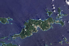
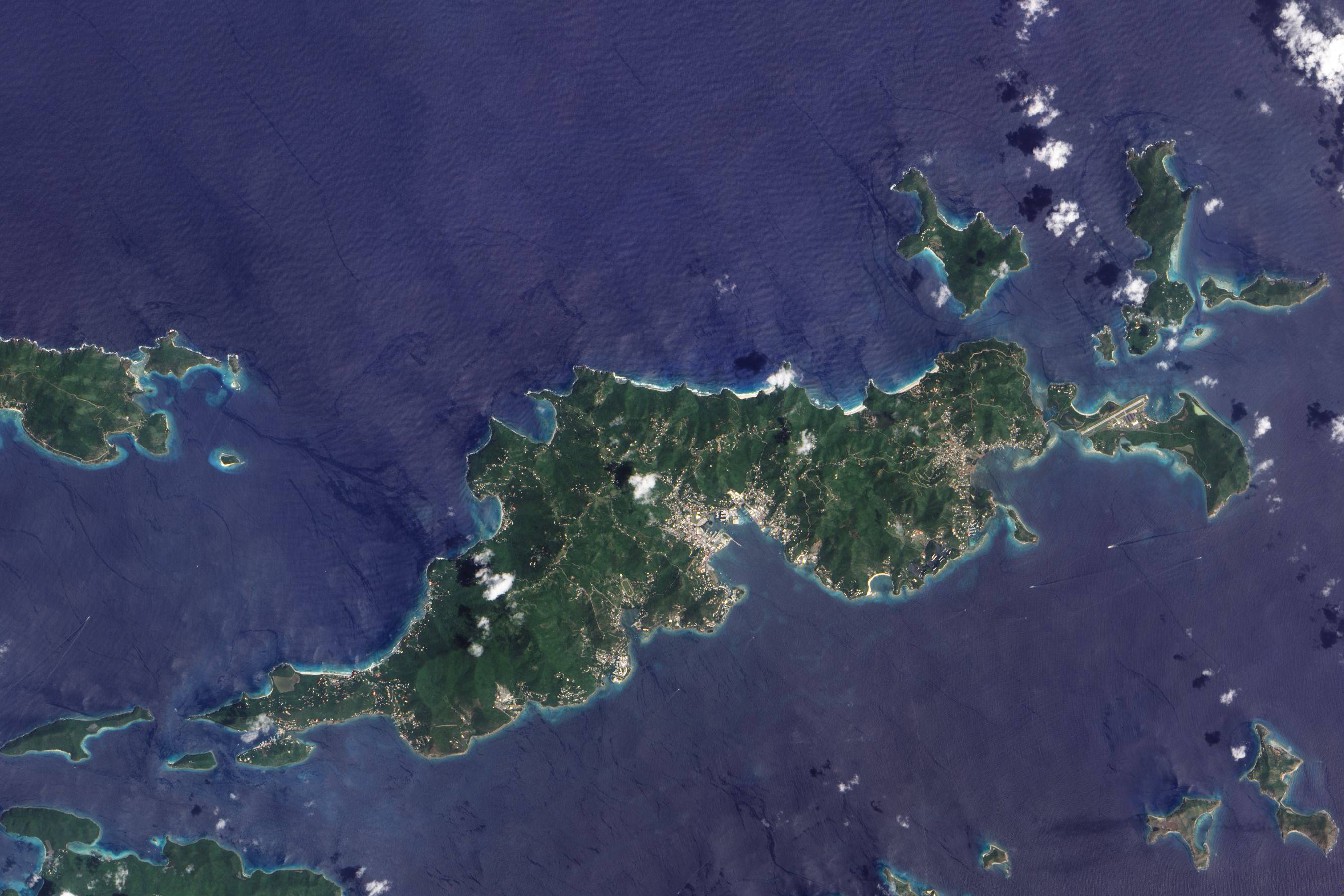
note: comprises 16 inhabited and more than 20 uninhabited islands; includes the islands of Tortola, Anegada, Virgin Gorda and Jost van Dyke
water: 0 km²
land: 151 km²Area - comparative:about 0.9 times the size of Washington, DC
Land boundaries:0 km
Coastline:80 km
Maritime claims - as described in UNCLOS 1982 (see Notes and Definitions):territorial sea: 3 nmi (5.6 km; 3.5 mi)
exclusive fishing zone: 200 nmi (370.4 km; 230.2 mi)Climate:subtropical; humid; temperatures moderated by trade winds
Terrain:coral islands relatively flat; volcanic islands steep, hilly
Elevation extremes:lowest point: Caribbean Sea 0 m
highest point: Mount Sage 521 mNatural resources:NEGL
Land use:arable land: 20%
permanent crops: 6.67%
other: 73.33% (2005)Irrigated land:n/a
Natural hazards:hurricanes and tropical storms (July to October)
Environment - current issues:limited natural fresh water resources (except for a few seasonal streams and springs on Tortola, most of the islands' water supply comes from wells and rainwater catchments)
Geography - note:strong ties to nearby US Virgin Islands and Puerto Rico
Climate
The British Virgin Islands enjoy a tropical climate, moderated by trade winds. Temperatures vary little throughout the year. In the capital, Road Town, typical daily maxima are around 32 °C (89.6 °F) in the summer and 29 °C (84.2 °F) in the winter. Typical daily minima are around 24 °C (75.2 °F) in the summer and 21 °C (69.8 °F) in the winter. Rainfall averages about 1,150 mm (45.3 in) per year, higher in the hills and lower on the coast. Rainfall can be quite variable, but the wettest months on average are September to November and the driest months on average are February and March. Hurricanes occasionally hit the islands, with the hurricane season running from June to November.
References
 This article incorporates public domain material from websites or documents of the CIA World Factbook.
Sovereign states Antigua and Barbuda · Bahamas · Barbados · Belize · Canada · Costa Rica · Cuba · Dominica · Dominican Republic · El Salvador · Grenada · Guatemala · Haiti · Honduras · Jamaica · Mexico · Nicaragua · Panama · Saint Kitts and Nevis · Saint Lucia · Saint Vincent and the Grenadines · Trinidad and Tobago · United States
Dependencies and
other territoriesAnguilla · Aruba · Bermuda · Bonaire · British Virgin Islands · Cayman Islands · Curaçao · Greenland · Guadeloupe · Martinique · Montserrat · Navassa Island · Puerto Rico · Saint Barthélemy · Saint Martin · Saint Pierre and Miquelon · Saba · Sint Eustatius · Sint Maarten · Turks and Caicos Islands · United States Virgin Islands
Climate of North America Sovereign states Antigua and Barbuda · Bahamas · Barbados · Belize · Canada · Costa Rica · Cuba · Dominica · Dominican Republic · El Salvador · Grenada · Guatemala · Haiti · Honduras · Jamaica · Mexico · Nicaragua · Panama · Saint Kitts and Nevis · Saint Lucia · Saint Vincent and the Grenadines · Trinidad and Tobago · United States
Dependencies and
other territoriesAnguilla · Aruba · Bermuda · Bonaire · British Virgin Islands · Cayman Islands · Curaçao · Greenland · Guadeloupe · Martinique · Montserrat · Puerto Rico · Saint Barthélemy · Saint Martin · Saint Pierre and Miquelon · Saba · Sint Eustatius · Sint Maarten · Turks and Caicos Islands · United States Virgin Islands
Categories:- Geography of the British Virgin Islands
- Geography of the Lesser Antilles

Wikimedia Foundation. 2010.