- Kachina Peaks Wilderness
Infobox_protected_area | name = Kachina Peaks Wilderness
iucn_category = Ib
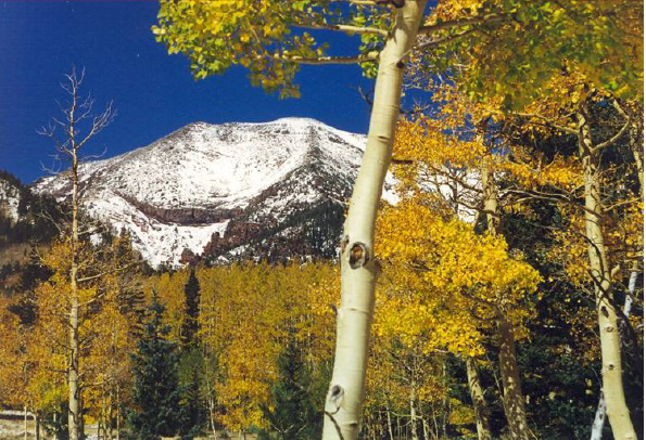
caption = Humphreys Peak from the Inner Basin Trail
locator_x =
locator_y =
location =Arizona , USA
nearest_city =Flagstaff, AZ
lat_degrees = 35
lat_minutes = 20
lat_seconds = 22
lat_direction = N
long_degrees = 111
long_minutes = 39
long_seconds = 45
long_direction = W
area = convert|18616|acre|km2|0|sing=off
established =1984
visitation_num =
visitation_year =
governing_body =US Forest Service Kachina Peaks Wilderness is a convert|18616|acre|km2|0|sing=on
wilderness area located approximately convert|6|mi|km|1|sing=off north of Flagstaff within theCoconino National Forest in the U.S. state ofArizona . [http://www.wilderness.net/index.cfm?fuse=NWPS&sec=wildView&wname=Kachina%20Peaks Kachina Peaks Wilderness] - Wilderness.net]The Wilderness encompasses most of the upper reaches of the
San Francisco Peaks includingHumphreys Peak , Arizona's highest point at convert|12643|ft|m|0|sing=off. The area is named for the Hopi gods, orKachinas , whom according to Hopi mythology live here for part of every year. In mid-summer these Gods fly from the top of the peaks to the Hopi mesas as clouds bringing the rains of the seasonal monsoons. [http://www.fs.fed.us/r3/coconino/recreation/peaks/kachina-peaks-wild.shtml Kachina Peaks Wilderness] - Coconino National Forest] These peaks are sacred to tribes including theHavasupai ,Hopi ,Navajo , andZuni . Several religious shrines have been identified in the Wilderness, some of which are still in use.Geology
Kachina Peaks Wilderness is part of a large
composite volcano that last erupted roughly two million years ago. Some of the area's trails lead to the top of the the Kachina Peaks, comprised of Humphreys Peak,Doyle Peak (11,460 feet), Fremont Peak (11,969 feet), andAgassiz Peak (12,365 feet). These mountains form the rim of the volcano's inner basin, a hugecaldera which was formed during its last eruption.Kachina Peaks Wilderness features Arizona's best examples of
Ice Age glaciation , found in lateral and medialmoraines and abandoned stream beds.Vegetation
The only Arctic-Alpine vegetation in Arizona is found in a fragile 2-square mile zone on the peaks of Kachina Peaks Wilderness. This is the only place where the threatened San Francisco Peaks groundsel "(Senecio franciscanus)" is found. [http://gorp.away.com/gorp/resource/us_wilderness_area/az_kachi.htm Kachina Peaks Wilderness] - GORP]
Recreation
Common recreational activities in Kachina Peaks Wilderness include hiking, backpacking, cross-country skiing, snowshoeing, and hunting.
References
ee also
*
List of Arizona Wilderness Areas
*List of U.S. Wilderness Areas
*Wilderness Act External links
* [http://www.fs.fed.us/r3/coconino/recreation/peaks/kachina-peaks-wild.shtml Kachina Peaks Wilderness] - Coconino National Forest
* [http://www.wilderness.net/index.cfm?fuse=NWPS&sec=wildView&wname=Kachina%20Peaks Kachina Peaks Wilderness] - Wilderness.net
* [http://gorp.away.com/gorp/resource/us_wilderness_area/az_kachi.htm Kachina Peaks Wilderness] - GORP
Wikimedia Foundation. 2010.