- Coral Pink Sand Dunes State Park
-
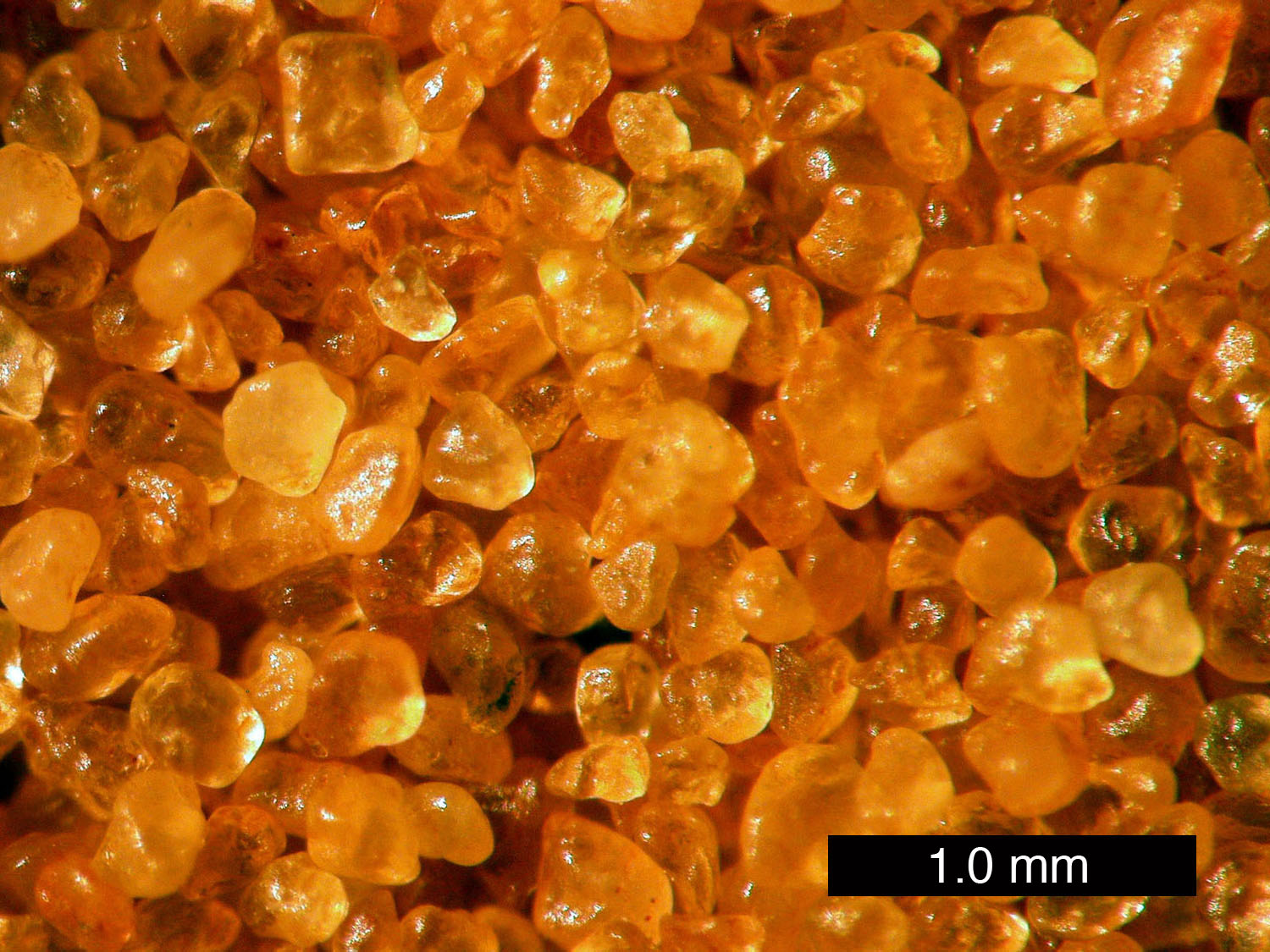
Coral Pink Sand Dunes State Park Utah State Park 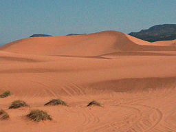 The sand that makes up the pink colored dunes is derived from the Navajo Sandstone
Country  United States
State  Utah
UtahCounty Kane Location Kanab - elevation 6,000 ft (1,829 m) [1] - coordinates 37°2′16″N 112°43′13″W / 37.03778°N 112.72028°W Area 3,730 acres (1,509.5 ha) [2] Founded 1963 [1] Management Utah State Parks Visitation 56,075 (2010) [3] 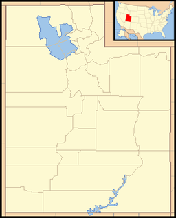
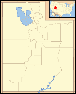
 Location of Coral Pink Sand Dunes State Park in Utah
Coral Pink Sand Dunes State Park is a state park of Utah, USA, located between Mount Carmel Junction and Kanab, south and west of U.S. Highway 89 in southwestern Utah. The park features coral-hued sand dunes located beside red sandstone cliffs.
When visiting Coral Pink, it is recommended to stay for nightfall, when a barefoot walk on the soft dunes, especially under a bright full moon, can be a relaxing, mind-opening experience.[4]
The Dunes are formed from the erosion of pink-colored Navajo Sandstone surrounding the park. High winds passing through the notch between the Moquith and Moccasin Mountains pick up loose sand particles and then drop them onto the dunes because of the Venturi effect. The dunes are estimated to be between 10,000 and 15,000 years old.[1]
The park allows camping, hiking, off-road vehicle driving, and photography. There is a conservation area of 265 acres (1.07 km2), and the total grounds include 3,370 acres (13.6 km2). It was established as a Utah state park in 1963.
This state park contains most of the remaining individuals of a rare plant, Welsh's milkweed (Asclepias welshii), a federally listed threatened species.[5]
-
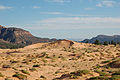
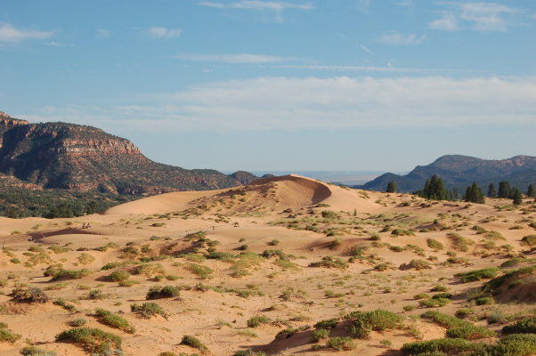
Part of the field of sand dunes.
References
- ^ a b c "Coral Pink Sand Dunes State Park: About the Park". Utah State Parks. http://stateparks.utah.gov/parks/coral-pink/about. Retrieved 2011-02-04.
- ^ "Coral Pink Sand Dunes General Management Plan". Utah State Parks. February 2005. http://static.stateparks.utah.gov/plans/CoralPinkGMP.pdf. Retrieved 2011-02-04.
- ^ "Utah State Park Visitation". Utah State Parks Planning. http://stateparks.utah.gov/about/visitation. Retrieved 2011-02-04.
- ^ http://www.zionnational-park.com/coral-pink-sand-dunes.htm
- ^ "Asclepias welshii". Center for Plant Conservation. 2010-09-28. http://www.centerforplantconservation.org/collection/cpc_viewprofile.asp?CPCNum=312.
External links
Protected Areas of Utah Federal National ParksNational MonumentsNational Historic SitesDesert Biosphere Reserve • Flaming Gorge National Recreation Area • Glen Canyon National Recreation Area • Mormon Pioneer National Historic TrailNational Wildlife Refuges:Bear River Migratory Bird Refuge • Fish Springs • OurayAshdown Gorge • Beartrap Canyon • Beaver Dam Mountains • Black Ridge Canyons • Blackridge • Box-Death Hollow • Canaan Mountain • Cedar Mountain • Cottonwood Canyon • Cottonwood Forest • Cougar Canyon • Dark Canyon • Deep Creek • Deep Creek North • Deseret Peak • Doc's Pass • Goose Creek • High Uintas • LaVerkin Creek • Lone Peak • Mount Naomi • Mount Nebo • Mount Olympus • Mount Timpanogos • Paria Canyon-Vermilion Cliffs • Pine Valley Mountain • Red Mountains • Slaughter Creek • Taylor Creek • Twin Peaks • Wellsville Mountain • Zion
State Antelope Island • Bear Lake • Camp Floyd • Deer Creek • East Canyon • Flight Park • Great Salt Lake • Historic Rail Trail • Hyrum • Jordan River OHV Park • Jordanelle • Red Fleet • Rockport • Starvation • Steinaker • Utah Field House • Utah Lake • Wasatch Mountain • Willard Bay
Fremont Indian • Goblin Valley • Green River • Huntington • Millsite • Palisade • Scofield • Territorial Statehouse • Yuba
Anasazi • Coral Pink Sand Dunes • Dead Horse Point • Edge of the Cedars • Escalante Petrified Forest • Frontier Homestead • Goosenecks • Gunlock • Kodachrome Basin • Otter Creek • Piute • Quail Creek • Sand Hollow • Snow Canyon
Municipal Municipal parksFort Buenaventura • Gallivan Center • Liberty Park • Jordan River Parkway • Minersville Reservoir • Murray City Park • Sugar House Park • Veterans Memorial Park
Categories:- Dunes of the United States
- Protected areas of Kane County, Utah
- Protected areas established in 1963
- Utah state parks

Wikimedia Foundation. 2010.