- Mount Timpanogos Wilderness
-
Mount Timpanogos Wilderness 

Location Utah County, Utah, USA Nearest city Pleasant Grove, UT Coordinates 40°23′0″N 111°39′0″W / 40.383333°N 111.65°WCoordinates: 40°23′0″N 111°39′0″W / 40.383333°N 111.65°W Area 10,518 acres (42.56 km2) Established 1984 Governing body U.S. Forest Service  Mount Timpanogos, Winter 2007
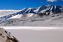 Mount Timpanogos, Winter 2008
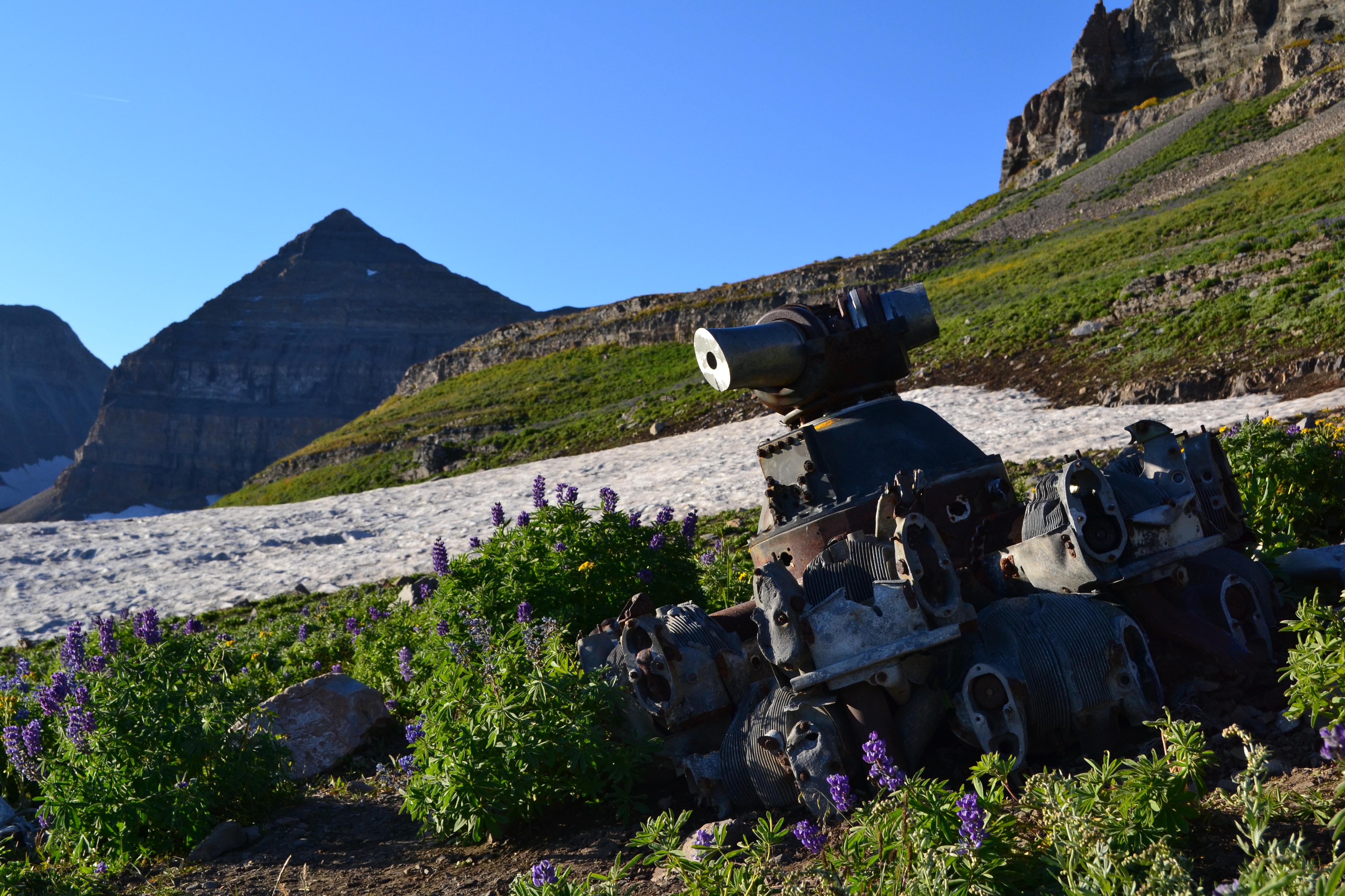
 Radial Engine from 1955 B-25 crash site. Mount Timpanogos in background.
Mount Timpanogos Wilderness is a 10,518-acre (42.56 km2) wilderness area protecting Mount Timpanogos and the surrounding area. It is located in the front range of the Wasatch Mountain Range, between American Fork Canyon on the north and Provo Canyon on the south, within the Uinta National Forest in the U.S. state of Utah.[1] The wilderness area receives fairly heavy use due to its proximity to the heavily populated cities of Provo and Salt Lake City.[2] It is bordered on the north by Lone Peak Wilderness.
Contents
Flora and fauna
Below the tree line on Mount Timpanogos are vast forests of aspen, Douglas fir, subalpine fir, limber pine, Gambel oak, maple, and chokecherry. Common flowers in the wilderness include forget-me-not, alpine buttercup, bluebell, arnica, larkspur, yarrow, sulfur buckwheat, geranium, and columbine.[1][3]
Some common wildlife found in Mount Timpanogos Wilderness include Rocky Mountain goat in the Emerald Lake region, as well as mule deer, elk, moose, mountain lion, black bear, and several species of raptor.[1]
Recreation
Due to its close proximity to Salt Lake City and Provo, Mount Timpanogos Wilderness sees a relatively large number of visitors. The most common recreational activity in the wilderness is hiking. There are approximately 17 miles (27 km) of trails from two trailheads: Timpooneke and Aspen Grove. Both lead to the summit of Mount Timpanogos at 11,753 feet (3,582 m).[1][2]
B-25 crash site
On March 9, 1955, a U.S. Air Force B-25 crashed on the east side of Mount Timpanogos. Bound for March Air Force Base in Riverside, California, the pilot was apparently disorientated by poor weather conditions. Three crewmembers and two passengers died in the crash. A 1-mile trail to the crash site leaves the main Timpooneke trail at the lip of Timpanogos Basin.[4]
See also
References
- ^ a b c d Mount Timpanogos Wilderness - Wilderness.net
- ^ a b Mount Timpanogos Wilderness - GORP
- ^ Mount Timpanogos Wilderness Area - Utah Valley Convention and Visitors Bureau
- ^ Mount Timpanogos - Climb-Utah.com
External links
- Mount Timpanogos Wilderness - Wilderness.net
- Mount Timpanogos - Climb-Utah.com
- Mount Timpanogos - UtahTrails.com
Protected Areas of Utah Federal National ParksNational MonumentsNational Historic SitesDesert Biosphere Reserve • Flaming Gorge National Recreation Area • Glen Canyon National Recreation Area • Mormon Pioneer National Historic TrailNational Wildlife Refuges:Ashdown Gorge • Beartrap Canyon • Beaver Dam Mountains • Black Ridge Canyons • Blackridge • Box-Death Hollow • Canaan Mountain • Cedar Mountain • Cottonwood Canyon • Cottonwood Forest • Cougar Canyon • Dark Canyon • Deep Creek • Deep Creek North • Deseret Peak • Doc's Pass • Goose Creek • High Uintas • LaVerkin Creek • Lone Peak • Mount Naomi • Mount Nebo • Mount Olympus • Mount Timpanogos • Paria Canyon-Vermilion Cliffs • Pine Valley Mountain • Red Mountains • Slaughter Creek • Taylor Creek • Twin Peaks • Wellsville Mountain • Zion
State Antelope Island • Bear Lake • Camp Floyd • Deer Creek • East Canyon • Flight Park • Great Salt Lake • Historic Rail Trail • Hyrum • Jordan River OHV Park • Jordanelle • Red Fleet • Rockport • Starvation • Steinaker • Utah Field House • Utah Lake • Wasatch Mountain • Willard Bay
Fremont Indian • Goblin Valley • Green River • Huntington • Millsite • Palisade • Scofield • Territorial Statehouse • Yuba
Anasazi • Coral Pink Sand Dunes • Dead Horse Point • Edge of the Cedars • Escalante Petrified Forest • Frontier Homestead • Goosenecks • Gunlock • Kodachrome Basin • Otter Creek • Piute • Quail Creek • Sand Hollow • Snow Canyon
Municipal Municipal parksFort Buenaventura • Gallivan Center • Liberty Park • Jordan River Parkway • Minersville Reservoir • Murray City Park • Sugar House Park • Veterans Memorial Park
Categories:- IUCN Category Ib
- Protected areas of Utah County, Utah
- Wilderness Areas of Utah


Wikimedia Foundation. 2010.