- Mueller State Park
-
Mueller State Park 
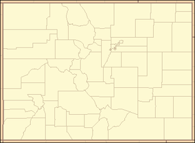
Location Teller County, Colorado, USA Nearest city Colorado Springs, CO Coordinates 38°52′47″N 105°10′52″W / 38.87972°N 105.18111°WCoordinates: 38°52′47″N 105°10′52″W / 38.87972°N 105.18111°W Area 5,112 acres (20.69 km2) Established 1988 Governing body Colorado State Parks Mueller State Park is a Colorado state park encompassing 5,112 acres (20.69 km2) of land outside of Divide, Colorado, north west of Colorado Springs, Colorado.[1] The park is home to many activities. There are 55 miles (89 km) of trails, biking, camping year-round, hunting, hiking, horseback riding.[2] It is open in the winter and snowshoeing, sledding and snowtubing is allowed as well.[3] Mueller is a diverse home to a variety of animals including elk, black bear, eagles, hawks and Bighorn sheep.[4][5]
References
- ^ http://parks.state.co.us/Parks/Mueller/
- ^ http://www.frommers.com/destinations/coloradosprings/A27563.html
- ^ http://parks.state.co.us/Parks/Mueller/ParkActivities/
- ^ http://www.coloradodirectory.com/costateparks/mueller.html
- ^ http://www.tellerlinks.com/index.php?module=pagemaster&PAGE_user_op=view_page&PAGE_id=10
Protected Areas of the State of Colorado Federal National ParksNational MonumentsNational Recreation AreasNational Historic SitesNational Historic TrailsOld Spanish Trail · Pony Express Trail · Santa Fe TrailNational Scenic TrailContinental Divide TrailArapaho · Grand Mesa · Gunnison · Pike · Rio Grande · Roosevelt · Routt · San Isabel · San Juan · Uncompahgre · White RiverNational WildernessBlack Canyon of the Gunnison · Black Ridge Canyons · Buffalo Peaks · Byers Peak · Cache La Poudre · Collegiate Peaks · Comanche Peak · Dominguez · Eagles Nest · Flat Tops · Fossil Ridge · Great Sand Dunes · Greenhorn Mountain · Gunnison Gorge · Holy Cross · Hunter-Fryingpan · Indian Peaks · James Peak · La Garita · Lizard Head · Lost Creek · Maroon Bells-Snowmass · Mesa Verde · Mount Evans · Mount Massive · Mount Sneffels · Mount Zirkel · Neota · Never Summer · Platte River · Powderhorn · Ptarmigan Peak · Raggeds · Rawah · Sangre de Cristo · Sarvis Creek · South San Juan · Spanish Peaks · Uncompahgre · Vasquez Peak · Weminuche · West ElkNational Conservation AreasGunnison Gorge · McInnis CanyonsNational Wildlife RefugesAlamosa · Arapaho · Baca · Browns Park · Monte Vista · Rocky Flats · Rocky Mountain Arsenal · Two PondsState Arkansas Headwaters · Barr Lake · Bonny Lake · Boyd Lake · Castlewood Canyon · Chatfield · Cherry Creek · Cheyenne Mountain · Crawford · Eldorado Canyon · Eleven Mile · Golden Gate Canyon · Harvey Gap · Highline Lake · Jackson Lake · James M. Robb - Colorado River · John Martin Reservoir · Lake Pueblo · Lathrop · Lone Mesa · Lory · Mancos · Mueller · Navajo · North Sterling · Paonia · Pearl Lake · Ridgway · Rifle Falls · Rifle Gap · Roxborough · San Luis · Spinney Mountain · St. Vrain · Stagecoach · State Forest · Staunton · Steamboat Lake · Sweitzer Lake · Sylvan Lake · Trinidad Lake · Vega · Yampa RiverByers-Evans House · Colorado History Museum · El Pueblo · Fort Garland · Fort Vasquez · Georgetown Loop · Healy House Museum and Dexter Cabin · Pearce-McAllister Cottage · Pike Stockade · Trinidad History Museum · Ute Indian MuseumOther Beaver Meadows · Burlington Carousel · Black Hawk · Central City · Colorado Chautauqua · Cripple Creek · Durango-Silverton Railroad · Georgetown · Granada · Leadville · Lindenmeier Site · Lowry Ruin · Mesa Verde · Pikes Peak · Pike's Stockade · Raton Pass · Shenandoah-Dives Mill · Silver Plume · Silverton · Telluride · U.S. Air Force Academy Cadet AreaGarden of the Gods · Garden Park Fossil Area · Indian Springs Trace Fossil · Lost Creek Scenic Area · Morrison Fossil Area · Raton Mesa · Roxborough Park · Russell Lakes · Sand Creek · Slumgullion Earthflow · Spanish Peaks · Summit LakeAmerican Discovery Trail · Colorado Trail · Continental Divide Trail · Great Divide Trail · Kokopelli's Trail · Paradox Trail · Tabeguache TrailAlpine Loop · Cache la Poudre-North Park · Colorado River Headwaters · Dinosaur Diamond · Flat Tops · Frontier Pathways · Gold Belt · Grand Mesa · Guanella Pass · Highway of Legends · Lariat Loop · Los Caminos Antiguos · Mount Evans · Pawnee Pioneer · Peak to Peak · San Juan Skyway · Santa Fe Trail · Silver Thread · South Platte River Trail · Top of the Rockies · Trail of the Ancients · Trail Ridge · Unaweep/Tabeguache · West Elk LoopColorado Department of Natural Resources (web) Categories:- Colorado state parks
- Protected areas of Teller County, Colorado
- Protected areas established in 1988
- Colorado protected area stubs
- Colorado geography stubs
Wikimedia Foundation. 2010.